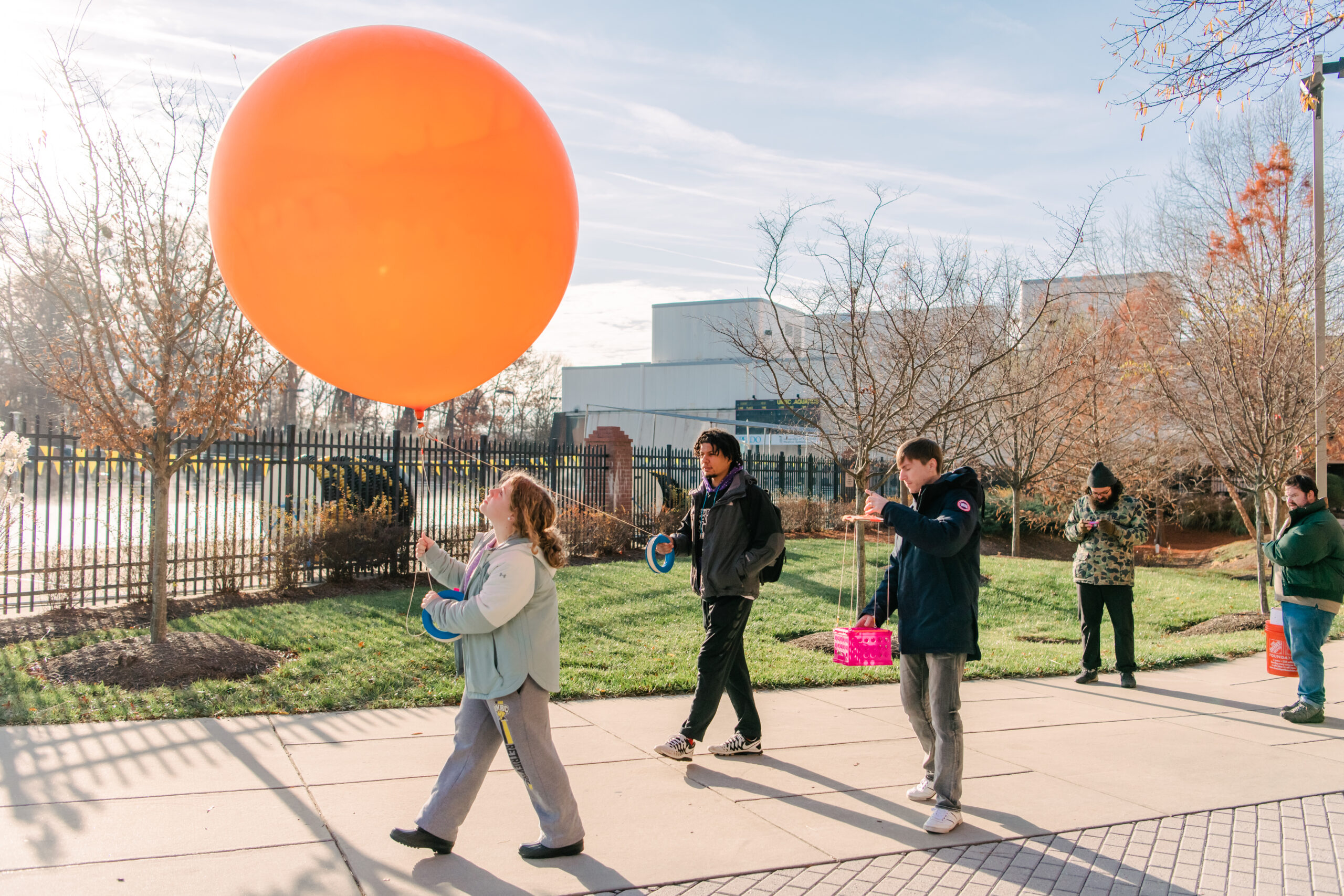
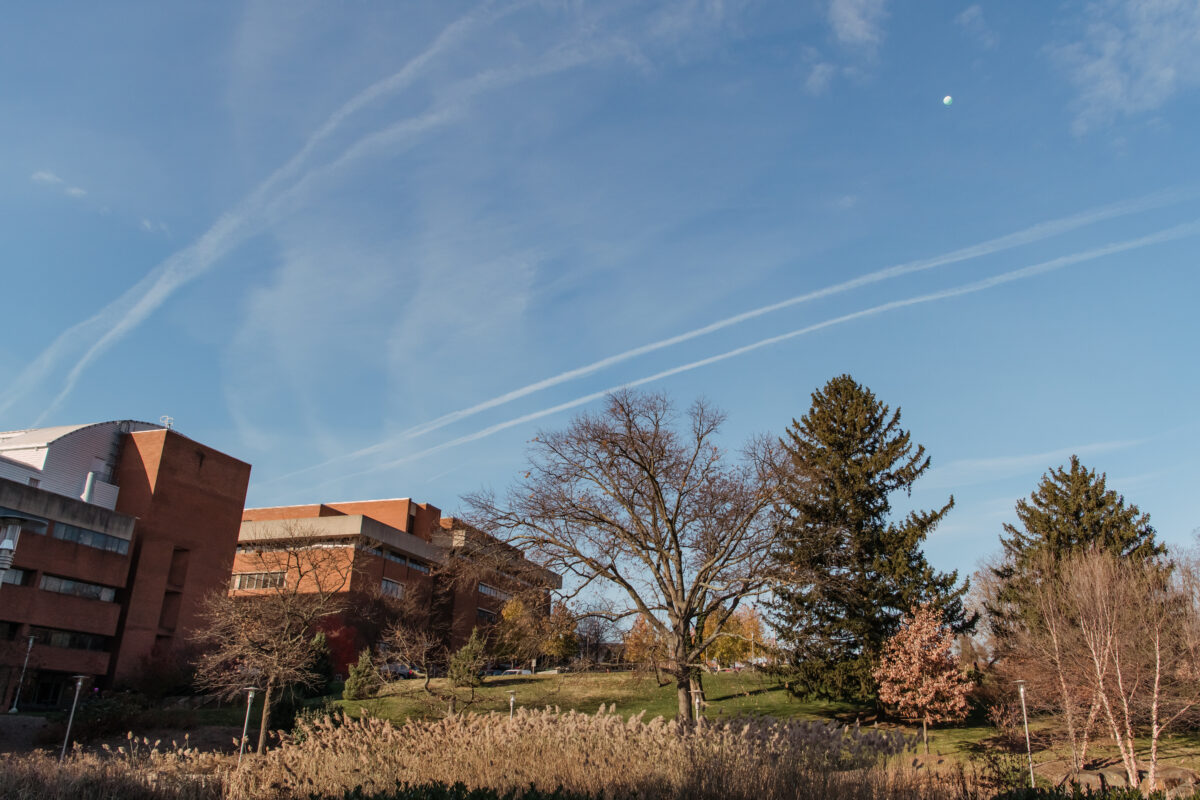
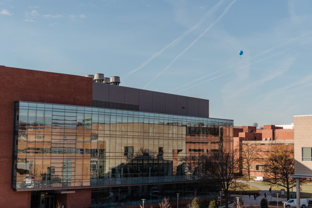
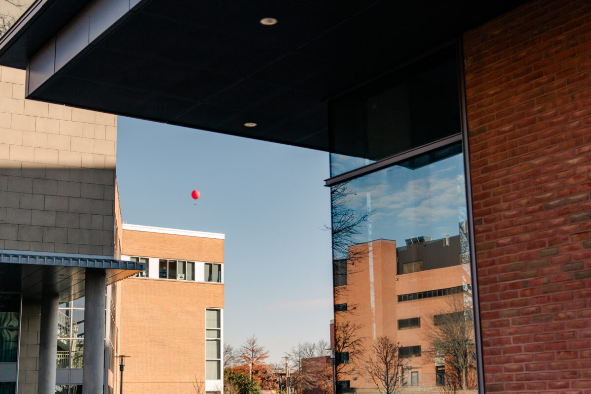
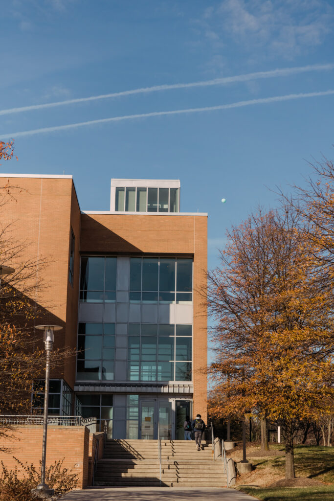
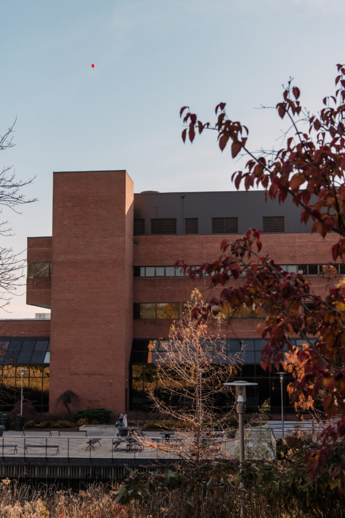
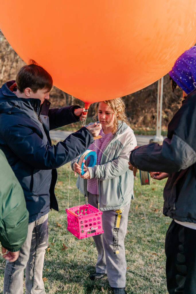
On a brisk but clear day in early December, half a dozen brightly colored weather balloons barely squeeze through the double doors of Sondheim Hall’s lower level one by one.
A group of four or five students handles each balloon, proceeding to the quad in front of the Interdisciplinary Life Sciences Building in a makeshift parade. A red balloon rises aloft as a demonstration, and then the remaining groups fan out across campus to follow suit. By 9:30 a.m., anyone walking across campus can see colorful dots hundreds of feet high, tethered by ropes that each end at a student on the ground.
This is the peak experience of GES 286, “Exploring the Environment: A Geospatial Perspective.” The course is structured around various data gathering projects, explains Charles Kaylor, the instructor and director of GIS (geographic information systems) and cartography labs in the department of geography and environmental systems (GES). “We use the campus as a laboratory,” he says.
“Where are we?”
Kaylor opens the first class with a deceptively simple question: “Where are we, and how do we know that?” After beginning with a basic orienteering activity (no smartphones allowed!), the course advances through the surprisingly complex answer to Kaylor’s question, which leads students to develop skills in statistics, data analysis, and various software programs. They also pick up knowledge in disciplines like ecology, sociology, and hydrology.
Given its interdisciplinary bent, the course attracts students from a range of majors, most often those in the GES department (like environmental science) and computer science. With a background in GIS and environmental education, Kaylor is a perfect fit to teach the course to this mixed audience.
At the beginning of the semester, “computer science students will understand that it’s data science-driven. GES students will understand the hands-on sciences,” Kaylor says. By the end, “they’ll meet in the middle. It’s actually a really interesting blend of students to work with, and it’s fun to see how their strengths play off each other.”
Learning in real time
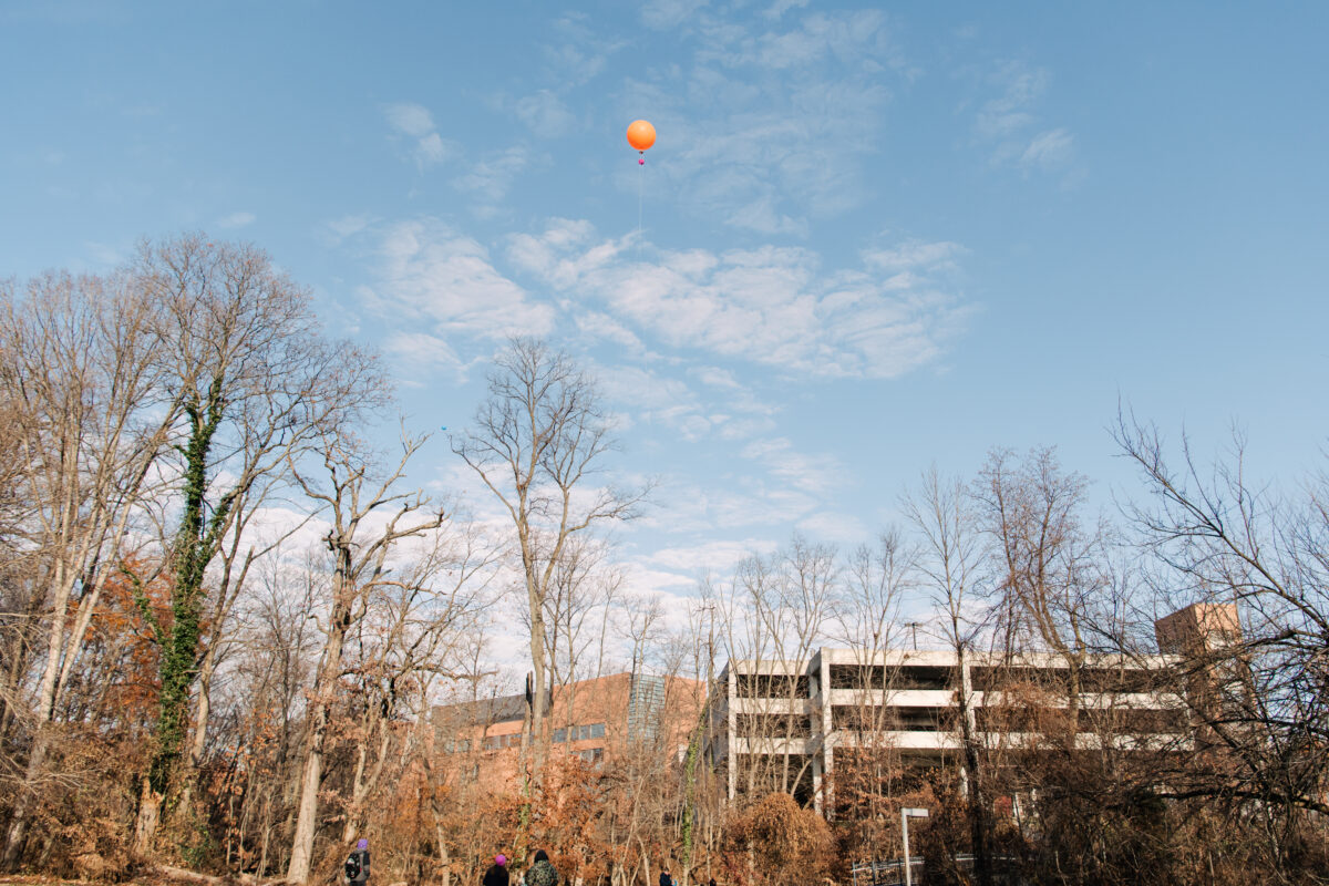
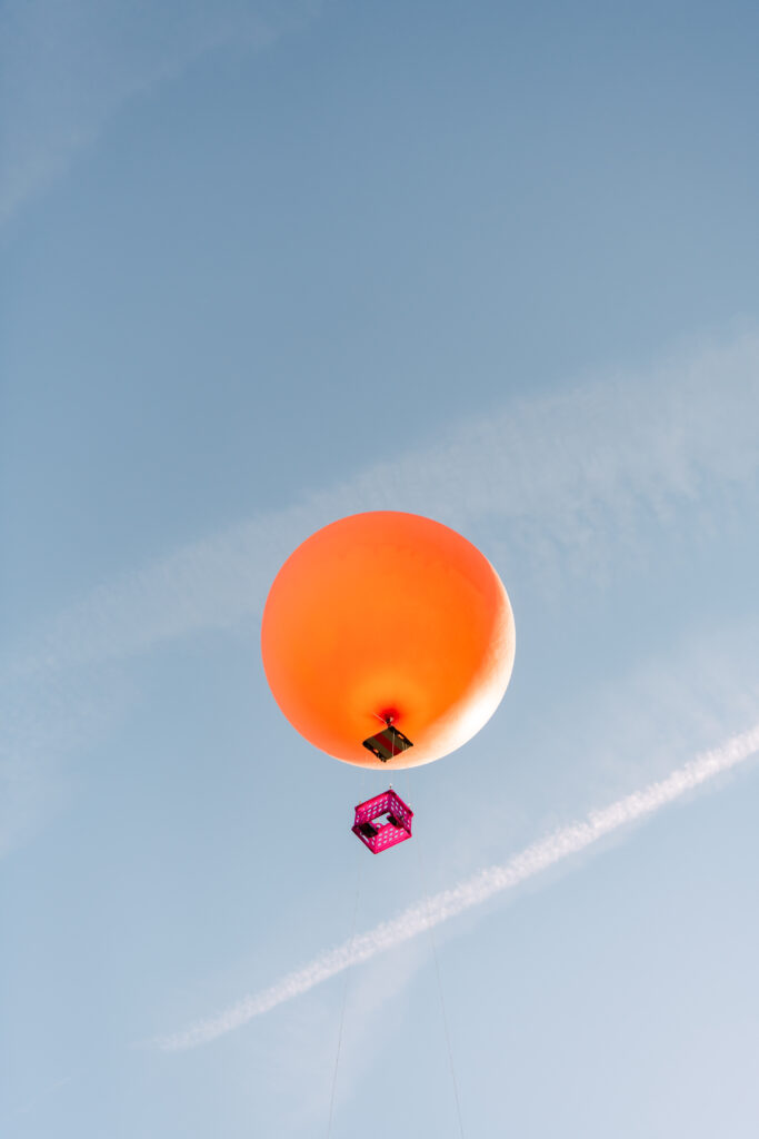
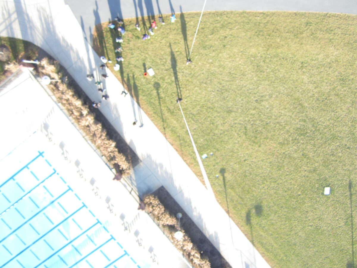
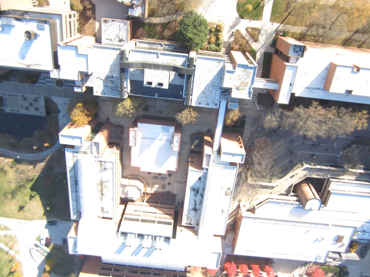
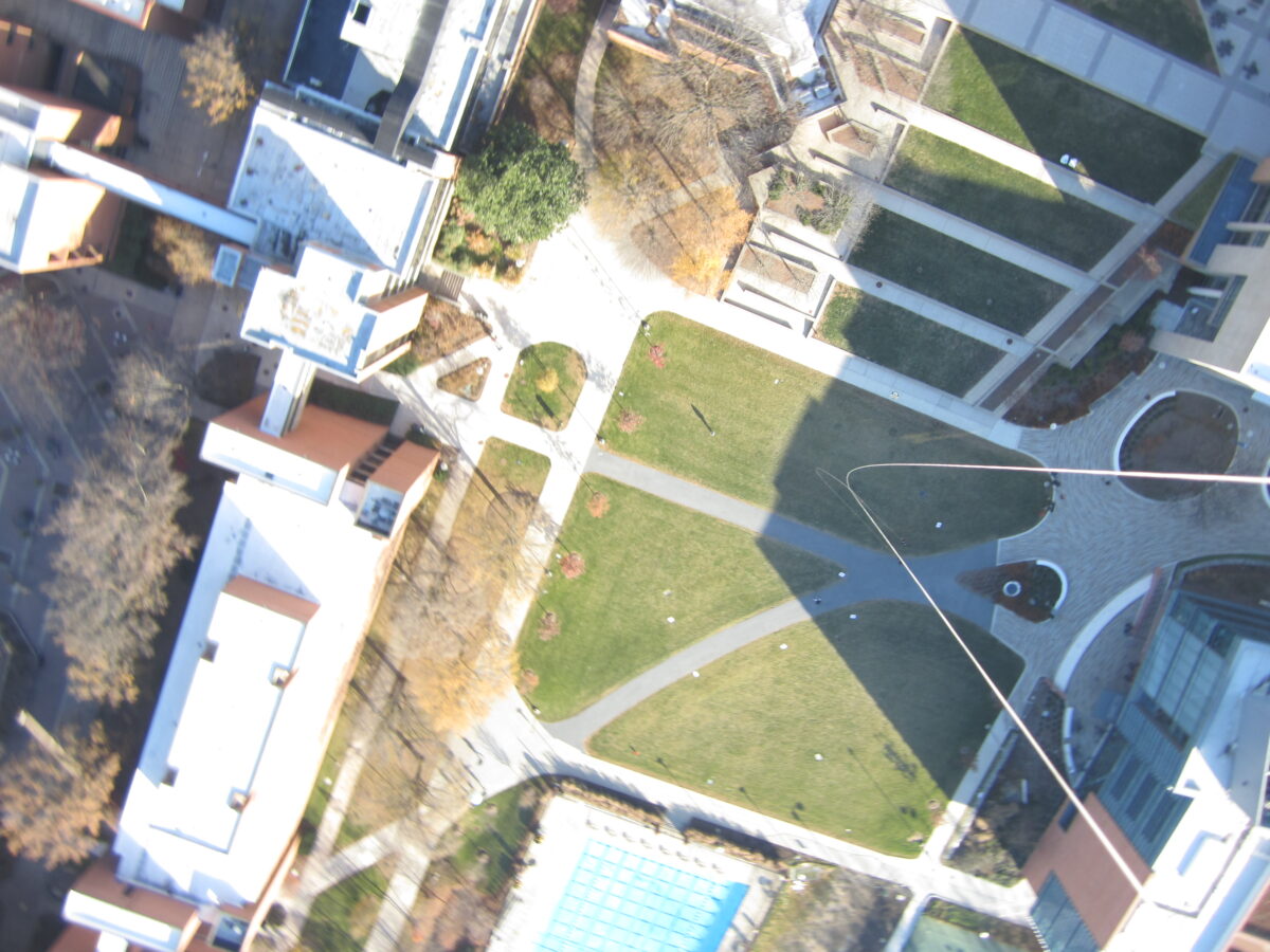
But back to the balloons. Each balloon flies with a digital camera attached, pointed at the ground. Previous students in the course coded a hack into the cameras that commands them to take a picture every 15 seconds as they float above campus.
Far below, students lay what look like paper archery targets flat on the ground and record their precise coordinates using GPS. These targets will show up in the photos taken by the camera on the balloon. Using the targets as reference points, the students will then be able to “geolocate” (tie to a point on the Earth’s surface) other objects—like buildings, trees, even people—in the camera’s photos.
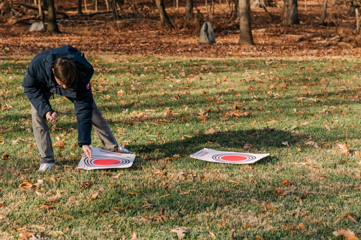
Kaylor creates a blank digital map at the start of the morning to record the coordinates. “It’s fun to watch in the lab while students are out in the field doing it,” Kaylor says, “because it starts blooming. You see students adding points in real time.”
In what other class…
The balloons have been a mystery to much of the campus community for years, with the colorful orbs dotting the campus sky in the tenth week of the semester. But for the students in Kaylor’s class, the balloons represent a culmination of the knowledge and skills they’ve gained.
Each student has their own reasons for taking the course. For some, it’s an opportunity to learn GIS skills—a must in the environmental field today—without spending too much time in front of a computer. As Kamsy Nwaiwau ’23, geography and environmental systems, puts it, “What other class do you get to hold a balloon 450 feet in the air? It’s something different.”
Whereas Alex Flitter ’23, mathematics and computer science, has a different perspective. He’s conducting research with Bedřich Sousedik, associate professor of mathematics, on how to model disease spread using ArcGIS—the same tool the students are using to locate points on the ground. GES 286 is “adding to my ability to visualize my research,” he says.
Learning openness
The course integrates a range of activities to get students thinking about how they could apply GIS to many fields of study. For one assignment, the students explore their own neighborhoods and mark the location of different businesses, like restaurants, pharmacies, and retail shops, and other neighborhood elements, like parks or bus stops. Then they use available data sets to see if they can identify associations with other neighborhood factors, like median income or education level.
This project “gets at the scientific process,” Kaylor says. He tells his students, “Any time a data set floats by, take a look at it and go, ‘What questions could I ask with this data?’ It’s a certain mode of openness.” Each in their own time, students get the idea. “What I love about GIS is—and you can count on it—any student who tries is going to have a GIS epiphany and start figuring things out,” Kaylor says, “and because it’s so applied and so tangible, it’s captivating.”
Making it real
This is Kaylor’s second time teaching the course after coming to UMBC from Temple University. He inherited the course backbone from Joe School, emeritus professor of GES, who still teaches the course in the summer. Kaylor has already made substantial changes, but has more in mind. One major goal is to create more opportunities for the students’ efforts to connect to real research projects.
““What I love about GIS is—and you can count on it—any student who tries is going to have a GIS epiphany and start figuring things out. And because it’s so applied and so tangible, it’s captivating.”
Kaylor has already launched a collaboration with Facilities Management at UMBC to compare the latest data set of campus trees to the reality on the ground. So far, the students have checked about 10 percent of the listed trees, and Kaylor plans to add more each semester.
“I’m hoping to integrate more things like that, that have an obvious practical application or benefit to campus,” Kaylor says. “Since we’re measuring things on campus, we might as well see what we can do with that.” For example, Kaylor has discussed with Matthew Baker, professor of geography and environmental systems, how his students might be able to support Baker’s environmental monitoring work on campus.
No matter what direction they go—whether epidemiology, ecology, or other fields—students who complete GES 286 will be better prepared to ask and answer useful questions about the world around them.
Teaching the class has been a rewarding experience for Kaylor as an instructor, too. The course “reconnected me with something that makes [GIS] live and breathe in a different way—a more exciting way,” he says. “Taking a more applied approach to it is a fun challenge. I’ve been having a great time teaching this class.”
Geography applies to everything
Finally, it’s time for the balloons to come down. As the students are wrangling them down and heading back to Sondheim Hall for a debrief, Joey Laiosa ’23, environmental science, shares that he previously worked in public safety as a dispatcher, then came back to school. He’s interested in conservation ecology, and using remote sensing to measure environmental health has particularly caught his attention.
“GIS is a really sought-after skill to have in a range of industries,” he says. That includes public safety, Laiosa says, where it could involve better pinpointing the location of an emergency in a complex environment like a construction site or an amusement park. “Geography applies to everything.”
Learn more about undergraduate research opportunities at UMBC.
Tags: CAHSS, CNMS, COEIT, CSEE, GES, MathStat