When talking about their summers, people in Scandinavia often refer to something magic they call “the week”. It’s the one week in the entire year which brings stable, sunny weather and high temperatures, which might reach the upper twenties. It’s the one and only week during which you can have breakfast and dinner in t-shirt on the trail day after day. A good summer may even offer two or three of those weeks, a bad one can pass without. The summer of 2012 keeps the pleasant surprise for the very end. But in mid-august, when I am about the reach the arctic circle, the weather forecast promises a dazzling series of warm, sunny days. The playground will be the Okstindan and Saltfjellet ranges.
About half an hour after leaving the camping in Hattfjelldal, I realize I have forgotten my Gore-Tex socks, which were drying in the camping building. As they were full of holes anyway and Fre, who will arrive in 5 days, will bring me a new pair, I decide not to turn back and cover the distance on my Sealskinz socks which I use as camp socks. I have another small concern: when going through the maps I have sent to Snasa, I notice I have somehow forgotten to print the maps I wanted to use to packraft across the Rossvatnet lake (later I will find them back in the post package I sent to Kautokeino). I will have to make it with a 1:200000 tourist map I have found in the village.
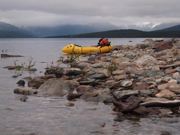
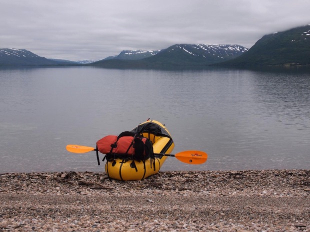
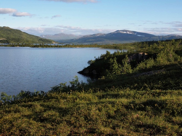
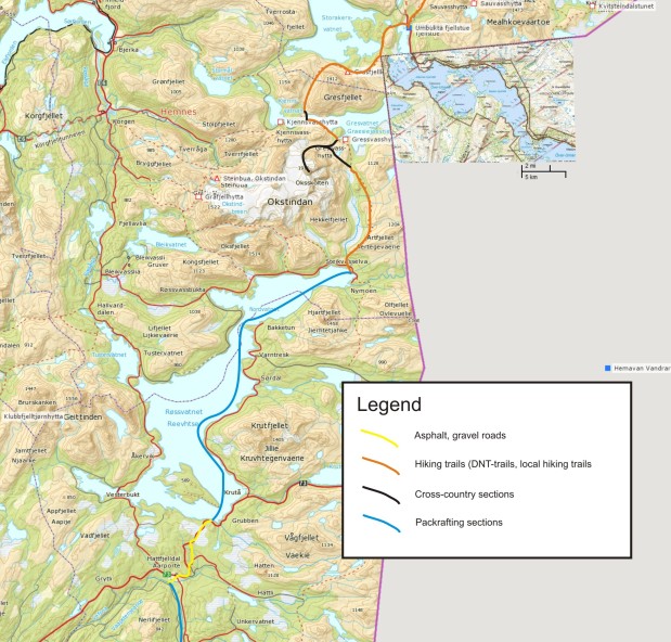
Not too much wind is predicted for the next two days, on which I want to do a 42km flatwater crossing of Rossvatnet, Norway’s second largest lake. My initial plan was to raft the western side of the lake, but as wind will be from the east I divert to the eastern side to have minimal waves.It’s an 11km stroll along the road until I reach the Elvneset inlet at the southern tip of the lake and start inflating my raft. The weather is cool and overcast with regular drizzle, and a very low cloudbase at about 800m. The remainder of the day passes without too much history. With almost no wind I keep paddling well into the evening hours. I beach my raft near the Tolkmoen farm and pitch my Cricket on a meadow.
The following morning the weather remains unchanged. It’s a pity as the lake could probably offer magnificent views onto the jagged peaks and large glaciers of the Okstindan range, but I rather have low clouds here than while being in the mountains. I pass the Hjartfjellneset narrow and continue following the southeastern shore of the northern part of the enormous lake. After another 20km of flatwater I finally reach the northeastern tip of the Rossvatnet near the Granheim farm. Right at the moment I leave my raft, the clouds start to break and the Okstinden range starts to appear. These first views immediately make the hair on my arms raise. It just feels like something very special is about the happen.
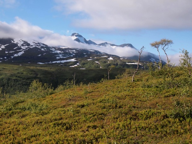
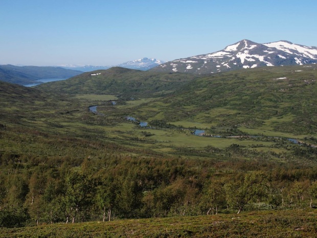
The Granheim farm also is the trailhead of a DNT-trail following the eastern slopes of the Speltfjelldalen valley towards the Gressavasshytta cabin. The path starts to climb through birch forest towards the west ridge of the Artfjellet. I cross a group of 6 women on the way up, who complain about the grey weather they have had during their trip from Umbukta. Looks like they have made their trip 3 days too early! When I reach the ridge, a phenomenal view onto the valley, with the river meandering peacefully through enormous peat bogs, opens up. The clouds have lifted and the highest peaks of the Okstindan range, Okshornet (1901m) and Oksskolten (1916m, highest mountain in Northern Norway) opens up. Small glaciers tumble down their eastern slopes.
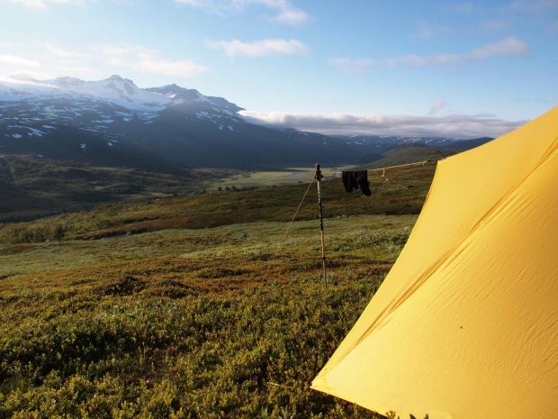
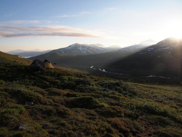
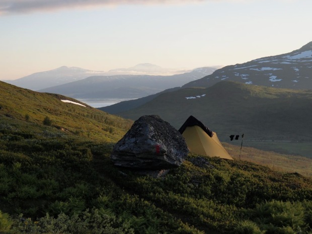
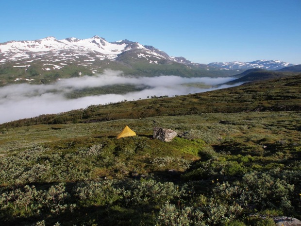
While the light gets softer I continue traversing the slopes of Artfjellet in this astounding scenery. Just before crossing the Artfjellbekken stream I find a nice, flat spot on the slope close to a big boulder. I immediately decide to stop and pitch my tarp. It is one of the finest camps of the entire trip and I stay outside long after sunset to enjoy the views, and the arrival of summers last recrudescence.
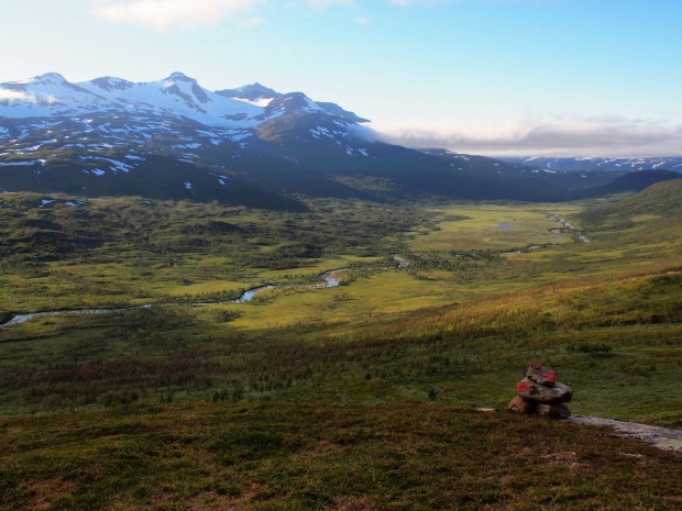
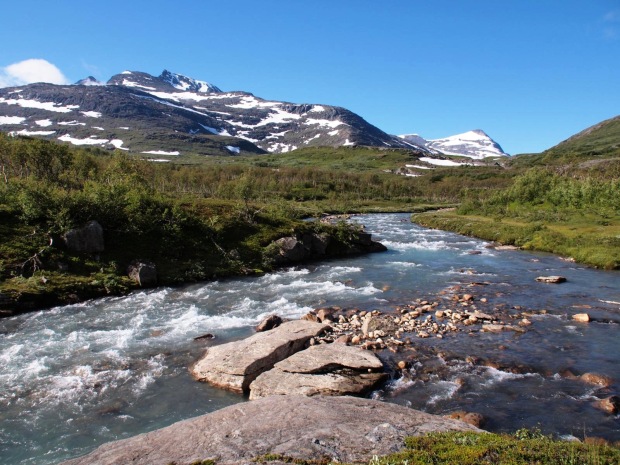
The magnificent Speltfjelldalen valley, with Oksskolten in the back, as seen while traversing the slopes of Artfjellet
The valley is filled with fog the next morning, but I am high above the humid zone and pack in warm sunshine. I am now one day ahead of schedule and I know all too well what I want to day with that day: go for a bivouac on the very summit of Oksskolten (1916m), the highest mountain of the range and of entire northern Norway. I can’t keep my eyes of the summit, which still towers an impressive 1300m above me, while continuing north on the panoramic route above the splendid Speltfjelldalen.
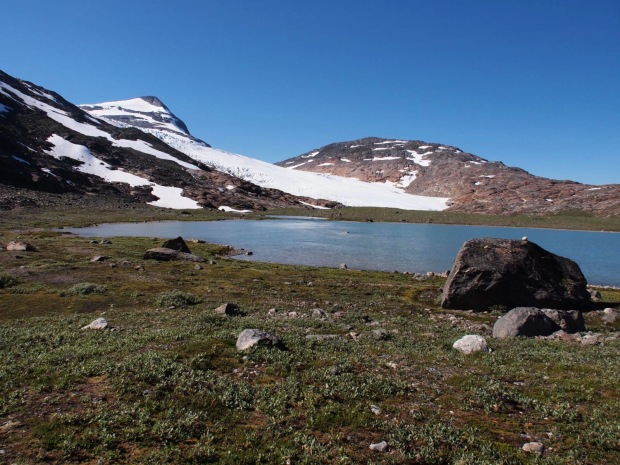
A few kilometers before reaching the Gressavasshytta I leave the trail and start my off-trail approach of the mountain. I have no idea if there is any route up marked by cairns or whatever, but looking at the maps the best route seems to be up the NW-ridge, starting from the proglacial Bretjønna lake at the snout of the huge Austre Okstindbreen, a glacier with an area of about 13km². I skirt along the Okstindtjønna lake and continue west until I finally reach the base of the mountain. Vegetation clearly becomes more scarce when I approach the snout of the rapidly retreating glacier.
It is 1 o’clock when I reach the Bretjønna lake. 1200m of ascent still separate me from the summit. I take a very long break not to be up there too early. Like always before I attempt a summit bivouac, I am overwhelmed by a mix of feelings of joy and nervosity. I hide my raft and paddle between some boulders to lighten my pack and then start climbing at around 3 o’clock.
I first climb up boulders along a stream draining the Oksskoltbreen, a small glacier in a cirque higher up the northern slopes of the mountain. At around 950m I reach the base of a long section of steep rock slabs, which are often wet and slippery because of melting snowfields higher up the slopes. With great care and a detour every now and then I make slow progress until the gradient eases at around 1150m. I quickly build a cairn to find back my route tomorrow morning. After that, I easily climb further up until I reach a bowl at 1200m, where I take a break to eat and drink before continuing. The final section of the NW-ridge looks rather impressive from this perspective. While I am sitting there, I suddenly notice a couple descending. We have a quick chat. They are Swiss making a 3 week tour in Northern Norway, and call the summit better than anything they have done in the Alps. Then they start complaining about the weather during the first half of august. Well, lucky they had not planned their trip in july…
I continue climbing on easy snowfields until I reach the NW-ridge near a pass at about 1350m, and then start tracking the ridge, which gets steeper and steeper, towards the summit. The views onto the Austre Okstindbreen are phenomenal. At about 1550m the most difficult part of the climb starts, with regular scrambles on boulders and rocks. At one point I say to myself: “well, if it gets any harder than this I better turn back”. But it doesn’t get any harder and at 1780m the ridge suddenly flattens out, a point which is marked by a huge cairn (the only one of the entire climb). The remainder of the climb is an easy hike while I start absorbing the landscape. At 6 o’clock I reach the summit of Oksskolten.
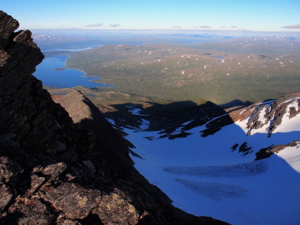
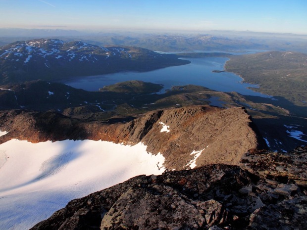
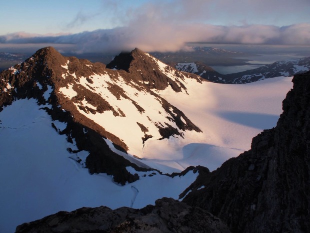
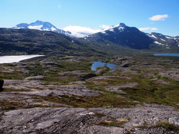
The views are extraordinary and amongst the best I’ve had in my life. Immense glaciers, notably the Austre Okstindbreen, drape the entire wild hearth of the range, with summits like Tvillingtindan and Okstinden (1804m) looking like small nunataks from my perspective. The Svartisen glacier is clearly visible in the west, Saltfjellet and even Sulitjelma dominate the northern horizon, with the Gresvatnet lake deep below me in front. The huge Rossvatnet, with Børgefjell in the back, is visible in the south. And then there is of course hundreds of lakes and mountains everywhere around me I cannot name.
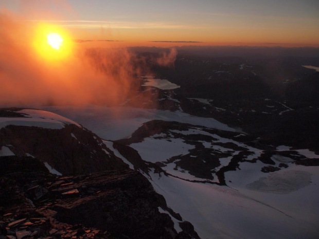
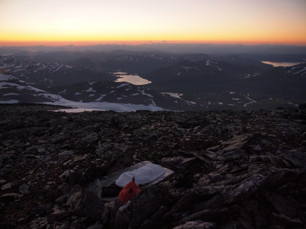
Fog drifts around the summit while the sun sets, making for a mysterious and dramatic atmosphere. I find a place to sleep about 10 meters below the summit; and when I open my eyes during the night, I can see stars for the first time of the trip. Autumn is on its way south and I won’t be long before the northern lights will start the cast their ghostly shadows upon the sleeping land.
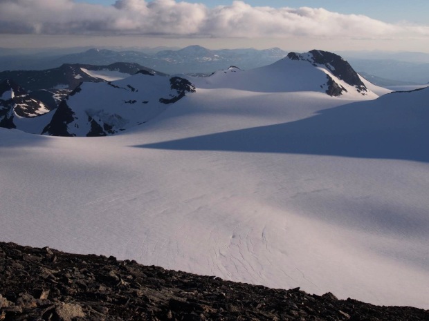
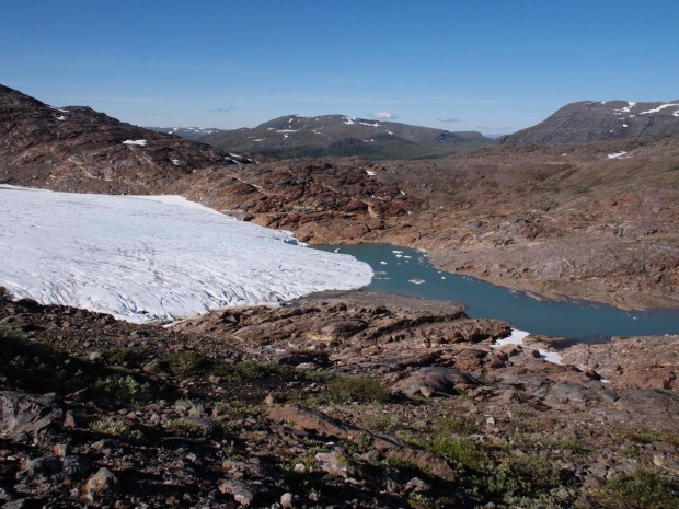
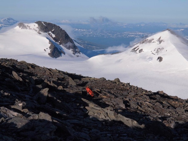
The Austra Okstindbreen, with the summits of Tvillingtanden and Okstinden at the other side of the glacier
I wake up at 5 o’clock in the morning. The sun is already up and I have breakfast at the summit while admiring the views for one last time. It’s always wonderful to see how the landscape shows new subtleties with the sunlight coming from the other side. At 6.30 I leave the summit of Osskolten. I carefully navigate down the ridge again, take a break in the bowl and then find back my route across the rock slabs and down to the lake, which I reach a bit after 9 o’clock.
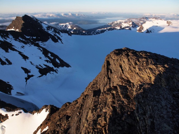
The upper part of Austra Okstindbreen with Rossvatnet in the back, as seen from Oksskolten in the morning
My plan for the day is easy: I will descend to the Gresvatnet lake, inflate my raft and paddle across both the Gresvatnet and Over-Uman lakes towards Umbukta, where I have a food drop waiting. It should be a 5-6 hour stage from this point, and I am ready to make a good pace so I can arrive early, take a shower and enjoy a beer on the terrace. I descend off-trail along the thundering glacial Oksfjellelva river until I reach the shores of the lake.
But I have a problem. A northerly wind (headwind) has suddenly picked up, with relatively large waves sweeping across the lake. No way I can make it across in these conditions. For every lake I have prepared a ‘plan B’ at home, with some maps to allow an on-shore detour. But apparently I have forgotten to print the maps for the Gresvatnet – Over-Uman stretch. I know there is a DNT-path from Gressvasshytta towards Umbukta, but I have no idea how long it is (I vaguely remember 5 DNT-hours), and have no map are whatever I case the trail is poorly marked. But my options are few and I only have food left for today, so I start walking anyway with the intention to make it all the way to Umbukta.
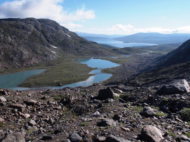
I follow the southern shore of Gresvatnet of sometimes rough terrain until I reach the dam at the western end of the lake. Waymarking has been good so far, but here the DNT-volunteer seems to have been running out of paint. Nothing to be found anywhere. No mobile phone coverage to have a quick check on the general route description on the DNT-website. There is a valley towards the north and I have a bet that’s the one I have to walk through. I cross the dam and after 2km of off-trail hiking, I find a marking again! Ouf! I take a break, then continue following the valley (Storskardet), which offers highly enjoyable tundra terrain and splendid views back towards the Oksskolten summit. My hopes to make it to Umbukta are high again.
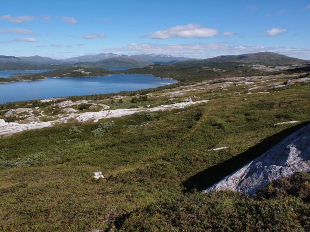
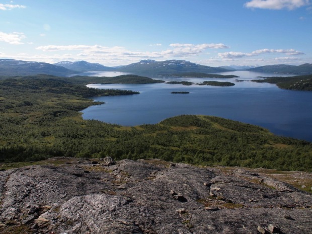
By 2 o’clock in the afternoon I reach the northern end of the valley. A massive view onto the Storakersvatnet opens up. But this is also the point where I realize I’m not quite there yet. I have been in Umbukta during a winter trek in april and recognize some points in the landscape. The only conclusion I can draw from this is that it is at least another 15km towards the hut. It is the warmest day of the entire summer with temperatures well into the 20’s. The wind has dropped and the sun doesn’t take a break for the entire day. I literaly get cooked when I traverse above the lake, and feel my energy level running lower and lower as I have to descend into and climb out of yet another deep gully cutting through the slopes.
I am near Grunnvasskardet, only 6km short of Umbukta (and back onto my maps), when realize I am getting dehydrated and sunstroked. It is 5 o’clock. Instead of pushing on immediately, I decide to take a long break, cook dinner and drink 2 liters of water. In the meantime the temperature starts to drop. After one hour I get going again, cross a final pass, batter through a long peat bog and eventually reach the Umbukta hut a bit before eight in the evening. I have been on the trail for well over 13 hours, covered 35km and made an accumulated altitude difference of nearly 3000m. It has been the longest hiking day I have ever made and I feel absolutely knackered when I ring the doorbell at the hut. It is a very sobering feeling that guys like Skurka can make this kind of stages for months and months.
Thor-Inge is not a standard warden. He is one of the very few people who have covered Norge pa Langs both in summer ánd in winter. I guess I must have looked rather spent when he opens the door.
He immediately askes: “where have you walked from???”.
“Today?”, I answer.
“No, no, before…”
“Lindesnes”
“Come with me”, he says. He gets the key of the Stabburet, a small authentic side building. I get it for free for the night! I also get my beer for free. I feel intensely happy when I feel my muscles relax on the terrace in the warm evening sun. Sometimes life is even better than you could have dreamt it.
Stages:
11/08/2012: Hattfjelldal – Tolkmoen (33km, +290/-130, 6h30)
12/08/2012: Tolkmoen – Speltfjelldalen (25km, +400/-40, 6h30)
13/08/2012: Speltfjelldalen – Oksskolten (20km, +1480/-410, 6h45)
14/08/2012: Oksskolten – Umbukta (35km, +660/-2050, 9h10)
