


You also want an ePaper? Increase the reach of your titles
YUMPU automatically turns print PDFs into web optimized ePapers that Google loves.
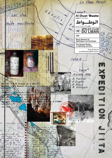
<strong>Al</strong>-Ouat ’Ouate<br />
NUMBER 15 NEW SERIES<br />
طاوـطولا<br />
ةديدجلا ةلسلسلا 15 ددعلا<br />
2009<br />
SPELEO CLUB<br />
DU LIBAN<br />
Revue <strong>Liban</strong>aise de<br />
<strong>Spéléo</strong>logie et de Karstologie<br />
The Lebanese Review<br />
on Speleology and Karst<br />
ةينانبللا ةلجملا<br />
تسراكلا ملعو رواغملا ةساردل<br />
<strong>Al</strong>-Ouat ’Ouate 15<br />
| 1
2 | <strong>Al</strong>-Ouat ’Ouate 15<br />
| 3
17/1/57 خيرات 90 مقر ربخو ملع 1951 ماع سسأت<br />
28/11/63 خيرات 14262 مقر موسرملا ةماع ةعفنم تاذ ةيعمج<br />
28/11/69 خيرات 512 مقر )طباض( ينطولا زرلاا ماسو لماح<br />
10/10/05 خيرات 154000 مقر )سراف( ينطولا زرلاا ماسو لماح<br />
رواغملا يف بيقنتلل ينانبللا يدانلا<br />
نانبل, سايلطنا 70 923 :ب.ص<br />
<strong>Spéléo</strong> <strong>Club</strong> <strong>du</strong> <strong>Liban</strong><br />
P.O.Box 70 923, Antelias, Lebanon<br />
For more information:<br />
info@speleoliban.org<br />
www.speleoliban.org<br />
ISSN 1999-8287<br />
FONDE EN 1951 AU.MIN.NO. 90 DU 17/1/57<br />
RECONNU D’UTILITE PUBLIQUE DU NO. 14262 DU 28/11/63<br />
CITE A L’ORDRE NATIONAL DU CEDRE (Officier) NO. 512 DU 24/2/69<br />
CITE A L’ORDRE NATIONAL DU CEDRE (Chevalier) NO.15400 DU 10/10/05<br />
يدان مدقأ وه و يبكرك يماسو ماوخ نومير ،يفانأ ريبلا ،ه ّ رغ لانويل دي ىلع رواغملا يف بيقنتلل ينانبللا يدانلا سسأت 1951 يف<br />
ةقلعتملا نوؤشلا يف يدانلا متهي .ملاعلا ءاحنا عيمج يف نيعزوم وضع 200 نم رثكا مضي .طسولاا قرشلا يف نيروغتسملل<br />
يف و )1963/11/28 خيرات 14262 مقر موسرملا( ةماع ةعفنم تاذ ةيعمج بقل قحتسا 1963 يف .ةسراكلا ملع و رواغملاب<br />
زرلاا ماسو لان هنأ امك اتيعج ةراغم يف هلامعا ىلع )1969/2/24 خيرات 512 مقر( طباض ةبترب ينطولا زرلاا ماسو لان 1969<br />
.)2005/1./1. خيرات 154000 مقر( سراف ةبترب ينطولا<br />
The <strong>Spéléo</strong> <strong>Club</strong> <strong>du</strong> <strong>Liban</strong> was founded in 1951 by Lionel Gorra, <strong>Al</strong>bert Anavy, Raymond Khawam and Sami<br />
Karkabi. It is the oldest caving club in the Middle East. It has over 200 members all over the world. The club<br />
specializes in speleology and karst. The club was awarded the 'A <strong>Club</strong> that is a Benefit to the Public' Order by the<br />
Lebanese government in 1963. 'The National Order of the Cedars', from the Lebanese government was awarded<br />
for their work in Jiita Cave, rank Officer, in 1969. In 2005 a second Order of the Cedars was awarded to the<br />
club, rank Knight.<br />
Le <strong>Spéléo</strong> <strong>Club</strong> <strong>du</strong> <strong>Liban</strong> fut fondé en 1951 par Lionel Gorra, <strong>Al</strong>bert Anavy, Raymon Khawam et Sami Karkabi. Il s’agit<br />
<strong>du</strong> plus ancien club de spéléologie au Moyen-Orient et comprend plus de 200 membres au monde entier. Le club est<br />
spécialisé en spéléologie et karstologie. En 1963, il fut décrété d’utilité publique (décret N˚14262 <strong>du</strong> 28/11/1963). En<br />
1969, il reçu l’Ordre National <strong>du</strong> Cèdre <strong>du</strong> grade Officier (N˚512 <strong>du</strong> 24/02/1969) pour les travaux effectués dans la grotte<br />
de Jiita et reçu en 2005, un second Ordre National <strong>du</strong> Cèdre <strong>du</strong> grade Chevalier (N˚154000 <strong>du</strong> 10/10/2005).<br />
<strong>Al</strong>l Rights Reserved<br />
© 2009 SPELEO CLUB DU LIBAN<br />
No part of this publication may be repro<strong>du</strong>ced or transmitted in any form by any means, electronic or mechanical, including photocopy,<br />
recording or any information storage and retrieval system, without the permission in writing from the copyright owner.<br />
<strong>Al</strong>-Ouat ’Ouate<br />
NUMBER 15 NEW SERIES<br />
طاوـطولا<br />
ةديدجلا ةلسلسلا 15 ددعلا<br />
Revue <strong>Liban</strong>aise de<br />
<strong>Spéléo</strong>logie et de Karstologie<br />
In collaboration with<br />
The Lebanese National Council for Scientific Research<br />
4 | <strong>Al</strong>-Ouat ’Ouate 15 | 5<br />
2009<br />
SPELEO CLUB<br />
DU LIBAN<br />
The Lebanese Review<br />
on Speleology and Karst<br />
ةينانبللا ةلجملا<br />
تسراكلا ملعو رواغملا ةساردل<br />
Editors<br />
Issam Bou Jaoude<br />
Johnny Tawk<br />
Layout and collages<br />
Rena Karanouh
“Learn to see” as physician William Osler said in the 19th century.<br />
What helped scientists like Charles Darwin, <strong>Al</strong>fred Russel, Franklen Evans, Edouard Dupont and<br />
others to understand is that they not only possessed the ability to look but also to see. This is the major<br />
foundation for their amazing discoveries.<br />
Learning to ‘look and see’ is what SCL is trying to do.<br />
Lebanon, the land of karst in the Middle East, has a special ecosystem being a melting point<br />
between Africa, Asia and Europe. It has striking caves and karst elements that not only need to be looked at,<br />
but also to be seen.<br />
In Lebanon we are starting to uncover the amazing karst environment that we live in, including our<br />
remarkable caves, speleothems and fauna present in them. <strong>Al</strong>l this and much more are to be looked at and<br />
seen in such a fragile environment. Caves are truly the last frontiers on earth and in Lebanon and they still hold<br />
places that have never been seen before.<br />
Let us keep our eyes open and watch out for the amazing environment that we live in.<br />
We should also thank and pay tribute to our fathers, who got us were we are now, and in their<br />
honour let us teach and help the new generation to follow the path that we have learnt.<br />
Issam Bou Jaoude<br />
Editor<br />
We would like to thank Shk. Khalid Bin Thani A. <strong>Al</strong> Thani from First International Investment Group,<br />
Mr. Ab<strong>du</strong>lla Bin Nasser <strong>Al</strong> Misnad from Gulf Cement Company and Mr. Marwan Zgheib from MZ & Partners for<br />
their moral and financial support to ensure a consistent release of our publication.<br />
We would also like to thank Dr. Dia Karanouh and Mrs. Nidal Nseir and Ms. Hala Bou Jaoude for<br />
their valuable revision of the English articles, Stephanie Mailhac for her French translation and Maya Sarrouf<br />
for her help.<br />
اهيفلؤم ةيلؤسم يه طاوطولا ةلجم يف تروشنلما اهونيماضمو تلااقلمأ.<br />
The articles and their content published in the <strong>Al</strong> Ouat’Ouate magazine are the responsibility of their authors.<br />
La responsabilité des articles publiés dans <strong>Al</strong> Ouat’Ouate n’engagent que leurs auteurs.<br />
10 LES PREMIERS<br />
20 ROUGE SUR BLANC 24 FINAL NOTES<br />
28<br />
TRAÇAGES À<br />
Maïa Sarrouf<br />
ON SALLE<br />
L’URANINE<br />
BEAYNO<br />
AU LIBAN<br />
Elias Labaki<br />
Sami Karkabi<br />
Samer Harb<br />
34 FIRST GEOCHEMICAL 42 JIITA WITH SAMI<br />
50 STALAGMITES AND 54<br />
STUDY OF<br />
Rena Karanouh<br />
COLUMNS OF JIITA<br />
STALAGMITES<br />
Georges Haddad<br />
FROM JIITA CAVE<br />
Fadi Nader<br />
Issam Bou Jaoude<br />
68 PRELIMINARY<br />
70 BAT CENSUS IN<br />
74 EVALUATION OF<br />
80<br />
ANALYSIS OF THE<br />
LEBANESE CAVES<br />
HUMAN IMPACTS<br />
ARCHAEOLOGICAL<br />
2008 & 2009<br />
ON KANAAN CAVE<br />
MATERIAL<br />
Assad Saif<br />
Ivan Horáček et al<br />
Maïa Sarrouf<br />
85 مادتسلما طئارلخا مسر<br />
Philipp Häuselmann<br />
88 WHAT’S IN A LOGO<br />
Nadine Sinno<br />
94 OUR THURSDAY<br />
MEETING<br />
HEADQUARTERS<br />
Bashir Khoury<br />
96<br />
98 ADVENTURES IN<br />
CAVE CLIMBING<br />
Issam Bou Jaoude<br />
104<br />
IRAN<br />
Johnny Tawk<br />
Habib el Helou<br />
Fadi Nader<br />
108 DISCOVERING ES-<br />
SUWAYDA<br />
LAVA CAVES IN<br />
SOUTHERN SYRIA<br />
Johnny Tawk et al<br />
112<br />
contents<br />
THE SALLE<br />
BLANCHE<br />
EXPEDITION<br />
Issam Bou Jaoude<br />
Wassim Hamdan<br />
LA PHOTOGRAPHIE<br />
SPÉLÉOLOGIQUE<br />
AU LIBAN<br />
Sami Karkabi<br />
Johnny Tawk<br />
RAYMOND KHAWAM<br />
Sami Karkabi<br />
Johnny Tawk<br />
PROTECTING OUR<br />
CAVING HERITAGE<br />
Karen Moarkech<br />
BARLANGS IN<br />
BUDAPEST<br />
& UNDER AGGTELEK<br />
Emma Porter<br />
116 A RENDEZVOUS WITH 118 A YEAR INSIDE<br />
126 ROUEISS GEOLOGY 132 NEW DISCOVERIES<br />
MAMMOTH CAVE<br />
ROUEISS CAVE<br />
Rena Karanouh<br />
Rena Karanouh<br />
Hadi Kasammani,<br />
Wassim Hamdan,<br />
Nabil Shehab<br />
Issam Bou Jaoude<br />
6 | <strong>Al</strong>-Ouat ’Ouate 15 | 7
A canyon passage in Rahoue cave<br />
(Photo by Johnny Tawk)<br />
> Mgharet el Rahoue<br />
> The detailed survey of Chaos, Jiita.<br />
> The Pearls of Jiita.<br />
Thanks to our generous sponsors<br />
Shk. Khalid Bin Thani A. <strong>Al</strong> Thani,<br />
Mr. Ab<strong>du</strong>lla Bin Nasser <strong>Al</strong> Misnad<br />
and Mr. Marwan Zgheib, the<br />
coming issue of <strong>Al</strong>-Ouat’Ouate<br />
Magazine, issue 16, is already in<br />
the works. Several articles are<br />
already being researched. Here<br />
are some of the new discoveries,<br />
scientific reasearch and many<br />
varied cave related issues that<br />
will appear in our next issue:<br />
> Underground Activities<br />
> The Pearls of Kanaan.<br />
> Bats survey of Lebanon, 2010<br />
> Roueiss cave Archeology > Mgharet el Hadid<br />
<strong>Al</strong>-Ouat ’Ouate 16<br />
> Karst plateau > Colouration. > The karst of Lebanon<br />
8 | <strong>Al</strong>-Ouat ’Ouate 15 | 9
.بيرغ عباط ةراغلما هذهل<br />
مجح« مجلحا ثيح نم نانبل يف رواغلما ةعيلط يف نوكت نا ديرت يه<br />
.تلاكشتلا لامجو عافترلااو لوطلاو »تلاكشتلاو تارملما<br />
هذه مهاو .ةراغلما هذه لخاد رطسم نانبل يف راوغتسلأا خيرات<br />
نانبل يف راوغتسلاا ةدمعا دحأ ةدايقب ينينانبللا دي ىلع ةئاج تافاشتكلاا<br />
.يبكرك يماس ديسلا رواغلما يف بيقنتلل ينانبلا يدانلا يسسؤم دحاو<br />
عقوم نلاا وهو يولعلا قباطلا فاشتكا ىلع ةنس ينسمخ دعب<br />
رارساب ظفتتح لازت ام ةراغلما هذه .يبرعلا انلماع يف مارتحلااب ريدج يحايس<br />
.لمم سيلو قيطب لكشب نكلو ًايرود اهنع حاصفلاا ىلع دمتعتو<br />
ةراغلما هذه لمج ىلع طاوطولا ةلجم نم ددعلا اذه يف ءوضلا يقلن<br />
تارماغمو ناولأا ةددعتم تلاكشت نم اهلماعم نع حاصفلاا للاخ نم<br />
.اهلخاد تافاشتكلأا ةقفار ةقوشم<br />
هيلع ةظفالمحاو اتيعج ةراغلم بيرغلا عباطلا اذه عم ملقأتن نا بجي<br />
.ةمداقلا لايجلاا كلم هنلا<br />
Have you ever met Jiita?<br />
It can never bore you.<br />
You can never but enjoy every moment you spend in her realms. It<br />
amazes you when you go in but will beat you every time on your way out.<br />
But it is surely a cave with an attitude.<br />
Jiita cave wants to be the Giant of all caves in Lebanon. It desires to be<br />
the longest, the largest, the most beautiful and the one that holds the most<br />
cave secrets.<br />
It is the mother of our founding fathers. It witnessed the birth of our<br />
club in 1951. It triggered a swirl of caving adventures in Lebanon. Caving<br />
history was written in it.<br />
Fifty years since the discovery of its Upper Gallery, Jiita is now<br />
the most visited tourist attraction in Lebanon, its beauty rivaling many<br />
international show caves.<br />
This cave still holds on to many of its secrets. But it is slowly showing<br />
them to us bit by bit. The process is so slow it hurts, but still, anything<br />
worthwhile is worth waiting for, right?<br />
We pay tribute in this issue of the <strong>Al</strong>-Ouat’Ouate magazine to this<br />
amazing cave by showing you some of its new secrets: big columns;<br />
amazing stalagmites; stories from one of its great discoverers Mr. Sami<br />
Karkabi; its white and red galleries; and its climatic imprints...all this and<br />
more.<br />
We keep on watching for what she decides to unveil next.<br />
Connaissez-vous Jiita?<br />
Vous ne pourriez que prendre plaisir de chaque moment passé dans<br />
ses bras. Jiita vous surprendra et vous marquera de manière inoubliable<br />
au cours de votre visite et bien après. Cette grotte a sûrement un caractère,<br />
un charme, la plus longue des grottes libanaises, la plus jolie et surtout,<br />
la plus secrète. Elle est la mère de nos pères fondateurs et témoin de la<br />
naissance de notre club en 1951 où le berceau et l’histoire des aventures<br />
spéléologiques libanaises furent écrits.<br />
50 ans après la découverte des Galeries Supérieures, Jiita est la plus<br />
grande attraction touristique <strong>du</strong> pays et sa beauté rivalise celle des grottes<br />
internationales aménagées.<br />
Conservant minutieusement ses secrets, Jiita les dévoile peu à peu.<br />
Le progrès est lent et douloureux, mais les résultats prouvent le mérite des<br />
efforts.<br />
Dans cette édition <strong>du</strong> magazine <strong>Al</strong> Ouat’Ouate, nous rendons hommage<br />
à cette grotte en vous dévoilant, autant que possible, sa splendeur, ses<br />
colonnes, ses stalagmites, les histoires de son plus grand explorateur M.<br />
Sami Karkabi, ses galeries rouges et blanches, ses empreintes climatiques…<br />
tout cela et encore plus.<br />
Prenez plaisir dans l’attente de ses prochains dévoilements.<br />
10 | <strong>Al</strong>-Ouat ’Ouate 15 | 11
DYE-TRACING hISToRY<br />
Sami Karkabi | kraks@cyberia.net.lb<br />
LES<br />
PREMIERS<br />
TRAÇAGES<br />
ÀL’URANINE<br />
AU LIBAN<br />
Résumé<br />
Le désaccord qui opposait la Compagnie des Eaux<br />
de Beyrouth à la Société des Eaux <strong>du</strong> Kesrouan remonte à<br />
1911. Il concernait le captage des eaux de Nabaa el Laban<br />
à des fins d’irrigation. La Compagnie assurait qu’elle<br />
était lésée par ce captage, soupçonnant que les eaux qui<br />
s’écoulaient librement auparavant dans le lit <strong>du</strong> Nahr<br />
es Salib alimentaient aux travers de fissures la rivière<br />
souterraine de Jiita, ce cours d’eau souterrain ravitaillant<br />
à son tour la rivière souterraine. Trois traçages à la<br />
fluorescéine destinés à vérifier les faits furent entrepris en<br />
1913 dans des conditions précaires, rendant les résultats<br />
peu fiables.<br />
Afin de mettre fin à ce litige, le Général Weygand,<br />
Haut Commissaire de la République Française en Syrie<br />
et au <strong>Liban</strong>, institue par décision N°1998, le 26 juillet<br />
1923, une ‘’Commission’’ destinée à chercher l’origine de<br />
l’alimentation en eaux de la source principale <strong>du</strong> Nahr el<br />
Kelb.<br />
C’est à la suite de recherches effectuées dans les<br />
archives diplomatiques de Nantes (Mandat Syrie-<strong>Liban</strong>) et<br />
dans la revue <strong>Al</strong> Kulliyah de l’Université Américaine de<br />
Beyrouth qu’un certain nombre d’éléments relatifs à cette<br />
affaire ont été reconstitués.<br />
Il nous est apparu indispensable, vu la complexité de<br />
cette histoire, de retracer brièvement les différentes phases<br />
de son évolution.<br />
يذلا لدجلاب ةطيحملا فورظلاو لحارملا ىلا لاقملا اذه قرطتي<br />
هايم ةيعمجو توريب هايم ةكرش نيب نبللا عبن مرح ىلع لصح<br />
عبن نم ةقفدتملا هايملا نا لوقت ةكرشلا .1911 ماع يف ناورسك<br />
يفوجلا ىرجملا يذغتل بيلصلا ةقطنم يف قوقشلا يف روغت نبللا<br />
نم دكأتلل 1914 ةنس تلصح يتلا نيولتلا تايلمع .اتيعج عبنل<br />
نانبلل يماسلا ضوفملا ماق كلاذل .ًاعفن يدجت مل ةيرظنلا هذه<br />
1923 زومت يف 1998 مقر رارق رادصأب دراغنيو لارنجلا كاذنا ايروسو<br />
فيشراب ثحابلأ نيعتسي .لاكشلأا اذه يف رظنلل ةنجل نيعتب<br />
.تنان يف يسامولبدلا فيشرلااو ةيكرملأا ةعماجلا<br />
The disagreement on the catchment area of Nabaa el Laban between the<br />
Beirut Water Company and the Society of Waters of Kesrouan goes back to<br />
1911. The Company argued that the water passing freely in the bed of Nahr<br />
el Salib fed the underground river of Jiita through fissures and fractures.<br />
Three tracing tests using fluorescéine were undertaken in 1913 to prove<br />
this theory, proved inconclusive. To put an end to this debate, the General<br />
Weygand, high commissioner of the French République in Syria and in<br />
Lebanon, formulates a decision N°1998, on July 26th, 1923. The decision<br />
stipulates a «Commission» intended to search for the main source of Nahr<br />
el Kelb. This paper shortly illustrates the history and the stages regarding<br />
the issue at hand with the aid of information gathered from the archives of<br />
’Archives Diplomatiques de Nantes’ (Mandate Syria – Lebanon) and the <strong>Al</strong><br />
Kulliyah bulletin from the American University of Beirut.<br />
Il nous est apparu<br />
indispensable,<br />
vu la complexité<br />
de cette histoire,<br />
de retracer<br />
brièvement<br />
les différentes<br />
phases de son<br />
évolution.<br />
L’alimentation en eau de Beyrouth en 1870<br />
La capitale libanaise est ravitaillée dès 1870 par<br />
les eaux issues de la résurgence des grottes de Jiita,<br />
source principale <strong>du</strong> Nahr el Kelb. La concession de cette<br />
opération appelée ‘’Entreprise des Eaux de Beyrouth’’<br />
(devenue Compagnie des Eaux de Beyrouth) est accordée<br />
le 22 juillet 1870 par firman <strong>du</strong> Gouvernement Impérial<br />
Ottoman à M. Thevenin, ingénieur français, aux conditions<br />
suivantes : les eaux nécessaires seront empruntées au Nahr<br />
el Kelb en un point voisin de son embouchure dans la<br />
Méditerranée et seront con<strong>du</strong>ites par un canal d’amenée à<br />
l’usine de Dbayeh. Une partie de ces eaux servira de force<br />
motrice aux turbines qui la refouleront à Beyrouth, l’autre<br />
sera préalablement filtrée puis élevée au moyen d’une<br />
usine hydraulique qui s’établira et fonctionnera de façon<br />
à ne gêner ni les irrigations ni les moulins desservis par le<br />
cours d’eau. La quantité d’eau amenée à Beyrouth est fixée<br />
au minimum à 4000 m 3 par 24 heures. L’eau utilisée pour<br />
refouler à la vapeur 1 m 3 , exigerait l’emploi de dix autres<br />
mètres cubes environ par les installations hydrauliques.<br />
Le 6 novembre 1897 cette concession, à courir de la<br />
date <strong>du</strong> firman impérial, a été prolongée de 40 ans par une<br />
convention additionnelle.<br />
L’alimentation en eau <strong>du</strong> Kesrouan<br />
Le 3 avril 1893, un permis d’exploitation à but<br />
d’irrigation, <strong>du</strong> Nahr es Salib est accordé par la cour<br />
administrative <strong>du</strong> <strong>Liban</strong> au Cheikh Sejaan Maroun el<br />
Khazen. La Compagnie ne s’en inquiéta pas estimant que<br />
le Cheikh n’avait apparemment pas les moyens financiers<br />
d’aboutir mais soupçonnant toutefois, quoique n’en ayant<br />
aucune preuve, que les eaux issues de la résurgence de Jiita<br />
étaient directement alimentées par les eaux d’infiltration<br />
provenant <strong>du</strong> Nahr es Salib.<br />
En 1905, les droits <strong>du</strong> Cheikh Sejaan, étaient<br />
transférés au Cheikh Mansour el Bittar.<br />
Au mois de Juin 1907, Sélim Bey Chaker, sujet<br />
ottoman, natif <strong>du</strong> village libanais de Deir el Harf,<br />
représentant un syndicat de financiers d’Egypte, demande<br />
à la cour administrative de transférer encore une fois ces<br />
droits à son propre nom. Craignant que cette fois ne soit<br />
réalisé le projet, la Compagnie s’en alarme et proteste<br />
de façon formelle auprès de Youssef Pacha, Gouverneur<br />
<strong>du</strong> <strong>Liban</strong>. Cette crainte découle <strong>du</strong> fait, que si la quantité<br />
d’eau fournie pendant les mois d’hiver suffisait à tous les<br />
besoins, il n’en serait pas de même à l’étiage (de juin à<br />
novembre) pour refouler 640.000 m 3 d’eau à la vapeur. A<br />
ceci, s’ajouterait l’obligation de modifier les installations<br />
hydrauliques afin de les adapter à un débit plus ré<strong>du</strong>it que<br />
celui pour lequel elles avaient été calculées, d’où préjudice<br />
et énorme dommage.<br />
Ne tenant aucun compte de cette protestation ainsi<br />
que celle de la demande de Sélim Bey Chaker,<br />
12 | <strong>Al</strong>-Ouat ’Ouate 15 | 13
Youssef Pacha, accorde une nouvelle autorisation à Michel<br />
Bey Tueni. La Compagnie protesta alors auprès de la<br />
Sublime Porte, par l’intermédiaire <strong>du</strong> Wali de Beyrouth. Le<br />
Gouverneur <strong>du</strong> <strong>Liban</strong> fut invité à fournir des explications<br />
et le Gouvernement Impérial envoya de Constantinople<br />
un haut fonctionnaire des Travaux Publics mandaté pour<br />
effectuer une étude scientifique et géologique de concert<br />
avec les ingénieurs <strong>du</strong> Wilayet et <strong>du</strong> <strong>Liban</strong>. Toutefois,<br />
la Compagnie n’ayant qu’une confiance limitée dans<br />
les connaissances scientifiques de ces fonctionnaires,<br />
demanda au Wali de Beyrouth de leur adjoindre M. Elie<br />
Day, professeur de géologie au Collège Américain. La<br />
Compagnie profita d’une absence <strong>du</strong> dit professeur, pour<br />
se rendre dans le Kesrouan et faire seule son enquête. Le<br />
rapport fut présenté le 21 octobre 1908. Il contenait de<br />
nombreuses erreurs et lacunes. Le professeur Day se rend<br />
alors dans les vallées <strong>du</strong> Nahr es Salib et <strong>du</strong> Nahr el Kelb.<br />
Son étude conclut à la probabilité d’une communication<br />
souterraine entre le haut Nahr es Salib et les grottes de<br />
Jiita. Une série d’observations confirmèrent cette opinion.<br />
Dès lors, Michel Bey Tueni, renonça à continuer ses<br />
démarches.<br />
Extrait de l’étude <strong>du</strong> Pr. A. E. Day publié en 1912:<br />
… The river bed at Meiruba and the Jaita<br />
cave are both in the lower (Jurassic)<br />
limestone of Lebanon, and it is probable<br />
that the whole of the subterranean channel<br />
is excavated in this formation. Caves are<br />
common in limestone countries, being formed<br />
by the solvent action of the water of the<br />
rains and the snows as it percolates through<br />
the rock. While it has been stated as<br />
probable that the water which flows out of<br />
the Dog River cave, it must be remembered<br />
that this not been proved. If a large amount<br />
of solution of some harmless coloring matter<br />
were turning into stream near Meiruba at<br />
the time of low water in the latter part of<br />
the summer, while competent persons made<br />
careful observations at the Dog River cave,<br />
it might thereby be ascertained whether or<br />
not the water of Meiruba forms a part of<br />
the subterranean river. This would entail<br />
considerable expense and careful attention<br />
from skilled observers. A demonstration of<br />
another character seems likely to be made in<br />
the near future. A company has been formed<br />
to divert the water of Neb’-ul-Asal by an<br />
aque<strong>du</strong>ct, which shall take it to the region<br />
of Reifun, Ajaltun, and Ashkut. Preliminary<br />
surveys were made recently and it may be<br />
that the plan will be carried out. It is to<br />
be hoped that if is results in a diminution<br />
of the output of water from the Dog River<br />
cave, the amount remaining may prove to be<br />
sufficient for the wants of Beirut. The<br />
Beirut Water Company contested the right of<br />
the new Company to divert the head waters of<br />
the Dog River systems, but the litigation<br />
resulted unfavorably to the Beirut Company.<br />
(réf. <strong>Al</strong>-Kulliyah,<strong>Al</strong>fred Ely Day, Professor<br />
of geology - A.U.B. - Vol. III N°3, p.72 –<br />
January 1912).<br />
Sélim Bey Chaker revint à la charge en 1911. Malgré<br />
les protestations de la Compagnie, la concession lui<br />
fut finalement accordée par «mazbata» sanctionné le<br />
7 juillet 1911 par Youssef Pacha, Gouverneur <strong>du</strong> <strong>Liban</strong>.<br />
Ce dernier accorde à M. Sélim Bey Chaker le droit de la<br />
fourniture, d’alimentation et d’irrigation à divers villages<br />
<strong>du</strong> Kesrouan. Le transfert de cette concession prend<br />
nom de ‘’Société des Eaux <strong>du</strong> <strong>Liban</strong>’’. Elle sera reportée<br />
quatre mois plus tard par son bénéficiaire à une société<br />
constituée par un groupement anglais. Le gouvernement de<br />
Constantinople ne parait pas être intervenu dans l’affaire.<br />
Sur quoi la Compagnie adressa le 1er novembre 1911<br />
au Ministère des Travaux Publics une dépêche le rendant<br />
responsable des dommages que l’octroi de cette concession<br />
entraînerait. Suite à cette dépêche, le Ministre des Travaux<br />
Publics nomma une commission d’experts et adressa au<br />
Wali de Beyrouth, en date <strong>du</strong> 17 novembre 1911, l’ordre<br />
de faire rechercher par cette commission, soit par matières<br />
colorantes, soit par examen microscopique, si oui ou<br />
non, il y avait communication entre les eaux <strong>du</strong> Nahr es<br />
Salib et les grottes de Jiita et, en attendant les résultats, de<br />
suspendre les travaux. Puis le temps passa et rien ne fut<br />
exécuté.<br />
La Compagnie protesta à nouveau, mais cette fois<br />
par acte notarié <strong>du</strong> 31 janvier 1912. Cette démarche<br />
n’ayant pas plus de succès que les autres et la Commission<br />
Officielle n’ayant aucune velléité de remplir sa mission, le<br />
Consul Général de France intervint en raison des intérêts<br />
français considérables représentés dans la Compagnie, et,<br />
sur son désir, celle-ci lui adressa le 14 février 1913 un<br />
rapport complet réclamant de surcroît son intervention<br />
personnelle.<br />
Cette fois, après un nouvel ordre <strong>du</strong> Ministère des<br />
Travaux Publics en date <strong>du</strong> 2 avril 1913, le Gouvernement<br />
<strong>du</strong> <strong>Liban</strong> s’exécuta et ainsi que le Wilayet le faisait de<br />
son côté, désigna en Août une Commission d’experts,<br />
composée de membres <strong>du</strong> Conseil Administratif <strong>du</strong> <strong>Liban</strong><br />
et <strong>du</strong> Wilayet afin de réexaminer la situation.<br />
Les premières colorations<br />
Les colorations de la Société des Eaux <strong>du</strong> Kesrouan<br />
et de la Compagnie des Eaux de Beyrouth (septembre et<br />
novembre 1913).<br />
1 - la Compagnie fit faire par son personnel un<br />
essai privé de coloration qui, exécuté le plus discrètement<br />
possible (sans témoins accrédités) et sans attirer<br />
l’attention, donnait des résultats prouvant l’existence<br />
d’une communication souterraine entre le Nahr es Salib<br />
et le Nahr el Kelb. Ces résultats sont consignés dans un<br />
procès-verbal d’analyse établi le 6 septembre 1913 par<br />
le Docteur GUIGES, professeur à la Faculté Française<br />
de Médecine. Ce document n’a pas été trouvé dans les<br />
archives diplomatiques de Nantes.<br />
2 – la seconde coloration (20kg d’uranine versés à<br />
Nahr es Salib) réalisée le 30 septembre 1913 en privé par<br />
la ‘’Concession’’ n’a donné aucun résultat positif. Il reste<br />
que ces deux expériences restent entachées <strong>du</strong> même vice,<br />
celui d’une trop courte attente à la sortie des eaux de la<br />
résurgence de Jiita et ne peuvent servir de témoignage.<br />
3 - La troisième expérience (30kg d’uranine),<br />
officielle cette fois-ci, a été exécutée le 6 novembre 1913<br />
par une commission déléguée par la Compagnie. Elle fut<br />
entourée d’une publicité inévitable. Malheureusement la<br />
Commission eut le tort d’attendre trop peu de temps à la<br />
grotte de Jiita, et de faire ses prélèvements d’eau avant<br />
l’arrivée de la grande masse de colorant, qui ne survint,<br />
prétend-elle, qu’après son départ et dont les habitants<br />
de Beyrouth ont gardé le souvenir car ils le burent deux<br />
jours <strong>du</strong>rant. Mais cette présence de colorant n’avait<br />
pas été constatée officiellement à la grotte même, et les<br />
échantillons prélevés prématurément par la Commission<br />
n’ayant donné de traces qu’au fluoroscope, sans coloration<br />
visible à l’œil, la majorité de la Commission déclara<br />
l’expérience insuffisante.<br />
DOCUMENT N° 9 – Rapport <strong>du</strong> chimiste James A. Patch, chargé par la Compagnie des Eaux de Beyrouth de prélever et<br />
d’analyser les échantillons d’eau à la grotte de Jiita. Ce rapport est daté <strong>du</strong> 8 novembre 1913, c’est-à-dire au surlendemain<br />
de la coloration effectuée avec 30kg de fluorescéine au niveau de Nabaa el Mghara dans la région de Meiruba. Comme<br />
signalé plus haut, l’attente fut trop courte et seul le témoignage tardif de M J. Patch (voir plus loin, “The Dog river dyed<br />
green” confirme par la suite la réussite de l’expérience.<br />
Dear Sir,<br />
At your request on Nov 6, I took in collecting and examining samples of water from the<br />
Nahr el Kelb as issues from the cave of Jiita. The object of the test was to determine if<br />
the water contained any trace of the special dye called ‘’uranine’’ which had been added to<br />
the extent of 30 kilos in the Nahr Salib before it disappears in the ground.<br />
I took the first sample at 10.50 A.M. Thursday, Nov.6th. It consisted of an ‘elfeeyah’<br />
(approximately 3 liters) and being perfectly clear, was reserved for comparison. At 11.15<br />
A.M. we began to take regular samples of 250 cc. each every 15 minutes, and continued<br />
the sampling without a break until 8 A.M. Friday morning, the samples sent to Beirut for<br />
further analysis. Here each was treated and traces which might not be evident in the tube<br />
comparisons. Colorimetric comparisons of the samples which in 1-10,000,000 solution of<br />
uranine showed them free from color. As a result of the examination of original samples and<br />
later the collective samples, I am able to state that between the hours of 11,15 A.M. on<br />
Thursday and 8 A.M. on Friday, Nov. 6-7, no trace of uranine could be found in water.<br />
Trusting that report will serve you need, I remain,<br />
Yours very sincerely,<br />
(Sgd) James A. Patch<br />
THE DOG RIVER DYED GREEN<br />
<strong>Al</strong>-Kullyah, Vol. N°3 - January 1914<br />
LES PREMIERS TRAÇAGES<br />
À L’URANINE AU LIBAN<br />
In <strong>Al</strong>-Kulliyah for January 1912 appeared an interesting article giving a description of the<br />
Dog River Cave and of the experiences of various exploring parties who have made excursions<br />
into the cave. Towards, Professor Day, discusses the possibility of the water flowing<br />
from the cave being the same as that which sinks into the river bed of Nahr us-Salib near<br />
Meiruba. Professor Day suggests, as a method of proving this connection, that there be<br />
emptied into the Nahr-us-Salib near Meiruba a large quantity of some harmless dye which, if<br />
there is a connection between the streams, would appear later in the water at the Dog River<br />
Cave.<br />
Considerable importance has recently become attached to the proving or disproving of<br />
this connection between the two rivers. The water supply of the City of Beirut is mainly<br />
drawn from the stream issuing from the Dog River Cave. Another water company is now engaged<br />
in reconstructing tunnels and aque<strong>du</strong>cts preparatory to diverting the water of Nar-ul-Assal,<br />
which at present flows into the Nahr-us-Salib, and so, perhaps eventually, into the Dog<br />
River, to supply the needs of the towns of Reifun, Ajaltun and Ashkut. If, as many believe,<br />
the Neb-ul-Assal water furnishes one-fifth of the Dog River supply, then the leading away of<br />
this amount would appreciably decrease the Beirut supply, especially at the end of the dry<br />
season.<br />
The writer was recently called to assist in making such a color test as Professor Day<br />
has suggested. By previous arrangement with both the Beirut and the Reifun water companies a<br />
large quantity of a special dye, called ‘’uranine’’, was dissolved in water and turned into<br />
the Nahr-us-Salib near Meiruba at seven o’clock on the morning of Nov. 6th, last. Uranine<br />
when in dilute solutions, imparts to water a beautiful green fluorescence, greater dilution<br />
can still observed by looking through a considerable length of solution in a colorimetric<br />
tube. On the occasion here described sufficient uranine (30 kilograms) was poured into Nahrus-Salib<br />
to give a strong color to all the water that then flowing from the Dog River Cave<br />
in twenty-for hours (about 130.000 cubic meters). The color was dissolved and mixed with<br />
the stream by representatives of the Beirut Water Company. Soon after the experiment was<br />
made, tests were begun on the water flowing from the Dog River Cave. Samples were collected<br />
and tested every fifteen minutes until eight o’clock the following morning, that is, until<br />
twenty-five hours elapsed after the color was added to the Nahr-us-Salib at<br />
14 | <strong>Al</strong>-Ouat ’Ouate 15 | 15
Meiruba. From the length of time it took the color to travel a given distance in the stream<br />
above, it had been calculated that the color ought to appear at the cave in about nine<br />
hours. Sixteen additional hours were considered a very safe margin to wait for appearance<br />
of the uranine. However, <strong>du</strong>ring all this time not the slightest indication of coloration<br />
appeared.<br />
It was a great disappointment to many of the watchers of this interesting experiment to<br />
realize that their belief in a close connection between the two streams must be altered.<br />
<strong>Al</strong>l the small samples of water collected <strong>du</strong>ring the test were mixed in two-hour samples<br />
in large bottles and brought to the College for further testing, but with the same negative<br />
results. The most careful examination failed to show any signs of coloration and a report<br />
was made out to that effect.<br />
On the morning of November 12th, six days later, a messenger from the water company<br />
at Dubeiyeh appeared at the College to say that at six o’clock that morning the water of<br />
the Dog River began to run green. Mr McCann, representing the writer, went out on the next<br />
train and hastened to the cave to make note of the facts. He reported on his return the<br />
green appearance of the water and brought with him a sample of the colored water to be<br />
tested. Uranine was present but in a very minute quantity. The following morning the writer<br />
tested the city supply in the laboratory and in his house and found it also green but much<br />
less colored than the cave water. For more than a day the city of Beirut drank green water<br />
without knowing it. Those who looked at the sample in the writer’s laboratory can testify<br />
to the fact that it was really green.<br />
The experience of the previous week had altered our belief in regard to the origin<br />
of the Dog River water. Now this new incident again upset out conclusions. Surely the<br />
green in the water must have come from Meiruba, but where had it been all this time? How<br />
could it have been concealed for six days within a distance of thirteen kilometers? At a<br />
previous test one month before a similar tardy appearance of the color was reported to have<br />
occurred.<br />
After all, then, Professor Day’s conjecture is perhaps correct. Until some new data<br />
is presented it is natural to assume that the water, which is sinking into the stony river<br />
bed of the Nahr-us-Salib, appears again at the Dog River Cave. Not many months hence a more<br />
certain proof of the truth or falsity of the assumption will be furnished by the actual<br />
diverting of the Neb-ul-Assal waters.<br />
James A. Patch<br />
Malgré l’apparition <strong>du</strong> colorant à Dbaiyeh et dans<br />
les robinets de Beyrouth, la Commission n’osa conclure<br />
l’exactitude des résultats obtenus. La Commission de 1913<br />
se proposait de renouveler ses expériences à la fin de l’été<br />
de 1914, mais survient la guerre, et la question des Eaux <strong>du</strong><br />
Nabeh el Assal tombe dans un sommeil de sept ans. Quand<br />
la Société des Eaux <strong>du</strong> Kesrouan manifeste l’intention de<br />
les reprendre, la Compagnie des Eaux de Beyrouth proteste<br />
de nouveau et obtient le 5 octobre 1922 <strong>du</strong> gouverneur <strong>du</strong><br />
Grand <strong>Liban</strong> la nomination d’une commission nouvelle<br />
chargée de réaliser le programme interrompu par les<br />
hostilités.<br />
Mais cette commission présidée par le Directeur<br />
des Travaux Publics <strong>du</strong> Haut-Commissariat, posa dans<br />
les deux séances qu’elle tint, les 12 et 14 <strong>du</strong> même<br />
mois, la question préjudiciable suivante : nommée par<br />
le Gouvernement <strong>du</strong> Grand <strong>Liban</strong>, héritier de l’ancienne<br />
Administration <strong>du</strong> <strong>Liban</strong>, avait-elle le droit, le cas<br />
échéant, de conclure à la responsabilité pécuniaire de ce<br />
Gouvernement ? A la majorité, elle estima que non, et<br />
conclut à son incompétence.<br />
Devant cette fin de non-recevoir, la Compagnie des<br />
Eaux de Beyrouth se retourna vers le Haut-Commissariat.<br />
Elle lui demanda de constituer une commission définitive<br />
indépendante <strong>du</strong> Grand <strong>Liban</strong> et susceptible de mener à<br />
bien les expériences ajournées depuis neuf ans. La saison<br />
était trop tardive pour y procéder en 1922.<br />
Afin de mettre fin à ce litige, le Général Weygand,<br />
Haut-Commissaire de la République Française en Syrie<br />
et au <strong>Liban</strong>, institue par décision N°1998, le 26 juillet<br />
1923, une ‘Commission’ destinée à chercher l’origine de<br />
l’alimentation en eaux de la source principale <strong>du</strong> Nahr el<br />
Kelb.<br />
Cette «Commission» comprenait deux représentants<br />
<strong>du</strong> Haut-Commissariat, deux représentants de<br />
l’Administration <strong>du</strong> Grand <strong>Liban</strong>, un représentant de la<br />
Compagnie des Eaux de Beyrouth, le concessionnaire des<br />
Eaux <strong>du</strong> Nabeh el Assal, plus un représentant de la Société<br />
rétrocessionnaire, ainsi que deux experts indépendants<br />
de l’Administration et des parties en cause. Le point<br />
essentiel qui nous intéresse ici est la procé<strong>du</strong>re à suivre<br />
pour des expériences de coloration des eaux <strong>du</strong> Nahr es<br />
Salib au moyen d’uranine fournie par la Compagnie des<br />
Eaux de Beyrouth. Pour réaliser ce projet, une commission<br />
parallèle est créée, composée d’un ingénieur chimiste,<br />
d’un géologue, d’observateurs en amont lors de l’injection<br />
<strong>du</strong> colorant et d’observateurs en aval à la résurgence pour<br />
certifier l’arrivée <strong>du</strong> colorant. En outre, et afin d’assurer le<br />
bon déroulement de l’opération et éviter toute équivoque,<br />
une dizaine de gendarmes sont affectés à l’entrée de la<br />
grotte de Jiita.<br />
Les opérations préparatoires comprenaient une<br />
reconnaissance des lieux permettant une étude géologique,<br />
la localisation des pertes supposées, une mission de<br />
jaugeage et bien enten<strong>du</strong> le programme concernant<br />
l’opération de coloration elle-même.<br />
A – Considérations géologiques<br />
(Larges extraits <strong>du</strong> rapport géologique (Septembre<br />
1923) de M. Odinot professeur de Géologie à l’école<br />
Française d’Ingénieurs de Beyrouth (Fig. 1). Note : lire en<br />
place de Ouadi bou Roqaa, Nahr es Salib tel qu’indiqué sur<br />
les cartes en 1923.<br />
Nous avons remonté le Nahr es Salib un kilomètre environ en amont de Nabaa el Mghâra sur les premières pentes <strong>du</strong><br />
Sannine. L’endroit où est établi notre campement est assez caractéristique ; en aval les couches sont calcaires, plongent<br />
25 degrés environ O.E. en direction N.S. et se rétablissent horizontalement à hauteur de Maïroûba où les parois de la<br />
rivière, deviennent très abruptes jusqu’au moment où nous avons suivi le lit de la rivière, c’est-à-dire jusqu’au droit de<br />
Reyfoun. En amont les couches calcaires plongent sous une puissante venue de basalte qui les a métamorphosés. L’arête<br />
rocheuse aussi bien côté Maïroûba que côté Mazraat Kfar Debian, est recouverte dans ses parties horizontales par les<br />
grés rouges. On peut donc se situer logiquement dans la partie où ont eu lieu les essais, l’on se trouve dans les calcaires<br />
les plus anciens de la montagne <strong>du</strong> <strong>Liban</strong>, c’est-à-dire vraisemblablement dans le Jurassique supérieur et sous le dernier<br />
étage le plus ancien <strong>du</strong> crétacé, le grès <strong>du</strong> néocomien qu’on retrouve dans la vallée <strong>du</strong> Nahr el Kelb, en aval de la grotte<br />
de Jiita, mais ici les couches sont presque verticales.<br />
Ces considérations permettant ainsi de présumer que le fond de la vallée n’est pas imperméable mais que les apports<br />
de la rivière ont constitué une sorte de colmatage jusqu’à présent perméable de la partie inférieure de la vallée en la<br />
nivelant à peu près. Ceci laisse supposer et permet de considérer qu’il y a un lit souterrain inférieur au niveau actuel <strong>du</strong><br />
lit aérien avec lequel il y aura communication tant que le colmatage ne sera pas complet. Mais nous devons dire aussi<br />
que par suite <strong>du</strong> cours naturel des choses, l’effet de colmatage sera certainement d’amener un jour le lit souterrain à<br />
être aérien sur tout son parcours. L’inclinaison des couches dans la partie amont <strong>du</strong> Platane semblerait indiquer que les<br />
eaux qui se perdent dans cette partie de la rivière peuvent être captées et dirigées vers et sous la circonscription <strong>du</strong><br />
Sannine, puisque ces couches plongent à<br />
l’Est. Les eaux qui s’infiltrent dans les lits de<br />
stratification sont vraisemblablement dirigées de<br />
ce côté. Un réseau souterrain de fissures doit<br />
certainement exister dans toute la région<br />
commandée par le Sannine pouvant modifier assez<br />
considérablement le système d’écoulement des<br />
eaux superficielles et il est très probable qu’il doit<br />
y avoir d’assez grandes différences entre les<br />
lignes de séparation des eaux à la surface (eaux<br />
pluviales) ou bassin topographique et la ligne de<br />
séparation des eaux souterraines (eaux<br />
d’infiltration) ou bassin d’alimentation<br />
proprement dit.<br />
Pour parler en complète connaissance de cause il faudrait faire l’étude <strong>du</strong> bassin hydrographique complet <strong>du</strong> Nahr el<br />
Kelb. Mais ceci demande <strong>du</strong> temps. Ce qu’il y a de certain, c’et que la nature <strong>du</strong> terrain qui est fissuré en grand dans un<br />
seul étage géologique rend probable au plus haut degré la communication entre le bas et le haut, entre le Nahr el Kelb et<br />
le Nahr es Salib.<br />
Il sera beaucoup plus délicat de déterminer dans quelles proportions, si même cela est possible, car dans des<br />
expériences sincères et exemptes de toute critique au point de vue qui nous occupe, il faudrait faire surveiller tous les<br />
points d’où peut sortir l’eau. L’évaluation de la relation quantitative entre les grottes de Jiita et le Nahr es Salib peut<br />
se faire en serrant de très près la vérité, à l’aide d’un colorant sensible dans le genre de l’uranine. Les conditions<br />
géologiques sont donc au plus haut degré favorables à ce que les eaux qui sortent aux grottes de Jiita constituent une<br />
résurgence partielle des eaux per<strong>du</strong>es aux environ de Maïroûba. Concernant ce dernier point, des jaugeages dans les<br />
bassins supérieurs et inférieurs renseigneront utilement sur la perméabilité des lits et les quantités disponibles utilisées<br />
et per<strong>du</strong>es de l’eau en question.<br />
Beyrouth, le 28 septembre 1923.<br />
Odinot<br />
B – Localisation des pertes<br />
Six pertes ont été repérées avant de<br />
subir les injections d’uranine (Fig. 2). Deux<br />
sur la rive gauche : gouffres <strong>du</strong> Platane et<br />
de AÏn Ouarka, deux sur la rive droite :<br />
gouffres de Zeiat et <strong>du</strong> moulin, ainsi que<br />
deux pertes dans le lit filtrant à l’amont et<br />
l’aval <strong>du</strong> barrage initial dit aussi barrage de<br />
la Cie des Eaux <strong>du</strong> <strong>Liban</strong>.<br />
LES PREMIERS TRAÇAGES<br />
À L’URANINE AU LIBAN<br />
16 | <strong>Al</strong>-Ouat ’Ouate 15 | 17<br />
Fig. 1<br />
Fig. 2
BASSIN SUPÉRIEUR<br />
lit/sec m3 /24 h lit/sec m3 /24h.<br />
Nabaa el Assal canal supérieur de Mazraat 50 4320 Nabaa el Assal 200mètres aval confluent 449 38800<br />
À la source lit torrentiel 585 50544<br />
Total à la source 635 54864<br />
Fig. 3<br />
Nabaa el Laban canal de Mazraat 40 3456 Nahr el Salib<br />
lit torrentiel 14 1200 sous Harajel barrage maçonné 504 43545<br />
total de la source 54 4656 sous Maïroûba aval Chébli 250 21600<br />
Nabaa el Mghara à la perte 59 510 Nabaa el Qana 37 320 0<br />
a la résurgence 281 24260<br />
BASSIN INFÉRIEUR<br />
Nahr el Kelb résurgence Jiita 17 1000<br />
Soit un total de 191.435 m3/jour <strong>du</strong> bassin supérieur pour 171.000 m3/jour à la résurgence <strong>du</strong> Nahr el Kelb.<br />
C – Les sources principales se déversant dans le<br />
Nahr es Salib (Fig. 3)<br />
Par ordre d’importance: Nabaa el Laban, Nabaa el<br />
Assal, Nabaa el Mghara, Nabaa el Qana, Nabaa el Hadid.<br />
D – Les Jaugeages<br />
Vingt trois jaugeages ont été effectués dans les<br />
bassins supérieurs et inférieurs des pertes présumées <strong>du</strong><br />
Nahr es Salib. Nous n’en retiendrons que sept, résumant<br />
l’ensemble de ces mesures empruntées aux résultats de la<br />
mission Odinot/Troccaz (Fig. 4).<br />
Il nous semble intéressant par ailleurs de relever<br />
une observation concernant les eaux de Nabaa el Laban<br />
faite lors de la reconnaissance des lieux. (Extrait <strong>du</strong><br />
compte-ren<strong>du</strong> de monsieur Patras, gardien <strong>du</strong> barrage de la<br />
Cie des Eaux de Beyrouth).<br />
Nabaa el Laban offre la particularité d’être<br />
la source la plus importante de cette région pendant la<br />
saison des pluies à partir de Janvier et jusque vers le<br />
15 août. A cette dernière date, la quantité d’eau diminue<br />
brusquement. Il paraît que cette baisse (observée à la<br />
source en 1923) de 1.5m au moins en une nuit) serait très<br />
régulièrement observée dans une période de 3 jours autour<br />
<strong>du</strong> 15 août et même, tomberait invariablement le 15, 16<br />
et 17 de ce mois; Le fait est assez curieux et mérite d’être<br />
étudié. Il peut s’expliquer facilement par l’existence d’un<br />
siphon ou d’un système de plusieurs siphons dont l’un se<br />
désamorcerait à cette époque de l’année. Ceci implique<br />
soit une très grande régularité annuelle dans le régime de<br />
précipitations atmosphériques soit l’existence d’une masse<br />
d’eau dont le niveau descendrait mathématiquement à la<br />
même cote au même moment de l’année.<br />
Hypothèse<br />
La seconde supposition se rapporte aux résultats<br />
d’une plongée et d’une topographie exécutée par C.<br />
Locatelli et J-J Bolanz (voir aussi <strong>Al</strong> Ouat’Ouate N°7-<br />
8/1992-1993, pp.18-20).<br />
Deux plongées ont eu lieu dans la source de Nabaa<br />
el Laban. La première le 11/08/1992 et la seconde le<br />
lendemain 12. La visibilité était meilleure que la veille. Au<br />
regard <strong>du</strong> plan et de la coupe présentée en trois dimensions<br />
la présence de galeries latérales décrites par J-J Bolanz<br />
(pré-rapport d’expédition - Fédération Française de<br />
<strong>Spéléo</strong>logie – Mission <strong>Liban</strong> 92) nous incite à croire à la<br />
présence de siphons latéraux désamorcés pour l’instant à<br />
savoir (Fig. 5) :<br />
… je tire 42 mètres dans la galerie ovale aperçue hier.<br />
Au début elle est ovale, 2m par 1, mais rapidement elle<br />
diminue de taille pour atteindre 1m par 0,80. Le passage<br />
est loin d’être aisé, car le rocher est hérissé d’aspérités<br />
qui vous accrochent partout. De plus, le faible courant<br />
n’est pas suffisant pour évacuer la touille provoquée par<br />
les bulles …(Intéressante observation de ce réseau à faible<br />
courant alors que J-J Bolanz indiquait plus haut …). C’est<br />
bien 18h00 quand nous arrivons à la source. La visibilité<br />
n’est que de trois mètres et le courant aussi fort que la<br />
veille …<br />
E – La coloration<br />
Il serait fastidieux de décrire les différentes étapes<br />
qui ont marqué la coloration. Le rapport manuscrit de 13<br />
pages en écriture serrée de Mr. Claris, professeur de chimie<br />
à l’Ecole Française d’Ingénieurs de Beyrouth et chargé<br />
de l’opération ‘’coloration’’ en décrit minutieusement<br />
les infimes détails, y compris celle de l’analyse de 221<br />
échantillons d’eau prélevés à la grotte de Jiita. Sachons<br />
toutefois que de nombreux observateurs témoins de la<br />
démarche étaient présents sur les lieux. Ils étaient partagés<br />
en deux équipes comprenant une commission d’amont et<br />
une d’aval. La commission d’amont supervisait l’injection<br />
d’uranine, celle d’aval étant chargée de vérifier l’arrivée <strong>du</strong><br />
colorant et <strong>du</strong> prélèvement des échantillons.<br />
Le tableau ci-joint résume les horaires des<br />
opérations d’injection faites entre le barrage de la<br />
Compagnie et le gouffre de Aïn Ourka, distant d’environ<br />
300 mètres (Fig.4).<br />
Réapparition de la coloration à la résurgence de la<br />
grotte de Jiita<br />
Les eaux de Jiita sont apparues colorées à l’œil nu,<br />
à partir <strong>du</strong> lundi 10 septembre à 2 heures <strong>du</strong> matin. La<br />
coloration a été très caractéristique, les lundi 10 septembre,<br />
mardi 11 septembre, mercredi 12 septembre pour diminuer<br />
progressivement et ne plus être visible le mercredi 19<br />
septembre (Fig. 6).<br />
L’existence de la communication entre les<br />
eaux <strong>du</strong> Nahr es Salib et la grotte de Jiita est ainsi<br />
irréfutablement prouvée.<br />
Il y aurait lieu suite à cette expérience de chercher<br />
à déterminer le volume des eaux <strong>du</strong> Nahr es Salib arrivant<br />
à Jiita. La quantité totale d’uranine versée dans le Nahr es<br />
Salib de 43kg600 est-elle réapparue en totalité à la grotte?<br />
Les responsables avancent le chiffre de 75%. Et pourtant<br />
s’il faut recouper les témoignages de l’époque, il y aurait<br />
eu des pertes relativement importantes de colorant. A<br />
savoir :<br />
1 – Que l’uranine employée était de même<br />
provenance, mais une partie avait été importée<br />
antérieurement à la guerre de 1914-18 et l’autre<br />
dernièrement. 24kg datant <strong>du</strong> stock de 1913 se<br />
présentaient compact et difficiles à dissoudre. Il est permis<br />
de croire que l’uranine pouvait ne pas être homogène et<br />
qu’une partie n’aurait pas été dissoute, mais probablement<br />
précipitée. La partie nouvellement importée était<br />
enveloppée dans des boîtes en fer blanc, hermétiquement<br />
clauses, chaque boîte contenant 0,200 gr. Lors des<br />
LES PREMIERS TRAÇAGES<br />
À L’URANINE AU LIBAN<br />
colorations il a été constaté que l’uranine nouvelle était<br />
facilement dissoute dans l’eau et qu’il n’en était pas de<br />
même de l’ancienne que, retirée en blocs, il fallait ré<strong>du</strong>ire<br />
en poudre.<br />
2 - Une boîte de 200 grs renversée a été per<strong>du</strong>e<br />
au gouffre <strong>du</strong> Moulin, à laquelle il faut ajouter ce qui est<br />
resté en particulier dans les boîtes en carton où l’uranine<br />
n’était pas en poudre et qu’il a été impossible d’extraire<br />
entièrement. Il y a eu certainement des pertes d’uranine<br />
provenant de ces diverses manipulation. L’uranine<br />
nouvelle moussait facilement, l’uranine ancienne presque<br />
pas. Lors des colorations quelle que soit l’uranine, il<br />
semblait que la coloration était identique, mais comme la<br />
concentration était très chargée, il était difficile d’apprécier<br />
à l’œil une différence.<br />
18 | <strong>Al</strong>-Ouat ’Ouate 15 | 19<br />
Fig. 4<br />
Fig. 5<br />
Fig. 6
3 – Ne peut-on craindre vu les faits<br />
exposés que les résultats trouvés ne fussent<br />
légèrement affaiblis par la supposition que<br />
l’uranine ancienne avait les mêmes propriétés<br />
que celle contenue dans les boîtes nouvelles ?<br />
4 – Les canaux d’irrigations situés<br />
entre Zeiat et le canal de Reyfoun sont restés<br />
ouverts pendant la <strong>du</strong>rée des opérations (canal<br />
<strong>du</strong> Moulin, canal amont <strong>du</strong> Platane, canal<br />
Chébli). L’eau qui s’est répan<strong>du</strong>e dans ces<br />
terrains qui est restée stagnante et colorée<br />
jusqu’au 22 septembre, laisserait croire<br />
que la matière colorante est descen<strong>du</strong>e très<br />
lentement à travers les terrains. Une partie<br />
s’est évaporée et d’autres a été dissoute<br />
ou fixée par les plantes et les racines. Ici<br />
se trouve donc une perte impossible à<br />
évaluer. Ce qui est à retenir, car étant donné<br />
l’abaissement progressif de l’uranine au débit<br />
(voir diagramme de restitution, Fig. 6), la<br />
courbe aurait dû atteindre l’axe X plus tard<br />
que le point fixé. Autre argument concernait<br />
le débit <strong>du</strong> Nahr es Salib. La Compagnie<br />
arguait que les 4, 5, 6 septembre 1923, un<br />
Shlouk (vent chaud) d’une rare intensité<br />
sévissait au <strong>Liban</strong>. Il aurait augmenté<br />
considérablement l’évaporation, concentrant<br />
le colorant dans certaines parties où les eaux<br />
étaient stagnantes, faussant le calcul des<br />
pertes.<br />
Messieurs Odinot et Troccaz, ont<br />
effectué des mesures exactes <strong>du</strong> débit des<br />
eaux en octobre. Ils ont trouvé en amont <strong>du</strong><br />
barrage 43545m 3 par jour, or un mois plus<br />
tôt, c’est-à-dire vers le 4 septembre celui-ci<br />
devait être selon appréciation de 15% environ<br />
supérieur, soit 50000 m 3 de débit d’eau par<br />
jour.<br />
5 - Les barrages amont et aval<br />
péchaient par leur étanchéité. Il était<br />
nécessaire de réévaluer les pertes d’eau par<br />
infiltration et par conséquent <strong>du</strong> colorant<br />
per<strong>du</strong>.<br />
Quelques observations<br />
– La coloration met environ une<br />
DIZAINE D’HEURES pour franchir les 3 km<br />
qui existent entre le barrage de la Compagnie<br />
des Eaux <strong>du</strong> <strong>Liban</strong> et le point où les eaux<br />
disparaissent totalement dans le lit de la<br />
rivière (Fig. 7). La côte approximative de ces<br />
points est respectivement 1180 et 1160 mètres<br />
environ, soit une différence d’altitude de 20<br />
mètres.<br />
– D’autre part, la coloration met CENT<br />
TRENTE HEURES environ pour franchir<br />
le trajet souterrain estimé à seize kilomètres<br />
entre le point de coloration (1180m) et où<br />
elles surgissent à Jiita (60m).<br />
Fig. 8<br />
Conclusion<br />
En guise de conclusion, ce texte manuscrit de M. Claris (1923),<br />
(Fig. 8).<br />
Annexe<br />
Cet encadré paru dans le quotidien libanais L’Orient-Le Jour <strong>du</strong> 30<br />
juillet 2008 (signé Victor Fleury) nous informe qu’un vaste programme<br />
d’étude a été lancé en collaboration des organisations italiennes dans le<br />
but de préserver les eaux <strong>du</strong> Nahr el Kelb.<br />
En voici de larges extraits :<br />
“Un projet d’étude sur la qualité de l’eau <strong>du</strong> Nahr el Kelb a<br />
été présenté dernièrement lors d’un séminaire à l’Université Notre-<br />
Dame de Zouk Mosbeh. Les représentants des principaux partenaires<br />
de cette initiative, le ministre de l’Energie et de l’Eau, le Centre de<br />
recherche de l’eau, de l’environnement et de l’énergie de l’Université<br />
Notre-Dame (WEERC-NDU), la fondation AVSI et l’Institut italien<br />
pour la coopération universitaire (ICU), étaient présents lors de cette<br />
conférence. Cette recherche pourrait permettre à l’avenir la mise en<br />
place d’une politique de préservation efficace des réserves d’eau dans<br />
cette région”.<br />
Et plus loin : A terme, les objectifs principaux de cette recherche<br />
sont multiples. Les scientifiques souhaitent constituer une base de<br />
données sur le versant de Nahr el-Kalb, pour pouvoir développer<br />
ultérieurement des projets d’infrastructure, visant à améliorer la gestion<br />
de l’eau.<br />
Il est regrettable que le <strong>Spéléo</strong>-<strong>Club</strong> <strong>du</strong> <strong>Liban</strong> n’ait point été<br />
présent à ce séminaire. Il aurait indiqué aux organisateurs de nombreux<br />
éléments concréts.<br />
A titre de rappel:<br />
a - Il avait été démontré dès 1923 qu’une partie des eaux <strong>du</strong> bassin<br />
versant <strong>du</strong> Kesrouan alimentait directement la rivière souterraine de<br />
Jiita, source principale <strong>du</strong> Nahr el Kelb (voir l’article intitulé ‘Les<br />
premiers traçage à l’uranine au <strong>Liban</strong>’).<br />
b - La revue libanaise de spéléologie et de karstologie <strong>du</strong> <strong>Spéléo</strong>-<br />
<strong>Club</strong> <strong>du</strong> <strong>Liban</strong> (<strong>Al</strong> Ouat’Ouate- Nouvelle série - N°3 - 1988 - pp. 3 à<br />
17- B. Hakim, J. Loiselet - G. Srouji - S. Karkabi) décrit précisément<br />
l’aspect spéléologique <strong>du</strong> cours d’eau souterrain, les<br />
traçages réalisés en amont et une carte hydrogéologique <strong>du</strong><br />
bassin versant <strong>du</strong> Nahr el-Kalb établie par le Dr Bahzad<br />
Hakim.<br />
c - La revue <strong>Al</strong> Ouat’Ouate N°4 - 1989, pp. 6 à 16<br />
fournie une étude faite sur 150 échantillons d’eau prélevés<br />
de 25 sources <strong>du</strong> Kesrouan sur une période de 9 mois. Ces<br />
échantillons furent soumis à des tests bactériologiques<br />
et physiques par le Professeur Joseph Hatem et M. Fady<br />
Chbatt M.S. Le nombre de sources contaminées s’est élevé<br />
à 84 %.<br />
d -A signaler aussi, qu’une reconnaissance nous a<br />
amené en 2007 sur les lieux de la coloration effectuée en<br />
1923 sur les ordres <strong>du</strong> Général Weygand. Nous avons pu<br />
localiser l’emplacement des pertes <strong>du</strong> Ouadi Bou Roqaa<br />
grâce au croquis N°1 établi par M. Odinot (géologue) et<br />
membre de la commission de la Cie des Eaux de Beyrouth.<br />
Le paysage est aujourd’hui entièrement bouleversé.<br />
De nombreux terrains des rives gauches et droites ont<br />
gagné sur le lit de la rivière.Terrains agricoles, maisons<br />
indivi<strong>du</strong>elles et immeubles ont été construits le long des<br />
berges. Nous avons pu toutefois repérer l’emplacement<br />
des gouffres <strong>du</strong> Moulin et celui <strong>du</strong> Platane. Ce dernier a<br />
été partiellement exploré et non topographié.<br />
Fig. 7<br />
En jaune sur le croquis, l’emplacement des pertes des gouffres <strong>du</strong><br />
Moulin et <strong>du</strong> Platane.<br />
Photo 1<br />
Terrain agricole amputant le cours d’eau.<br />
Des eaux usées se déversent à l’heure actuelle dans<br />
le cours principale de la rivière. Ces eaux se perdent en<br />
des fissures en aval <strong>du</strong> gouffre <strong>du</strong> Platane. Les marres<br />
rési<strong>du</strong>elles, la puanteur et les moustiques y habitent de<br />
concert. Les documents photographiques ci-joints illustrent<br />
cette catastrophe écologique.<br />
En conclusion : de graves problèmes de pollution<br />
apparaissent sur le bassin versant <strong>du</strong> Nahr el Kalb.<br />
Photo 2<br />
Constructions en bor<strong>du</strong>re <strong>du</strong> cours d’eau. Les eaux usées coulent à<br />
leurs pieds.<br />
Photo 3<br />
Marre stagnante et eaux usées dans le cours <strong>du</strong> Ouadi Bou Roqaa.<br />
Photo 4<br />
Le gouffre <strong>du</strong> Platane.<br />
20 | <strong>Al</strong>-Ouat ’Ouate 15 | 21<br />
Photo 5<br />
L’entrée <strong>du</strong> gouffre.<br />
LES PREMIERS TRAÇAGES<br />
À L’URANINE AU LIBAN
CAVE SURVEY Maïa Sarrouf | maiasarrouf@gmail.com<br />
ةقطنملا يف تلاكشتلا ىلع انعلطي لاقملا اذه<br />
تدمع .اتيعج ةراغم ىف رمحلأا رمملا تامسملا<br />
نافنص ىلإ تلاكشتلا هذه فينصت ىلع ةفلؤملا<br />
.رمحلأاو ضيبلأا ,امهنيب نوللا قراف ىلع ةدمتعم<br />
ROUGE SUR BLANC<br />
Une description des Galeries Rouges de Jiita<br />
Fig. 2<br />
Gours inondés dans la partie amont des Galeries.<br />
(Photo by Johnny Tawk)<br />
This article presents a general description of the Galeries Rouges’s concretions in Jiîta cave, visited<br />
<strong>du</strong>ring the <strong>Spéléo</strong> <strong>Club</strong> <strong>du</strong> <strong>Liban</strong> expeditions in 2007. The concretions are described according to the<br />
author’s vision who divided them into two categories, based on the striking contrast of white and red<br />
color found in the gallery.<br />
INTRODUCTION<br />
Cet article présente une description<br />
générale des concrétions dans les Galeries<br />
Rouges de Jiita visitées en 2007, à l’occasion<br />
des expéditions organisées par le <strong>Spéléo</strong> <strong>Club</strong><br />
<strong>du</strong> <strong>Liban</strong>.<br />
LOCALISATION ET DESCRIPTION<br />
DES GALERIES ROUGES<br />
Les Galeries Rouges se trouvent sur la<br />
rive gauche de la rivière souterraine, à environ<br />
200 mètres en aval <strong>du</strong> siphon terminal. On y<br />
accède par un porche de moyenne dimension<br />
menant à une large salle d’effondrement.<br />
L’appellation des Galeries Rouges (1954)<br />
revient à la présence de concrétions<br />
particulièrement rougeâtres formées de<br />
dépôts d’argile et d’autres minéraux fortement<br />
calcifiés ornant l’ensemble des réseaux. Ces<br />
galeries se développent sur 140 mètres de<br />
long et se partage en deux sections ne se<br />
connectant pas (Fig. 1). La première est de<br />
direction E-O de 60 mètres de longueur, la<br />
seconde est de 80 mètres et son entrée se<br />
caractérise par une grande coulée de calcite<br />
révélant des concrétions riches et variées.<br />
Elle se termine par un large gour inondé. Sa<br />
topographie rejoint la tendance directionnelle<br />
<strong>du</strong> cours d’eau, NE-SO.<br />
A l’entrée des « Galeries Rouges », les<br />
spéléologues se déchaussent avant toute<br />
progression par souci de protection des<br />
fragiles formations calcaires.<br />
Les Galeries comprennent une variété<br />
de concrétions de calcite (stalagmites,<br />
stalactites, colonnes, draperies et coulées)<br />
ainsi que différents types de concrétions<br />
émanant de l’écoulement de l’eau sur le<br />
plancher (gours et micro-gours). Le contraste<br />
Fig. 1<br />
Topographie des Galeries Rouges de Jiita.<br />
qui existe entre ces deux types de concrétions<br />
blanchâtres et rougeâtres caractérise au<br />
mieux le charme de cet espace et a inspiré<br />
le titre de l’article (rouge sur blanc), dont la<br />
suite propose une description des différents<br />
spéléothèmes observés.<br />
CONCRETIONS DES GALERIES ROUGES<br />
Concrétions rougeâtres<br />
Le rouge caractérise par les gours qui<br />
ornent le plancher des couloirs. En amont,<br />
ces bassins naturels sont espacés (Fig. 2) et<br />
atteignent des profondeurs de 20 à 30 cm,<br />
tandis qu’en aval, ils montrent un festonnage<br />
plus régulier, concentré et moins profond<br />
(Fig. 3).<br />
Les plus grands gours (dont le gour<br />
terminal) comprennent des plans d’eau calme<br />
permettant le développement de calcite<br />
flottante (Fig. 4). Cette pellicule, rarement<br />
observée au <strong>Liban</strong>, est fragile et se précipite<br />
au fond de la vasque à la moindre secousse<br />
ou vibration. Les gours moins profonds sont<br />
généralement secs à l’étiage. Ils présentent de<br />
nombreux cristaux de calcite dans leurs parois<br />
internes ainsi que des formations no<strong>du</strong>laires<br />
sous forme de billes d’argile. Les bords<br />
externes de ces gours sont pour la plupart<br />
festonnés de micro gours (Fig. 4 et 5).<br />
Concrétions blanchâtres<br />
Les concrétions de calcite blanches des<br />
22 | <strong>Al</strong>-Ouat ’Ouate 15 | 23
Fig. 3<br />
Gours dans la partie aval des Galeries.<br />
(Photo by Johnny Tawk)<br />
Galeries tranchent avec les gours et le plancher stalagmitique de<br />
couleur rouge.<br />
Les draperies (Fig. 6) se développent sur les plafonds ou les<br />
paroisses inclinées et possèdent des dimensions variables de<br />
quelques mètres, atteignant 5 à 6 mètres de longueur.<br />
Les coulées sont assez répan<strong>du</strong>es au sein des Galeries.<br />
La forme la plus commune est celle des cascades (Fig. 7)<br />
retombant sur les gours gorgés d’eau et formant un clair<br />
contraste blanc sur rouge. Elles possèdent des tailles variant de<br />
2 et 5 mètres de long.<br />
Le mondmilch (formations blanchâtres) (Fig. 8), a été<br />
repéré sur la majorité des parois des Galeries surtout dans les<br />
branches comprenant les gours. Etant humides, ces formations<br />
étaient douces et plastiques lors de leur identification.<br />
Fig. 6<br />
Draperie au sein des Galeries.<br />
(Photo by Johnny Tawk)<br />
Fig. 4<br />
Calcite flottante et micro-gours sur le bord<br />
externe des gours.<br />
(Photo by Johnny Tawk)<br />
Fig. 7<br />
Calcite blanchâtre délicatement « coulée » sur les gours rougeâtres.<br />
(Photo by Johnny Tawk)<br />
.<br />
Fig. 5<br />
Formations no<strong>du</strong>laires dans le bord interne et micro-gours dans le<br />
bord externe des gours.<br />
(Photo by Johnny Tawk)<br />
Les stalagmites, stalactites et colonnes (Fig. 9, 10 & 11)<br />
sont de loin les plus communément observées et ornent le plafond<br />
et le plancher des Galeries. Certaines stalagmites et colonnes sont<br />
légèrement teintées aux couleurs de l’argile ou d’autres minéraux<br />
et pigments inorganiques.<br />
Des stalactites tubulaires sont de même observées. La<br />
Photo 12 illustre une stalactite tubulaire qui s’est jointe au micro<br />
gour <strong>du</strong> plancher formant une petite colonne d’environ 20 cm<br />
de longueur. Notons de plus, l’observation de stalactites dont<br />
la face externe est couverte de pointes cristallines, facilement<br />
assimilables à de minuscules excentriques et ne dépassant pas 2<br />
cm de long.<br />
Un type particulier de stalagmite est de même noté, celui<br />
des stalagmites d’argile (Fig. 13). Leurs dépôts sont associés aux<br />
Fig. 8<br />
Mondmilch sur les parois des couloirs.<br />
(Photo by Johnny Tawk)<br />
Fig. 9<br />
Massif stalagmite montrant à sa base le contraste<br />
blanc sur rouge marqué par le niveau de l’eau.<br />
(Photo by Johnny Tawk)<br />
Fig. 10<br />
Stalactite au sein des Galeries.<br />
(Photo by Johnny Tawk)<br />
changements dans la composition de l’eau d’écoulement.<br />
Leur morphologie est caractérisée par leur forme conique et par<br />
l’existence d’un cratère ou trou central. Au sein des Galeries, elles<br />
ne furent observées que dans les gours et ne possèdent pas plus de<br />
30 à 40 cm de haut, ne dépassant pas la hauteur des ces bassins<br />
étagés.<br />
CONCLUSION<br />
Un diagnostic aussi préliminaire des concrétions des Galeries<br />
Rouges permet de conclure que cette partie de la grotte mérite<br />
une attention particulière, formant une combinaison de tonalité<br />
et de richesse rare à observer. Des études plus approfondies<br />
sont recommandées pour tenter de comprendre la présence et la<br />
séquence de formation des concrétions.<br />
Fig. 12<br />
Petite colonne formée par la jointure d’une stalactite<br />
tubulaire aux micro-gours <strong>du</strong> plancher.<br />
(Photo by Johnny Tawk)<br />
Fig. 13<br />
Stalagmite d’argile à cratère central observé au sein des gours.<br />
(Photo by Johnny Tawk)<br />
Fig. 11<br />
Remarquable contraste formé par une colonne et des gours.<br />
(Photo by Johnny Tawk)<br />
RÉFÉRENCE<br />
Auteurs ayant travaillés sur des articles similaires:<br />
Bou Jaoude, I., Karanouh, R., 2002. Identification<br />
of Calcite Speleothems in Mgharet Nabaa el<br />
Shatawie. <strong>Al</strong>-Ouate’Ouate, 12 , 48-57.<br />
Bou Jawdeh, I., Karanouh, R., 2005. Photographic<br />
Documentation of Some Special Speleothems<br />
from Lebanon, <strong>Al</strong>-Ouate’Ouate, 13, 62-71.<br />
RECONNAISSANCE<br />
L’auteur remercie les contributions<br />
techniques, les commentaires et les avis de Sami<br />
Karkabi et de Issam Bou Jaoude.<br />
24 | <strong>Al</strong>-Ouat ’Ouate 15 | 25
CAVE SURVEY<br />
Fig. 1<br />
‘The Ballerina’ in Salle Beayno.<br />
(Photo by Issam bou Jaoude)<br />
Elias Labaki | e.labaki@gmail.com<br />
FINAL<br />
NOTES<br />
ON<br />
SALLE<br />
BEAYNO<br />
Samer harb | samaelh@hotmail.com<br />
ريبك ددعب رواغملا يف بيقنتلل ينانبللا يدانلا قفار اتيعج ةراغم نم ءزجلا اذه<br />
ام فاشتكا ةداعا ّمت نا دعب ىهتنا لمعلا نكلو .مرصنملا ماعلا يف تلاحرلا نم<br />
.اتيعج ةراغمل يلامجلاا لوطلا ىلا فاضي مقرلا اذهو تارمملا نم م 850 نع ديزي<br />
لاغشلاا هذه تقفار .ةراغملا نم ءزجلا اذهل قيقد روصم عضو يدانلا نوكي كلاذبو<br />
.لاقملا اذه يف بتاكلا اهيلا قرطتي ةقوشم ثادحاو تارماغم<br />
Après sa première visite, la salle Beayno a été réexplorée et retravaillée. Même<br />
si elle ne figurera plus dans nos prochaines sorties, elle laissera toujours dans<br />
notre mémoire tous les souvenirs d’une belle salle, là-haut, en passant par le<br />
boulevard SCL de Jiita.<br />
Fig. 2<br />
The large tunnel in Salle Beayno.<br />
(Photo by Issam Bou Joude)<br />
Fig. 3<br />
Mud stains on crystal white calcite a result of careless explorers.<br />
(Photo by Rena Karanouh)<br />
Salle Beayno…<br />
For the last year this name accompanied us in each and<br />
every Jiita trip, but now it’s over (Fig. 1, 2 and 3).<br />
The result: eight hundred and fifty-five meters of extra<br />
cave development to be added to the total development of Jiita cave<br />
with a fourth connection to the main Jiita axis; a new and more<br />
accurate survey is now finally completed (Fig. 4 and 5); and above<br />
all, lots and lots of adventures, stories and memories…<br />
We’re definitely going to miss the delightful climb up left<br />
after the SCL camp site, the opposition climb following that and<br />
finally the caving ladder, leading to a traverse line which leads in<br />
turn to a crawl, then a big chamber and a crawl and a… the point is<br />
that we spent memorable moments in gallery Beayno’s tunnels and<br />
chambers.<br />
Come to think of it, it was not long ago that we first<br />
decided to re-explore this section of our beloved mother of all<br />
caves, Jiita. The first trip to Salle Beayno took place in June of last<br />
year.<br />
During that outing, a small group of SCL cavers pointed<br />
out the discrepancies between the published map and the actual<br />
structure of the cave (Labaki and Harb, 2008).<br />
Salle Beayno had – again – its fair share of allotted time<br />
<strong>du</strong>ring the infamous three-day expedition trip in October 2007.<br />
The team spent a whole day exploring and surveying the galleries,<br />
except for the sinkholes which required dedicated equipment. These<br />
drops were later fully explored and drawn <strong>du</strong>ring a third trip.<br />
Two question marks remained on the survey map. Now,<br />
is it just me or are they really provoking…. those small question<br />
marks left behind, here and there on cave surveys?<br />
So we packed our bits and pieces in June 2008 and<br />
journeyed in once again. The remaining two sinkholes were finally<br />
explored; they turned out to lead into a common chamber and<br />
from that chamber a second sinkhole had to be rigged. The rigging<br />
was fast, the array of stalagmites, stalactites, columns and other<br />
formations made our rigging rather easy. The natural choice was to<br />
rig around these.<br />
To rig ‘naturally’ whenever possible, as much as possible,<br />
saves the burden of using nuts and bolts on the delicate cave<br />
environment, an environment that already bore a lot of scars from<br />
previous expeditions. An environment, that in some places, used<br />
to be as white as snow, as beautiful as heaven, and now most of its<br />
beauty is covered by mud (Fig. 3). Ethics in speleology should be<br />
reminded, taught and stressed again and again.<br />
That second sinkhole guided us to the top of the giant<br />
‘coulee’ between the camp of SCL and the climb that leads to Salle<br />
Beayno. The view from up there was impressive, just like sitting<br />
on a balcony on top of a valley of wonders, with roaring water and<br />
twinkling stars; steep, intimidating edges framing the spectacle<br />
from the ceiling to the floor... then, back to caving reality… we<br />
were getting cold and had to leave.<br />
One last passage was left unexplored though. It was one<br />
of those tight tunnels that only Rena K. can do, or so we decided…<br />
she loves them really!<br />
She did enter and Hadi K. followed.<br />
She found herself in a new, virgin tunnel but then she<br />
let go and suggested we leave it for future generations and we all<br />
agreed. We will certainly not tell them that it’s filled with that sticky<br />
thick heavy mud. Good luck to them.<br />
Leaving Salle Beayno that day, we knew, deep inside,<br />
that the work was over for now and we will probably never see this<br />
place again (Fig. 6 and 7). But at least the next time we pass by the<br />
SCL camp in Jiita, when someone points to a climb or an opening<br />
on top of a massive ‘coulee’… we know what’s up there…<br />
26 | <strong>Al</strong>-Ouat ’Ouate 15 | 27
Fig. 4<br />
The survey of Salle Beayno showing the last section that was discovered which is the fourth link between the gallery and the main Jiita cave axis.<br />
(m)<br />
40<br />
35<br />
30<br />
25<br />
20<br />
15<br />
10<br />
5<br />
0<br />
(N)<br />
A<br />
Fig. 5<br />
Cross section of Salle Beayno.<br />
Main Jiita Tunnel<br />
black level<br />
red level<br />
brown level<br />
B<br />
green level<br />
(S)<br />
Fig. 6<br />
A general view of Salle Beayno. (Photo by Rena Karanouh)<br />
Fig. 7<br />
The general view of a tunnel in the Big Room of Salle Beayno. (Photo by Rena Karanouh)<br />
28 | <strong>Al</strong>-Ouat ’Ouate 15 | 29
CAVE SURVEY<br />
Issam Bou Jaoude | iboujaoude@gmail.com<br />
Wassim hamdan | whamdan@earthtimegroup.com<br />
يف نيروغتسملا نم ددع ماق اهفاشتكا خيرات نم ةنس 45 دعب<br />
فاشتكا ةداعاب 2005 ةنس يف رواغملا يف بيقنتلل ينانبلا يدانلا<br />
ةعاقلا ىمست اتيعج ةراغم طسو يف ةقطنم طيطختو ريوصتو<br />
خيراتل قرطتت ةلاقملا هذه .عصانلا اهضايبل انميت ءاضيبلا<br />
ةداعا نيحل 2005 ةنس ىلا 1960 ةنس ةقطنملا هذه فاشتكا<br />
.نيخيراتلا نيذه نيب ام تلاواحملا عيمج لصفتو اهفاشتكا<br />
45 ans après sa découverte, la Salle Blanche a été de nouveau accédée par des<br />
spéléologues en 2005 . Cette galerie d’un blanc pur extraordinaire, avec son grand<br />
nombre de formations exceptionnelles, de larges cônes de tailles différentes (qui<br />
n’ont pas été documentés auparavant au <strong>Liban</strong>) a été revisitée, topographiée<br />
et photographiée. Cet article reflètera l’histoire de la Salle Blanche depuis sa<br />
découverte en 1960 jusqu’à sa redécouverte en l’an 2005; incluant les tentatives<br />
intermédiaires infructueuses.<br />
THE<br />
SALLE BLANCHE<br />
EXPEDITION<br />
The Salle Blanche (White Gallery) was a<br />
legend of Lebanese speleology until its rediscovery in<br />
2005.<br />
It was discovered in the early 60’s <strong>du</strong>ring the<br />
Jiita cave expeditions con<strong>du</strong>cted by SCL. Ever since<br />
then attempts to access the gallery were unsuccessful<br />
<strong>du</strong>e to a treacherous climb in its approach.<br />
The archives of the Speleo <strong>Club</strong> <strong>du</strong> <strong>Liban</strong> had<br />
no survey of this gallery and the final Jiita cave survey<br />
only showed the location of its entrance. There were<br />
also a few tantalizing photographs taken by Mr. Sami<br />
Karkabi in the 60’s.<br />
After 45 years an expedition in the summer<br />
of 2005 made the breakthrough and Salle Blanche<br />
was once again accessed by cavers. This amazingly<br />
pure white gallery with its large number of special<br />
speleothems, mainly large cave cones of various sizes<br />
(that have not been documented in Lebanon before)<br />
was revisited, mapped and photographed (Fig. 1).<br />
This article will glance into the history<br />
of Salle Blanche, from its discovery in the 1960<br />
until its rediscovery in the year 2005; including the<br />
unsuccessful attempts inbetween.<br />
ATTEMPTS To REACH SALLE BLANCHE<br />
The Salle Blanche was discovered by Mr.<br />
Sami Karkabi and his mapping crew in early 1962 as<br />
they were surveying the main axis passage of Jiita cave<br />
using the theodolite.<br />
When they got to the Chaos Gallery they<br />
wanted to measure the height of the ceiling, which<br />
appeared very high to them. So they assembled a long<br />
stick with a kerosene lamp and raised it to light the<br />
roof. This is how they came to define the 80 m height of<br />
the ceiling.<br />
During this endeavor and at the height of<br />
approximately 70m, they noticed an opening on the<br />
right side close to the beginning of the Chaos Gallery.<br />
This opening was the entrance of the gallery to be<br />
named Salle Blanche (Personal Communication with<br />
Sami Karkabi). During that trip they did not have<br />
time to climb and explore the cavity so they left it for<br />
another expedition.<br />
30 |<br />
Fig. 1<br />
The White Gallery showing cave domes, columns and speleothems.<br />
(Photo by Issam Bou Jaoude)<br />
<strong>Al</strong>-Ouat ’Ouate 15 | 31
On September 12, 1963 Sami Karkabi<br />
accompanied by Raymond Khawam, Robert Kasparian<br />
and Emile Ghanem free climbed the 70 m with very<br />
limited equipment, discovered the gallery and named it the<br />
Salle Blanche <strong>du</strong>e to its marvelous and pure white surfaces<br />
(Personal Communication with Sami Karkabi).<br />
Sami Karkabi took a dozen of pictures, two of<br />
which are present in the <strong>Al</strong>-Ouat’Oaute magazine issue<br />
number one published year 1986. A number of other<br />
pictures are also present in the archives of Sami Karkabi<br />
(Fig. 2 and 4).<br />
Even though the location of the Salle Blanche<br />
is clearly shown on the Jiita cave map drawn in the year<br />
1962 (Fig. 5), it was not mapped for 45 years and attempts<br />
to reach it failed until 2005.<br />
After the Lebanese civil war ended in 1990 SCL<br />
members were reminded by Sami Karkabi of the presence<br />
of the gallery, however no attempts were made to access it<br />
<strong>du</strong>ring that period until 2003 when an attempt was made to<br />
reach the gallery. It was unfortunately unsuccessful <strong>du</strong>e to<br />
shortage of equipment.<br />
That attempt saw seven members of SCL access<br />
Jiita cave from its lower entrance. This meant working<br />
their way against the water current for 3 km where the<br />
Salle Blanche was located. The trip upstream was difficult<br />
as the water current was strong. One of the dinghies got a<br />
puncture and after about 4 hours the team finally reached<br />
the Salle <strong>du</strong> Domes. They ascended a 45 degrees slope and<br />
rigged a rope at about 60m up on a large white concretion.<br />
At this level the mud traverse was found but it<br />
was dangerous to continue without any aid. However, one<br />
of the team members made his way across and climbed up<br />
10m and reached the entrance. Obviously the location of<br />
the Salle Blanche and its possible course were located on<br />
this trip but it was a risky situation and the exploration and<br />
mapping of this gallery was left for another trip.<br />
Fig. 2<br />
The cavers who first entered the Salle Blanche.<br />
(Photo by Sami Karkabi)<br />
Fig. 3<br />
The cavers of the 2005 Salle Blanche Expedition.<br />
(Photo by Issam Bou Jaoude)<br />
Fig. 5<br />
The survey of Salle Blanche.<br />
EXTRACT FRoM TRIP REPoRT<br />
BY ISSAM BoU JAoUDE:<br />
At the terminal siphon we wore our<br />
wet suits and began the 6 hour trek to<br />
reach the 1951 camp site.<br />
A small incident delayed us further<br />
<strong>du</strong>ring the first 100 m of the wet section.<br />
One of the group members blew his inner<br />
tube and according to him managed to<br />
dislocate his shoulder. However, after a<br />
break of few minutes all was back to normal<br />
and we were on our way again. Stress builds<br />
up at the early stages of the expedition<br />
and one must be careful.<br />
This section of the cave before<br />
the allocated camp site is mostly a wet<br />
section interrupted by short dry walk-able<br />
portages, mostly walking on rocks in the<br />
shallow depth of the water ways.<br />
Two short rope sections were required<br />
before reaching the camp site at 5:30pm<br />
the same day. The first rope is located<br />
before passage Zoughbi and the other close<br />
to Palais des Milles et une Nuit.<br />
Located almost in the center of the<br />
cave, the camp site was chosen in a dry<br />
spot at the end of the huge gallery called<br />
the Chaos Gallery. Its name is quite<br />
indicative for it is large and one can<br />
easily get lost there. In the middle of<br />
Salle <strong>du</strong> Domes, 20 minutes before reaching<br />
the camp site, a muddy slippery 30mdecent<br />
was encountered. At this location<br />
and after 8 hours of nonstop activities,<br />
exhaust and fatigue can easily promote<br />
2005 SALLE BLANCHE EXPEDITIoN<br />
The trip was sche<strong>du</strong>led to start on the 5<br />
Fig. 6<br />
Map showing the location of the Salle Blanche on the Jiita Cave map.<br />
32 | <strong>Al</strong>-Ouat ’Ouate 15 | 33<br />
th of<br />
August. The plan was to enter the cave by descending<br />
into the Daraya tunnel at 7:00 am. Delays in caving trips<br />
are always expected and after approximately 2 hours we<br />
started our descent into the tunnel at 9:15am.<br />
Daraya’s tunnel is a man made tunnel measuring<br />
approximately 600m, descending at a slope of 45 degrees<br />
from the northern side of the valley of Nahr el Kalib<br />
to the terminal siphon of the cave. The tunnel can be<br />
accessed through a meandering road that descends from<br />
the Ballouneh village on top of the mountain to nearly<br />
the river level. The tunnel was a government project<br />
made primarily for the exploitation of the underground<br />
water that emerges form that terminal siphon.rily for the<br />
exploitation of the underground water that emerges from<br />
the terminal siphon.<br />
To meet our objective, the plan was to spend the<br />
night inside the cave and then exit on the 6th Fig. 4<br />
of August,<br />
The entrance of the Salle Blanche photographed from the inside to outside.<br />
Inset is the same location from the first exploration in the 60’s.<br />
(Photo by Issam Bou Jaoude)<br />
making the total <strong>du</strong>ration of the trip around 36 hours.<br />
THE SALLE BLANCHE<br />
EXPEDITION
lack of concentration while descending this<br />
particular slope.<br />
At the camp site tasks that were<br />
assigned previously were carried out, with<br />
some members collecting water and purifying<br />
it and others cooking dinner.<br />
The next day we woke up at 7:00 am;<br />
five of us were assigned the task of trying<br />
to reach the Salle Blanche while the other<br />
two volunteered to remain at the camp site.<br />
The cliff where the Salle Blanche is located<br />
(70m above the level of the river) is<br />
fifteen minutes from the camp site towards<br />
the west.<br />
The climb has already started. A rope<br />
was rigged at a muddy steep slope from a<br />
previous expedition. At an elevation of 60<br />
meters the tricky 30m horizontal slippery<br />
traverse had to be rigged. Rena belayed<br />
me and I planted 5 bolts to complete the<br />
traverse. With a final vertical climb of<br />
15m I reached the entrance of the gallery<br />
at around 11:30am. I called on everyone<br />
to follow. Even the guys at the camp were<br />
called upon by Johnny to join in the<br />
exploration, topography and photography of<br />
this gallery. Dirty cloths and boots were<br />
removed at the entrance in order to protect<br />
the fragile white environment in Salle<br />
Blanche (Fig. 3 and 4).<br />
We regrouped at 3:00 pm in the camp<br />
site, ate a small snack, packed our gear<br />
in dry bags, wore our neoprene, and headed<br />
towards the exit at around 4:30 pm.<br />
The last kilometer of the cave is<br />
a river passage (including the show cave<br />
section); therefore, it was necessary to<br />
make use of scuba diving fins to aid in<br />
swimming this section.<br />
At around 8:30 pm on the 6 th of August<br />
we exited the cave.<br />
SALLE BLANCHE<br />
The Salle Blanch represents a large dry L-shaped<br />
gallery that extends in the E-W direction. It measures more<br />
than 2250 m 2 (Fig. 5 and 6).<br />
The entrance of Salle Blanche is rectangular in<br />
shape (Fig. 7) with a pool of water acting as a gate that<br />
separates the outer section which is a balcony overlooking<br />
the main gallery of Salles <strong>du</strong> Domes.<br />
The walls, floor and roof of this gallery are all<br />
decorated with pure white calcite speleothems. The<br />
calcite is in the form of stalactites, stalagmites, war-club<br />
bulbous stalactites, columns, flow stones, rafts, popcorn,<br />
and moonmilk. <strong>Al</strong>l of those speleothems in the gallery<br />
are purely white in color from which the name “Salle<br />
Blanche” was derived.<br />
After passing the entrance (Fig. 7) there is a<br />
descent into a dry pool with white calcite covering the<br />
floor. Moonmilk covers this calcite and it is sometimes<br />
so thick that it forms a soft spongy-like feeling under the<br />
feet. Large columns with diameters of more than 3 m are<br />
present (Fig. 8). The ceiling of this gallery is filled with<br />
white stalactites and soda straws.<br />
Several bat skeletons were discovered in the<br />
southern end of Salle Blanche (Fig. 5). These skeletons<br />
were covered with a few millimeters of calcite coating.<br />
At the end of this gallery war club like bulbous<br />
stalactites dangle from the roof. It is believed that these<br />
are features that form under water in cave pools. This<br />
is a clear indication that this gallery was under water<br />
for an extended period of time and later dried out <strong>du</strong>e<br />
to unknown reasons. However, some small water-filled<br />
pools of various sizes are still present. The most important<br />
feature in this gallery is the large number of cave cones<br />
and tower cones scattered on the floor (Fig. 1). These vary<br />
in height and diameter, up to 2m and 1m, respectively.<br />
Cave cones of that size and number have never been<br />
documented in Lebanon before.<br />
Most of the speleothems in this gallery are<br />
decorated with coralloids and covered with moonmilk<br />
(Fig. 8).<br />
Salle Blanche proved rewarding in terms of its<br />
scientific value and beauty. We cannot but end this article<br />
by pointing out that care should be taken while visiting<br />
this gallery. It is important that cavers remove their caving<br />
shoes and their muddy gear before entering into this fragile<br />
environment.<br />
REFERENCES<br />
Ab<strong>du</strong>l Nour, H. and Kallab, O., <strong>Al</strong> Ouat’Ouate 5 (New<br />
Series),1986. Bulletin <strong>du</strong> <strong>Spéléo</strong> <strong>Club</strong> <strong>du</strong> <strong>Liban</strong>. pp.12.<br />
Fig. 7<br />
A general view of Salle Blanche from the entrance showing one of the columns to the left.<br />
(Photo by Issam Bou Jaoude)<br />
Fig. 8<br />
A general view of Salle Blanche showing large columns.<br />
34 | (Photo by Issam Bou Jaoude)<br />
<strong>Al</strong>-Ouat ’Ouate 15 | 35
SPELEoThEMS<br />
* Fadi h. Nader |<br />
Sophie Verheyden |<br />
FIRST GEOCHEMICAL<br />
STUDY OF<br />
STALAGMITES<br />
FROM THE<br />
JIITA CAVE<br />
Abstract<br />
In a previous contribution, Nader et al. (2007)<br />
presented and discussed absolute-dated oxygen and<br />
carbon isotopic profiles from a Holocene stalagmite from<br />
the Jiita cave (Lebanon). This contribution has two main<br />
objectives: (1) to compare the previous oxygen and carbon<br />
isotopic profiles to the variations in crystallographic habit,<br />
stalagmite diameter and growth rate; and (2) to compare<br />
data of the Jiita cave speleothem with other speleothems<br />
and other proxies (pollen, lake sediments,…) in the<br />
Levant area, and provide additional information about the<br />
Holocene climate evolution in Lebanon. Based on the good<br />
correlation between the morphological, crystallographic<br />
and geochemical parameters in the stalagmite and the<br />
correspondence with other stalagmites form central and<br />
northern Israel, we relate high δ 18 O and δ 13 C values to drier<br />
conditions. Between 6.5 and 5.8 ka an increase in isotopic<br />
values, a decrease in growth rate and stalagmite diameter<br />
suggests a transition from wet conditions in the early<br />
Holocene towards drier conditions in the mid-Holocene.<br />
Keywords:<br />
Speleothems, oxygen isotopes, Holocene, Jeita, Lebanon,<br />
paleoclimate.<br />
Department of Geology, American University of Beirut,<br />
PO Box: 11-0236/2010 Beirut – Lebanon<br />
*Corresponding author (Present Address): F. H. Nader, Sedimentology-Stratigraphy<br />
Department, IFP, 1 & 4 Av. de Bois-Préau, 92852 Rueil-Malmaison Cedex – France,<br />
Tel : +33-1-47527457, Fax : +33-1-47527126, fadi-henri.nader@ifp.fr.<br />
Université Libre de Bruxelles, Département des Sciences de la Terre et de l’Environnement (DSTE), Avenue<br />
F.D. Roosevelt 50, 1050 Brussels, Belgium & National Fund for Scientific Research (FNRS) Belgium.<br />
Intro<strong>du</strong>ction<br />
The Levantine region (Lebanon, Israel/Palestine,<br />
Syria, and Jordan; Fig. 1) witnessed important Glacial<br />
- Interglacial (G-IG) climate changes as well as a shift<br />
of varying climate belts (Robinson et al., 2006). This<br />
region currently lies very close to the arid/semi-arid<br />
boundary and has a long history of human settlement<br />
and habitation (at least the last 5,000 years). Hence, the<br />
Levant is believed to be an ideal region for the study of<br />
climate and societal changes.<br />
Previously constructed δ 18 O and δ 13 C curves from<br />
Israel/Palestine – e.g. Soreq, West Jerusalem and Peqiin<br />
caves – all show similarities for the last ~250,000 years,<br />
with changes in δ 18 O and δ 13 C corresponding to changes<br />
in precipitation and soil activity, respectively, and<br />
therefore demonstrated the high potential of speleothems<br />
for regional paleoclimate reconstruction (Bar-Matthews<br />
et al., 1997, 1999, 2003; Frumkin et al., 2000). They<br />
provided evidence for rapid and large climatic changes<br />
<strong>du</strong>ring the last Glacial-Interglacial cycle.<br />
This paper attempts to reconstruct the Holocene<br />
paleoclimatic and environmental evolution of Lebanon,<br />
which is an important step for discussing the regional<br />
climate changes and vegetation dynamics in that region<br />
in order to evaluate climatic predictive approaches for<br />
the future. Furthermore, the particularity of Lebanon<br />
with respect to ancient human settlements and trades<br />
makes this study an attractive approach for further<br />
multidisciplinary research projects aiming to investigate<br />
the impact of climate on socioeconomic developments<br />
<strong>du</strong>ring the Holocene.<br />
ةحورطملا اتيعج ةراغمل يولعلا قباطلا نم ةدعاصلا نع ةيملعلا ةساردلا<br />
نيجيسكولأل صاوخلا ينحنم نراقي لولاا قشلا .ناقش اهل لاقملا اذه يف<br />
يف تاريغتملاو ,ةدعاصلا رطق يف تاريغتملا عم نوبركلأ ديسكوأ يناث و<br />
ةدعاصلا نع تايطعملا نراقي يناثلا قشلا .ومنلا يف تاريغتملاو ,تايرولبلا<br />
.طسولأا قرشلا ةقطنم يف ىرخا تاسارد نم تامولعم عم اتيعج ةراغم نم<br />
Dans cet article, Nader F. et Verheyden S. ont deux objectifs:<br />
(1) Comparer les profils précédents d’oxygène et de carbone isotopique aux<br />
variations cristallographiques, le diamètre des stalagmites ainsi que leur rythme<br />
de développement; et (2) comparer les données des formations de la grotte de<br />
Jiita avec des formations et des données (pollen, sédiments de lacs, ...) dans<br />
la région <strong>du</strong> Levant.<br />
Fig. 1. A simplified topographic map of Lebanon showing the main physiographic units (Mounts Lebanon and Anti-Lebanon, and the Bekaa Plain) – the inset map shows<br />
the location of Lebanon and the Levant (striped area) in the Middle East. B. Simplified precipitation map of Lebanon – from UNDP (1970). The position of the Jiita cave is<br />
indicated with an arrow on both maps.<br />
Fig. 2. A geological map of the Jiita region (western flank of central Mount-Leban) showing the cave underground development (Dubertret, 1955; Karkabi, 1990). B & C. Crosssections<br />
intercepting the Jiita cave and displaying the relationship of the cave development and the various geological aspects (e.g. western Lebanon flexure, overburden<br />
rocks; Nader et al., 2003).<br />
36 | <strong>Al</strong>-Ouat ’Ouate 15 | 37
Fig. 3. A. Topographic survey of the Upper showcave (Galerie Supérieure) modified<br />
from Karkabi (1990), showing the location of the sampled stalagmite JeG-Stm-1. B.<br />
Composite cross-section showing the location of JeG-Stm-1.<br />
Climatological settings<br />
The Lebanese territories cover the central-eastern<br />
coastline of the Mediterranean Sea, between latitudes<br />
32°34’N and 34°41’N (Fig. 1A). It is characterized<br />
by a Mediterranean climate close to the arid/semi-arid<br />
climate boundary (in Israel/Palestine). The average annual<br />
precipitation rate at the Jiita cave site today is around<br />
1000mm (Fig. 1B; UNDP, 1970). The climate is seasonal,<br />
with rainy winters (between November and February) and<br />
dry, relatively hot summers (usually the period from May<br />
to October).<br />
Location<br />
The Jiita cave (Fig. 1) is the longest and most wellknown<br />
cave in Lebanon (Nader, 2004). It is located within<br />
the western flank of central Mount Lebanon (Fig. 1A, B).<br />
The natural entrance of the cave is situated at about 100m<br />
above sea-level (N32°56.616’; E035°38.516’), ~5km East<br />
of the Mediterranean coastline and ~15km North of Beirut<br />
City (Capital of Lebanon; Fig 1A, B). The cave system is<br />
entirely developed in Middle Jurassic grayish fossiliferous<br />
limestone rocks (the Nahr Ibrahim Member; Fig. 2A,<br />
B, C), a part of the Kesrouane Formation, which has an<br />
average stratigraphic thickness of 1000 m (Dubertret,<br />
1975; Walley, 2001, Nader et al., 2004).<br />
Since the 1950s, a part of this cave had been<br />
Fig. 4. Cut face of the JeG-Stm-1 and a sketch showing the U/<br />
Th dating values (from Nader et al., 2007) – rectangle shows the<br />
location of Figure 5.<br />
Fig. 5. Photomicrograph showing the ‘wings’ pattern at the sides of<br />
the stalagmite (location of photo is shown in Figure 4).<br />
transformed into a touristic cave through the efforts<br />
of local cavers and cave scientists. A tunnel was <strong>du</strong>g<br />
making the cave more easily accessible to tourists. The<br />
cave was also subject to various studies mainly related to<br />
hydrogeological aspects, as it hosts a major underground<br />
river with a discharge of about 2.3m 3 /s <strong>du</strong>ring the<br />
recession period (UNDP, 1970). The cave hosts numerous<br />
speleothems in large underground halls, especially in an<br />
upper gallery that is located in the touristic part of the<br />
cave (Fig. 3A). In many places, the ceiling is more than<br />
fifteen meters high (Fig. 3B) and most speleothems are<br />
characterized by a ‘pile d’assiettes’ or dish-stacks type<br />
structure. The stalagmite JeG-stm-1 was retrieved from<br />
the upper gallery of the Jiita touristic cave in October<br />
2005. The stalagmite was collected at ~200 meters from<br />
the entrance (N32°56.620’; E35°38.640’) of the upper<br />
gallery (Fig. 3). The ceiling of the cave at this location<br />
is situated at 16.45 m high, and the thickness of the<br />
overburden rock (mainly micritic limestone) is estimated<br />
to be around 100 m (Fig. 3B). Water dripping from the<br />
high ceiling occurs in the stalagmite site <strong>du</strong>ring winter<br />
and spring seasons, while possible short-term dryness<br />
prevails <strong>du</strong>ring the summer. Cave temperature at the<br />
stalagmite location is 22.0±0.5°C and remains constant<br />
throughout the year.<br />
Petrographic Aspects<br />
The sampled JeG-stm-1 stalagmite part is 121.5<br />
cm long. The inner profile of the stalagmite (Fig. 4)<br />
displays a regular deposition of dense calcite, varying in<br />
colour from dark grey to light yellow-beige. A regular<br />
lamination with very thin layers (
Fig. 7. δ 13 C and δ 18 C profiles (values are in ‰ VPDB) of the JeG-stm-1<br />
stalagmite (Jiita cave, Lebanon). Slightly modified from Nader et al (2007).<br />
and Pequin caves are located in the present-day semiarid<br />
Mediterranean-type climatic regions, all situated at less<br />
than 50 km from the East Mediterranean coast in the<br />
western Mediterranean – facing flanks of their respective<br />
mountain systems. The Jiita cave is at a distance of<br />
115 km from the Peqiin cave, some 240 km from the<br />
West Jerusalem cave and 260 km from the Soreq cave.<br />
The present day similar climate and close geographical<br />
location of the four caves invoke a common isotopic<br />
response to climate and subsequent vegetation changes<br />
(Bar-Matthews et al. 1997, 1999, 2003; Frumkin et al.,<br />
2000). Furthermore, the similarity of the Jiita δ 18 O record<br />
to that of the Soreq cave, and that of the Jiita δ 13 C record to<br />
that of the West Jerusalem cave confirms that the studied<br />
speleothems reflect similar responses to regional climatic<br />
variations. Such climatic changes as invoked from the<br />
Jiita stalagmite isotopic record and compared to the<br />
records from the nearby caves are grouped into three major<br />
time periods.<br />
Period from 11.9 to 10.1 ka:<br />
According to the review of multiple datasets of<br />
Robinson et al. (2006) the Younger Dryas (YD), between<br />
12.7 and 11.5 ka, was a regional event with extremely<br />
arid and cold conditions. The Jiita cave record starts<br />
at 11.9 ±100 (2σ) ka with high δ 18 O values consistent<br />
with higher aridity <strong>du</strong>ring the YD. The Jiita δ 18 O record<br />
begins to decrease at 11.2ka, at the same time compared<br />
to the δ 18 O decrease in Soreq cave speleothems (Fig. 8)<br />
corresponding to the end of the YD and the transition to<br />
more humid conditions of the pre-Boreal (PB) Similar to<br />
the δ 18 O record, the carbon record starts (at the base of the<br />
studied stalagmite) with relatively high values (-9.8‰) in<br />
agreement with a less favourable period for soil activity,<br />
associated with the drier conditions of the YD, however<br />
not dry enough to significantly decrease speleothem<br />
deposition as suggested by a still relatively high growth<br />
rate (1.65 cm/100yrs; Fig. 6) and thick speleothem<br />
diameter (between ten and eighteen centimetres).<br />
Period from 10.0 to 5.8 ka:<br />
During the period 10.0-5.8 ka (Early Holocene),<br />
the Jiita stalagmite displays particular low δ 18 O and δ 13 C<br />
values compared to the rest of the stalagmite. The isotopic<br />
data from the JeG-stm-1 stalagmite indicate that <strong>du</strong>ring<br />
the Holocene, most humid conditions in western Lebanon<br />
occurred between 9.2 and 6.5 ka. This period corresponds<br />
to parts of the stalagmite with particularly high growth<br />
rates (between 1.17 and 2.62 cm/100 yrs; Fig. 6) and in<br />
general the thickest stalagmite diameter giving further<br />
evidence for a high water availability and/or a high CaCO 3<br />
saturation of the depositing water linked with an active<br />
vegetation above the cave. Simultaneously occurs the onset<br />
of clear dish-stacks stalagmite morphology; which needs<br />
a high ceiling (Gams 1981 in Hill and Forti, 1997), but<br />
also a high water supply with an important “splash effect”<br />
and high carbonate supersaturation for the development<br />
of the “wings” (cf. Fig. 5). Only a short part of the<br />
stalagmite around 6.7 ka, displays a slightly lower growth<br />
rate (0.92cm/100 yrs). Since δ 18 O and δ 13 C records are<br />
remarkably stable <strong>du</strong>ring this period, the observed change<br />
in growth rate is believed to have no regional climatic or<br />
environmental cause. It is more probably related to local<br />
changes in the water supply system, as also suggested by<br />
the horizontal shift in growth axis occurring at 6.7 ka (see<br />
Fig. 4).<br />
A warm and wet Early Holocene is evidenced in<br />
several other proxy data (pollen, lake sediments,…) in the<br />
Levantine region. The Early Holocene (9.5-7.0 ka) could<br />
have been the wettest phase of the last 25,000 years across<br />
much of the Levant and Eastern Mediterranean(Robinson<br />
et al.,2006). The same period witnessed higher lake levels<br />
of the Lisan and Dead Sea lakes. The lake level record was<br />
further refined by Migowski et al. (2006), who dated this<br />
period between 10 and 8.6 ka; Fig. 8).<br />
A sudden increase in δ 18 O and δ 13 C values in the<br />
JeG-stm-1 stalagmite suggests a decline from wet to drier<br />
conditions at around 6.0 ka. The transition occurred in<br />
two steps with a progressive decline from 6.5 to 5.9ka<br />
interrupted at 5.9 ka by a short (~100 years) return to<br />
Fig. 8. Correlation charts from various speleothem records and proxies, see text for details<br />
(Bar-Matthews et al., 1997; Frumkin et al., 2000; Migowski et al. 2006; Robinson et al., 2006).<br />
wetter conditions and followed by an equal but rapid<br />
decline in less than a century (Fig. 7). The change to<br />
dry conditions indicated by the δ 18 O and δ 13 C profiles is<br />
supported by the decrease in diameter, the drop in growth<br />
rate (Fig. 6) and a progressive change towards a matt white<br />
porous calcite (Fig. 4).<br />
A wet Early Holocene was also recorded in<br />
speleothems from Oman (Neff et al., 2001; Fleitmann et<br />
al., 2003; 2007), and the probable link with other climate<br />
systems such as the Asian monsoon system and the North<br />
Atlantic Oscillation (NAO) is explained by Staubwasser<br />
and Weiss (2006).<br />
Period from 5.8 to 1.1 ka<br />
The JeG-stm-1 stalagmite displays indications for<br />
dry conditions until the end of stalagmite deposition at 1.1<br />
ka through high δ 18 O and δ 13 C values (Fig. 7) and smaller<br />
stalagmite diameter, as well as changes to a more whitish<br />
porous stalagmite without dish-stacks morphology (Fig. 5).<br />
The Soreq cave record (Bar-Matthews et al., 1997; 1999)<br />
and other terrestrial data such as lake levels, paleosoils and<br />
snail records (Robinson et al., 2006; Fig. 8), suggest wet<br />
FIRST GEOCHEMICAL STUDY OF<br />
STALAGMITES FROM THE JIITA CAVE<br />
conditions for the period from 4.5 to 5 ka, while according<br />
to the JeG-stm1 stalagmite record, a wetter period occurred<br />
only between 3.0 and 4.0 ka (as suggested by a small<br />
decrease in δ 18 O and δ 13 C values). At about 4.0 ka, a brown<br />
layering suggests the occurrence of a flood event often<br />
responsible for the rapid transfer to the cave of impurities<br />
like oxides or clay particles with incorporation in the<br />
stalagmite. The absence of a drastic change in petrography<br />
as well as in δ 18 O and δ 13 C values confirms that the brown<br />
layering is not <strong>du</strong>e to a regional climate event. Instead, a<br />
slight regular decrease in δ 18 O and δ 13 C values indicates<br />
a gra<strong>du</strong>al change towards less dry conditions to 3.0 ka.<br />
The relatively wetter period between 4.0 and 3.0 ka seems<br />
contradictory with the evidences from other proxies for<br />
severe drought <strong>du</strong>ring the so-called 4.2 ka climate event<br />
brought in relation with the decline of the Akkadian empire<br />
(deMenocal, 2001) and several other civilizations of the<br />
In<strong>du</strong>s Valley (Staubwasser and Weiss, 2006). After the 4.2<br />
ka event, entire regions of northern Mesopotamia, Syria<br />
and Palestine were intensively resettled (Staubwasser<br />
and Weiss, 2006), suggesting a return to relatively wetter<br />
conditions in agreement with the indications of JeG-stm-1<br />
40 | <strong>Al</strong>-Ouat ’Ouate 15 | 41
in the present study (see above). Between 3.0 and 1.1<br />
ka, soil activity progressively decreased as indicated by<br />
increasing δ 13 C values. δ 18 O values present more variability<br />
and it is therefore less clear if the δ 13 C increase is <strong>du</strong>e to a<br />
progressive dryer climate (in which a δ 18 O increase would<br />
be expected) or if it is to be ascribed to a decrease in soil<br />
activity linked with increasing agriculture and/or grazing.<br />
Conclusions<br />
This contribution emphasises on the importance of<br />
speleothem studies by providing complementary data that<br />
help in understanding the Holocene paleoclimate of the<br />
Levant area. Petrographic and geochemical studies carried<br />
out on the JeG-stm-1 stalagmite (previously dated; 11.1<br />
to 1.1ka) from the Jiita cave, central Mount Lebanon, as<br />
well as regional correlation with speleothem records from<br />
several nearby caves in Israel/Palestine, resulted in the<br />
following conclusions:<br />
1- The wettest period in western central Lebanon<br />
occurred from 9.2 to 6.5 ka.<br />
2-<br />
3-<br />
A two-step transition from wet Early Holocene<br />
to drier Mid-Holocene conditions is observed<br />
between 6.5 and 5.8 ka.<br />
The JeG-stm-1 stalagmite registered a dry Mid-<br />
to Late Holocene until the end of stalagmite<br />
deposition at 1.1 ka, with exception of a<br />
relatively wetter period between 4.0 and 3.0 ka.<br />
Acknowledgements<br />
This research was primarily funded by the Lebanese<br />
National Council for Scientific Research (LNCSR). Dr.<br />
Nabil Haddad, director of MAPAS (operator of Jiita<br />
Grotto showcave), is especially thanked for his continuous<br />
support and generous hospitality throughout the project.<br />
Mr. B. Idriss (AUB) is thanked for field and lab-work.<br />
Mr. M. Ijreiss (AUB) is thanked for technical support.<br />
Mrs. A. Koumaiha & W. Nasr Jad are thanked for graphic<br />
support. Members of the <strong>Spéléo</strong> <strong>Club</strong> <strong>du</strong> <strong>Liban</strong> are thanked<br />
for their help <strong>du</strong>ring the fieldwork (inside the cave) and<br />
for providing maps and data concerning the cave. Mr.<br />
Sami Karkabi is acknowledged for fruitful discussion and<br />
guidance.<br />
References<br />
Bar-Matthews, M., Ayalon, A., Kaufman, A., 1997. Late<br />
Quaternary paleoclimate in the eastern Mediterranean<br />
region from stable isotope analysis of speleothems at Soreq<br />
cave, Israel. Quaternary Research 47, 155-168.<br />
Bar-Matthews, M., Ayalon, A., Kaufman, A., Wasserburg,<br />
G. J., 1999. The Eastern Mediterranean paleoclimate as a<br />
reflection of regional events: Soreq cave Israel. Earth and<br />
Planetary Science Letters 166, 85-95.<br />
Bar-Matthews, M., Ayalon, A., Gilmour, M., Matthews,<br />
A., Hawkesworth, C. J., 2003. Sea-land oxygen isotopic<br />
relationships from planctonic foraminifera and speleothems<br />
in the Eastern Mediterranean region and their implication<br />
for palaeorainfall <strong>du</strong>ring interglacial intervals. Geochimica<br />
et Cosmochimica Acta 67(17), 3181-3199.<br />
deMenocal P.B., 2001. Cultural response to climate change<br />
<strong>du</strong>ring the Late Holocene. Science 292, 667-673.<br />
Dubertret, L., 1975. Intro<strong>du</strong>ction à la carte géologique au<br />
1/50000 <strong>du</strong> <strong>Liban</strong>. Notes et Mémoires sur le Moyen-Orient<br />
23, 345-403.<br />
Fleitmann D., Burns S. J., Neff U., Mangini A., Matter A.,<br />
2003. Changing moisture sources over the last 330,000<br />
years in Northern Oman from fluid inclusion evidence in<br />
speleothems. Quaternary Research 60, 223-232.<br />
Fleitmann D., Burns S.J., Mangini A., Mudelsee M.,<br />
Kramers J., Villa I., Neff U., <strong>Al</strong>-Subbary A.A., Buettner<br />
A., Hippler D. and Matter A., 2007. Holocene ITCZ and<br />
Indian monsoon dynamics recorded in stalagmites from<br />
Oman and Yemen (Socotra). Quaternary Science Reviews<br />
26, 170–188.<br />
Frumkin A., Carmi I., Gopher A., Ford D.C., Schwarcz<br />
H.P. and Tsuk T., 1999. A Holocene millenial-scale climatic<br />
cycle from a speleothem in Nahal Qanah Cave, Israel. The<br />
Holocene 9 (6), 677-682.<br />
Frumkin A., Ford D.C. and Schwarcz H.P., 2000. Paleoclimate<br />
and vegetation of the last glacial cycles in Jerusalem from<br />
a speleothem record. Global Biogeochemical cycles 14 (3),<br />
863-870.<br />
Karkabi, S., 1990. (Editor) <strong>Al</strong> Ouat’Ouate N°5: Special<br />
Jeita – Cinquantenaire de la spéléologie libanaise. <strong>Spéléo</strong>-<br />
<strong>Club</strong> <strong>du</strong> <strong>Liban</strong>, Lebanon, 136.<br />
Migowski, C., Stein, M., Prasad, S., Negendank, J. F.W.,<br />
Agnon, A., 2006. Holocene climate variability and cultural<br />
evolution in the Near East from the Dead Sea sedimentary<br />
record. Quaternary Research 66, 421-431.<br />
Nader, F. H., Swennen R., Ellam, R., 2004. Stratabound<br />
dolomite versus volcanism-associated dolomite: an<br />
example from Jurassic platform carbonates in Lebanon.<br />
Sedimentology 51 (2), 339-360.<br />
Nader, F. H., Verheyden, S., Cheng, H., Swennen R., 2007.<br />
Etude pétrographique et géochimique d’une stalagmite de<br />
la grotte de Jeita (<strong>Liban</strong>). Lebanese Science Journal 8 (2),<br />
45-58.<br />
Nader, F. H. 2004. The Jiita Cave (Lebanon). In Gunn, J.<br />
(Ed) Encyclopedia of Caves and Karst Science, Fitzroy<br />
Dearborn, New York – London, pp 463-464.<br />
Neff U., Burns S.J., Mangini A., Mudelsee M., Fleitmann<br />
D. and Matter A., 2001. Strog coherence between solar<br />
variability and the monsoon in Oman between 9 and 6 kyr<br />
ago. Nature 411, 290-293.<br />
Robinson S.A., Black S., Sellwood B.W., Valdes P.J.,<br />
2006. A review of palaeoclimates and palaeoenvironments<br />
in the Levant and Eastern Mediterranean from 25,000 to<br />
5,000 years BP: setting the environmental background for<br />
the evolution of human civilization. Quaternary Science<br />
Reviews 25, 1517-1541.<br />
Staubwasser M. and Weiss H., 2006. Holocene climate and<br />
cultural evolution in late prehistoric-early historic West<br />
Asia. Quaternary Research 66, 372-387.<br />
United Nations Development Program (UNDP), 1970.<br />
<strong>Liban</strong> Etude Des Eaux Souterraines. Government of<br />
Lebanon, Beirut, Lebanon.<br />
Walley, C.D., 2001. The Lebanon passive margin and the<br />
evolution of the Levantine Neotethys. In: Ziegler, P.A.,<br />
Cavazza, W., Robertson, A.H.F. and Crasquin-Soleau, S.<br />
(Eds.): Peri-Tethys Memoir 6: Peri-Tethyan Rift / Wrench<br />
Basins and Passive Margins, Mémoire <strong>du</strong> Muséum national<br />
d’Histoire naturelle, Paris, 86, 407-439.<br />
Left. the 1952 camp bottle showing the names of Sami Karkabi, Lionel Gorra and Raymond Khawam (This bottle can still be found on site inside Jiita cave).<br />
Right, the 1951 camp bottle showing the names of <strong>Al</strong>bert Anavy, Joseph Ghannum and Lionel Gorra with a small Lebanese flag (This bottle can still be found on site inside Jiita cave).<br />
(Photos by Rena Karanouh)<br />
42 | <strong>Al</strong>-Ouat ’Ouate 15 | 43
SPELEoLoGY<br />
JIITA<br />
WITH<br />
SAMI<br />
Rena Karanouh | renakaranouh@hotmail.com<br />
Fig. 1<br />
Sami in Jiita,1954.<br />
(Photo by Sami Karkabi)<br />
Fig. 2<br />
Sami in Chaos.<br />
(Photo by Issam Bou Jawdeh)<br />
اتيعج ةراغم لخاد 2000 ةنس تلصح ىتلا ةرماغملا ىلا لاقملا اذه قرطتي<br />
اتيعج ةراغم يفشتكم مها نم دحاوو راوغتسلاا ةدمعا دحا اهيف كراشو<br />
ةصاخبو ثادحلاا يوري هنلأ ةيمها هل لاقملا اذهو .يبكرك يماس ديسلا<br />
خيرات ىف اهريغو لايرغنشلاو رقصلا عقوم لثم ةمهملا تاطحملاو عقاوملا<br />
.ميظعلا روغتسملا اذه نيعا للاخ نم ةراغملا هذه فاشتكا<br />
IT IS GOOD WE<br />
ARE DOING<br />
THIS IN DARKNESS...<br />
WE WOULD NEVER<br />
DARE IF WE SAW<br />
WHAT WE WERE<br />
ACTUALLY DOING<br />
H.BLISS<br />
Shangi-la, Styx, Maxwell, Bliss, the Eagle, Dardanelles,<br />
La Minaret, La Pagode, Pantheon, Chaos, Thompson,<br />
Crusaders Column, Rapids de l’Enfers, the Tunnel…<br />
What am I going on about?<br />
What images do these wild places inspire?<br />
They are all actual places soon to be seen by me for the<br />
first time!<br />
To start.<br />
Why are we doing this? How are we finally being<br />
taken by Sami K. to see Jiita through his eyes? The only<br />
thing I will say at this point is Sami Karkabi is Jiita. If<br />
there is anyone who knows, lives, breaths, and loves this<br />
cave, it is he.<br />
A couple of months back he had said he wanted to<br />
tell us the history of Jiita. We (Issam and I) told him that<br />
it would so much better to go into Jiita and then he can<br />
explain the history on the ground. He agreed. We couldn’t<br />
believe it. Sami Karkabi after a 20 year absence, was<br />
entering the lower gallery of Jiita to spend two days in the<br />
cave he helped discover and map in the 50’s.<br />
So that was it.<br />
As simple as that.<br />
We all met at 2pm in the parking lot of Jiita to enter<br />
the cave. For me this was the first time in this area of<br />
Jiita, so excited doesn’t even begin to explain how I was<br />
feeling. We had planned to arrived slightly earlier than<br />
Sami as we wanted to prepare all the bags before we went<br />
inside. Sami was also notoriously known to get very angry<br />
if anyone was late. Sami’s reputation preceded him.<br />
But true to form we all arrived together! At least we<br />
were on time for once and not late.<br />
We arrived at the parking lot of Jiita Cave in our<br />
cars. The pioneering explorers could only access the cave<br />
using donkeys to carry the supplies down into the valley,<br />
a 2.5km trek that used to take around half an hour. Our<br />
boat inside the cave was made of an aluminium alloy<br />
with a flat hull. In 1873 they used a few planks of wood<br />
tied together and supported by inflatable goat-skins (<strong>Al</strong><br />
Ouat’Ouate, No5, 1990).<br />
3:30pm<br />
After the bags were placed in the boat we all got<br />
in. Marc steered at the front, Issam and I rowed, next sat<br />
Sami and finally Joe, who steered from the back. A steerer<br />
at the front and one at the back does not make for good<br />
steering, ‘too many cooks…’ came to mind very often.<br />
At last count there were 13 sacs, four cameras, lots of<br />
food, 2 writing books, lots of smiles, and the feeling that<br />
something special was happening. We also had a gallon of<br />
water because earlier in the week we had gotten a lecture<br />
from Marc about the water in Jiita being contaminated<br />
with Epoxi-hepi-fluoro-sewage-bacter’ium-includis……<br />
no-one ever understands Marc but we didn’t want to take<br />
the chance of ending up with the previously mentioned<br />
disease so we took our own water….ever heard of ‘Water,<br />
water, everywhere but not a drop to drink?’…that was us.<br />
We were finally on our way. The first 400m was the<br />
illuminated tourist section Lac Thomson, named after<br />
the first person to explore and write about the cave. Here<br />
we saw the Screen, a narrow passage where Sami had<br />
dynamited the rock to allow the boats to pass through.<br />
Before the dynamiting the barrier of rock meant that the<br />
boats had to be carried over the rock and then replaced<br />
into the water. Then came; Tower of Pisa on the right<br />
which was indeed a leaning stalagmite, the Weeping<br />
Willow on the left, a beautiful curtain wall, the Flic (the<br />
police roundabout) which was a protruding rock in the<br />
middle of the water.<br />
44 | <strong>Al</strong>-Ouat ’Ouate 15 | 45<br />
JIITA<br />
WITH SAMI<br />
Une aventure extraordinaire vécue par quelques spéléologues en l’an 2000 et qui leur<br />
a permis de voir l’incroyable grotte de Jiita à travers les yeux d’un de ses explorateurs<br />
M. Sami Karkabi. Shangri-la, Styx, Maxwell, Bliss, l’Aigle, Dardanelles, Le Minaret, La<br />
Pagode, Pantheon, Chaos, Thompson, Crusaders Column, Rapides de l’Enfer, le Tunnel...<br />
tous ceux-là et bien plus ont inspiré le vieillissant Sami K. à vivre ses rêves à nouveau.
We stopped at the sand mound on the right just after<br />
the Flic and before Maxwell’s Column. Sami and Issam<br />
photographed, we modelled, held flashlights, and listened<br />
to Sami as he explained the history.<br />
In 1873, W.J Maxwell, an engineer from London<br />
commissioned by the water board entered Jiita with the<br />
purpose of studying the cave to see if the water from the<br />
Dog River can be used to supply water to the city of Beirut.<br />
The other men who entered with him for the exploration<br />
were W.G Huxley his second on the engineering staff, Rev.<br />
D Bliss, then president of the Syrian Protestant College<br />
(later to be the AUB), and R.W. Brigstocke. Maxwell had<br />
read a previous account by a Dr. Thomson, an American<br />
missionary, who in 1836, had fired a gun into the cave<br />
and judging from the echoes he heard said the cave must<br />
be very big. He had no boat at the time to explore but he<br />
had seen the beautiful concretions at the entrance (with<br />
foresight this was a good thing because in his account<br />
he states that he longed for a boat so he can gather the<br />
stalactites and stalagmites. He became the first ‘caver’<br />
to write an account of a cave in Lebanon. Unknowingly<br />
he had entered the first 50m of Jiita (<strong>Al</strong> Ouat’Ouate, No5,<br />
1990).<br />
4:00pm<br />
From the sand mound we stood on we could see<br />
Maxwell’s Column. This gigantic column is a landmark<br />
in the cave. I recognized it from all the old photographs<br />
and etchings I had seen in the <strong>Al</strong>-Ouat’Ouate. Issam of<br />
course found some concretions that got him all excited.<br />
Decalcification seems to get him all hot and bothered these<br />
days.<br />
We all got back into the boat and made our way<br />
to Maxwell’s Column. Surrounded by sand, this pillar is<br />
stunning. It is approximately 8m high and seems to stand<br />
guard to the rest of the cave. In Maxwell’s report he writes<br />
that this column was so imposing and grandiose it stopped<br />
their exploration for a while,<br />
‘Standing out in bold relief, with fine fluted front<br />
and continued to the rear in a mass of pendent drapery,<br />
like a sheet let down in graceful folds from the roof. The<br />
leader of the party, amid ringing cheers was compelled to<br />
allow his name to be given to the central attraction.’ (<strong>Al</strong>-<br />
Fig. 3<br />
A dinghy passage, 1954.<br />
(Photo by Sami Karkabi)<br />
Ouat’Ouate, No5, 1990)<br />
From that time on the pillar came to be known as<br />
Maxwell’s Column.<br />
We climbed the rocks behind it only to discover<br />
a small bottle placed on top of a colonette. We opened<br />
the bottle and read the paper that had been placed<br />
inside, ‘Christmas 2000, Dr. Nabil Hadad.’ (Dr. Hadad<br />
is currently the director of Jiita cave). Sami didn’t like<br />
this very much as all the bottles that had previously been<br />
placed in Jiita were placed as a reward and proof of the<br />
explorers’ feats in the cave.<br />
I wandered through the forest of stalagmites on<br />
the slope next to the column when Sami asked me, ‘So<br />
do you recognize this?’ I thought and thought and then I<br />
recognized it from his photos. I had seen it many times<br />
and here it was in front of my eyes. I shouted the answer<br />
to Sami and he smiled. This game was to carry on through<br />
the entire trip. I loved it. We had reached ‘the Minaret’<br />
and ‘the Pagoda’. Marc was wandering through the<br />
stalactites, Joe was sitting on a rock and I was watching<br />
Sami and Sami just stood there. What must have been<br />
going through his mind? It had been 20 years since he had<br />
been inside this cave. He had lived, breathed, explored,<br />
slept her for 15 days straight, twice, while he was drawing<br />
the survey and exploring the cave. For twenty years this<br />
cave was his life and <strong>du</strong>ring the civil war in Lebanon, <strong>du</strong>e<br />
to political events, it had been taken over by someone else<br />
to manage. What a feeling. He was now back standing in<br />
the same places. This was a cave he had told us repeatedly<br />
that he would never enter again and this outing was<br />
special for us because of Sami. But here he was. I guess<br />
when you love something the heart always wins over the<br />
mind.<br />
4:40pm<br />
We left Maxwell’s Column to pass through<br />
‘The Dardanelles’, a series of water channels between<br />
protruding rocks. After that we arrived at a well known<br />
site, which is portrayed on the old Lebanese pound note.<br />
Fig. 4<br />
The Lac Dorothy dinghy crossing.<br />
(Photo by Issam Bou Jaoude)<br />
We were sitting now looking at the real thing. We passed<br />
a curtain concretion called the Me<strong>du</strong>sa, or ‘The Jellyfish’.<br />
The English called it ‘The Parachute’. In this passage<br />
we passed the postage stamp (original photo taken by<br />
Manoug) illustration called the ‘The Camel’. Behind and<br />
above the Me<strong>du</strong>sa lies a pocket of red straw concretions.<br />
We stopped at a mound of eboulis with an iron<br />
ladder placed at the top. It was old, rusted and connected<br />
the Lower Gallery with the Upper Gallery. Here was<br />
where they had placed the mat and gone up to discover<br />
the beauty of the Upper Gallery. Marc and Joe went up to<br />
walk around a bit.<br />
In 1957 a mat was bought from Grenoble in France.<br />
This was used by Raymond Khawam, in 1958, who<br />
went up the ladder and placed a rope. Later George Farra<br />
went up but it was finally Kasparian, Sami Karkabi and<br />
Raymond Khawam who went up and reached the upper<br />
gallery some 55m up. They actually climbed 80m up and<br />
then came down 33m to reach the Upper Gallery. On<br />
the first attempt they found themselves on the opposite<br />
side of what is now the touristic upper gallery. Then they<br />
took ladders and connected with the other side. President<br />
Chehab approved turning the Upper Gallery touristic from<br />
photographs taken by Sami. While they were exploring so<br />
many rocks fell below that the boat they were using was<br />
destroyed.<br />
5.15pm<br />
We were now some 600m inside the cave. Marc<br />
found an old coin that was apparently thrown from the<br />
Upper Gallery. Asking Issam to photograph it didn’t go<br />
down all that well with Issam. Marc had thought that the<br />
coin was stuck on the calcite but Issam was able to take it<br />
out and later on, at the end of the sortie, Issam gave it to<br />
Marc who (to put it mildly) didn’t appreciate the offer and<br />
immediately ratted us out to Sami. Sami just laughed it off.<br />
My comment of, ‘It is not a naturally occurring element<br />
in a cave so it was good we took it out’ was met with a<br />
hostile look. Oh well!<br />
5:35pm<br />
Rapid Bliss.<br />
Where were they?<br />
We could not find them.<br />
We were then told that it was <strong>du</strong>e to the dam that<br />
had been built at the ‘entrance’. The water level had gone<br />
up and the rapids were lost.<br />
And now, the Pantheon.<br />
Maxwell explained:<br />
More than a half mile underground we find<br />
ourselves in a spacious cavern, whose roof is lost in the<br />
gloom. Under this dome, standing out clear as alabaster in<br />
midst of darkness, is one of the most beautiful stalagmite<br />
formations of the grottoes, which, from its resemblance<br />
to the Pantheon, has been distinguished by that name (<strong>Al</strong>-<br />
Ouat’Ouate, No5, 1990).<br />
As we rowed we missed the place were we could<br />
go up into the Pantheon. We tried to go up from another<br />
location but the rock was covered with a black slimy<br />
coating. Later we found out that this was manganese<br />
oxide. We went back to the proper de-embarkation point<br />
which we knew was correct as there was a survey point<br />
at the top that we found on the map as well. We explored<br />
inside The Pantheon and here Sami told us that we need<br />
to survey this part of the cave as they had not done<br />
it. We followed the black cable and arrived at a sand<br />
plateau. Here we found Issam...his nose (already very big<br />
naturally) stuck in some rather interesting concretions.<br />
Hot and bothered again! We were, at this point, getting<br />
used to it. He photographed them. We named them ‘The<br />
Delta’ and ‘The Recrystalisation’. Issam tried to explain<br />
this phenomenon to Marc who only seemed interested in<br />
peeing and filling his carbide lamp with water. A small<br />
fight ensued over where Marc should pee. Should he pee<br />
in the water or the sand?…finally the sand won…As he<br />
was doing this Marc noticed bubbling in the water. He<br />
got all excited that this was a spring but Issam soon put<br />
an end to that saying it was his weight pressurising air in<br />
the sand and it bubbled out under the water. We made our<br />
way around the rest of the Pantheon which doubles back<br />
to the main axis river.<br />
6:50pm<br />
We were back in the boat. We passed by Bliss’s<br />
bottle. This bottle had been placed at the top of a<br />
stalagmite. It is calcified now and the note inside is<br />
unreadable. Explorers of the cave have tried to shake the<br />
bottle loose but to no avail as explained by E. Thompson<br />
on his 1927 expedition.<br />
In it (the Pantheon) is an island that rises to a peak,<br />
icy in pallor, and in slipperiness, on whose summit is the<br />
bottle containing the names of the first explorers, placed<br />
there more than fifty years ago. It stands in an incessant<br />
rain, and is now a solid part of the rock; we could not<br />
shake it in the least (<strong>Al</strong>-Ouat’Ouate, No5, 1990).<br />
To date the known bottles with notes inside, that were<br />
placed in Jiita by the early explorers are:<br />
-Bliss’s bottle, Pantheon, 1873<br />
-Bottle (unknown who placed it but probably Maxwell),<br />
Pantheon, 1874<br />
-West and Crawford’s bottle, Lake Dorothy, 1926<br />
-Thompson’s bottle, Thompson’s Cavern, 1927<br />
-Sami’s bottle (unknown location)<br />
-Gorra, Anavy, Ghanuum, inscription at 2800m (Falaise<br />
Karkabi)<br />
-Grand Chaos bottle, 1951<br />
-Salle Seche Camp, 1952<br />
As we rowed we found we are approaching the<br />
‘Potern’ and what seems to be a very narrow opening. In<br />
fact it was just large enough to fit the boat. 1.5m wide<br />
by 0.5m high from the water. A semicircle hole in the<br />
rockface. Sami said that they had to blast certain areas to<br />
allow the boat to go through. The tourist’s boats used to<br />
reach here (800m) but now they do not because it takes<br />
them too long to reach this point and return. The route<br />
was decreased to 300m so that less of this beautiful cave<br />
can be seen by the public for purely economical reasons,<br />
less time, more people, more money.<br />
46 | <strong>Al</strong>-Ouat ’Ouate 15 | 47<br />
JIITA<br />
WITH SAMI
Fig. 5<br />
The ‘cross’ in the Rapides de l’Enfer, 1955.<br />
(Photo by Sami Karkabi)<br />
7.35pm<br />
Chaos.<br />
No….. I mean the place!<br />
1000m into the cave.<br />
We had arrived at our bedroom for the night.<br />
Chaos is a mountain of rocks surrounded by beautiful<br />
curtains of concretions, one, the Torpedo, is 12m high<br />
(after a haggling match with Marc), the Two Sisters (two<br />
identical large, white stalagmites) but what stood out the<br />
most was a column on the opposite side that was massive,<br />
known as Crusader’s Column. We had to carry our<br />
equipment up as we were sleeping in Shangri-la. We took a<br />
break here and Sami once again started talking.<br />
In 1892 and 1902 a professor A. E. Day reached the<br />
1000m accompanied by a crew from the water works.<br />
In 1923, Odinot reached 400m only researching the source<br />
of Jiita.<br />
In 1925, Dr. Lamarche, Odinot, Delanges and Janvier<br />
enter reaching 1000m.<br />
In 1926, Dr. Lamarche, Brun, Delanges and Janvier reach<br />
1100m, using a hand made boat.<br />
In 1926 W.A. West and J.P. Crawfard reach 1320m,<br />
reaching and naming Lake Dorothy and ‘The Tunnel’.<br />
In 1927, E. Thompson, D.H. <strong>du</strong> Bois, H.Hall, P. W. Ireland<br />
explored the cave using rafts made from 16 benzene tins.<br />
1940, Clan Lyautey, 1060m. Lionel Gorra was not allowed<br />
to enter with them. He was told that he was too young (he<br />
was18 years old) but it is believed that he was not allowed<br />
in because he was Lebanese.<br />
1946, L. Gorra, A.Anavy, L.Eid, N. Elnékavé, 1950m - The<br />
first Lebanese led expedition. Louis Eid was to discover<br />
Shangri-La. The Lebanese had finally taken back their<br />
cave back from the Americans and the French.<br />
1947, 1949, 1951 saw Lebanese led expeditions into the<br />
Fig. 6<br />
The ‘cross’ in the Rapides de l’Enfer.<br />
(Photo by Issam Bou Jawdeh)<br />
cave. They reached 2800m (<strong>Al</strong> Ouat’Ouate, No5, 1990).<br />
The speleological age of the Lebanese had begun, there<br />
was no stopping them now.<br />
As we transported the bags Sami told Issam that he had<br />
no photograph of the Crusader’s Column (this was thus<br />
called because the 1940 expedition was lead by the French<br />
who where from the Clan ‘Crusaders’ who discovered this<br />
column). So Issam went down to check the site out. At this<br />
point I was praying (For what? I hear you ask).…well my<br />
prayers were not answered as a few minutes later I heard<br />
Issam’s voice….’RENA…come here….’ Oh well, I guess<br />
it will be a bit of flash holding and modelling for me….so<br />
grudgingly I went down and posed next to the column.<br />
The fact that Issam forgot to tell me that he had<br />
finished taking the shot, and so leaving me standingfor a<br />
good five minutes in a very awkward position, one foot on<br />
the column and the other on a rock, made my scream of<br />
‘Haven’t you bloody well taken it yet?’ loud enough to get<br />
him out of his trance, releasing me from my position.<br />
The Jiita cave has gone through lots of name<br />
changes, from the Grottoes of Nahr el Kalb, Djaita, Jehita,<br />
to finally settling on Jiita. The name change from Grottoes<br />
of Nahr el Kalb to Jiita Grottoes seems to have happened<br />
in 1927 when in newspapers the name Jiita Grottoes was<br />
used. Naher el Kalb was the name of the river that runs<br />
through Jiita Grottoes but the entrance to the cave is an<br />
area called Jiita which means ‘roaring water’ in Aramaic.<br />
Finally we were all in Shangri-la. After a small<br />
clamber to the top of the Chaos’s rockfall we found that<br />
we could see the entire room from the top. It was like a<br />
balcony overlooking a surreal landscape. The Crusader’s<br />
Column was directly in front of us. The Torpedo<br />
concretion was to the left. The beautiful draperies of Chaos<br />
were to the right, and behind us was ‘The Jug’ (a huge<br />
stalagmite shaped like a Lebanese jug). The old explorers<br />
had reached here wearing swimming suits and carrying<br />
candles. To just stand here knowing all the work Sami<br />
and the others had put into this place made me feel like<br />
I was walking on sacred ground. Marc of course decided<br />
to smoke the cigar Sami had given him on this jug. Sami<br />
also told us of the dry 1600m upper passage that leads to<br />
Clayton’s Passage which starts from here. Basically it is a<br />
passage that runs on an upper level but on the walls of the<br />
lower galleries.<br />
8:00pm<br />
Shangri-La<br />
To sleep per chance to dream…<br />
No such luck!<br />
We settled in for the night. First things first. Candles<br />
lit up the place making it appear to be like a temple.<br />
Shangri-la turned out to be a 10m by 6m white room<br />
undergoing decalcification. The floor was stone much to<br />
our distress….Sami told us this was the first time anyone<br />
had ever slept in Shangri-la. Marc argued that he would<br />
have liked to sleep on sand rather than rock…<br />
‘Did someone say ‘karkabi’?’ Sami asked,<br />
‘I had no idea what he was talking about until he pointed<br />
to the mess we had made with our stuff. ‘Look at the<br />
‘karkabi’ in Shangri-la!’ he continued. Of course, to all<br />
non-arabic speakers reading this, you are not going to get<br />
the joke since it is a play on words in Arabic! Karkabi<br />
means ‘mess’ in Arabic.<br />
As the noodles were cooking we asked Sami what<br />
they had eaten on their expeditions. ‘On short trips dry<br />
things were on the menu. For long expeditions rice,<br />
chicken, eggs, stews’….Sami had also only allowed one<br />
glass of Arak a day for each person. He told us that he<br />
checked all bags that were entering the cave to see if<br />
anyone had brought with them any useless stuff.<br />
What was on our menu?<br />
Curried noodles, salami, ham, mushrooms, hot dogs,<br />
wheat, bread, and a bottle of wine brought by Sami.<br />
10:30pm<br />
<strong>Al</strong>l the food was packed and we settled to sleep. <strong>Al</strong>l<br />
the lights were switched off and it was so dark I couldn’t<br />
tell if my eyes were shut or open. This was the time for<br />
thinking. If I had been born in Sami’s time I would not<br />
be here. Sami had told us that he didn’t allow women in<br />
explorations as they distract from the work. They only<br />
came on ‘picnic’ sorties. I am glad things have changed.<br />
Issam told Marc to set the alarm at 5:00am. When<br />
everyone had settled in for the night Issam got his camera<br />
out and started photographing us while asleep. Sami<br />
shouted at him ‘voyeur!’<br />
7:30am<br />
Sami woke us up. Marc had forgotten to set his alarm<br />
and if Sami had not woken up we would have slept even<br />
longer. The joke of the night was that we will wake up<br />
when the sunlight appears…well it was funny at the time<br />
and I guess you had to be there….<br />
We were making breakfast debating why Shangrila<br />
was called Shangri-la. Sami said it meant ‘paradise’. I<br />
think the guys had other ideas. Breakfast consisted of tea,<br />
cheese, bread, fruit salad (Issam, who else?), croissant and<br />
wheat.<br />
48 | <strong>Al</strong>-Ouat ’Ouate 15 | 49<br />
Fig. 7<br />
The boat being used <strong>du</strong>ring surveying, 1955.<br />
(Photo by Sami Karkabi)<br />
Fig. 8<br />
Arrival at the end point.<br />
(Photo by Sami Karkabi)<br />
JIITA<br />
WITH SAMI
8:15am<br />
We packed all our stuff and placed the bags back<br />
into the boat. Carrying the dinghies we were on our way.<br />
We could hear the Rapid’s d’Enfers (also known as Hells<br />
Rapids) known as Huxley and Bridstockes’s Rapids…<br />
these rapids had stopped many of the earlier expeditions.<br />
After walking for about 10minutes Issam climbed<br />
up to rig a ladder. I tried to find another way to go up<br />
and I did. Sami didn’t like this a lot as he said we were<br />
trying to retrace the old explorer’s routes. Issam gave me<br />
an exasperated stare…sorry…I just thought it would be<br />
easier. At the top of the rock we found old wine bottles<br />
from the 1902 expedition. Then we reached the rapids.<br />
Marc went ahead to find the walkway that would get us<br />
past them safely. He found it and we followed. There<br />
was a traverse and then a protruding rock from the rapids<br />
which was used as a foot hold and over to the other side,<br />
another traverse and then another cross over, until we<br />
reached a deep passage. We had to blow the dinghies up<br />
and use them to pass the deep part. <strong>Al</strong>l clear? Marc and I<br />
had a little race over the wall. He was not impressed when<br />
I got his feet wet! Calling me a little cheat was all I could<br />
hear in the distance as he ate my <strong>du</strong>st!!!…just kidding…<br />
he also swore unprintable things! Thompson in 1927 had<br />
written about this next part of the traverse.<br />
You lower yourself from ledge to ledge, to a<br />
place where you can stretch one foot to a split rock in<br />
mid-water, an inch or two below the surface. The upper<br />
side of the split is firm; the lower is loose and is better not<br />
stepped on. From this rock you spring across, and then<br />
climb. Though never so high again (<strong>Al</strong> Ouat’Ouate, No5,<br />
1990).<br />
Here, in this passageway were two inscriptions<br />
could be found. The first was “1873”…the other being<br />
“1875 another hundred feet”.<br />
10:00am<br />
1080m.<br />
The dinghies were placed in the water and Issam<br />
and Sami went first so that Issam could rig the second<br />
ladder. There was an old metal ladder still dangling and<br />
Issam climbed about 2m and rigged the ladder. The water<br />
here is very strong as we were close to a waterfall. We<br />
followed and climbed up the two meters to a ledge. The<br />
dinghies were transported with us, carrying them over the<br />
climb and past the Deversoir Lamarche waterfall. We then<br />
walked through the ‘Tunnel’.<br />
The Tunnel turned out to be exactly as its name<br />
describes. It was an easy walk all through the entire<br />
section of this passage. It looked like a deep, straight<br />
canyon. Only one dingy was used to pass Lake Dorothy.<br />
Again this took two trips, transporting Sami, Issam and<br />
I first, and then going back to get Joe and Marc. Lake<br />
Dorothy is not really a lake as such. It is just where the<br />
river becomes wider and deeper.<br />
We had finally landed on the sands of Thompson’s<br />
Cavern. This room is massive. After walking for 5<br />
minutes over rocks and sand beaches we arrived at what<br />
is commonly known as The Eagle Obelisk. This large<br />
stalagmite had what looks like a head of an eagle on its<br />
top. We were now at 1700m. I stood at the bottom of the<br />
pillar while Issam photographed, and Marc and Joe held<br />
flashes. Sami was wandering between the rocks and we<br />
followed him a few meters behind.<br />
We then arrived at what was to be out final<br />
destination: The Gours. These turned out to be beautiful<br />
rimstone dams with cave pearls the size of marbles. What<br />
a sight….One by one we took our shoes off and walked<br />
on the wet dams. Joe placed a bottle here with all our<br />
names. Who knows, maybe in one hundred years someone<br />
will find it and wonder who we were. Issam, Joe and I are<br />
the only ones who know what was written on that note. I<br />
hope someday someone reads it and agrees with what was<br />
written.<br />
We put our shoes back on and made our way back.<br />
Back through Thompson, the Eagle, Lake Dorothy, the<br />
Tunnel, the Inscriptions (at this point I have to tell you<br />
that we didn’t actually see these writings but I am sure we<br />
will on later occasions), the Hell’s rapids, the Crusaders<br />
Pillar, Chaos, Shagri-la, Styx, Pantheon, Maxwell’s<br />
Column, Le Flic, the Willows, Lake Thomson…and<br />
finally the exit.<br />
So we were finally back where we started.<br />
2:00pm<br />
Our boat was called Caroserce Abillama.<br />
Thank you for not tipping us into the water.<br />
We carried all our bags towards the cars. Sami<br />
wanted to get photographed under the sculpture that now<br />
stands outside the lower gallery of Jiita cave. ‘The God of<br />
the Cave’ I presume. So we took the most touristy photos<br />
ever (Fig. 10). <strong>Al</strong>l smiles and laughter.<br />
2000m upstream. We still have a lot to do inside<br />
this cave as this was only the beginning. The history<br />
continues.<br />
I came out of the cave full of emotions. I felt<br />
that this was something so special. Probably never<br />
to be repeated again. Sami promised to take us to the<br />
Upper Gallery and tell us about that escapade. The next<br />
report will contain names like Anavy, Gorra, Khawam,<br />
Kasparian and of course Karkabi. It will contain places<br />
like Cascade Mica, Falaise Karkabi, Salle Blanche, Salle<br />
Rouge, Salle <strong>du</strong> Dome, Palace of the Thousand and One<br />
Nights, Grand Chaos, I can go on and on….<br />
At this point I would like to point out that Sami is 72<br />
years old. Just a thought to ponder on.<br />
Thank you Issam, for being patient with my endless<br />
questions.<br />
Thank you Joe for being so reliable.<br />
Thank you Marc for not asking too many questions.<br />
But most of all thank you Sami for being who you are and<br />
for loving caving so much.<br />
Last but not least thank you Jiita, for still having secrets<br />
you want to share with us.<br />
Until next time.<br />
References<br />
- S. Karkabi, 1990. Cinquantenaire de la speleologie<br />
<strong>Liban</strong>ese, <strong>Al</strong> Ouatouate.<br />
- Personal communication with Sami Karkabi.<br />
50 | <strong>Al</strong>-Ouat ’Ouate 15 | 51<br />
Fig. 10<br />
The 2000 Jiita cave expedition. Issam bou Jaoude, Rena Karanouh, Sami Karkabi and Marc Metni (from left to right),<br />
Joe Mhanna took the photograph.<br />
(Photo by Joe Mhanna)<br />
Fig. 9<br />
The 1950’s SCL cavers of Jiita cave.<br />
(Photo by Farid Zoghbie)
SPELEOTHEMS<br />
The gianTs<br />
of jiiTa cave<br />
stalagmites & columns of jiita<br />
ةيسلكلا دعاوصلاو ةدمعلأا<br />
اتيعج ةراغم يف ةدوجوملا ةمخضلا<br />
ىلع دهاش يه لاوأ :ناتزيم اهل<br />
ايناثو ةراغملا هذه فاشتكا طاطحم<br />
نيروغتسملل حيتت ةقراف تاملاع يه<br />
ةيلمع للاخ مهعقاوم نم دكاتلا<br />
.ةليوطلا راوغتسلأا<br />
Issam Bou Jaoude | Georges Haddad<br />
iboujaoude@gmail.com<br />
| jorjehaddad80@hotmail.com<br />
The maxwell column<br />
Ces formes géantes de stalagmites et<br />
colonnes de carbonate de calcium cristallisé<br />
témoignent et tracent les évènements<br />
historiques qui ont abouti à la découverte et<br />
à l’exploration de la grotte de Jiita, et servent<br />
toujours de points de référence pour les<br />
nouveaux explorateurs et les aventuriers de<br />
cette grotte extraordinaire.<br />
from The Time you seT fooT inTo The<br />
amazing cave of jiiTa you are confronTed wiTh<br />
gianT calciTe figures in The form of sTalagmiTes<br />
and columns. Those gianT figures have Been<br />
and sTill are Bench marks for discoverers and<br />
explores of This amazing cave. hisTorically<br />
cavers used Them as reference poinTs <strong>du</strong>ring<br />
Their caving endeavors ThaT sTarTed as early<br />
as 1873 and conTinued Till laTe 70’s. They have<br />
well marked Them on Their maps and clearly<br />
documenTed Them in Their reporTs. recenTly<br />
afTer The 1990’s cavers used Them as reference<br />
poinTs for locaTing Themselves <strong>du</strong>ring Their<br />
long venTures inTo This marvelous cave. This<br />
shorT synThesis highlighTs seven of Those<br />
gianT figures ThaT Take The form of eiTher<br />
sTalagmiTes or columns.<br />
The first of those giants is Maxwell<br />
Column located in Salle de Maxwell some 400<br />
meters inside the lower water section of this<br />
cave. This calcite monster was named after<br />
W.J. Maxwell in 1873. He was the leader of a<br />
party of four: D.D. Bliss, W.G. Huxley and R.W.<br />
Brigstock who explored the first 800 meters<br />
of this cave in year 1873. The leader was part<br />
of a group of engineers who were trying to<br />
find an exploitation method to bring the water<br />
of the dog river (Nahr el Kalib) to Beirut. The<br />
following extraction from the report that was<br />
written in 1875 by Jas. Robertson unraveled<br />
the historical monument.<br />
“At this time however, an object of<br />
imposing grandeur arrested their progress<br />
and claimed their admiration. It was an<br />
immense column, some fifty feet high…<br />
….A shoal at the base of the column offered<br />
a convenient resting place for luncheon,<br />
and the leader of the party was compelled,<br />
amid ringing cheers, to allow his name to<br />
the central attraction of this cave.”<br />
Fig. 1<br />
The maxwell’s column.<br />
(Photo by Marwan Zgheib)<br />
The Bliss BoTTle sTalagmiTe (BouTeille de Bliss)<br />
The crusader column<br />
The second of the giants is the Bliss Bottle<br />
stalagmite. This calcite giant foot like stalagmite<br />
stands 5 to 6 meters tall in the Pantheon in the<br />
middle of the water way approximately 600 m<br />
inside the water section of this cave. It was<br />
discovered in the 1873 by the same group of<br />
four lead by Maxwell and a bottle was placed on<br />
top of it by D.D. Bliss, one of the team members.<br />
However, the name was given to this growing<br />
calcite giant by the Ward and Thompson expedition<br />
in 1927 when they discovered a calcified bottle on<br />
top of this stalagmite and Ed Thompson a journalist<br />
for the Times and Sphere magazine wrote in his<br />
report following that expedition:<br />
“In it is an island, which rises to a peak,<br />
icy in pallor and in slipperiness, on whose<br />
summit is the bottle containing the names of the<br />
first explorers, placed their more than fifty years<br />
ago. It stands in an incessant rain and now a<br />
solid part of the rock; we could not shake it in<br />
the least.”<br />
Since that time the stalagmite was known as<br />
the Bliss Bottle Stalagmite. <strong>Al</strong>though the bottle now<br />
is totally covered with calcite the stalagmite still<br />
bears the name and holds amazing history in it.<br />
Fig. 2<br />
The Bliss bottle stalagmite.<br />
(Photo by Johnny Tawk)<br />
The third of those giants is the Crusader<br />
Column. This giant 20 meters calcite column<br />
greats you at the entrance of the Chaos some<br />
800 m inside the cave. This area was the<br />
focus of much exploration <strong>du</strong>ring the years<br />
before 1940. But it was not been tagged by any<br />
name until the 1940’s when Le Clan Lyautey<br />
reached the Chaos on the way to extend the<br />
discoveries in this cave and named it as the<br />
Crusader Column. On the rough schematic map<br />
of the cave drawn by A. Anavy in 1950 this<br />
column is well noted. <strong>Al</strong>though it has been a<br />
giant figure in the Chaos that cannot be missed<br />
and a station for explores since the time of its<br />
discovery it has not been photographed until<br />
the 21 century.<br />
Fig. 3<br />
The crusader column.<br />
(Photo by issam Bou Jaoude)<br />
52 | <strong>Al</strong>-Ouat ’Ouate 15 | 53
The oBelisk sTalagmiTe<br />
(oBelisque de l’Aigle)<br />
Fig. 4<br />
The obelisk stalagmite.<br />
(Photo by issam Bou Jaoude)<br />
The fourth of these giants is an eagle shaped calcite<br />
stalactite located in the Thompson cavern area of the<br />
cave some 2000 m from the entrance of the lower wet<br />
section. This stalagmite stands some 15 meters high<br />
and was given its name by explorers <strong>du</strong>ring the Ward-<br />
Thompson’s expedition in the year 1927.<br />
Ed. Thompson a journalist for the Times and Sphere<br />
magazines joined the 1927 expedition and wrote the<br />
following in his report on the expedition:<br />
“Since we were in the mood of naming, when<br />
we held our breath in delight at a snowy pillar, rising<br />
40 feet from a base 30 feet above the stream, Ireland<br />
called out, “I suppose we call this Thompson’s<br />
Pillar.” “Carried by acclamation,” he announced,<br />
after my generous comrades’ agreement. “No,” said<br />
<strong>du</strong> Bois, a few yards further on. “Obelisk is a better<br />
word.”<br />
gianT sTalagmiTes &<br />
columns in salle <strong>du</strong> dome<br />
Fig. 5<br />
The three stalagmites that make up ‘the Totem’ in salle <strong>du</strong> dome.<br />
(Photo by sami Karkabi)<br />
Instead of having a single fifth giant in this cave the area<br />
located some 3000 meters inside holds a nest of them. This<br />
collection of giant calcite figures was named by the 1950<br />
Lebanese explorers led by S. Karkabi as Stalagmites and<br />
Columns of the Salle <strong>du</strong> Dome in relation to the dome shaped<br />
chamber they are located in. They vary in diameter but reach<br />
heights of more than 15 m.<br />
This group of giants greets you when you enter the<br />
Salle <strong>du</strong> Dome. They signal the start of a series of elongate<br />
humongous connected dry chambers that extend some 600m.<br />
This is an extraction from the report written by Issam B.<br />
after the 2007 Jiita expedition “One cannot count the number<br />
of times members of the SCL have sat down under those<br />
giant stalagmites and columns in the Salle <strong>du</strong> Dome to catch<br />
their breath and snake before continuing on their venture into<br />
the cave or on their way out. The material left their stands<br />
witness of that and it also reminds us on the effect humans<br />
have on this fragile environment.”<br />
gianT sTalagmiTes &<br />
columns in The palais<br />
milles eT une nuiT The icing column<br />
Fig. 6<br />
stalagmites at the palais milles et une nuit.<br />
(Photo by issam Bou Jaoude)<br />
Another collection of giants, the stalagmites<br />
and columns in the Palais Muilles et une Nuit are<br />
located some 3300m from the entrance. Those<br />
giants are in a room called Palais Muilles et une<br />
Nuit named by the 1950 Lebanese explorers led<br />
by S. Karkabi. Those stalagmites and column<br />
stand tall more than 15 meters high sometime<br />
touching the roof in an area that is quite<br />
rewarding in its beauty. They are the sixth giant<br />
group figures inside the cave.<br />
Fig. 7<br />
icing column, jiita upper gallery.<br />
(Photo by issam Bou Jaoude)<br />
The seventh of those giant calcite figures is located in the<br />
upper dry gallery of Jiita cave. <strong>Al</strong>though when you enter the<br />
upper dry cave from the touristic tunnel you are confronted with<br />
amazingly large number of beautiful stalagmites and columns,<br />
one giant calcite column some 100 meters inside stands out. It is<br />
almost 20 meters high and fully decorated with icing shaped calcite<br />
features. <strong>Al</strong>though the area was discovered in the late 1960’s it has<br />
not been given a name until recently in the 21st century when it<br />
was nick-named the Icing Column.<br />
REFERENCES<br />
- Jas. Robertson, 1875. The Grotto of Nahr el Kalb. Good Words, Pages 768-773.<br />
- Ed. Thomson, 1927. Crusader’s coast. The dog river and its caves, Pages 147-171.<br />
- S. Karkabi, 1990. Cinquantenaire de la speleologie <strong>Liban</strong>ese, <strong>Al</strong> Ouatouate.<br />
54 | <strong>Al</strong>-Ouat ’Ouate 15 | 55<br />
The gianTs<br />
of jiiTa cave
PHOTOGRAPHY<br />
فيشرلأا نم ذوخأم لاقملا اذه يف روصلا مظعم<br />
لامجلأاب قرطتيو .يبكرك يماس ديسلل صاخلا<br />
.نمزلا عم هروطتو نانبل يف راوغتسلأا ةئشن ىلا<br />
قباطلا فاشتكا ىلع ءوضلا لاقملا اذه يقليو<br />
ةيحايس ةراغم لوا يهو .اتيعج ةراغمل يولعلا<br />
ريوطت ّ متو .طسولأا قرشلا يف اهمهاو نانبل يف<br />
ةحايسلا ةرازو فارشا تحت مهملا عقوملا اذه<br />
دوعي ةريخلأا ةنولأا يف لصاحلا بارخلا نكلو<br />
.ةميلس ريغلا ةرادلأا ىلا<br />
Sami Karkabi | kraks@cyberia.net.lb<br />
Johnny Tawk (pour le traitement des photographies) | johnnytok@hotmail.com<br />
LA<br />
phoTographie<br />
spÉlÉologiQue<br />
AU LIBAN<br />
historique et Témoignage<br />
(suite de l’article <strong>du</strong> n°14 <strong>du</strong> al ouat’ouate).<br />
Photo 52<br />
les passages délicats ont été sécurisés<br />
par des mains courantes.<br />
(Photo by sami Karkabi)<br />
Taken from the personal archives of mr. sami karkabi this<br />
article is a photographic documentations and a testimony to the<br />
birth of lebanese speleology. special attention is dedicated to<br />
the underground exploration in lebanon with emphasis on the<br />
development and improvement of underground exploration in<br />
lebanon with time. This article also pays tribute to the discovery of<br />
the upper gallery of jiita by lebanese cavers and turning this great<br />
discovery into the first real show cave in lebanon and opening an<br />
amazing unknown world to the public. The development was done<br />
under the supervision of the ministry of Tourism and the national<br />
council of Tourism and it actual degradation is mainly the result of<br />
current unprofessional management.<br />
Résumé<br />
Le présent article est illustré de nombreux clichés<br />
inédits. Certains remontent à 1953 et demeurent<br />
d’inestimables et précieux témoignages des premiers pas de<br />
la spéléologie libanaise. Il ne s’agira ici ni de prodiguer des<br />
conseils techniques ni d’exposer de belles photographies<br />
souterraines, mais de montrer le cheminement premier et<br />
aventurier de ces passionnés <strong>du</strong> monde des ténèbres, de<br />
profiter pour rendre hommage à certains d’entre eux pour<br />
leur apport à la spéléologie nationale et de rappeler que<br />
l’an 2008, représente un cinquantenaire (1958-2008) qui ne<br />
devrait pas tomber dans l’oubli : celui de la découverte des<br />
‘Galeries Supérieures de Jiita’. Offerte sans contrepartie<br />
par le <strong>Spéléo</strong> <strong>Club</strong> <strong>du</strong> <strong>Liban</strong> à l’Etat libanais, elles sont<br />
devenues la première attraction <strong>du</strong> spéléo tourisme au<br />
<strong>Liban</strong>. Joseph Tarrab, que je remercie ici, en guise de<br />
conclusion à son intro<strong>du</strong>ction <strong>du</strong> N° 5 <strong>du</strong> <strong>Al</strong>’Ouat’Ouate -<br />
1990, n’hésitait pas à écrire:<br />
… <strong>Al</strong>ors que la grotte était interdite au tourisme en<br />
raison de la guerre <strong>du</strong> <strong>Liban</strong>: “JIITA, une grande<br />
cérémonie: inaccessible depuis 15 ans, elle continue<br />
de nous hanter en ces temps incertains. Elle reste<br />
l’une des images les plus prestigieuses d’un certain<br />
<strong>Liban</strong>, je veux dire d’un <strong>Liban</strong> certain”*.<br />
Il reste à déplorer que le prolongement <strong>du</strong> circuit<br />
actuel, dont les travaux étaient prévus pour l’an 1975,<br />
ait été abandonné. J’éviterai, et l’envie ne m’en manque<br />
pas, de signaler la dégradation des Galeries Supérieures<br />
à l’heure actuelle, depuis le dessaisissement <strong>du</strong> ministère<br />
<strong>du</strong> tourisme libanais en 1992, en faveur d’une société<br />
d’exploitation ignorant totalement la fragilité <strong>du</strong> monde<br />
souterrain.<br />
En guise d’intro<strong>du</strong>ction.<br />
C’est avec réticence que j’aborde le second volet<br />
de “La photographie spéléologique au <strong>Liban</strong>”. J’aurais<br />
préféré, qu’une tierce personne achève ce reportage sous<br />
forme d’entrevue. Ce ne sera pas le cas.<br />
J’avais décidé l’an dernier (2007) de mettre de l’ordre<br />
dans mes archives photo-spéléologiques et d’en faire don<br />
au SCL. Il fallait pour cela classer puis scanner non loin<br />
de vingt mille documents composés de négatifs couleurs<br />
et noir et blanc de petit et moyen format, de diapositives<br />
et de nombreux tirages sur papier. A cela il fallait joindre<br />
(progrès oblige) toutes les prises de vue en numérique.<br />
L’idée m’est alors venue de créer en collaboration de<br />
nos photographes spéléologues, une photothèque au sein<br />
de notre club. Elle rassemblerait sous forme de banque<br />
de donnée une inestimable documentation relative aux<br />
cavernes <strong>du</strong> liban. Il reste à créer une équipe à même de<br />
gérer cet ambitieux projet et à rédiger un règlement destiné<br />
à préserver les droits d’auteur. En attendant sa réalisation,<br />
56 | <strong>Al</strong>-Ouat ’Ouate 15 | 57<br />
* Pour plus<br />
de détails,<br />
se référer au<br />
<strong>Al</strong>-Ouat’Ouate<br />
N°5 (1990),<br />
et le N°14<br />
(2007).
Photo 1<br />
franchissement de la falaise située à 2800 mètres de l’entrée en 1953 par<br />
s. karkabi et f. zoghbi.<br />
(Photo by sami Karkabi)<br />
je voudrais remercier Johnny Tawk qui fidèlement et de longs<br />
mois <strong>du</strong>rant, a consacré son temps à scanner et à classer la<br />
totalité de mes archives personnelles. C’est à lui que seront<br />
confiés en un premier temps les originaux de cette collection.<br />
Je ne m’attarderai pas sur l’aspect technique ou<br />
artistique de la photographie souterraine. J’avais pour<br />
cela, dès mes premiers pas, profité de l’expérience de mes<br />
prédécesseurs. J’évoquerai par contre et sous ses différents<br />
aspects le témoignage (la mémoire) que la photographie est<br />
seule capable de générer. Ce retour en arrière ne s’est pas<br />
fait sans réflexion et émotion. Inexpérience spéléologique<br />
alliée à la découverte d’un monde souterrain infiniment beau,<br />
aventure souterraine pleinement vécue, partage harmonieux<br />
et amical d’un groupe uni. J’en profiterai aussi pour rendre<br />
hommage à mon ami Raymond Khawam, trop tôt disparu, à<br />
qui la spéléologie libanaise doit dans nombre d’explorations<br />
ses sources de succès. Je n’oublierai pas non plus de<br />
signaler que l’année 2008 représente un anniversaire, un<br />
cinquantenaire qui ne devrait pas tomber dans l’oubli, celui de<br />
la découverte des « Galeries supérieures de la grotte de Jiita<br />
(1958-2008). Un long chapitre lui a été consacré dans le N° 5<br />
- 1990 <strong>du</strong> <strong>Al</strong> Ouat’Ouate (pp. 76 -104). J’y ajouterai d’autres<br />
informations.<br />
Mes premiers pas de photographe spéléologue.<br />
Les premières tentatives ont été catastrophiques,<br />
l’errance la plus totale. En suivant les conseils de L. Gorra,<br />
je me trouvais confronté à la fumée abondante <strong>du</strong>e à la mise<br />
à feu <strong>du</strong> ruban de magnésium, aux temps de pose trop longs<br />
et aux instantanés difficiles à exécuter. Le tableau proposé<br />
par Z. Hakim indiquant les temps de pose et les ouvertures<br />
en fonction des différentes sources de lumière nécessitait trop<br />
de temps de réflexion. J’ai finalement opté pour le flash non<br />
électronique à ampoule fort performant. (Pour rappel, le flash<br />
Photo 2<br />
franchissement de la falaise située à 2800 mètres de l’entrée en 1953 par s. karkabi et f. zoghbi.<br />
(Photo by sami Karkabi)<br />
électronique à cette époque n’était pas encore miniaturisé).<br />
J’avais abusé de ce procédé. La réussite <strong>du</strong> cliché tenait <strong>du</strong><br />
hasard. Manoug y a mis un frein. C’est de son expérience<br />
que j’ai le plus profité. A titre d’information je joins la liste<br />
des appareils photographiques utilisés lors de mes différentes<br />
explorations.<br />
1953 : Voigtlander (Vito II - f .5.6).<br />
1958 : Hasselblad 500c. - Modèle standard. Utilisé jusqu’en 1961.<br />
1961 : Rolleiflex 50mm - f : 4.<br />
1962 : Nikon sous toutes ses formes : Nikon F et la série des F2.<br />
2002 : Adoption non sans méfiance <strong>du</strong> numérique Nikon D100 et<br />
D200.<br />
La qualité et la variété des appareils photos, dont<br />
certains ont fini noyer ou mis hors de service en cours<br />
d’expédition, ne reflètent nécessairement pas le rendement<br />
espéré.<br />
Rappel historique.<br />
Deux périodes distinguent l’histoire de la spéléologie<br />
libanaise. La première s’inscrit entre 1946 et 1951 et la<br />
seconde dans l’après 1951, année de la fondation <strong>du</strong> <strong>Spéléo</strong><br />
<strong>Club</strong> <strong>du</strong> <strong>Liban</strong>. La première période a été longuement<br />
décrite dans le N°5 <strong>du</strong> <strong>Al</strong> Ouat’Ouate-1990. La seconde<br />
moins connue s’ouvre sur un fait divers. En 1952, L. Gorra<br />
organise une expédition à Jiita accompagné de R. Khawam<br />
et de moi-même. Elle <strong>du</strong>rera 6 jours, <strong>du</strong> 11 au 17 octobre et<br />
a pour but de parfaire la topographie de la “Salle <strong>du</strong> Dôme”<br />
et de franchir l’obstacle qui avait arrêté l’expédition de 1951.<br />
Cet obstacle est situé à l’est et dans le prolongement de la<br />
“Salle <strong>du</strong> Dôme”. Il se présente sous forme d’un ressaut<br />
transversal s’adossant aux parois de part et d’autre de la grotte<br />
et dominant une galerie de grandes proportions. Il est estimé à<br />
40 ou 50m de hauteur par L. Gorra (p.10 <strong>du</strong> rapport L. Gorra<br />
Photo 3<br />
découverte des sources de la rivière souterraine de jiita en 1954. de gauche à droite : s. karkabi, r.<br />
khawam, a. anavy et f. zoghbi.<br />
(Photo by sami Karkabi)<br />
à l’Office des Eaux de Beyrouth), donc infranchissable avec le<br />
matériel dont on disposait à l’époque.<br />
En 1953, riche de l’expérience de cette première<br />
expédition à laquelle je participais, je décidais de poursuivre<br />
l’exploration <strong>du</strong> réseau actif de Jiita. La falaise, au vu de<br />
l’éclairage dont nous disposions à cette époque, prenait allure<br />
d’inviolabilité. Cependant, contrairement à mes prédécesseurs<br />
qui estimaient la hauteur de l’obstacle à une quarantaine ou<br />
plus de mètres, je considérais qu’elle ne devait pas dépasser<br />
20 mètres prise à l’une de ses extrémité. Je décidai sous l’oeil<br />
sceptique de mes prédécesseurs de reprendre l’expédition<br />
en 1953. Je contactai pour cela Robert de Joly inventeur des<br />
échelles souples et commandai deux trains d’échelles de dix<br />
mètres. C’est ainsi que l’obstacle a été franchi (Photo 1). Pour<br />
rappel le SCL est redevable à M. Kamel Mroué directeur <strong>du</strong><br />
quotidien <strong>Al</strong> Hayat qui sponsorisa deux expéditions (1953<br />
et 1954) en échange de l’exclusivité <strong>du</strong> reportage dans son<br />
journal AL Hayat de 1953 et <strong>du</strong> 26 septembre au 2 octobre<br />
1954.<br />
Les Photo 2 et 3 demeurent historiques. Le cliché 2<br />
représente de gauche à droite : S. Karkabi, Yves Arambourg,<br />
F. Zoghbi et S. Mohbat. Aucun de ces aventuriers ne<br />
pouvait prétendre à cette époque avoir une quelconque<br />
expérience spéléologique. Et pourtant cette expédition<br />
réussit à franchir l’obstacle qui avait arrêté celles de 1951 et<br />
de 1952 et à découvrir plus d’un km de rivière souterraine.<br />
la phoTographie<br />
spÉlÉologiQue au liBan<br />
Les photo 2 et 3 demeurent historiques.<br />
La première représente de gauche à droite:<br />
S. Karkabi, Yves Arambourg, F. Zoghbi et<br />
S. Mohbat. Aucun de ces aventuriers ne<br />
pouvait prétendre à cette époque avoir une<br />
quelconque expérience spéléologique. Et<br />
pourtant cette expédition réussit à franchir<br />
l’obstacle qui avait arrêté celles de 1951<br />
et de 1952 et à découvrir plus d’un km de<br />
rivière souterraine. Pourquoi historique?<br />
Parceque aucun membre des anciens<br />
explorateurs n’en faisait partie. Sang neuf et<br />
jeune, futur noyau spéléologique <strong>du</strong> <strong>Liban</strong>.<br />
Pourquoi historique ? Parce que aucun membre des anciens<br />
explorateurs n’en faisait partie. Sang neuf et jeune, futur<br />
noyau spéléologique <strong>du</strong> <strong>Liban</strong>. Le cliché 3 représente l’équipe<br />
qui découvrit les sources <strong>du</strong> Nahr el Kelb. Autre exploit : la<br />
première expédition dans Jiita remonte à 1873 et il aurait fallu<br />
attendre 81 ans (et 19 expéditions) pour que l’énigme de<br />
l’origine <strong>du</strong> cours d’eau souterraine soit résolu.<br />
La photographie souterraine, aperçu inédit.<br />
Tout spéléologue détient dans un recoin de sa<br />
bibliothèque des ouvrages illustrés de haute ou moindre qualité<br />
d’impression, <strong>du</strong> monde souterrain. Il n’existe pas au <strong>Liban</strong>,<br />
hors les revues <strong>du</strong> SCL (<strong>Al</strong> Ouat’Ouate), <strong>du</strong> GERSL (Le<br />
Monde Souterrain) et de l’ALES (<strong>Spéléo</strong>rient), d’ouvrages<br />
spécifiquement spéléologiques. Cependant le sujet ne manque<br />
pas d’intérêt et mériterait que l’on y accorde plus d’attention.<br />
Pae ailleurs, l’évolution <strong>du</strong> matériel d’exploration des<br />
premières années de la spéléologie libanaise n’a jamais été<br />
décrite. J’ai puisé dans mes archives de quoi illustrer cet aspect<br />
jusqu’ici méconnu.<br />
L’équipement spéléo des années cinquante.<br />
Les pionniers de la spéléologie libanaise n’exploraient à<br />
l’époque (1946 - 1951) que la rivière souterraine de Jiita. C’est<br />
à la suite de la fondation <strong>du</strong> <strong>Spéléo</strong> <strong>Club</strong> <strong>du</strong> <strong>Liban</strong> que le<br />
Photo 4<br />
equipement personnel<br />
hétéroclite des premiers<br />
explorateurs libanais à la<br />
grotte de jiita. de gauche à<br />
droite : s. karkabi, n. waked,<br />
r. Bouchereau, z. hakim, g.<br />
kasparian et j. koleita.<br />
(Photo by Manoug)<br />
58 | <strong>Al</strong>-Ouat ’Ouate 15 | 59
Photo 5<br />
yvette philippine.<br />
(Photo by sami Karkabi)<br />
Photo 6<br />
hélène gombert.<br />
(Photo by sami Karkabi)<br />
domaine des investigations souterraines s’est éten<strong>du</strong> à d’autres<br />
cavernes. La tenue classique à l’époque se limitait au port<br />
d’un short ou d’un maillot de bain et d’une chemise à longues<br />
ou courtes manches (Photo 4).<br />
L’équipement féminin n’échappait pas à la règle.<br />
Belle époque où la spéléo féminine ne s’embarrassait pas <strong>du</strong><br />
superflu - Grotte de Nabaa el Chataoui - Antélias - 1955 -<br />
Photo 5 et Photo 6.<br />
L’usage de cet équipement pour le moins élémentaire<br />
est demeuré en pratique jusqu’aux premières reconnaissances<br />
<strong>du</strong> gouffre de Fouar Dara (1958) où la température ambiante<br />
n’excédait pas 6°C. (Photo 7 et Photo 8).<br />
Les spéléos réalisent alors l’inopportunité de cette tenue.<br />
Elle sera remplacée par la salopette en toile (Photo 9) et les<br />
espadrilles de corde par de grosses chaussures de montagne.<br />
Deux principaux obstacles rendirent cette tenue<br />
obsolète. Marmites d’eau profondes à franchir et puits arrosés.<br />
Photo 9<br />
r. khawam, salopette en toile grise (1962).<br />
(Photo by sami Karkabi)<br />
Photo 10<br />
yves deshays, dara (1965).<br />
(Photo by sami Karkabi)<br />
Photo 7<br />
r. k hawam dans dara en short et espadrilles<br />
de corde au puits de 15 m.<br />
(Photo by sami Karkabi)<br />
Ainsi la salopette en toile perméable ne pouvait convenir<br />
Les spéléos choisirent d’y remédier. Pour les uns ce sera<br />
un sac en plastique couvrant le haut <strong>du</strong> corps (Photo 10),<br />
maigre protection il faut le reconnaître, pour les autres, un<br />
survêtement en toile plastifiée, fragile et peu efficace (Photo<br />
11).<br />
De l’exotisme en spéléologie Photo 12 et 13.<br />
Le bivouac souterrain.<br />
Il n’y a eu au <strong>Liban</strong> que deux cavernes ayant nécessité<br />
de bivouaquer : Jiita et Dara. Photo 14, 15 et 16.<br />
Les repas.<br />
Toujours bien équilibrés, les repas sous terre n’avaient<br />
lieu qu’en fin de journée - (Photo17 et 18).<br />
Photo 11<br />
emile ghanem, dara (1965).<br />
(Photo by sami Karkabi)<br />
Photo 8<br />
ernest sasson en maillot de bain et espadrilles<br />
de corde à - 80 m. dans dara.<br />
(Photo by sami Karkabi)<br />
Photo 12<br />
youssef hajj - paysan mais néanmoins batelier à la grotte de jiita qui<br />
visite en 1958 et en tenue traditionnelle les galeries supérieures.<br />
(Photo by sami Karkabi)<br />
Photo 15<br />
Tente dréssée à -350m dans dara (1962).<br />
(Photo by sami Karkabi)<br />
Photo 17<br />
jiita - 2800m. - r. khawam et f. zoghb (1954).<br />
(Photo by sami Karkabi)<br />
Photo 13<br />
abou Tony - paysan <strong>du</strong> village de aïn saadé qui visite<br />
en 1969 la grotte kassarat à antélias. Tenue également<br />
traditionnelle de la montagne libanaise.<br />
(Photo by sami Karkabi)<br />
Photo 16<br />
Bivouac à -450m dans dara (1965).<br />
(Photo by sami Karkabi)<br />
Photo 14<br />
Bivouac dans la salle <strong>du</strong> dôme (1960).<br />
(Photo by sami Karkabi)<br />
Photo 18<br />
dara - 450m. de gauche à droite, e. ghanem, a. Boustany, g. farra, y. deshay (1965).<br />
(Photo by sami Karkabi)<br />
60 | <strong>Al</strong>-Ouat ’Ouate 15 | 61
Les Mesures de Débit d’Eau.<br />
Farid Zoghbi<br />
Le SCL doit à F. Zoghbi l’ensemble des mesures<br />
de débit des cours d’eaux souterrains <strong>du</strong> <strong>Liban</strong>. Les plus<br />
importantes concernent celles effectuées au mois d’octobre<br />
1960 le long de la rivière souterraine de Jiita. Jaugeages en 12<br />
points répartis sur 10 jours. Le résultat est surprenant, le débit<br />
à la résurgence accuse 1203 l/s, alors que proche <strong>du</strong> siphon<br />
terminal seulement 975 l/s. (Voir rapport à l’Office des Eaux<br />
de Beyrouth en date <strong>du</strong> 8 septembre 1960) (Fig. 5),<br />
(Photo. 38,39).<br />
Georges Dobroff<br />
Dans le but de capter à sa source les eaux souterraines<br />
de la grotte de Jiita, l’Office des Eaux de Beyrouth entreprend<br />
d’établir une topographie précise <strong>du</strong> cheminement souterrain.<br />
Un tunnel (Daraya) devrait permettre un accès direct au<br />
siphon terminal situé à 6.200 de l’entrée. Elle s’adresse pour<br />
cela aux spéléologues à l’origine de la découverte et familiers<br />
des lieux.<br />
L’entreprise n’était pas évidente. Il fallait disposer<br />
d’une équipe solide prête à séjourner de nombreux jours sous<br />
terre et trouver un topographe capable de réaliser ce projet<br />
ambitieux et coûteux. Le risque était grand vu l’objectif final.<br />
Le choix d’un topographe ayant les compétences<br />
requises devait avoir deux qualités: une connaissance parfaite<br />
des appareils topographiques en usage: le théodolite, le<br />
tachéomètre et le niveau et, aussi bien, d’avoir une bonne<br />
forme physique et morale.<br />
Je contactai Georges Dobroff (ami d’enfance),<br />
géomètre assermenté auprès <strong>du</strong> Ministère des Travaux<br />
Publics, afin de lui soumettre le projet. Il accepta sous<br />
réserve de découvrir les lieux, admettant n’avoir aucune<br />
expérience spéléologique. Nous partîmes pour deux jours en<br />
reconnaissance sous terre. Le test s’avéra positif.<br />
Quant aux coéquipiers je ne nommerai que les plus<br />
réguliers : A. Boustany, E. Ghanem, R. Khawam, M. Spiridon<br />
et F. Zoghbi, sans pour autant oublier l’apport inestimable des<br />
membres <strong>du</strong> SCL et de Youssef Zakkour qui trois ans <strong>du</strong>rant a<br />
été mon plus fidèle compagnon.<br />
Les différentes étapes de ce pari souterrain.<br />
La première étape, la plus déterminante, consistait à<br />
poser un point géodésique à proximité de la caverne. Le soin<br />
de cette opération délicate a été confié à M. Jean Grapotte,<br />
directeur auprès de la Direction des Affaires Géographiques<br />
et Géodésiques <strong>du</strong> Ministère de la Défense Nationale. Ce<br />
point a été matérialisé par une borne en béton située sur le<br />
toit de la station de pompage face à la résurgence de la grotte<br />
de Jiita (voir Fig. 6). La seconde étape consistait à établir un<br />
cheminement concrétisé par des stations aux coordonnées<br />
géographiques précises d’atteindre le dernier point situé au<br />
siphon terminal dans le but de percer un tunnel d’accès<br />
(Fig. 7). La troisième étape consistait en un levé de détail<br />
des parois et des principaux obstacles <strong>du</strong> circuit souterrain; à<br />
savoir le signalement des concrétions importantes et celui des<br />
passages clefs (Photo 40,41,42).<br />
Photo 19<br />
jiita, 1960.<br />
(Photo by sami Karkabi)<br />
Photo 20<br />
mgharet el kassarat, 1969.<br />
(Photo by sami Karkabi)<br />
Fig. 5<br />
fiche technique <strong>du</strong> jaugeage effectué en amont <strong>du</strong> déversoir lamarche par f. zoghbi.<br />
Photo 21<br />
le cheminement.<br />
(Photo by sami Karkabi)<br />
Fig. 6<br />
le point géodésique fixé sur le toit de la station de<br />
pompage (rive gauche) <strong>du</strong> cours subaérien <strong>du</strong> nahr<br />
el kelb.<br />
Fig. 7<br />
page <strong>du</strong> carnet de levé tachéométrique de g. dobroff.<br />
Photo 22<br />
dernière visée au niveau <strong>du</strong> siphon terminal. a la mire y. zakkour et f. zoghbi<br />
dans le canot pneumatique.<br />
(Photo by sami Karkabi)<br />
Photo 23<br />
levé de détail.<br />
(Photo by sami Karkabi)<br />
62 | <strong>Al</strong>-Ouat ’Ouate 15 | 63
L’occasion se présente encore, de rappeler par la<br />
photographie documentaire un anniversaire qui ne devrait<br />
pas tomber dans l’oublie, celui de la très grande découverte<br />
par le <strong>Spéléo</strong> <strong>Club</strong> <strong>du</strong> <strong>Liban</strong> des ‘’Galeries Supérieures de<br />
Jiita.’’ (1958 - 2008).<br />
1958-2008<br />
Le cinquantenaire de la découverte des<br />
Galeries Supérieures de Jiita.<br />
Le mardi 8 juillet 2008 à 21h30 une émission télévisée<br />
a été consacrée aux grottes de Jiita. Le but avoué des<br />
organisateurs était, à l’occasion d’un vote international, de<br />
convaincre les téléspectateurs de classer cette grotte parmi les<br />
7 merveilles <strong>du</strong> monde (wonders of the world). L’interview<br />
en directe se déroulait à l’entrée des Galeries supérieures de<br />
Jiita. Faisaient face à l’animateur le gérant touristique des<br />
lieux, entouré de deux spéléologues confirmé-es appartenant<br />
à l’Association <strong>Liban</strong>aise des Etudes <strong>Spéléo</strong>logiques. Durant<br />
une heure trente, interrompue par de courtes publicités, nous<br />
avons eu droit à une réciprocité de compliments admiratifs<br />
et de monologues traitant de l’état d’âme face au monde<br />
souterrain des intervenant-es. Des Galeries supérieures nous<br />
n’avons enten<strong>du</strong> que des éloges concernant l’inimaginable<br />
beauté <strong>du</strong> lieu, de son aspect unique au monde, de son pilier<br />
stalagmitique géant, le plus grand <strong>du</strong> monde (sic le gérant)<br />
et de son souci permanent de protéger le milieu souterrain,<br />
tout en avouant sincèrement n’avoir aucune expérience<br />
spéléologique. En tout état de cause, je souhaiterai demander<br />
à ceux nombreux qui ont voté pour Jiita, s’ils ont eu l’occasion<br />
de voir, ne serait-ce qu’à titre comparatif, d’autres cavernes<br />
dans le monde. Ce choix était-il objectif pour nos autochtones<br />
ou simplement inspiré d’une impulsion nationaliste ?<br />
Par contre, les participants à cette haute émission<br />
télévisée n’ont à aucun moment signalé les circonstances<br />
de cette découverte remontant à 1958, dont les auteurs sont<br />
tous de nationalité libanaise et membres <strong>du</strong> <strong>Spéléo</strong> <strong>Club</strong> <strong>du</strong><br />
<strong>Liban</strong>. C’est à cette jeune équipe que revient l’initiative de<br />
son aménagement offert avec le plus grand désintéressement<br />
à la nation libanaise. Autre lacune, le silence entourant la<br />
réalisation de ce projet, à savoir son aménagement à grand<br />
frais par le Ministère <strong>du</strong> Tourisme et le Conseil National <strong>du</strong><br />
Tourisme dès 1967, puis l’inauguration <strong>du</strong> site au mois de<br />
janvier 1969 par un concert électroacoustique au coeur de<br />
la caverne. Autre occultation de taille, la reconnaissance qui<br />
aurait dû être faite à notre grand artiste et architecte Ghassan<br />
Klink à qui l’on doit l’aménagement élégant et sobre qui fait<br />
l’admiration des spécialistes de l’aménagement des grottes<br />
touristiques. Le court rappel historique qui suit, rafraîchira<br />
la mémoire de ceux qui l’auraient oublié. Je conclurais cette<br />
courte intro<strong>du</strong>ction par une tirade enten<strong>du</strong>e ou lue, attribuée à<br />
un grand homme d’Etat:<br />
L’ignorance délibérée des sources d’information peut-être<br />
qualifiée d’imposture intéllectuelle.<br />
Premier ticket émis lors de l’inauguration touristique<br />
de la “Rivière souterraine de Jiita”. J’aimerais rappeler<br />
que jusqu’à sa fermeture en 1975 pour cause de guerre,<br />
les touristes naviguaient sur six cents mètres en période<br />
d’affluence et huit cents mètres en période de calme. Qu’en<br />
est-il aujourd’hui ? Circuit ré<strong>du</strong>it hélas à deux cents cinquante<br />
mètres.<br />
premier ticket émis lors de l’inauguration touristique de la “rivière souterraine de jiita”.<br />
j’aimerais rappeler que jusqu’à sa fermeture en 1975 pour cause de guerre, les touristes<br />
naviguaient sur six cents mètres en période d’affluence et huit cents mètres en période de<br />
calme. Qu’en est-il aujourd’hui ? circuit ré<strong>du</strong>it hélas à deux cents cinquante mètres.<br />
Rappel historique.<br />
Les spéléologues libanais ont toujours été intrigués par<br />
la hauteur inaccoutumée de la rivière souterraine de Jiita, à<br />
environ 500 mètres de la résurgence. Au lieu dit “Rapides<br />
Bliss” le cours d’eau se rétrécie. La rive droite en raison d’un<br />
haut-fond caillouteux n’est pas praticable pour nos canots<br />
pneumatiques. Du plafond de la rive gauche tombe de belles<br />
draperies au travers desquelles la rivière s’écoule rapide. Il<br />
faut s’agripper aux draperies pour le franchir. Maxwell dans<br />
son récit d’expédition” The grottoes of the Nahr el Kelb” de<br />
1875 le baptise “Bliss’ Straits”. En voici en extrait :<br />
...Two hundred yards further on the channel was found<br />
to be so narrow that only one craft could pass at a time,<br />
and the roof so low that the explorers had to stoop under<br />
gigantic fringes of stalactite, one mass which resembled the<br />
convolutions of an elepfant’s trunk, while others were thin<br />
and shell-like, and when struck gave forth a sound like that a<br />
deep-toned bells. Maxwell baptisa ce lieu : Bliss’ Straits et les<br />
concrétions Elephant Trunk.<br />
A 12m en amont des Rapides Bliss et sur la rive<br />
gauche, un important cône d’éboulis de 15mx16m et 10m<br />
de haut se déverse et bloque partiellement le cours d’eau<br />
souterrain. En temps de crue, la rivière entraîne une partie<br />
de la caillasse et la dépose en aval au niveau de l‘elephant’s<br />
trunk. La rivière ainsi endiguée par ce bouchon barrage,<br />
creuse et se fraye un passage sous les draperies provoquant un<br />
mini rapide.<br />
Cet éboulis nous intriguait. Nous apercevions à la<br />
lumière bien ré<strong>du</strong>ite de nos acétylènes et lampes à pression<br />
une importante ouverture à sa droite. Un obstacle d’une<br />
dizaine de mètres de haut en défendait l’accès. Il y eut bien<br />
quelques tentatives d’escalade en libre, bien vite abandonnées<br />
en raison de l’instabilité de la roche. Il ne restait plus qu’à<br />
tenter de franchir l’obstacle au moyen <strong>du</strong> mât télescopique.<br />
Photo 24<br />
rapides Bliss - concrétions connues sous le nom de”Trompe d’éléphant ou oreilles d’éléphant”.<br />
(Photo by sami Karkabi)<br />
1958<br />
La découverte des Galeries Supérieures.<br />
J’ai toujours affirmé que l’exploration d’une grotte est<br />
une oeuvre collective et l’honneur de la découverte revient<br />
à l’ensemble des membres de l’équipe en action. Je ferai<br />
une exception dans le cas de la découverte des “Galeries<br />
Supérieures de Jiita”. Le mât est monté et dressé contre la<br />
paroi (Photo 25). A son extrémité supérieure est accroché une<br />
échelle souple. Raymond Khawam est le premier à l’emprunter.<br />
Il débouche sur une corniche large de deux mètres. Nous<br />
sommes à environ 18 mètres au-dessus <strong>du</strong> niveau de la rivière.<br />
La corniche bute contre une vire étroite et rejoint une coulée<br />
de pierres instables. Il devient évident qu’elle est à l’origine <strong>du</strong><br />
gros cône d’éboulis formé au niveau de la rivière.<br />
Georges Farra assuré par une longueur confortable de<br />
Photo 26<br />
le spectacle grandiose qui se révèle à nos yeux.<br />
(Photo by sami Karkabi)<br />
Photo 27<br />
les fondateurs <strong>du</strong> scl. dans une des galeries de jiita. de gauche à<br />
droite : r. khawam, a. anavy et l. gorra.<br />
(Photo by sami Karkabi)<br />
Photo 25<br />
le mât télescopique dit “mât t grenoblois” imaginé par f. petlz (1958).<br />
(Photo by sami Karkabi)<br />
corde entreprend prudemment son ascension. Il atteint 15 mètres<br />
plus haut une large plateforme à l’abri des chutes de pierres. Il<br />
est rapidement rejoint par ses co-équipiers. Au-delà, le paysage<br />
est grandiose (Photo 45). La voie est ouverte pour les futures<br />
explorations.<br />
Quelques jours plus tard R. Khawam, R. Kasparian et moimême,<br />
reprenons en l’absence de notre ami G. Farra parti au US<br />
pour des études de pilotage, l’exploration de ce nouveau réseau.<br />
C’est alors une promenade le long de draperies translucides, de<br />
gours étagés, de colonnettes de toutes tailles et de piliers géants.<br />
L’excitation est à son comble et nous invitons à tour de rôle les<br />
membres de notre club à découvrir les lieux, sans oublier d’en<br />
faire profiter le personnel actif de l’exploitation touristique (Photo<br />
28 et Photo 29).<br />
Photo 28<br />
un petit groupe de bateliers de jiita. de gauche à<br />
droite : y. Baroud, j. aziz, r. farrah, m. nseir et en<br />
avant plan mon fidèle m. hajj.<br />
(Photo by sami Karkabi)<br />
64 | <strong>Al</strong>-Ouat ’Ouate 15 | 65
Photo 29<br />
le caterpillar déblayant la partie terminale <strong>du</strong><br />
tunnel. a l’extrême gauche, la petite ouverture<br />
donnant accès directe aux “galeries supérieures”.<br />
(Photo by sami Karkabi)<br />
C’est en 1962 que l’engouement des touristes pour<br />
la grotte de Jiita, entraîne une situation inextricable (plus<br />
de 2000 visiteurs par jour). La seule solution envisageable<br />
pour décongestionner la rivière souterraine était de rendre<br />
accessible par voie pédestre les galeries supérieures. Il fallait<br />
pour cela convaincre les autorités compétentes de réaliser<br />
ce projet. Or “les galeries supérieures” ne sont accessibles<br />
que par la rivière souterraine. Il était évident que pour une<br />
exploitation rationnelle, il fallait un moyen plus direct pour les<br />
atteindre, d’où le choix d’un tunnel. Un relevé topographique<br />
des lieux établi par G. Dobroff avait déjà déterminé la voie<br />
d’accès. Ce n’est qu’au mois de juillet 1963 que le Président<br />
de la République le Général Fouad Chéhab donne des ordres<br />
destinés à réaliser le projet. En 1967, le projet devait voir le<br />
jour.<br />
Le Tunnel d’accès aux « Galeries Supérieures ».<br />
Août 1967 : le tunnel de 120 m de long est enfin percé. Il<br />
aboutit avec grande précision dans le prolongement de la<br />
galerie s’ouvrant plein sud (Photo 29 et 30).<br />
Ghassan Klink<br />
1967 - L’aménagement touristique des Galeries Supérieures<br />
par l’artiste et architecte G. Klink (Photo 31).<br />
Le programme de l’architecte n’était pas simple.<br />
Il fallait allier la technique à l’esthétique, soumettre<br />
les impératifs fonctionnels, cheminement, escalier, rampe, à<br />
l’harmonie des lieux. Le choix <strong>du</strong> béton a été retenu pour ses<br />
qualités plastiques et sculpturales. Le cheminement intérieur<br />
sera constitué d’un long ruban en béton rappelant les méandres<br />
<strong>du</strong> cours de la rivière souterraine (Photo 36). La pierre de taille<br />
enjolivera les courbes des escaliers. Il faudra aussi édifier un<br />
pont au niveau des gours créant l’illusion de flottement. Quant<br />
au grand escalier reliant la partie basse à la partie haute, il sera<br />
conçu comme un ruban on<strong>du</strong>lant au dessus <strong>du</strong> précipice<br />
(Photo 37, 39). Les câbles électriques destinés à l’éclairage<br />
seront fixés sous les passerelles et consoles <strong>du</strong> circuit<br />
touristique. Pour rappel l’éclairage avait été confié à M. Khalil<br />
Gannouni, haut fonctionnaire auprès de la centrale électrique<br />
de Zouk Mikhaël.<br />
Janvier 1969. Inauguration des “Galeries supérieures”<br />
en présence de son excellence M Charles Hélou Président de<br />
la République <strong>Liban</strong>aise, de M le Premier Ministre Rachid<br />
Karamé de Cheikh Michel el Khoury et de Mme Nadia<br />
Kettaneh (Photo 32).<br />
Photo 30<br />
les ouvriers affectés au percement <strong>du</strong> tunnel posant à l’intérieure de la grotte.<br />
(Photo by sami Karkabi)<br />
Photo 31<br />
ghassan klink au pied d’une paroi<br />
stalagmitique dans les “galeries<br />
supérieures” (1967).<br />
(Photo by sami Karkabi)<br />
L’occasion se présente à nous pour remercier Cheikh<br />
Michel el Khoury et Mme Nadia Kettaneh pour la réalisation<br />
de ce projet, faute de quoi celui-ci serait demeuré au stade<br />
hypothétique d’étude.<br />
Nous l’avions déjà dit dans un autre contexte que<br />
la réalisation de l’architecte Ghassan Klink ne pouvait se<br />
matérialiser sans la collaboration étroite des membres <strong>du</strong><br />
<strong>Spéléo</strong> <strong>Club</strong> <strong>du</strong> <strong>Liban</strong>, familiers des lieux, mais, plus encore,<br />
riches en expériences quant aux visites et explorations<br />
de nombreuses grottes aménagées de par le monde.<br />
L’environnement extérieur de la caverne devait aussi être<br />
préservé. Le parking destiné aux visiteurs demeure en soi un<br />
chef d’oeuvre architectural (Photo 40).<br />
Plus encore, il a été décidé de préserver le charme<br />
sauvage de l’accès par la route à la rivière souterraine et<br />
aux Galeries Supérieures. A cet effet il a été prévu dans<br />
les bâtiments <strong>du</strong> départ et d’arrivée de la télécabine, des<br />
locaux destinés à une exploitation commerciale collatérale<br />
incluant,musée de spéléologique, restaurants et magasins de<br />
souvenirs. La visite des grottes pour ceux qui souhaitaient<br />
marcher serait une promenade en milieu naturel et sans artifice<br />
alentour. En 1972, les autorités responsables confièrent à<br />
Ghassan Klink le soin de réaménager l’accès de la rivière<br />
souterraine dans le but d’homogénéiser l’exploitation<br />
touristique.<br />
Photo 32<br />
l’occasion se présente à nous pour remercier sheikh michel el khoury et mme<br />
nadia kettaneh pour la réalisation de ce projet, faute de quoi celui-ci serait<br />
demeuré au stade hypothétique d’étude.<br />
Photo 33<br />
les travaux à l’intérieur de la grotte ont nécessité une<br />
main-d’oeuvre qualifiée et une surveillance soutenue.<br />
(Photo by sami Karkabi)<br />
Photo 40<br />
la rampe d’accès <strong>du</strong><br />
parking, de par ses<br />
circonvolutions reprenait<br />
le même schéma que le<br />
cheminement intérieur des<br />
galeries supérieures.<br />
Photo 34<br />
le pont flottant par dessus les gours.<br />
(Photo by sami Karkabi)<br />
Photo 38<br />
vers l’embarcadère.<br />
(Photo by sami Karkabi)<br />
Photo 36<br />
le cheminement en<br />
méandre rappelant<br />
celui de la rivière<br />
souterraine.<br />
(Photo by sami Karkabi)<br />
Photo 37<br />
la passerelle sur<br />
console au dessus <strong>du</strong><br />
précipice dominant<br />
de 55 m la rivière<br />
souterraine.<br />
(Photo by sami Karkabi)<br />
Photo 39<br />
le porche d’entrée<br />
historique. c’est de là que<br />
pénétrèrent les premiers<br />
explorateurs dès 1836.<br />
(Photo by sami Karkabi)<br />
Photo 35<br />
le grand escalier on<strong>du</strong>lant au-dessus <strong>du</strong> précipice.<br />
(Photo by sami Karkabi)<br />
66 | <strong>Al</strong>-Ouat ’Ouate 15 | 67
Photo 41<br />
‘la monumentale sculpture’.<br />
(Photo by sami Karkabi)<br />
Qu’en est-il aujourd’hui ? Peut-on affirmer que la<br />
nouvelle exploitation <strong>du</strong> complexe touristique a respecté<br />
le programme initial signalé plus haut. La route accédant<br />
aux grottes est parsemée de bas reliefs et de sculptures<br />
d’une effarante laideur. Je donnerai à titre d’exemple celui<br />
de la monumentale sculpture (Photo 41) qui obstrue la vue<br />
panoramique de l’entrée historique de la rivière souterraine.<br />
J’occulterai la présence ridicule d’un mini zoo et celui non<br />
moins polluant <strong>du</strong> train tracté au moteur à mazout (Photo 42)<br />
et de l’ensemble pitoyable d’un micro Disney Land de goût<br />
douteux. Je m’abstiendrai aussi de signaler la dégradation<br />
intérieure des Galeries Supérieures qui prend des allures de<br />
catastrophe tout au moins (et pour l’instant) dans ses cents<br />
premiers mètres.<br />
Autres aberrances qui est hélas pléthore. Je n’en<br />
choisirai que deux d’entre elles.<br />
a - Les stalagmites artificielles suspen<strong>du</strong>es à l’entrée<br />
<strong>du</strong> tunnel des ‘Galeries Supérieures’ (Photo 43). Témoignage<br />
inapproprié si non ridicule vue l’étonnante et riche perspective<br />
concrétionnée que découvre le visiteur au débouché <strong>du</strong> tunnel.<br />
b - La sculpture de Rudy Rahmeh intitulée: Moulin <strong>du</strong><br />
temps, exposée à proximité <strong>du</strong> tunnel d’accès des “Galeries<br />
supérieures” est terrifiante à savoir ce personnage à tête<br />
couronnée d’épines et recroquevillé dans une fourche<br />
Photo 42<br />
le train tracté au moteur à mazout.<br />
(Photo by sami Karkabi)<br />
Photo 43<br />
les stalagmites artificielles suspen<strong>du</strong>es à l’entrée <strong>du</strong> tunnel<br />
des ‘galeries supérieures’<br />
(Photo by sami Karkabi)<br />
(Photo 42). L’ensemble de cet appareillage (fourche + roue)<br />
n’est-il pas plus proche d’un instrument de torture que celui<br />
<strong>du</strong> mécanisme d’un moulin ? L’homme est-il destiné à être<br />
écrasé et ré<strong>du</strong>it à des débris humains à l’instar de ceux qui<br />
jonchent la plate-forme à ses pieds, ou simplement rappeler<br />
à l’homme son court passage terrestre. Représentation<br />
surréaliste et visionnaire non loin de rappeler les oeuvres de<br />
William Blake et de Gibran Khalil Gibran. Qu’a t’on besoin<br />
de tant de violence et de vision apocalyptique de monstres et<br />
êtres hybrides ?<br />
En place n’aurait-il pas été plus heureux de représenter<br />
par une maquette une coupe instructive et é<strong>du</strong>cative <strong>du</strong><br />
développement des ‘Galeries Supérieures’, en indiquant les<br />
auteurs (<strong>Spéléo</strong> <strong>Club</strong> <strong>du</strong> <strong>Liban</strong>), la date de la découverte, de<br />
leurs ouvertures au public et signaler les maîtres d’oeuvre de<br />
son aménagement ?<br />
En conclusion, la photographie documentaire demeure<br />
un témoignage irremplaçable d’un passé révolu et dans le cas<br />
de Jiita un triste constat.<br />
68 | <strong>Al</strong>-Ouat ’Ouate 15 | 69<br />
photographs of various jiita expeditions (Photos by issam Bou Jaoude, Johnny Tawk, Marwan Zgheib & Rena Karanouh).
ARCHEOLOGY<br />
Fig. 1<br />
preliminary observation of one hip bone reveal the<br />
presence of osteoarthritis of the femoral head.<br />
(Photo by Assad saif)<br />
Fig. 2<br />
The pierced shell, a cardium sea shell.<br />
(Photo by Assad saif)<br />
Fig. 3<br />
piece of wood found with the skeleton.<br />
(Photo by Assad saif)<br />
Assaad Seif | assadseif@culture.gov.lb<br />
HOUET mechane 4<br />
preliminary analysis of The archaeological maTerial<br />
Fig. 4<br />
pot is typical of the middle of the<br />
4 th millennium Bc.<br />
(Photo by Assad saif)<br />
Fig. 6<br />
a combed body sherd.<br />
(Photo by Assad saif)<br />
Fig. 5<br />
The small jug.<br />
(Photo by Assad saif)<br />
Published earlier in ‘<strong>Al</strong>-Ouat ‘Ouat 13’, this cave<br />
was discovered in 2003 by the SCL.<br />
In the section ‘A’ levels 1 and 2 of this six level<br />
cave, a tomb with archaeological material was found.<br />
Moreover, some scattered sherds were collected for<br />
analysis.<br />
I had the chance to visit the cave and observe<br />
the tomb location in addition to the collected material.<br />
Consequently, a preliminary analysis of the discoveries<br />
was done which revealed a long term use of the cave<br />
namely for funerary practices.<br />
The archaeological maTerial<br />
The material collected by the SCL in the year 2000<br />
included bones, one pierced cardium shell, a piece of<br />
wood, two almost complete pots and 19 pottery sherds<br />
collected from different parts of section A of the cave.<br />
As stated earlier in “<strong>Al</strong>-ouat ‘ouat 13”, the bones<br />
were partially smashed by falling rocks, still, some were<br />
intact. They included some long bones, short bones,<br />
vertebrae, a few ribs and parts of the skull. A preliminary<br />
observation of one hip bone revealed the presence of<br />
osteoarthritis of the femoral head (fig.1). Further analysis<br />
of the bones will shed more light on the approximate age,<br />
sex, diseases and diet of the inhumated indivi<strong>du</strong>al, thus<br />
giving us more insight into his/her daily life and activity.<br />
2003 ةنس يف 4 ناشم ةراغم لخاد يف فاشتكا ّمت<br />
,بشخ ,فادصا ,ةيخيرات ةربقم نمضتي يرثا عقوم<br />
اذه يف ملاعلا قرطتي .ةمطحمو ةلماك تايراخف<br />
.ةيملعلا هتلاولدمو فاشتكلاا اذه ةيمها ىلا لاقملا<br />
The pierced shell is a cardium sea shell found<br />
abundantly on the Lebanese coast (Fig. 2). This shell was<br />
obviously used as a necklace and deposited with the deceased<br />
as it was most probably of his/her personal belongings. Many<br />
examples of this type of funerary material are found on the<br />
coast especially within the tombs of Byblos.<br />
The piece of wood found with the skeleton is in rather<br />
good condition (Fig. 3). This throws doubt on its contextuality<br />
and depositional dynamic; it could be a later intrusion. Still a<br />
dendrochronology or C14 analysis could ascertain its nature,<br />
date and origin.<br />
The almost complete pottery types consist of a pot<br />
with two lateral handles, and a small jug. The pot is typical of<br />
the middle of the 4 th millennium, BC (Fig. 4). It has two handles<br />
connecting the top shoulders to the upper part of the neck,<br />
almost to the level of the rim. These handles have a chevron<br />
impressed design on their surface. Many examples of this<br />
type were found in the “énéolithique” tombs of Byblos. The<br />
same goes for the small jug (Fig. 5), thus forming a coherent<br />
ensemble with the pot.<br />
Among the 19 pottery sherds, one combed body<br />
sherd (fig.6) was identified dating from the Early Bronze II-<br />
III period (end of the 4 th millennium, BC – beginning of the<br />
third millennium, BC). Another rim sherd with internal light<br />
horizontal combing was also collected (Fig. 7); this type of<br />
surface treatment is typical of the Early Bronze IV and Middle<br />
Bronze I periods (end of the third millennium and beginning of<br />
the second millennium BC). Examples of this light combing<br />
can be found in the akkar region and on the northern coast as<br />
well as in the Qadisha valley.<br />
Fig. 7<br />
rim sherd with internal light horizontal combing.<br />
(Photo by Assad saif)<br />
Fig. 8<br />
Two terra sigilata sherds dating from the roman period.<br />
(Photo by Assad saif)<br />
houeT mechane 4<br />
preliminary analysis of The archaeological maTerial<br />
découverte en l’an 2000 par le sCl, cette grotte s’est avérée contenir dans ses deux premiers niveaux une<br />
tombe avec plusieurs éléments archéologiques incluant des os, une coquille de cardium percée, un bout de<br />
bois, deux pots presque entiers et dix-neuf morceaux en argile. l’auteur a eu la chance de visiter cette grotte<br />
une fois de plus et en a fait une évaluation préliminaire présentée dans cet article.<br />
Two terra sigilata sherds dating from the roman period<br />
were also found (Fig. 8).<br />
Nine other body sherds could be easily dated to the<br />
middle 4 th millennium BC because of their fabric and surface<br />
treatment. The remaining 8 sherds were non diagnostic; still their<br />
fabric and surface treatment may indicate a later date.<br />
In addition to the above mentioned archaeological<br />
material, scattered sherds especially with combed surfaces<br />
were found incrusted within the calcite bed in level 2 section A<br />
of the cave. Those sherds could have been brought down by the<br />
sediments or they could have been part of the material of other<br />
tombs destroyed by later natural or anthropic activity.<br />
preliminary conclusions<br />
Our knowledge of early as well as later period settlement<br />
in the Nahr Ibrahim Valley is presently very limited and this<br />
largely results from the lack of research undertaken in this<br />
region.<br />
However, most of the discovered sites are located in the<br />
upper valley rather than in the lower mountain belt as is the case<br />
with the Mechane cave. Moreover few of the discovered sites in<br />
the valley date from the Bronze Age. The few Bronze Age sites<br />
of the high lands are Yanuh, Tadmor and the cave of St. John<br />
(Mgharet Mar Hanna), which makes the Mechane cave the only<br />
evidence of this period in the lower mountain belt region.<br />
Out of all the sites found in the Nahr Ibrahim Valley,<br />
Mechane Cave provides the most pertinent evidence for longterm<br />
occupation in the Valley (4 th millennium BC until the roman<br />
period). Furthermore, the similarity between the material culture<br />
found in the cave and that at the major sites along the coast,<br />
indicates that the two areas participated in a common dynamic<br />
of cultural exchange.<br />
More intensive and systematic surveys in this region<br />
are likely to reveal many more sites and add to the evidence of<br />
continuity in settlement history.<br />
BiBliography<br />
-Abul-Nour, H. & Salamé-Sarkis, H. 1991. Trogloditisme mediéval au <strong>Liban</strong> : Premières<br />
données. Berytus XXXiX : 177-187.<br />
-Beayno, F., Mattar, C. & Ab<strong>du</strong>l-Nour, H. 2002. Mgharet al-Hourriyé (Karm Saddé,<br />
Caza de Zgharta). Rapport préliminaire de la fouille de 2001. Bulletin d’Archéologie et<br />
d’Architecture libanaises 6: 135-178.<br />
-Buikstra, J.E. & Ubelaker, D.H. 1994. standards for data Collection From Human<br />
skeletal Remains, Arkansas Archaeological Survey Research Series No. 44, Arkansas,<br />
USA.<br />
-Dunand, M. 1937. Fouilles de Byblos, 1926-1932, i. Paris, Geuthner.<br />
-Dunand, M. 1950. Fouilles de Byblos, 1933-1938, ii. Paris, Geuthner.<br />
-Dunand, M. 1973. Fouilles de Byblos V, Paris, Geuthner.<br />
-Gatier, P-L. et al. 2001. « Mission de Yanouh et de la haute vallé <strong>du</strong> Nahr Ibrahim,<br />
Rapport préliminaire 1999-2001 », Bulletin d’Archéologie et d’Architecture libanaises<br />
5: 93-152.<br />
-Gatier, P-L. et al. 2002. « Mission de Yanouh et de la haute vallé <strong>du</strong> Nahr Ibrahim,<br />
Rapport préliminaire 2002 », Bulletin d’Archéologie et d’Architecture libanaises 6:<br />
211-258.<br />
-Gatier, P-L. et al. 2004. « Mission de Yanouh et de la haute vallé <strong>du</strong> Nahr Ibrahim,<br />
Rapport préliminaire 2003-2004 », Bulletin d’Archéologie et d’Architecture libanaises<br />
8: 119-210.<br />
-Mann, R.W. & Hunt, D.R. 2005. Photographic Regional Atlas of Bone diseases: a<br />
guide to Pathologic and Normal Variation in the Human skeleton, Charles C Thomas<br />
Publishers LTD, Illinois, USA.<br />
-Mays, S. 1999. The Archaeology of Human Bones, Routledge, London and N.Y.<br />
70 | <strong>Al</strong>-Ouat ’Ouate 15 | 71
CAVE<br />
BIOLOGY<br />
Ivan Horáček | horacek@natur.cuni.cz<br />
Petr Benda | petr.benda@nm.cz<br />
Riyad Sadek | rsadek@aub.e<strong>du</strong>.lb<br />
Sami Karkabi | kraks@cyberia.net.lb<br />
Mounir Abi-Said | mabisaid@cyberia.net.lb<br />
Radekk Lučan | rlucan@centrum.cz<br />
Marcel Uhrin | marcel.uhrin@gmail.com<br />
Issam Bou Jaoude | iboujaoude@gmail.com<br />
Rena Karanouh | renakaranouh@hotmail.com<br />
Samir Akil | samir.akil@gmail.com<br />
BaT census<br />
IN LEBANESE CAVES<br />
2008 & 2009<br />
Following the article published in the Ouat’Oaute<br />
Magazine issue 14 and in frame of the monitoring project of<br />
bat population in Lebanese caves proposed by Horáček et al.<br />
( * 2008) a bat survey was con<strong>du</strong>cted in almost 21 different<br />
caves in the year 2008 and 17 caves in the year 2009 mostly<br />
in the same way con<strong>du</strong>cted in 2007. The two seasons<br />
revealed startling new discoveries. A simple key for visual<br />
bat identification is highlighted at the end of the article to aid<br />
cavers in continuous monitoring such a delicate species.<br />
resulTs of The 2nd season<br />
From 16 January to 25 January 2008 controls in 21<br />
Lebanese caves, mostly those inspected in the same way<br />
also in January 2007. The results of the census (surveyed in<br />
Table 1) revealed the following picture:<br />
(1) We found no essential differences from the previous<br />
winter (2007) in species composition, proportion of particular<br />
species and abundances in particular caves and in general.<br />
This suggests a recurrent pattern of inhabitation of the<br />
respective underground spaces by bats in winter and, hence,<br />
a promise of a reliable output of the monitoring project.<br />
(2) The large hibernating colonies found in 2007<br />
appeared either at the same place (Miniopterus schreibersii<br />
in Er Rouiss) or in different chambers of the same cave<br />
(Rhinolophus ferrumequinum in Afqa), in both the caves<br />
the total numbers were even higher than in 2007. In Afqa,<br />
the colony was splitted in four clusters (39, 33, 10, 9 ind.)<br />
and number of solitary indivi<strong>du</strong>als mostly roosting closer to<br />
entrace than in 2007. The similar pattern was observed also<br />
in other sites and also an incidence of active or semi-active<br />
bats was higher than in 2007.<br />
(3) Apparently, the winter 2008 has been undoubtedly<br />
warmer than that in 2007, snow cover was much less<br />
pronounced at time of census, temperature in low altitude<br />
caves was higher etc. In contrast to 2007, oranges were<br />
fully ripe and the fruit bats started already to feed on them.<br />
لبق نم ايرود اهتبقارمو شيفافخلا حسم تايلمعل روصت عضو دعب<br />
شيفافخلل حسم ةيلمعب ةساردلا هذه يعضاو ماق . )كشتروه 2007(<br />
ةئاج حسملا جئاتن .نانبل لخاد ةراغم 22 يف 2009 و 2008 ةنس<br />
.حسملا اذه ةيمها نيبتل شيفافخلا دادعاو ماقرلا ةفرشم<br />
Cet article montre les résultats de la 2ème et 3ème saison de<br />
recensement des chauves-souris dans les grottes libanaises,<br />
dans le cadre <strong>du</strong> projet de surveillance proposé par Horáček<br />
et al. en 2007. les auteurs nous propose d’observer 22<br />
grottes libanaises entre Janvier 2008 et 2009.<br />
In all colonies of that species, the average body condition of<br />
fruit bats was excellent - great contrast to situation in 2007<br />
when these bats show obvious signs of starvation. In three of<br />
four colonies controlled in winter 2007 we found a significant<br />
increase of abundance (by about 20% on avergage).<br />
(4) In fissures at entrances of two caves (Achou, Afqa)<br />
we found hibernating indivi<strong>du</strong>als of Pipistrellus pipistrellus and<br />
Myotis capaccinnii, not found there in 2007, which also can be<br />
ascribed to specific climatic conditions of 2008.<br />
resulTs of The 3nd season<br />
From 14 December to 25 February 2009 controls in 12<br />
Lebanese caves, mostly those inspected in the same way also<br />
in January 2007. The results of the census (surveyed in Table<br />
2) revealed the following interesting observation:<br />
(1)There is a noticeable increase in number of bats in<br />
large hibernating colonies. In the Roueiss cave roost which<br />
was found in the same place as the year 2008 a noticeable 4%<br />
increase was observed.<br />
(2) Two major new colonies were also found. One in<br />
Marjaba mines a roost of 700 Greater Horseshoe bat, R.<br />
ferrumequinum was discovered in the galleries of a newly<br />
discovered Marjaba mine (not controlled in previous years),<br />
and a colony of 69 bats of Miniopterus schreibersii was found<br />
in the Achou cave.<br />
(3) Apparently the winter of 2009 is a bit colder and came<br />
earlier than the previous year that is most probably why the<br />
bats were found in large quantities. The snow covered most of<br />
the mountains.<br />
(4) In fissures at entrances of two caves (Afqa, Roueiss<br />
& Marjaba) we found hibernating indivi<strong>du</strong>als of Myotis<br />
capaccinnii and eptesieus serotinos not found there in 2008.<br />
(5) The next years of the census are expected to answer<br />
which of the above mentioned differences may refer to some<br />
general trends.<br />
BAT SURVEYOF2008 BAT SURVEYOF2008 Locality<br />
Locality<br />
Table 1<br />
results of 2008 winter bat census of the lebanese caves<br />
BAT SURVEY OF 2009<br />
BAT SURVEY OF 2009<br />
Locality<br />
Locality<br />
Raeg Rfer Reur Rhip Rbla Mcap Mbly Msch Nnoc Eser Phyp<br />
Raeg Rfer Reur Rhip Rbla Mcap Mbly Msch Nnoc Eser Phyp<br />
L20<br />
L20<br />
L59<br />
L59<br />
L48<br />
L48<br />
L57<br />
L57<br />
L70<br />
L70<br />
L21<br />
L21<br />
L-54<br />
L-54<br />
L51<br />
L51<br />
L-25<br />
L-25<br />
L-25<br />
L-25<br />
L-18<br />
L-18<br />
L-37<br />
L-37<br />
L-32<br />
L-32<br />
L-31<br />
L-31<br />
L-15<br />
L-15<br />
L-14<br />
L-14<br />
L-64<br />
L-64<br />
L65<br />
L65<br />
Table 2<br />
M. Lebanon<br />
M. Lebanon<br />
M. Lebanon<br />
M. Lebanon<br />
M. Lebanon<br />
M. Lebanon<br />
M. Lebanon<br />
M. Lebanon<br />
M. Lebanon<br />
M. Lebanon<br />
M. Lebanon<br />
M. Lebanon<br />
Tripoli<br />
Tripoli<br />
Tripoli<br />
Tripoli<br />
Chekka<br />
Chekka<br />
Chekka<br />
Chekka<br />
Aamchit<br />
Aamchit<br />
Antelias<br />
Antelias<br />
Antelias<br />
Antelias<br />
Marjaba<br />
Marjaba<br />
Jezzine<br />
Jezzine<br />
Jezzine<br />
Jezzine<br />
South<br />
South<br />
South<br />
South<br />
Rouiss Cave<br />
Rouiss Cave<br />
Seraaya Cave<br />
Seraaya Cave<br />
Bechara Cave<br />
Bechara Cave<br />
Terrash cave=Qana Cave<br />
Terrash cave=Qana Cave<br />
Nabaa el Mghara Cave<br />
Nabaa el Mghara Cave<br />
Afqa Cave<br />
Afqa Cave<br />
Achou Cave<br />
Achou Cave<br />
Matal el Azrak<br />
Matal el Azrak<br />
Musailha Castle<br />
Musailha Castle<br />
Gallery near Musailha Castle<br />
Gallery near Musailha Castle<br />
Saleh Cave<br />
Saleh Cave<br />
Kanaan Cave<br />
Kanaan Cave<br />
El-Kassarat Cave<br />
El-Kassarat Cave<br />
Marjaba Mines/8 galleries<br />
Marjaba Mines/8 galleries<br />
Water spring Gallery<br />
Water spring Gallery<br />
Cellar in a house<br />
Cellar in a house<br />
Mgharet el Ouataouit<br />
Mgharet el Ouataouit<br />
Mgharet el Aaonamine<br />
Mgharet el Aaonamine<br />
11 Feb. 2009<br />
11 Feb. 2009<br />
11 Feb. 2009<br />
11 Feb. 2009<br />
11 Feb. 2009<br />
11 Feb. 2009<br />
11 Feb. 2009<br />
11 Feb. 2009<br />
14 Dec. 2008<br />
14 Dec. 2008<br />
11 Feb. 2009<br />
11 Feb. 2009<br />
18 Feb. 2009<br />
18 Feb. 2009<br />
18 Feb. 2009<br />
18 Feb. 2009<br />
1 Feb. 2009<br />
1 Feb. 2009<br />
16 Mar. 2009<br />
16 Mar. 2009<br />
8 Feb. 2009<br />
8 Feb. 2009<br />
23 Feb. 2009<br />
23 Feb. 2009<br />
23 Feb. 2009<br />
23 Feb. 2009<br />
24 Feb. 2009<br />
24 Feb. 2009<br />
25 Feb. 2009<br />
25 Feb. 2009<br />
26 Feb. 2009<br />
26 Feb. 2009<br />
2 Feb. 2009<br />
2 Feb. 2009<br />
2 Feb. 2009<br />
2 Feb. 2009<br />
300<br />
300<br />
150<br />
150<br />
100<br />
100<br />
400<br />
400<br />
820<br />
820<br />
20<br />
20<br />
2 6 8 28<br />
28<br />
2 1<br />
10<br />
10<br />
700<br />
700<br />
1 4 4 4<br />
4 1 2<br />
2 3 4<br />
1<br />
2<br />
1 1<br />
1300<br />
1300<br />
17<br />
17<br />
13<br />
13<br />
69<br />
69<br />
1<br />
results of 2009 winter bat census of the lebanese caves<br />
72 | <strong>Al</strong>-Ouat ’Ouate 15 | 73<br />
Date<br />
Date<br />
Date<br />
Date<br />
BAT SPECIES<br />
BAT SPECIES<br />
Raeg<br />
Raeg<br />
Rfer<br />
Rfer<br />
Rhip<br />
Rhip<br />
Rbla<br />
Rbla<br />
Mcap<br />
Mcap<br />
Mbly<br />
Mbly<br />
Msch<br />
Msch<br />
Ppip<br />
Ppip<br />
Eser<br />
Eser<br />
Hsav<br />
Hsav<br />
Phyp<br />
Phyp<br />
L20 M. Lebanon Rouiss Cave 17-Jan-08 16 2 1250<br />
L20 M. Lebanon Rouiss Cave 17-Jan-08 16 2 1250<br />
L59 M. Lebanon Seraaya Cave 21-Jan-08 5 3<br />
L59 M. Lebanon Seraaya Cave 21-Jan-08 5 3<br />
L48 M. Lebanon Bechara Cave 21-Jan-08<br />
L48 M. Lebanon Bechara Cave 21-Jan-08<br />
L57 M. Lebanon Terrash cave=Qana Cave 20-Jan-08 7 2<br />
L57 M. Lebanon Terrash cave=Qana Cave 20-Jan-08 7 2<br />
L21 M. Lebanon Afqa Cave 17-Jan-08 99 12 2 5 1 ?<br />
L21 M. Lebanon Afqa Cave 17-Jan-08 99 12 2 5 1 ?<br />
L69 M. Lebanon Aabadi cave 22-Jan-08 200<br />
L69 M. Lebanon Aabadi cave 22-Jan-08 200<br />
L50 M. Lebanon Nabaa el Saqia cave 20-Jan-08 7<br />
L50 M. Lebanon Nabaa el Saqia cave 20-Jan-08 7<br />
L-54 Tripoli Achou Cave 18-Jan-08 1 4 1 3 7<br />
L-54 Tripoli Achou Cave 18-Jan-08 1 4 1 3 7<br />
L51 Tripoli Matal el Azrak 18-Jan-083005 1<br />
L51 Tripoli Matal el Azrak 18-Jan-083005 1<br />
L-25 Chekka Musailha Castle<br />
18-Jan-08<br />
1<br />
L-25 Chekka Musailha Castle<br />
18-Jan-08<br />
1<br />
L-25b Chekka Gallery near Musailha Castle 18-Jan-08<br />
1<br />
L-25b Chekka Gallery near Musailha Castle 18-Jan-08<br />
1<br />
L-18 Aamchit Saleh Cave 22-Jan-08 150 4 3<br />
L-18 Aamchit Saleh Cave 22-Jan-08 150 4 3<br />
L-37 Antelias Kanaan Cave 25-Jan-08 100<br />
L-37 Antelias Kanaan Cave 25-Jan-08 100<br />
L-32 Antelias El-Kassarat Cave 25-Jan-08 400<br />
L-32 Antelias El-Kassarat Cave 25-Jan-08 400<br />
L-31 Marjaba Marjaba Mines/7 galleries 21-Jan-08 4 7<br />
1<br />
L-31 Marjaba Marjaba Mines/7 galleries 21-Jan-08 4 7<br />
1<br />
L-15 Jezzine Water spring Gallery 24-Jan-08<br />
L-15 Jezzine Water spring Gallery 24-Jan-08<br />
L-14 Jezzine Cellar in a house 24-Jan-08 1<br />
L-14 Jezzine Cellar in a house 24-Jan-08 1<br />
L-64 South Mgharet el Ouataouit 19-Jan-08 850<br />
L-64 South Mgharet el Ouataouit 19-Jan-08 850<br />
L65 South Mgharet el Aaonamine 19-Jan-0820 1<br />
L65 South Mgharet el Aaonamine 19-Jan-0820 1<br />
L-10b Adloun cave 16-Jan-08 26<br />
L-10b Adloun cave 16-Jan-08 26<br />
L-41 Anjar Bekaa Anjar Cellis Cave 21-Jan-08<br />
L-41 Anjar Bekaa Anjar Cellis Cave 21-Jan-08<br />
L-42 Bekaa Kfar Zabad Cave 21-Jan-08 1 17<br />
L-42 Bekaa Kfar Zabad Cave 21-Jan-08 1 17<br />
BAT SPECIES<br />
BAT SPECIES
a simple key for visual idenTificaTion of leBanese cave BaTs<br />
1}<br />
Bats of very big size, usually in a larger colony, active<br />
in winter, with large eyes shining when illuminated by<br />
hand reflectors:<br />
EGypTian fRuiT baT<br />
ROuSETTuS AEgyPTIACuS<br />
2}<br />
Medium to large sized bats (8–12 cm of head and<br />
body length) freely sitting on walls, conspicuous by<br />
their long (as long as a body) tail freely extending<br />
from short membrane:<br />
MouSE-TaiLED baTS<br />
gENuS RhINOPOmA<br />
Apparently quite rare; it is highly recommended to<br />
catch an indivi<strong>du</strong>al, take measurements (forearm<br />
length 45–62 mm: R. cystops, 61–72 mm R.<br />
microphyllum) and a detailed picture or a voucher<br />
specimen.<br />
3}<br />
Bats freely hanging from a ceiling or at walls, when<br />
torpid usually wrapped in membranes, when active<br />
they are conspicuous for intensive location movements<br />
of head, soon fly away, at shorter distance you can<br />
note large membranous leaflet around nose through<br />
which they emit their echolocation calls:<br />
HoRSESHoE baTS<br />
gENuS RhINOlOPhuS<br />
<strong>Al</strong>l are typical cave-dwelling species.<br />
By visual identification you can easily distinguish<br />
three size categories:<br />
-A larger species (10 cm when hanging):<br />
Greater Horseshoe bat, R. ferrumequinum.<br />
-A small species (about 5 cm when hanging):<br />
Lesser Horseshoe bat, R. hipposideros.<br />
-Medium-sized species (about 8–10 cm when<br />
hanging).<br />
This is a bit more complicated category as there<br />
are several species which come in account in that<br />
category, all - in contrast to the preceeding two which<br />
are widespread) relatively rare or even not yet found<br />
in lebanon. It can be recommended to catch one, take<br />
a measurement (length of forearm) and examine shape<br />
of noseleaf and take its macrophotograph, eventually.<br />
Rhinolophus euryale, R. mehelyi and R. blasii are<br />
characteristic by a pointed central leaf (visible from a<br />
side view). The other possible species, Asellia tridens,<br />
not known from lebanon, is pale or rufous coloured<br />
and has a noseleaf of a completely different shape.<br />
Rousettus aegyptiacus<br />
in mtal al azrak cave<br />
(photo by issam Bou Jaoude)<br />
a mouse-tailed bat<br />
(photo by I. Horáček )<br />
photograph of the mediterranean horse shoe bat found<br />
inside an old house in jezzine.<br />
(Photo by Rena Karanouh)<br />
4}<br />
Large bats (forearm length 75–95 mm, body length ca.<br />
15cm), roosting in fissures, elongated head with short<br />
and mutually separated auricles and naked belly:<br />
5}<br />
Smaller (body length ca. 7–8 cm), pale greyish brown<br />
coloured bats, often in large colonies hanging in cave<br />
ceiling, typically in spacious chambers deep inside<br />
the cave, short but broad auricles not extending dorsal<br />
profile of a rounded head:<br />
ScHREibER’S baT<br />
mINIOPTERuS SChREIBERSII<br />
Schreiber’s bat, Miniopterus schreibersii almost strict<br />
cave-dweller which colonies should be monitored with<br />
particular attention.<br />
6}<br />
Larger bats (length of body ca. 10–12 cm) with long<br />
elongated and pale coloured membranous auricles,<br />
either hanging from walls or roosting in crevices,<br />
forming summer large colonies in high chambers inside<br />
the cave:<br />
LaRGER & LESSER MouSE-EaRED baTS<br />
myOTIS myOTIS and m. BlyThII<br />
Sibling species, both cave-dwellers, which can be<br />
separated essentially only with genetical techniques,<br />
the former is larger and has a more eliptic and broader<br />
auricle.<br />
7}<br />
The remaining species which do not correspond to<br />
any of the above mentioned characteristics, are not the<br />
typical cave-dwellers, occupy preferably crevices in<br />
rocks, in shallow caves or in cave entrances. In most<br />
instances these are rare species which identification<br />
is not easy as a rule and should be supplemented with<br />
a detailed examination of an indivi<strong>du</strong>al in hand. This<br />
holds true also for the two species which preferably<br />
roost in caves.<br />
GEoffRoy’S baT<br />
myOTIS EmARgINATuS ANd<br />
lONg-fINgEREd BAT, m. CAPACCINII<br />
They both remind the large species of the genus (see<br />
above) but are distinctly smaller (length of body ca.<br />
5–7 cm).<br />
for more detailed information:<br />
BaT census in leBanese caves<br />
2008 & 2009<br />
naKED-bELiED ToMb baT<br />
TAPhOzOuS NudIvENTRIS<br />
Not known from lebanon as yet, voucher<br />
specimen or a detailed photograph obligatory.<br />
several small clusters of shreiber’s Bat found in saleh mines.<br />
(Photo by issam Bou Jaoude)<br />
Myotis blythii, detail of the face, Baalbek<br />
(photo by I. Horáček)<br />
Dietz C., 2005. Illustrated identification key to the bats of Egypt. Version 1.0. 36 pp. e-publication. pdf: http://<br />
www.uni-tuebingen.de/uni/bzt/Kontakt/mitarbeiter_seiten/dietz.htm.<br />
Dietz C. & Helversen O.V., 2004. Illustrated identification key to the bats of Europe, e-publication. http://public.<br />
carnet.hr/speleo/znanost/sismisi/Dietz_von_Helversen_2004IDkey_2.pdf<br />
Horáček I., Benda P., Sadek R., Karkabi S., Abi-said M., Lucan R., Hulva P., and Karanouh R. 2008. Bats of<br />
Lebanon, State of knowledge and Perspective, ِ<strong>Al</strong>-Ouat’Oaute, 14, 52-67.<br />
74 | <strong>Al</strong>-Ouat ’Ouate 15 | 75<br />
a long-fingered bat<br />
(photo by I. Horáček)
CAVE PROTECTION<br />
ىلع ناسنلأا ريثأت عوضوم جلاعت لاقملا اذه يف ةثحابلا<br />
.ةساسحلا ةئيبلا هذه ةيامح ةيمهلا قرطتتو .ناعنك ةراغم<br />
ىلع لمعلل ةرماغملاو راوغتسلأا ةيدنا عيمج دشانتو<br />
.ةساسحلا ةئيبلا هذه ىلع ةظفاحملا<br />
Maïa Sarrouf | maiasarrouf@gmail.com<br />
karsT proTecTion commission<br />
established in 2007 as a working<br />
group in the spéléo club <strong>du</strong> liban, its main<br />
focus is the protection of caves and karst<br />
environments in lebanon.<br />
preliminary steps where taken in order<br />
to identify the vulnerable sites and assess<br />
the urgency of measures that need to be<br />
taken.<br />
after establishing these priorities the<br />
commission focused its efforts on kanaan<br />
cave. This cave required protection even<br />
from cavers themselves. The next protection<br />
project was al-kassarat cave where a<br />
government project was being implemented.<br />
This required a great deal of monitoring and<br />
protection measures.<br />
The commission will also address<br />
issues related to jiita cave, the longest<br />
cave in lebanon and the most visited show<br />
cave in the middle-east.<br />
Photo 1<br />
development of ferns at the cave entrance.<br />
(Photo by issam Bou Jaoude)<br />
EVALUATION<br />
OF human<br />
impacT ON<br />
kanaan cave<br />
Cet article propose de présenter les différents impacts humains sur la grotte de Kanaan, dans la région<br />
d’Antelias afin de sensibiliser les lecteurs, les spéléologues et les amateurs sur la protection des grottes<br />
au liban. il contient une description de l’état actuel de la grotte, une identification des principaux<br />
impacts ainsi qu’une proposition de mesures de protection et de conservation de ce milieu fragile.<br />
Photo 2<br />
development of moss and green algae on speleothems and<br />
walls close to the cave entrance.<br />
(Photo by issam Bou Jaoude)<br />
Photo 3<br />
moss and green algae on the floor close to the cave<br />
entrance.<br />
(Photo by issam Bou Jaoude)<br />
INTRODUCTION<br />
Human impact on caves is an endless challenge but<br />
the <strong>du</strong>ty of a speleologist is to increase awareness among<br />
the people familiar and unfamiliar to the caving world. The<br />
following article identifies human impacts on Kanaan cave for<br />
the purpose of awareness and protection of the cave and other<br />
similar fragile environments. The article is dedicated to every<br />
caver and outdoor recreational group, especially in Lebanon.<br />
CAVE LOCATION AND DESCRIPTION<br />
Kanaan cave is located in the region of Antelias, few<br />
kilometers North of Beirut. It was discovered in 1996 by SCL<br />
members wandering around the quarries area (same area<br />
containing <strong>Al</strong> Kassarat cave). The cave is 80 m long and can<br />
be divided into three different parts (Nader, 1998):<br />
• The entrance: area intensively damaged by<br />
quarrying activities from the early sixties. It contains large<br />
blocks of collapsed rocks and broken speleothems. This area<br />
is biota rich with the presence of vascular plants such as<br />
ferns (Photo 1) and non-vascular plants such as moss and<br />
green algae (Photo 2 & 3). It also contains a variety of insects,<br />
spiders and an important bat colony with species such as<br />
the Egyptian fruit bat (Rousettus aegyptiacus) and Savi’s<br />
pipistrelle bat (Hypsugo savii) (Horacek et al., 2008);<br />
• The middle part: large muddy section also<br />
containing collapsed rock and cave features. Cavers developed<br />
the habit of taking their shoes off in that area before further<br />
progression towards the last section know as the temple of<br />
speleology;<br />
• The end part: described as the temple of speleology<br />
(Nader, 1998) contains a high variety of cave features<br />
condensed in a small area, such as stalagmites, stalactites,<br />
eccentrics, columns, curtains, flowstones, tulips and cave<br />
pearls.<br />
Photo 4<br />
impacts of muddy footsteps on white calcite shown<br />
in the circles.<br />
(Photo by issam Bou Jaoude)<br />
CAVE IMPACT IDENTIFICATION<br />
Since its discovery, the cave encountered many<br />
problems <strong>du</strong>e to its proximity to urbanized areas and its easy<br />
accessibility and developed a high risk factor from continuous<br />
human contacts. An assessment of these impacts has been<br />
elaborated to evaluate and visualize the intensity of damage.<br />
The source of cave damage is generated by human<br />
activities and interventions in the environment. The<br />
identification of impacts has been classified into two main<br />
groups:<br />
a. Direct human impact generated from current<br />
activities of visitors and cavers;<br />
b. Indirect human impact as a result of previous<br />
activities.<br />
a. direct human impact<br />
Direct human impact in the cave is generated by three<br />
type of visitors:<br />
i. Recreational groups;<br />
ii. Local and random visitors;<br />
iii. Cavers.<br />
The main damages observed are the muddy footsteps<br />
on the white calcite (Photo 4) and the muddy palms on cave<br />
features. Sensitive features such as cave pearls are crushed<br />
by visitor’s footsteps. Eccentrics and soda straws are broken<br />
under people’s palms, as visitors tend to ignore their highly<br />
delicate constitution.<br />
Litter is also a recurrent problem. How many times have<br />
we visited the cave to find a cigarette butts or an empty bag<br />
left behind on the floor?<br />
Furthermore, the impact of cavers is to be noted with<br />
special attention. Even with a credo of protecting caves,<br />
cavers tend to leave too many footsteps behind them and<br />
76 | <strong>Al</strong>-Ouat ’Ouate 15 | 77
Photo 5<br />
development of a green patina on the exposed side of a<br />
speleothem to air flow and humidity at the cave entrance.<br />
(Photo by issam Bou Jaoude)<br />
muddy palms on highly sensitive areas. First, cavers used<br />
to adopt the norm of taking their shoes off while entering<br />
the temple of speleology, a habit that was progressively<br />
lost <strong>du</strong>e to lack of continuous awareness. Furthermore, the<br />
easy accessibility of the cave and its rich environment, have<br />
attracted several scientific studies in the last couple of years.<br />
Unfortunately, some of them did not adapt the caving world of<br />
ethics and left too many scars.<br />
b. indirect human impact<br />
It is assumed that Kanaan cave had no natural entrance<br />
before the quarrying activities were actively initiated <strong>du</strong>ring<br />
the late sixties. The blasting involved in these activities caused<br />
immediate impacts such as the collapse of large geological<br />
strata, generating an artificial cave opening.<br />
That direct exposure to air flow and humidity caused<br />
irreparable alterations to the cave and created a chain of long<br />
term reactions <strong>du</strong>e to the direct exposure to the external<br />
environment. Several threats are therefore noted to the cave<br />
system such as :<br />
• deposition of <strong>du</strong>st and mud particles by air<br />
circulation, slowly progressing into the cave to mask the<br />
existing features;<br />
• change in the cave’s microclimate with the<br />
infiltration of micro-currents of air, affecting the growth of<br />
speleothems;<br />
• change in the cave’s biodiversity by increasing<br />
the development of vascular and non-vascular plants,<br />
especially at the entrance. The change in ventilation and<br />
Photo 6<br />
mice incident i: feces on cave features.<br />
(Photo by issam Bou Jaoude)<br />
Photo 7<br />
mice incidens ii: Tape damage and trail interruption.<br />
(Photo by issam Bou Jaoude)<br />
Photo 8<br />
mice incident iii – final assessment: Trail interrupted and tape<br />
dragged to the hole.<br />
(Photo by issam Bou Jaoude)<br />
Fig. 1<br />
chain of impacts generated by the quarrying activities<br />
humidity led to the development of a green patina on the<br />
surface of exposed speleothems (Photo 5). It is believed that<br />
this substance is a kind of microflora revealing a change in the<br />
microclimatological conditions. The increase in temperature<br />
and the change in concentration of carbon dioxide increases<br />
photosynthetic ability and encourages the faster growth of<br />
flora. An association could be made to the “maladie verte”<br />
(green disease) of caves, term mainly referring to the touristic<br />
impact generated in show caves (phenomenon that became<br />
famous in the 1960s with the development of chlorophycea<br />
from illuminated spotlights and human breath on the famous<br />
rock paintings of the Lascaux cave in France) (Merdenisianos,<br />
2005).<br />
We also note that mice feces were observed on the white<br />
calcite gours inside the Temple of Speleology section (Photo 6,<br />
7 & 8).<br />
The bat colony found at the cave entrance should be an<br />
important indicator of the caves’ biodiversity evolution. But in<br />
the case of Kanaan cave it is not known if the colony inhabited<br />
the cave before its exposure or if it migrated from the Kassarat<br />
Antelias cave system after the quarrying activities and the<br />
artificial cave opening.<br />
A recapitulation of the immediate and long term impacts<br />
of quarrying activities is shown in Figure 1.<br />
c. cave impact mapping<br />
In order to visualize these impacts a cave impact mapping<br />
was established to assess the damages in each of the affected<br />
areas (Fig. 2).<br />
The purpose of impact mapping is to locate the damaged<br />
areas generated by direct and indirect human activities. Each<br />
of the three parts of the cave has been assessed and classified<br />
according to the following rating classes:<br />
• Light impacts: impact present at a re<strong>du</strong>ced scale –<br />
no severe damage to cave features;<br />
• Heavy impacts: heavy damage to cave features<br />
with possible remediation or restoration;<br />
• Severe impacts: irreversible damage to cave<br />
features with no possible remediation.<br />
Assessments of the impact intensity in each area<br />
have been identified by several field observations and are<br />
summarized in Table 1.<br />
Area 1 or cave entrance is severely impacted as it<br />
contains large collapsed strata, several broken speleothems<br />
and an integrated biota system unfamiliar to the cave’s natural<br />
environment.<br />
Area 2, the middle part, is heavily impacted as well as it<br />
contains collapsed strata from blasting and a thick deposit of<br />
mud.<br />
Area 3, temple of speleology, contains light and heavily<br />
impacted areas that could be restored by proper practice.<br />
ACTIONS TAKEN FOR<br />
CAVE PROTECTION AND CONSERVATION<br />
Many techniques might be considered to restore damaged<br />
features and speleothems. A first step towards conservation<br />
was taken by the Karst Protection Commission by putting<br />
forward an action plan with the purpose of increasing<br />
awareness among cavers and visitors and possibly decreasing<br />
further degradation:<br />
area/damage light heavy severe<br />
Area 1 X<br />
Area 2 X<br />
Area 3 X X<br />
Table 1<br />
assessment of impacts per area<br />
evaluaTion of human<br />
impacT on kanaan cave<br />
78 | <strong>Al</strong>-Ouat ’Ouate 15 | 79
Fig. 2<br />
map showing the impact assessment in kanaan cave.<br />
(comprehensive map that does not show all the cave features)<br />
> sTep 1: awareness campaign<br />
Campaign among SCL cavers were given to highlight the<br />
cave’s sensitive environment and the negative impacts caused<br />
by lack of good practice. Cavers were also prompted to limit<br />
the number of outings to the cave, re<strong>du</strong>cing the occurrence of<br />
eventual damage and destruction. Local communities within the<br />
areas and outdoor recreational groups are the next target for an<br />
awareness presentations.<br />
> sTep 2: Trail delineaTion<br />
Routing was chosen to define boundaries for visitors and<br />
cavers away from sensitive and damaged areas, especially<br />
eccentrics, cave pearls, gours and curtains (Photo 9). Non<br />
biodegradable tape was used on parallel continuous strips to<br />
delineate an appropriate pathway on both sides of the cave.<br />
Though wild caves do not need trail designation and should be<br />
free of access, the observed cumulative impact from visitors<br />
has led to its serious degradation and routing will help protect<br />
the cave value.<br />
Though not rated as the most aesthetic way, trail<br />
delineation is an excellent tool for managing sensitive cave<br />
resources. When visitors are confined in defined pathways<br />
features are better preserved (Hildreth-Werker & Werker, 2006).<br />
> sTep 3: signs allocaTion<br />
<strong>Al</strong>ong with the defined pathway, signs were assigned<br />
in specified locations as indicators for visitors to take their<br />
boots off before entering the temple of speleology and as a<br />
reminder to respect the path erected all along the cave. The<br />
signs were written in three languages (Arabic, English, and<br />
French) stating the following:<br />
• Vulnerable area ahead! Please remove boots here<br />
• Do not get off main trail<br />
> sTep 4: remidiaTion measures<br />
• The slow progression of mud and <strong>du</strong>st deposition<br />
from the middle muddy part could be stopped by the<br />
construction of a natural gate from site existing rocks to<br />
re<strong>du</strong>ce micro-currents of air circulation;<br />
• The visitor’s impact with muddy footsteps<br />
and muddy palms left on different speleothems can be<br />
re<strong>du</strong>ced by the definition a routing, away from sensitive and<br />
damaged areas;<br />
• Cleaning the damaged features is a remediation<br />
option that requires intensive work, meticulous and long<br />
methods using tools such as plastic toothpicks, tweezers,<br />
toothbrush, sponges, combs, brushes, syringes and other<br />
customized techniques.<br />
Photo 9<br />
Trail delineation inside kanaan cave.<br />
(Photo by issam Bou Jaoude)<br />
RECOMMENDATIONS<br />
Even though cavers do not like to be told how to behave,<br />
we must not forget that the first enemy of caves is us. Do<br />
we need a code of con<strong>du</strong>ct? Listed below are some selected<br />
practices recommended by Val Hildreth-Werker and Jim C.<br />
Werker to minimize negative impacts on caves (Hildreth-<br />
Werker & Werker, 2006):<br />
• Stay on established trails. Sit inside the trails.<br />
Keep packs and other items within the path. Choose the most<br />
impacted pathways.<br />
• Move carefully and gently through the entire cave -<br />
avoid kicking up <strong>du</strong>st.<br />
• <strong>Al</strong>ways spot each other in fragile areas. Especially<br />
watch heads, backs, hands, feet and packs.<br />
• Touch as little as possible. Avoid leaning on walls,<br />
ceilings or speleothems. Don’t sit on formations. Look and<br />
avoid trampling floor deposits. When movement requires hand<br />
holds, look first to avoid delicate features and use knuckles or<br />
fingertips for balance rather than dirty open palms.<br />
• During survey and exploration, establish pathways<br />
on <strong>du</strong>rable surfaces to minimize future impacts.<br />
• Point out surface or damaging behaviour. It is every<br />
caver’s responsibility to ensure that cave environments remain<br />
as pristine as possible and that every team member is safe<br />
and aware of conservation ethics. Cave softly…and leave<br />
no trace.<br />
Photo 10<br />
sign assignation along the defined pathways.<br />
(Photo by issam Bou Jaoude)<br />
80 | <strong>Al</strong>-Ouat ’Ouate 15 | 81<br />
REFERENCES<br />
evaluaTion of human<br />
impacT on kanaan cave<br />
Hildreth-Werker, V., Werker, J.C., 2006. Cave Conservation<br />
and Restoration. National speleological society, 2006 Edition,<br />
p. 600.<br />
Horacek, I., Benda, P., Sadek, R., Karkabi, S., Abi-Said, M.,<br />
Lucan, R., Hulva, P., Karanouh, R., 2008. Bats of Lebanon.<br />
State of knowledge and perspectives. <strong>Al</strong> ouat’ouate, 14, 52-<br />
69.<br />
Nader, F., 1998. The Temple of Speleology. Mgharet Kanaan.<br />
<strong>Al</strong> ouat’ouate, 11, 54-59.<br />
Merdenisianos, C., 2005. The “Maladie Verte” (Green Disease)<br />
of the Caves, Proceedings of the 14th international Congress<br />
of speleology, Volume 2, 493-495.<br />
ACKNOWLEDGEMENT<br />
The author would to thank Issam Bou Jaoude for his ideas<br />
and especially for his precious time.
CAVER<br />
Photo 1<br />
raymond khawam.<br />
(Photo by sami Karkabi)<br />
Sami Karkabi | kraks@cyberia.net.lb<br />
Johnny Tawk (pour le traitement des photographies) | johnnytok@hotmail.com<br />
Raymond Khawam est né le 30 Octobre, 1924, à Haïfa et<br />
décédé le 13 Juin, 1968, à Faraya.<br />
Il fait des études d‘électricité et était en charge des installations<br />
de rayons X pour le Proche-Orient aux établissements Kettaneh.<br />
C’est là qu’il rencontre Lionel Gorra (premier explorateur<br />
libanais de la rivière souterraine de Jiita) en charge de l’audio visuel<br />
dans ce même établissement.<br />
C’est en 1951, qu’il fait ses premiers pas en spéléologie.<br />
Marié en 1963 à Augusta Gombert, il est père de deux enfants :<br />
Dominique et Yves.<br />
Membre actif <strong>du</strong> <strong>Spéléo</strong> <strong>Club</strong> <strong>du</strong> <strong>Liban</strong> il participe à de<br />
nombreuses explorations et demeure l’inventeur de nombreux<br />
matériels destinés à améliorer le mode d’exploration.<br />
-1954: L’éCLAIRAGE FRONTAL à L’ACéTYLèNE.<br />
-1955: LA SOURIS.<br />
-1956: LE TéLéPHONE LéGER ET PEU ENCOMBRANT.<br />
-1962: LE TREUIL DE DARA.<br />
La Souris (R. Khawam - <strong>Al</strong> Ouat’Ouate N°4-1955)<br />
L’idée de la conception de la SOURIS m’est venue en<br />
étudiant un jour la technique de la descente d’une équipe entière dans<br />
un gouffre. Le système courant employé pour assurer la dernière<br />
personne est d’amarrer une poulie au point de départ, de faire<br />
coulisser la corde, d’attacher une extrémité à la ceinture et d’envoyer<br />
le reste à l’équipe d’en bas. Rien de plus simple; on descend,<br />
l’assureur donne de la corde et le frottement est minime comme le<br />
montre la Figure 1.<br />
Mais supposons que le gouffre ait l’aspect de la figure 2. Si la<br />
corde est ten<strong>du</strong>e, il y aura usure par frottement contre la paroi. De plus<br />
elle risque de s’emmêler à l’échelle ou de céder en cas de chute.<br />
La “SOURIS” n’a rien de tout cela. Elle grimpe ou descend sur<br />
une corde fixe en compagnie <strong>du</strong> spéléologue, le bloquant en cas de<br />
danger sur simple pression pro<strong>du</strong>ite par l’assureur sur la corde.<br />
Le fonctionnement est le suivant; la corde est attachée en haut<br />
à X, passe en dessous de la poulie A sur C, contourne la poulie B,<br />
coulisse sur D par dessous A et descend au fond de l’abîme. L’assuré<br />
s’accroche à la Souris par F et G. L’assureur tient la corde en main et<br />
tire sur celle-ci. Que se passe-t-il? D est mobile et peu se déplacer vers<br />
RAYMOND<br />
khawam<br />
Raymond Khawam was born in Haifa on the 24th October 1924, and died<br />
in Faraya on the 13th June 1974, after 20 years of great inventions and<br />
contributions to speleology in Lebanon. An electrician by profession he joined<br />
the SCL in 1951. He invented a number of items that facilitated the exploration<br />
of caves such as the underground telephone, the ‘Mouse’ ascender, the ‘treuil’,<br />
a pulley system and the enhancement of cave lighting.<br />
ماع ناريزح يف يفوتو 1924 ماع لولاا نيرشت 24 يف افيح يف ماوخ نومر دلو<br />
راوغتسلاا لقح ىف ةمهملا لامعلااو تافاشتكلاا نم ةنس نورشع دعب 1974<br />
رواغملا يف بيقنتلل ينانبللا يدانلا يف عوطتت يئابرهك سدنهم .نانبل يف<br />
ةرافلا يه مهتافاشتكا يف نيروغتسملا ةدعاس يتلا هتعارتخا نمو .1951 ماع<br />
.اهريغو فتاهلاو<br />
Fig. 1<br />
le souris.<br />
Fig. 2<br />
Utilization de la Souris<br />
C mais garde sa position normale grâce au ressort E. A une certaine<br />
pression donnée par l’assureur qui est au fond <strong>du</strong> puits vers Y, la corde<br />
qui passe sur D, pousse D vers C et s’y coince entre C et D, d’où<br />
blocage de la Souris sur la corde. Pour le déblocage, il faut relâcher la<br />
corde.<br />
Le Téléphone (R. Khawam - <strong>Al</strong> Ouat’Ouate -N°6 – 1956)<br />
Schéma d’un téléphone léger et peu encombrant<br />
pouvant porter à plus de mille mètres.<br />
1° : Câble employé : 1/2 mm de diamètre.<br />
2° : F et L ne sont employés qu’en cas de camping<br />
sous terre ou par temps douteux.<br />
La chèvre (photo 3)<br />
La Chèvre crée en 1955 est destinée à éviter tout frottement de<br />
la corde en l’éloignant de la paroi. Elle est composée de trois tubes<br />
d’aluminium qui reliés forment une fourche. Dans la partie supérieure<br />
<strong>du</strong> manche est fixé une poulie dans laquelle coulisse la corde destinée<br />
à l’exploration. Un régulateur d’angle posé contre la paroi permet de<br />
contrôler l’angle de la fourche et par conséquent la verticalité de la<br />
corde. La Chèvre est reliée au sol par un câble ten<strong>du</strong> entre le manche et<br />
le bord <strong>du</strong> gouffre.<br />
Le Treuil (photo 4)<br />
Mis au point en 1962, a été spécialement conçu pour faciliter<br />
les manoeuvres dans le puits de 120 mètres <strong>du</strong> gouffre de Faouar Dara.<br />
Sa conception est simple (voir schéma) mais nécessite quelquefois la<br />
présence de deux volontaires.<br />
L’éclairage (photo 5 et 6).<br />
L’éclairage se ré<strong>du</strong>isait à une torche électrique à la main ou<br />
frontale et en cas extrême au recours à la bougie. L’éclairage ambiant<br />
était diffusé par la lampe à manchon dite lampe Lux. Cet équipement<br />
devait per<strong>du</strong>rer jusqu’en 1953. La lampe frontale à acétylène mise au<br />
point par Raymond Khawam n’a été intro<strong>du</strong>ite qu’en 1954.<br />
Le <strong>Spéléo</strong> <strong>Club</strong> <strong>du</strong> <strong>Liban</strong> doit à Raymond Khawam un grand<br />
nombre d’inventions et d’améliorations <strong>du</strong> matériel spéléologique<br />
indivi<strong>du</strong>el et collectif.<br />
Photo 3<br />
la chèvre au gouffre de houet sidani à jwar el hoz (1955).<br />
(Photo by sami Karkabi)<br />
Photo 4<br />
le treuil à dara.<br />
(Photo by sami Karkabi)<br />
Photo 2<br />
r. khawam en démonstration de sa capsule téléphonique.<br />
(Photo by sami Karkabi)<br />
Fig. 3<br />
reconstitution <strong>du</strong> treuil par johnny Tawk.<br />
82 | <strong>Al</strong>-Ouat ’Ouate 15 | 83
l’Éclairage fronTal ÉlecTriQue eT À acÉTylÈne<br />
Photo 5<br />
la première lampe frontale électrique en usage en 1953.<br />
il s’agit <strong>du</strong> corps d’une torche électrique, décapitée de son<br />
phare.. en guise d’intérrupteur une poire en plastique.<br />
(Photo by sami Karkabi)<br />
Photo 7<br />
le bec est posé à l’intérieure d’un réflecteur en inox fixé à un serretête métallique<br />
recouvert de tissu mousse. le tissus est relié au réservoir à carbure par un tuyau<br />
en plastique. un adaptateur sur le côté règle le serre tête à volonté. un protège<br />
front de forme elliptique protège l’avant-crâne de l’échauffement <strong>du</strong> réflecteur.<br />
(Photo by sami Karkabi)<br />
Photo 6<br />
la lampe frontale à acétylène de r. khawam en 1954.<br />
(Photo by sami Karkabi)<br />
Photo 8<br />
en 1955, r. khawam met au point la lampe frontale<br />
mixte, électrique et à acétylène.<br />
(Photo by sami Karkabi)<br />
Photo 15<br />
Écusson en cuivre incrusté sur le<br />
coté <strong>du</strong> réservoir de la lampe à<br />
carbure.<br />
(Photo by sami Karkabi)<br />
Photo 9 eclairage frontage vu de face.<br />
Photo 10 même éclairage vu de dos.<br />
Photo 11 casque muni d’un simple bec d’acétylène.<br />
Photo 12 casque avec réflecteur.<br />
Photo 13 eclairage avec rajoût <strong>du</strong> briquet piézométrique.<br />
Photo 14 combinaison mixte indépendate, électrique et acétylène.<br />
(Photos by sami Karkabi)<br />
Photo 16<br />
le premier lampe,<br />
made in england<br />
cristella - engineering<br />
co Tp leeds.<br />
(Photo by sami Karkabi)<br />
84 | <strong>Al</strong>-Ouat ’Ouate 15 | 85<br />
9<br />
12<br />
10<br />
13<br />
11<br />
14<br />
la phoTographie<br />
spÉlÉologiQue au liBan
1 ةمسر<br />
ةراغملا نا رهظي عطقملا . جردلا ةوهل ةيحطس ةيؤر عم مسق عسوم عطقم-<br />
تاقبطلا تاحطسم رهظت اهنا مث نمو ، نحنم دحاو رسكل ءانب ًايسيئر عسوتت<br />
نم ، دعصي نا لبق امهيف رودي نيناكم رهظي عطقملا .ايلعلا رئبلل يوطملا لكشلاو<br />
نمو ،يساسلأا رئبلا عم يزاوتملاو verstürzte hoffnung لفسلأل دتمملا رسكلا ةهج<br />
نوكت نا لجا نم ىرخأ ةهج<br />
.ةقصلاتم عسوملا عطقملاو ةحطسملا ةيؤرلا-<br />
.ةيواستملا ماسقلاا عم تعسو ايندلا يقوفلا يقفلأا مسقلل ةيحطسلا ةيؤرلا-<br />
راسكنلاا هاجتا ىلا ةفاضلإاب رهظي حطسلا هاجتاب تارمملا هذه لك نيب لاصتلاا اذهل<br />
.يسيئرلا<br />
لماكلا عسوتلا عطقملا رهظي نا بجي .ةمداقلا ةلحرلا رثكا يلمع<br />
.سايقملابو<br />
زكتري عسوملا عطقملل مهلأاو ًاراشتنا رثكلأا لامعتسلإا -<br />
تاراسكنلإا لك .ةراغملا لكشت لوح اهيوتحي يتلا تامولعملا ىلع<br />
لا هنكل ةحطسملا ةطيرخلاب هريوصت نكمي تابسرتلا عزوت و<br />
رمملا اذه له .عطقملا يف ةدوجوملا تامولعملا فصن يطعي<br />
تارمملا تابكارت عقت نيا ؟ )طوغضم رمم لاثم ( يئام حشرت هلصا<br />
ةدوجوم تامولعملا هذه ةدكؤم ةقيرطب ؟لفقلا ةحتف لكشب رمم ،<br />
ام لضفاو ادج مهم اهلك اهنيب ةقلاع داجيا نكل ، ماسقلأا يف<br />
يف رهظي حضاو لثم .عسوملا عطقملا يف ةقلاعلا هذه رهظت<br />
4 مسرلا<br />
انيطعي هنا :ًادج مهم مساقملا مسرو تامولعملا عمج ًاضيا<br />
. تريكشتلا لكش لوح تامولعملا انحنميو يلاحلا رمملا لكش<br />
ةيثلاثلا ةيؤرلا ةراغملل ةمهملا ةيجولويجلا تازيمملا راهظا فدهبو<br />
)ماسقاو عسوم عطقم ، ةحطسم ةطيرخ( ةسام يه<br />
؟داعبلاا يثلاثلا مسرلا اذامل<br />
يقفا مسر نم رثكا ىلا جاتحن اذامل حرطي لاؤس لوا<br />
حطس : طيسب وه باوجلا ؟ةيقفلأا رواغملا يف ًاصوصخو<br />
هليثمت ىلا يدؤي امم طقف نيدعب نم فلؤم ءيش وه ضرلأا<br />
ةيفارغجلا طئارخلا هعبتت ام اذهو ةطيرخ ىلع ةلوهسب<br />
ةراغملاف اذه نم سكعلاب .تاقرطلا طئارخو ةيجولويجلا<br />
هليثمت نكمي لاو داعبا ةثلاث وذ ءيش لعفلاب يه ةيقفلأا ىتحو<br />
نإف لماكلاب ةيقفا ةراغم يف ىتح .ةطيرخ ةطساوب ةقدب<br />
لا يتلا تامولعملا نم ريثك ىلع يوتحي رمملا لكشو مجح<br />
ةثلاثلا داعبلاا هذه تازيمم مدقن نحن يلاتلاب .اهلهاجت نكمي<br />
نم اذامل حرشن نحن مث نمو .ةداع اهيوتحت يتلا تامولعملاو<br />
ىلع لمعلا نع سايقمب )يكورك( ةمسر ىلع لمعلا لضفلأا<br />
نحن ةياهنلا يف .عيرس قيرط طقف وا عيرس فاشتكا ةمسر<br />
.جئاتنلاو طئارخلا رشن ىلع رصن<br />
؟حطسملا مسرلا اذامل<br />
نا .مسرلا ءارجلإ عيمجلل لولأا زفاحلا وه لولأا باوجلا -<br />
رهظتو ةراغملل لوطلاو تاهاجتلإا رهظت ةحطسملا ةطيرخلا<br />
هذه ليصافت لك رهظتو اهنيب اميف تلاصولاو ,تارمملا مجح<br />
.تارمملا<br />
ىلع لوصحلاب حمسي يقفلأا مسرلا نإف اديدحت رثكاو -<br />
سفن ىلع ىرخأ رواغم عم ةلمتحملا تلاصولا لوح تامولعم<br />
ةيقفلأا طئارخلا ىلع ةرظن ءاقلا يرورضلا نم كلذل . روحملا<br />
لاا اهلجأ نم دجوي لا ةداع يتلاو )تاوهلا( ةيدوماعلا رواغملل<br />
يقيقحلا دادتملإا . )coupe( ةيعطقم يا ةيدوماع طئارخ<br />
ًادج ةبيرق اهنا ًلاثم نيبي نا نكمي اهلك تاهاجتلاا يف ةراغملل<br />
ةيمهلأا غلاب ًارما لكشي امم ىرخأ ةراغمل ةدئاع تادادتما نم<br />
ةقلاعلا رهظت حطسلا ىلع ةذوخأملا تاظحلاملا )1 مسر(<br />
.ةراغملا لخاد كلتو حطسلل ةيجولويجلا لاكشلأا نيب<br />
لوح تامولعم ىلا يدؤت يحطسلا ططخملا ةيؤر -<br />
ًامئاد انيطعي يحطسلا ططخملا كلذل .ةراغملا لكشت<br />
ءانب تلكشت ةراغملا تناك اذا ًلاثم تامولعملا نم ريثكلا<br />
ةطساوب رفح( نايدولا عون نم تناك اذا وا تاراسكنلإا ةكرحل<br />
)2 مسر ( )ءاملا نايرج<br />
لوح تامولعملل ردصم يه ةيحطسلا ةيؤرلا نا -<br />
دجن نايحلأا نم ريثك يف .ةراغملا يف ةاقتلملا تابسرتلا<br />
تابسرتلا هذه زكرمت نكاما ةفرعم ةلمكت داجيلإ يساسا هنا<br />
نم عونا هذه .يسيئرلا رمملا يف رورملا قيعت ةجرد يلأو<br />
يف بتكي مل نا هنكل روغتسملا نم ظحلام تامولعملا<br />
يف لامكلإا ةيناكمإب ثحب كانه نوكي نل ةحطسم ةطيرخ<br />
ناكملا اذه<br />
رهظت لا اهنا ةحطسملا طئارخلا يف صقنلا ىقبي -<br />
ةصقانلا داعبلاا.ةراغملل يدوماعلا دادتملإا لاو رمملا عافترا<br />
؟ماسقلأا اذاملو عسوملا يضرعلا عطقملا اذامل<br />
عطقمب ءافتكلإا اننكمي لا اذامل( قباسلا لاؤسلا سكعب<br />
طقسملا يضرعلا عطقملا نا وه باوجلا )؟ طقسم يضرع<br />
طاقسلإا ناك لاح يف ًلاثم . تامولعملا نم ريثكلا يفخي<br />
مسر اذا( برغلا هجتإب دتمت ةراغمل يبرغ يقرش روحم ىلع<br />
لامشلا هاجتإب ةراغملا هذه فرحنت مث )ةراغملل حضاو<br />
ةراغملا رهظيس ءزجلا اذه )3 مسر( ءانحنلإا سفنب لمكتو<br />
يف تارمملا لكشل ريغت كانه ناك اذاو .يدوماع رئب اهنا امك<br />
نإ .تامولعملا عيضتسو ءيش يا رهظي نل مسقلا اذه<br />
ةدعاسمب طاقسلإا نيوكت ديعي نا ردقي ديجلا يفارغوبوطلا<br />
نم ىقبي هنكل عسوملا يضرعلا عطقملاو يحطسلا مسرلا<br />
جارختسا )رادحنلإا ريغت ةلاح يف ليحتسمو ( ناكمب بعصلا<br />
.طقسم عطقم قيرط نع عسوم عطقم<br />
تاراسكنلإا لئلاد انيطعي عسوملا عطقملا نإ -<br />
ةيحطسلا ةطيرخلل رظنلاب ىرت نا نكمي لا يتلا تابسرتلاو<br />
1 مسرلاب ىطعم لثملا اذه.طقف<br />
تابوعصلا لهسا لكشب رهظي عسوملا عطقملا -<br />
لكشب ميظنتب حمسيو ).. للاش ،فحز ، رئب ( ةرظتنملا<br />
Philipp Häuselmann and the UISIC workgroup “Topography and mapping” | praezis@speleo.ch<br />
Translated to Arabic by Issam Sbat & Mohammad Helo | isssbat@hotmail.com mmmhelou@hotmail.com<br />
CAVE SURVEY<br />
مادتسملا طئارخلا مسر<br />
Sustainable mapping does exist. Experience has shown that il est commun de renouveler la topographie d’une grotte. l’expérience a montré<br />
remapping of caves is an ever-repeating issue. Often, remapping without que c’est une procé<strong>du</strong>re qui se répète sans cesse. Refaire la topographie d’une<br />
including necessary data occurs because the cavers involuntarily lack grotte sans en inclure les données nécessaires arrive souvent, dû aux spéléos qui<br />
knowledge of what is needed and why. The aim of this paper is thus involontairement, manquent de connaissance au niveau de ce qui est demandé et le<br />
to inform the speleologist working in the field why quality mapping is pourquoi. le but de cet article est donc d’informer le spéléologue sur le besoin d’une<br />
needed and what elements are necessary. These elements include the topographie de qualité ainsi que sur les éléments nécessaires. Ces éléments incluent<br />
«holy trilogy» of plan view, longitudinal section (and cross-sections), and la “sainte trilogie” de la vue <strong>du</strong> plan, de la section longitudinale (et intersections), et<br />
a written description. We, the team of cave mappers all over the world, de la description par écrit. Nous, l’équipe de topographes de grottes dans le monde,<br />
hope that this article will be as widespread as possible, to minimize espérons que cet article soit répan<strong>du</strong> autant que possible, pour minimiser les futurs<br />
future impacts of remapping projects and to maximize the amount impacts des projets de re-topographie et pour maximiser la quantité d’informations<br />
of information than can be taken from mapping a cave, even to non- qui pourrait être obtenue par la topographie d’une grotte, même aux spéléologues<br />
geologic speleologists.<br />
non-géologues.<br />
لب )مداق لاقم عوضوم اذه نوكيس( ىرخأ باسح ىلع ةنيعم<br />
لدبتت لا ةدحاو يه ةيساسلاا دعاوقلا نا طئارخلا يماسر ريكذت<br />
مسر يف ساسلاا لكشت يتلاو ةيلاتلا طاقنلا ىلا انب يدؤي اذهو ،<br />
:طئارخلا<br />
اهتنايص عم ةزاتمم ةلاحب سايق ةزهجا لامعتسا -<br />
لمعتسنو ... رزيلالاب سايقلا ةلآ ، طيرشلاب سايقلا :رارمتساب<br />
.سيياقملل ًاقبط ةبرجم ةزهجا ةيلضفلااب<br />
عم سيياقملل هبنتمو ةربخ وذو بردم قيرف دامتعا -<br />
.ةيرصب بويع ةيأب ةطاحلاا<br />
ءاوضا ( نداعملا ىلا ةدئاعلا سايقلا ءاطخا ىلا هابتنلإا -<br />
مت دقو .)تاراظنلا ةيحايسلا رواغملا تازيهجت تايراطبلا ةرانلإا<br />
لقحلا ىلع رثؤت ةثيدحلا (led) دلالا راونا ىتح هنا فاشتكا<br />
ىجري كلذل )لاعتشلاا ةلاح يف طقف ضعبلا( يسيطانغملا<br />
.كلذ نم دكأتلا مث دكأتلا<br />
كلذل .ةطقن ىلا ةطقن نم طئارخلا مسر ىلع انه رصن -<br />
.رمملا فصتنم يف دوجوملا ليمزلا سأر لامعتسا بنجت ىجري<br />
طاقن يا وا روخصلا ىلع طئاحلا ىلع ، ةتباث طاقن رايتخا بجي<br />
بجي .رملأا مزل اذا اهداجيإ ةداعاو اهميلعت نكمملا نم ةتباث<br />
وا ًلاثم رفاظلأا ءلاط( ةمئادو ةيكذ ةقيرطب تاطحملا ميلعت<br />
نأك ةتباث ةقيرطب تاطحملا ديدحت بجي .ةسكاعلا طئارشلا<br />
.فقسلا وا ضرلأا طقف رسيلأا وا طقف نميلأا رادجلا ًلاثم مرتحن<br />
لك يف اهميلعت نكمم ةطحملا .)تارمملا سايقل ةدحاو ةقيرط(<br />
.لبقتسملا يف اهداجيإ ليهستل ةراغملا نم ءزج<br />
ريودت ىلع ةداعلا تجرد دقف : ةقيرطلا نع ملكتن اننا امبو<br />
3.56 وا 3.55 حبصت 3.56 ًلاثمف برقلأا رشعلا ىلع سايقملا<br />
سايقلا ةلآ ةطساوب يقيقحلا سايقملا يطعا دقل ؟اذاملف<br />
.ًاديفم اذه نكي مل نا ةقدلا صاقنا متي اذاملف<br />
يققدم ضعب – ساسح هنا رهظي مسرلا طاقن عقوم<br />
فدهب( ةراغملا لخاد تاملاع كرت بجي لا هنا نوري لاقملا<br />
تاملاع كرت بجي هنا نورخآ ىري نيح يف )ايئيب اهيلع ظافحلا<br />
طاقن عضول زيلاهدلاو قرافملا رهظت ةمئادو ةءورقمو ةحضاو<br />
رهظت لا ةيفخ تاملاع عضوب وه يصخشلا ييأر .ةيئاهنلا ءاقتللإا<br />
.ةيسيئرلا تاطحملا دنع لاا عضوت لاو ثحبلا دنع لاا<br />
نيماو عضاو )يكورك( عيرس مسر عضو يه ةريخلأا ةطقنلا–<br />
اذامل ةرقف نمض يلي اميف رهظتس مسرلا اذه ةيمها .لصفمو<br />
يكوركلا مسرت طئارخلا يماسر ضعب ؟ةلصفم عيرسلا ةمسرلا<br />
رطاسملا لامعتساب( ةراغملا لخاد ىتح سايقملا دامتعاب<br />
طئارخلا مسر ةيلمع سوملم لكشب ئطبي اذهو )ةيسدنهلا<br />
.ةمسرلا ةقد نسحيو ءاطخلأا صيلقت ىلا يدؤي هنكل<br />
نم مغرلاب .ءيشلا ضعب ًابيرغ لاقملا اذه ناونع ودبي دق<br />
بقل لمحت ماعلا عفنلا تاذ عيضاوملا مظعم انمايا يف هنا<br />
ريثأتلا فيفختك مادتسملا ةملك انذخا اذا كلذل .مادتسملا<br />
نع ثيدحلا نجهتسملا ريغ نم هنا دجن اهمارتحاو ةئيبلا ىلع<br />
.مادتسملا حسملا<br />
نم ةنيعم ةيعونب ةداشلاا ًادبا سيل لاقملا اذه ضرغ نإ<br />
نكل )ةيلضفلااب ماس ريغلا ( هافشلا رمحا عون طيطختلا ملاقا<br />
ةراغملا حسم مت لاح يف مادتسملا ةطيرخلا مسر نا راهظا<br />
، تاونس ةعضب للاخو ، ةسكاعملا ةلاحلا يف .ديج لكشب<br />
ًاديدج ًاحسم ءيس لكشب ةحوسمملا ةراغملا دهشتس<br />
ىلع ةيبلسلا تاساكعنلاا نم ديزم ىوس هل نوكي نل اذهو<br />
.ةقيقرلا اهتئيب<br />
تسيل ديدج نم ام ةراغم حسم ةداعا نا رهظت ةبرجتلا<br />
ًلاثم .حسملا ةداعلإ بابسلاا نم ريثكلا كانه .ًارركم ًلامع لاا<br />
تايثادحلاا اماو ةعئاض اما ، ةدوجوم ريغ ةيلصلاا ةخسنلا<br />
عطقملا صقنت وا ،ةلمعتسم ريغ وا ةرفوتم ريغ ةيساسلاا<br />
ىوتسم نود ًاضيا نوكت دق ةرفوتملا ةخسنلا ةيعون. يضرعلا<br />
.ةدمتعملا سيياقملا<br />
نيذلا ، نيروغتسملا نم ديدعلا نا لاملآل ًابييخت رثكلاا رملااو<br />
مسر نوسني يملعو قيقد لكشب رواغملا حسم نوديعي<br />
ةجردل .ىرخا ةمهم تامولعم وا ةراغملل يضرعلا عطقملا<br />
رصانعلا هذه ةفاضلإ طقف ىرخا ةرم ةراغملا حسمل رارطضلاا<br />
.ةصقانلا<br />
يف صقاون كانه .ةدوصقم ريغ تاوفهلا هذه نوكت بلاغلا يف<br />
.»يرورض رملاا اذه اذامل « ، طئارخلا مسر ميلعت<br />
اذه يروغتسمل حيضوتلا : جودزم اذا وه لاقملا ضرغ<br />
رصانعلا نايبتو ٍنأتب حسملا ةرورض )طئارخلا مسر( لاجملا<br />
.ديجلا يعونلا حسملل ةيرورضلا<br />
ءاوس ، »سدقملا ثولاثلا« ىوس اوسيل رصانعلا هذه<br />
)زيلاهدلا ماسقا عم (يضرعلا عطقملا وا ، يحطسلا مسرلا<br />
،رواغملا حسمب لمعي قيرفب ءاضعأك نحنو .يطخلا فصولاو<br />
رارضلاا فيفختب عساو لكشب لاقملا اذه مهاسي نا لمأن<br />
حسملل ةرركتملا تاداعلاا ءارج نم يفوجلا طسولاب ةقحلالا<br />
هجوم اذه حسملا للاخ تامولعملاو تايطعملا عفر نيسحتو<br />
.نييجولويج ريغلا نيروغتسملل ًاضيا<br />
طئارخلا مسر تايساسا<br />
اهضعب ، ملاعلا يف طئارخلا مسر ءارجلإ قرط ةدع كانه<br />
ةقيرط عيجشت سيل انفده نا ريغ ، رخلآا ضعبلا نم لضفا<br />
86 | <strong>Al</strong>-Ouat ’Ouate 15 | 87
مئادلا طئارخلا مسر<br />
3 مسر<br />
طقسم عطقمو ) ىلعلأا نم ( ةيحطس ةيؤر<br />
نيبي طاقسلإا .ةلمتحم ةراغمب رممل )لفسلااب(<br />
طبهي نإ ةقيقحلا يف هنا نيح يف رئب لكشب نوكت<br />
.طاقسلإا حطسم عم يدوماع لكشب ةموعنو ءطبب<br />
عطقملا طقف نا دكؤملا نم ةمسرلا هذه ةيؤرب<br />
.يقيقحلا لكشلا رهظي يذلا وه عسوملا<br />
5 مسر<br />
يف ةراغملا نم مسقلا اذه يف رهظت مسرلا ةيعون ةيمها<br />
ةيحطسلا ةيؤرلا ، فاشكتسلإ يكورك وه ىلعلاا مسرلا .اينامور<br />
لك عم رمملا سفن رهظي ىندلاا مسرلا نا نيح يف ليصافتلا نودب<br />
و ةركاذلا نم يه تلايصفتلا نا هابتنلإا بجي (.ةظحلاملا تلايصفتلا<br />
دحا يف لمكيس زيلهدلا اذه نا دكؤملا نم و اهتشقانم نكمملا نم<br />
زيلهدلل ةلمتحملا ةلمكتلا رهظي قيقدلا مسرلا طقف .)نكاملاا<br />
.ةعارلا ةراغملا هذهل يسيئرلا رمملا نوكي دق يذلا<br />
6 مسر<br />
.نيا فرعا لا يتحول عضو تيسن دقل ! نيسيدقلا لك مساب “ ةئبعت<br />
2 مسر<br />
– زاقوقلا ( anglorusskaya peshtshera يف قيض رممل ةيحطس ةيؤر<br />
لسلست تاذ تامولعم ةدع ىلع يوتحت ةيحطسلا ةيؤرلا انه . )ايسور<br />
ةيناكما نإف يلاتلابو لوطا وه عسوملا عطقملا نإف ديكأتلاب .يقطنم<br />
هذه ىلع طقف ءورقم وه حطسلا عم وا ىرخا ةراغم عم عم لصاوتلا<br />
.ةطيرخلا<br />
4 مسر<br />
ةقطنمل لفسلاا نم عسوم عطقمو ىلعا نم يحطس يكورك مسر<br />
ىذتحي لا ( ةئيس ةيعون نم مسرلا اذه . اينامور يف pestera humpleu لخدم<br />
لحارملا ةيؤر هللاخ نم اننكمي يذلا عسوملا عطقملا ىلا دجوي لا.)لثملا هب<br />
رواغملل ةعسوملا عطاقملا ًاضيا اومسرت نا بجي .ةراغملا نوكتل ثلاثلا<br />
.ةيقفلاا<br />
اوعض ، ةراغملل يقيقح رطخ لكشي رشنلا ناك اذا ! مكتايطعم<br />
نيفشرؤم كانه . رواغملل ينطولا فيشرلأا يف طئارخلا نم ةخسن<br />
.ةمات ةيرسب تايطعملاو طئارخلا ظفح نوحرتقي نادلب ةدع يف<br />
يف هتئبختب رطخلل مكلمع اوضرعت لا .لامتحلإا اذه اولمعتسا<br />
.ةزهجم ريغلا مكجاردا<br />
تايطعملا لخدت نا نكمملا نم ، مكلامعا مترشن اذا ىتح :ةحيصن<br />
للاخ حطسلا عم ةسارد ةقطنم يف داعبلأا يثلاث جذومنب ةيساسلأا<br />
دتمت ام ةراغم نا دحا دكأتيل لاثم ادج مهم اذه .نلآا نم نينس ةعضب<br />
لك يف .ةميدق ةكبشل تارممب لاصتلإل وا ... هضرا تحت راتما ةعضبل<br />
يف وا اندنع ءاوس ةيلصلاا تايطعملا ةزايح يويحلا نم لاوحلأا هذه<br />
مكتاركذم يمرب وموقت لا ًادبا .ةينطولا تافيشرلأا يف وا يدانلا فيشرا<br />
اذهو. نيخستم اوناك ول ىتح ، ةعيرسلا مكتامسرو مكتاظحلامو<br />
اوناك لاح يف ديدج نم يفارغوبوطلا حسملا ءارجلإ باهذلا نم انيفعي<br />
ًائيش لكشي لا هلغشت يتلا ناكملا.اهب اوظفتحا .ًاقباس نيبوتكم<br />
.لبقتسملاب ديدج نم ماقرلأا عفر ديعن نا ةبسنلاب<br />
لبقتسملا ىلا ةرظن<br />
يف .يوديلا مسرلا لحم رتويبموكلا ذخأي ًائيشف ًائيش<br />
مسرل لمعتست )بودلأا لثم( مسرلل جمارب كانه ةريخلأا تاونسلا<br />
حمسي ايجولونكتلا مدقت .نلآا اهارن يتلا ةليمجلاو ةعئارلا طئارخلا<br />
صاخشلألو )...روخصلا وا ءاملا وا لمرلل( .ناوللأا ةدايزب ىتح ًاضيا<br />
ثيح هاندا ةروكذم تنرتنا عقاوم كانه ينورتكللاا ةسرلاب ةمتهملا<br />
نكل .طئارخلا مسر عيبكتل ةعونصمعجارم ءامساو تامولعم دجن<br />
قرولا – قرولا وه ةيلاحلا ةعاسلا ىتح مئادلا فيشرلأا نا وظفحا<br />
لا يد يسلا ضعب نا نيح يف رثكا ةنس 500 ىلا 20 ظفتحي<br />
نم اوهتنت ام درجم ، نيرصبتم اونوك .نيتنس دعب مهتءارق نكمي<br />
طقف ةقيرطلا هذهب . اهوفشراو طئارخلا اوعبطا ينورتكللاا مسرلا<br />
.مكلمع متممتا دق اونوكت<br />
لوح حئاصنو تامولعم مدقت يتلا تنرتنلاا عقاوم نم ريثكلا دجوي<br />
مهيصحن نا نكمي لا كلذل .لولحلاو لكاشملا ،طئارخلا مسر تاينقت<br />
:ًلاامعتسا رثكلأا ركذنس نكل مهلك<br />
http://www.sghbern.ch/hrh.html<br />
Site Internet de la HRH (Siebenhengste, Suisse) où l’on trouve bon<br />
nombre d’articles à propos de la topographie, des erreurs fréquentes, etc.<br />
.ةعئائلا ءاطخلأاو مسرلا لوح تلااقملا نم ريبك ددع دجن ثيح -<br />
http://www.carto.net/neumann/caving/cave-symbols/<br />
Les symboles officiels de topographie de l’UIS<br />
.رواغملا فاشكتسلا يملاعلا داحتلاا نم ةدمتعملا تاحلطصملا -<br />
http://www.sghbern.ch/surfaceSymbols/symbol1.html<br />
Les symboles pour la cartographie géomorphologique de la surface<br />
.ةيجولوفرومويجلا طئارخلل زومرلا -<br />
http://www.ngdc.noaa.gov/seg/geomag/jsp/Declination.jsp<br />
Pour calculer la déclinaison magnétique tout autour de la Terre<br />
.ملاعلا لوح يسيطانغملا فارحنلاا باسحل -<br />
http://www.speleo.ch/~scmn/topographie.php<br />
Librairies Adobe Illustrator (version 9 et 10) pour dessins sur<br />
informatique.<br />
.رتويبموكلاب مسرلل 10 و 9 بودلاا ةبتكم -<br />
http://www.ssslib.ch (rubrique topo)<br />
Librairies Adobe Illustrator (version 10 et CS) pour dessins sur<br />
informatique.<br />
: ىلا ركش<br />
نيذلاو ،تاحرتقملاو ،تاحيحصتلاو ،داوملا اومدق نيذلا صاخشلاا لك<br />
:لاقملا اذه اومجرت<br />
Lukas Plan (Autriche), Ralph Müller (<strong>Al</strong>lemagne), Ken Grimes<br />
(Australie), Gabriel Redonte (Argentine), Rafael Carreno<br />
(Venezuela), Jelena Calic (Serbie), Erik Agrell (Suède), Pat<br />
Kambesis (USA), Andy Dickert (Suisse), Yvo Weidmann (Suisse),<br />
<strong>Al</strong>ex Hof (Suisse), Eckart Hermann (Autriche), Arnauld Malard<br />
(France), Daniela Spring (Suisse).<br />
لمع قيرف ىلا نوبستني صاخشلاا ءلاؤه نم ديدعلا<br />
.’طئارخلاو مسرلل‘ (l’UISIC)<br />
؟يطخلا فصولا اذامل<br />
ىلع طاوطو مسرت نا تلواح له : يهيدب ادج باوجلا<br />
نكاملاا وا )رهظي نل سايقملا دامتعاب( ةحطسملا ةطيرخلا<br />
لوح كيأر يطعتس فيك ؟ ةراغملا طئاوح ىلع ةظوحلملا ةللبملا<br />
؟ةراغملا لكشت<br />
نوكي نا نكميو تامولعملل يساسا ردصم وه يطخلا فصولا<br />
:نيروغتسملل ةبسنلاب نكل ءاملعلل ةبسنلاب طقف سيل ، يسيئر<br />
ريغلا ديملاجلا روخصلا ةيعون ةرومغملا تارمملا بيكرتلا مزاول<br />
نكمي لا روملأا هذه ...نيوكتلا ةيلمعو ايجولويبلا سبجلا دوجو ةباث<br />
طقف يفتكي لا فصولا ًاريخاو .ةباتكلا ىلا ًامئاد جاتحتو مسرت نا<br />
ىلا يدؤي رمم كراسي نع ًلاثم( ةطيرخلا فصو ديعي طيسب صنب<br />
.ةمهملاو ةيساسلأا تامولعملا هيف ركذي نا بجي نكل )32 رئبلا<br />
!ةمهم تاعلاطتساب مايقلا ىلع نورداق انلك معن<br />
يف تاقرطلا طقف سيلو طئارخلا ةقدب مسرن اذامل<br />
)يكورك( عيرس مسر وا ةراغملا<br />
قيقدلاو يبناجلا مسرلا نلأ زاتمم لاؤس اذه ىلولأا ةلهولل<br />
ًلامع طئارخلا مسر نوكي نلأ يدؤيو تقولا كلهتسي يذلا وه<br />
لامعتسلإل ؟يودي عيرس يكورك مسرب يفتكن لا اذامل اذا .ًلامم<br />
. ةلماكلا تامولعملا لمحي قيقد مسر نا ايلج رهظي يملعلا<br />
نم ريثكلا ىلع لوصحلا روغتسملا عيطتسي ةقيرطلا سفنلابو<br />
طئارخ مسرل جارختسا وه 5 مسرلا .قيقدلا مسرلا نم تانايبلا<br />
وهف ىندلأا ءزجلا اما يديلقت مسر حضوي ىلعلأا ءزجلا . ةراغمل<br />
ةيوازلا يف ؟ضيرعلا زيلهدلا تانوكم يه نيا .ًلاامج رثكا ةقيرطب<br />
عيطتسن لا ام اذهو .ةلمكتلا داجياو رفحلا عيطتسن ىنميلا ايندلا<br />
.ةيكوركلا ةمسرلا عم هلعف<br />
اهعقاومو تابسرتلا صاخ لكشبو تارمملا لكش نإ : راصتخإب<br />
انيطعت ، رمملا مجح عسوتو قيض لوح ىرخأ تامولعمب ةطبترم<br />
ةلدلأا هذه نكل .ةلمتحملا ةلمكتلا تلاامتحا لوح ةيقيقح تامولعم<br />
.ةلصفملاو ةقيقدلاو ةحضاولا طئارخلاب لاا رهظت لا<br />
موقي نا راظتناب ةزهجلأا ةءارق نم مترجض اذا : صوصخلا اذهب<br />
؟)اضيا دربلا نم نوصلختت ىتحو( نوعنصت اذام ، هتاموسرب ماسرلا<br />
. نيديكا ونوك اهنودجتس.ةلمتحم ةيبناج تارمم داجيإ اولواح<br />
هاجتلااب سيياقم ذخا يه ًاريثك نودربت لا ىتح ىرخا ةقيرط كانه<br />
.تأجافم اوعقوت .ًةلباقم ةذوخأملل ةقدلا ديكأتل سكاعملا<br />
سايقمب ةقلعتملا تلااكشلإا ضعب أشنت نا نكمملا نم<br />
.ةضيرخلا لامعتسلإ ةبسنلاب ددحي نا بجي سايقملا .ةطيرخلا<br />
هل 1/50 سايقم لمعتسا نكمم نكسلل لمعتسا عقوم نإ<br />
يف .قاروا ةدعبو 1/500 اهل لمعتسن ادج ةليوط ةكبش امنيب<br />
.ةريغصلا رواغملا لكل 1/100 سايقم ةداع لمعتسن نحن ابوروأ<br />
.ةريبكلا رواغملل رتم 1:500 و رتم 500 و 20 نيب رواغملل 1/200<br />
ةمسرلا نم ءزجلا سفن يف سيياقم ةدع اوطلخت لا نا اولواح<br />
اننا دكؤملا نم .تامسر ةدعل ماجحلأا نيب ةنراقملا عيطتسن ىتح<br />
نم سيل ، 1/500 لا دودحب يئاهنلا انمسر نوكي نا ديرن انك اذا<br />
لا نكل 1/50 لاب يكورك يرجن نا وا تاظحلام نودن نا ديفملا<br />
ةمسر وه هلعفن نا ًادبا انل قحي لا يذلا اما .لباقملاب عنمي ءيش<br />
اهمسر مث نمو ةراغم يف 1/500 سايقمب )ةيكورك( ةعيرس<br />
مسرلا ءارجإب أدبن نا لبق ةياهنلاب ركفنلف .ةقدب 1/50 سايقمب<br />
سيياقملا ذخاو<br />
؟رشنلا اذامل<br />
اهنومسرتف لوخدلا ةلهس ةليمج ةدعاو ةراغم نودجت دق<br />
داون نم نوروغتسم موقي نا نوشخت دق مكنكلو .دوهجم يا نودب<br />
اهودقفيف اهلوخدب يشملا نوبحي صاخشا وا حاوس وا ةسفانم<br />
ةراغملا هذه ىلع ظافحلا يه ىلولأا مكلعف ةدر .اهتايصوصخ<br />
وا رفاس دق مكدحا ناك اذا هنا وه يبلسلا بناجلا . نيفد رسك<br />
يماسر دحا نا وا تاونس ةعضبل راوغتسلاا نع فقوتلا ىلا رطضا<br />
نم طئارخلا قارحاب تماقف هتدلاو عم فلتخا مكيدان يف طئارخلا<br />
اذه نم تلااح تفرع يننا ذا ليحتسم سيل اذهو اوليخت( .بضغلا<br />
.تعاض دق تامولعملاف يلاتلابو )رملأا<br />
لك مكطئارخ لك مكرواغم لك اورشنا متحمس اذا<br />
88 | <strong>Al</strong>-Ouat ’Ouate 15 | 89
GRAPHIC DESIGN<br />
WHAT’S<br />
IN A<br />
logo?<br />
Nadine Sinno | info@speleoliban.org<br />
THANK YOU TO ALL THE CAVERS WHO TOOK THE TIME TO SEND THEIR LOGOS<br />
What is a logo? Why is it important and how do we<br />
relate to it? There are many famous logos recognizable the<br />
world over. They can be images, letters from an alphabet<br />
or a combination of both. Understanding why a certain<br />
logo is easily recognizable is the main reason a good logo<br />
is considered exactly that. A logo does not have to show<br />
everything it is trying to identify. It just has to give us a<br />
shortcut to particular pro<strong>du</strong>ct, place or person. The best<br />
logos in the world are the ones that have withstood the<br />
ravages of time, allowed for flexibility and growth and have<br />
managed to remain identifiable even as they evolve.<br />
Most elements in the world today have logos. It is<br />
hard to find a famous company or a shop or manufactured<br />
goods that has not been ‘logo’ed to death. It seems that<br />
caving clubs have also followed this route.<br />
The idea for this article was simple. If logos where<br />
brought together from caving clubs around the world would<br />
they be similar as they are all identifying the same thing? An<br />
open letter was sent out asking caving clubs to send their<br />
logo along with a certain explanation for the logo design.<br />
Over seventy replies were received.<br />
It was found that the caving club logos fit into<br />
five different categories: Karstic terrain, where images of<br />
cavers in caves, cavities underground and general water-<br />
flow through rocks prevailed; Cave fauna, showing mainly<br />
bats and proteuses; Type based logos where the initials of<br />
the caving clubs are used; equipment from karabiners to<br />
helmets; Abstract which are mainly geometrical patterns.<br />
Combinations of some of the other categories together<br />
elements.<br />
There does not seem to be a predominant colour<br />
for the logos. Only when the colours are significant to the<br />
country does a logo tend to have specifically different<br />
colours as with the KARST logo and the Mexica.<br />
‘The logo was designed in 1955<br />
featuring a bat and the lebanese<br />
national tree, the Cedar.’ The<br />
newer version (on the right) has<br />
been digitized into vectors with<br />
the cleaning of the cedar tree and<br />
more definition in the bat.<br />
sami karkabi, founder, speleo<br />
club <strong>du</strong> liban<br />
The predominant shape is the circle and over 60% of<br />
the logos were circular in format.<br />
It was found that from the hundreds or so logos<br />
researched the most used image to be placed on caving<br />
clubs logos is that of a bat, with approx. 30% of the logos.<br />
Some represent typical design elements of that<br />
specific country. The Swiss and German cleanliness and their<br />
strict geometrical typeface is typical of the design history of<br />
these countries.<br />
The combination logos can also create interesting<br />
images. The combined images of type with karst elements<br />
such as the NSS logo and the CSS show the integration of<br />
different aspects of caving such as the bat and a carbide<br />
lamp and type and karstic features.<br />
Some of the most beautiful logos remain the simplest.<br />
Depicting the most fundamental caving images these<br />
seem to keep the design identity of a country as well as<br />
understanding what caving is. The Carbide lamp with wings,<br />
the man climbing inside a country’s shape. There are too<br />
many to speak of.<br />
<strong>Al</strong>l in all it seems that caving clubs’ logos do not<br />
vary that much from each other with respect to the images<br />
they portray because in the end that is what joins them all<br />
together. Whether we see the differences or the similarities<br />
we all represent one thing and that is we all love these little<br />
(or not so little in some cases) underground heavens. How<br />
we choose to represent them depends on the country we<br />
come from and its graphic design history. We can see that<br />
the older the logo the more it is influenced by graphic design<br />
trends of the country but in recent time and with the newer<br />
logos this seems to have disappeared as it indeed has from<br />
mainstream graphic design since the advent of computers<br />
and the internet when so many styles are prevalent and so<br />
much is available to look at.<br />
THIS IS AN ON GOING PROJECT SO If YOU ARE INTERESTED IN SENDING YOUR LOGOS AND DETAILS PLEASE SEND THEM TO:<br />
renakaranouh@hotmail.com<br />
له ملاعلا يفراوغتسلاا ةيدنا تاراعش عمج مت اذا<br />
قرطتت اهنوكل نومضملا ثيح نم ةهباشتم نوكتس<br />
يذلا لاؤسلا وه اذه ؟راوغتسلأا وهو عوضوملا سفنل<br />
ددع ةثحابلا تعمج نا دعبو .لاقملا اذه يف جلوع<br />
ىلا اهمصق ملاعلا يفراوغتسلاا ةيدنا تاراعش نم ريفو<br />
وأ ةسراكلا عيضاوم :اهتاراعش يف ظحلت تآف ةسمخ<br />
تادعموأ ةيدنلاا ءامسا تاحلطصموأ رواغملا تاناويح<br />
.ةيلايخ عيضاوم ظحلت تاراعش اريخا و نيروغتسملا<br />
L’auteur de cet article se pose: si les logos des différents clubs de spéléo dans<br />
le monde étaient regroupés, seraient-ils pareils vu qu’ils identifient la même<br />
chose? Il a été trouvé que les logos des clubs de spéléologie appartiennent à cinq<br />
catégories différentes : le terrain karstique, où les images des spéléos sont des<br />
grottes, des cavités souterraines et des écoulements d’eau généraux à travers des<br />
rochers dominants; la faune des grottes, montrant surtout des chauves-souris et<br />
des proteus; des logos en lettres, où les initiaux des clubs de spéléologie sont<br />
employés; l’Equipement, des mousquetons, aux casques; Abstrait, des logos à<br />
motifs géométriques: combinaisons de certains éléments des autres catégories.<br />
VICTORIAN SPELEOLOGICAL ASSOCIATION, AUSTRALIA<br />
UNIÓN MEXICANA DE AGRUPACIONES ESPELEOLÓGICAS, MEXICO<br />
AGRUPACION SPELEOLOGICAL CLUB, MEXICO<br />
CZECH SPELEOLOGY SOCIETY, CZECH REPUBLIC<br />
BOLOGNA SPELEOLOGICAL GROUP, ITALY<br />
‘This logo is called «Nargun». The<br />
«Nargun» is the name of a mythical<br />
creature who lived in caves and caught<br />
people who came near. This is a myth<br />
of the east gippsland aboriginal tribes.<br />
We have at least two caves associated<br />
with this myth. The emblem logo was<br />
stylized as a cave man from a silhouette<br />
photograph of a caver in the entrance<br />
of a cave.’ nicholas white, australian<br />
speleological federation.<br />
‘The first semicircle means the union<br />
between the speleological groups; the<br />
second semicircle symbolizes a cord, which<br />
is an important element to practice the<br />
speleology. The human figure represents a<br />
seated Mayan wise person within the cave<br />
and is a symbol of the knowledge that is<br />
<strong>du</strong>e to have to study the caverns suitably.<br />
Finally in the center of the emblem there are<br />
stalactites and stalagmites, typical formations<br />
that are observed in the surroundings of the<br />
means in which you make its activities the<br />
speleologists.’ dr. palacios-vargas, mexico.<br />
‘our logo is a Mexica - our ancient culture<br />
- stylized bat with a waterfall coming<br />
out it’s mouth and a red caving helmet.<br />
surrounded by a yellow frame with<br />
stalactites and stalagmites.’ guillermo<br />
gonzález canales, mexico.<br />
i am sending the logo of the Czech<br />
speleological society - it was drawn by<br />
Karel saudek, a famous Czech painter.<br />
jirina novotna, css<br />
‘A symbol of a complete collaboration between the historical speleological groups of<br />
our city: Bologna speleological group (1932) and Bologna speleological union (1957).’<br />
stefano cattabriga secretary of Bologna speleological group<br />
KARST, ORGANIZACIÓN ARGENTINA DE<br />
INVESTIGACIONES ESPELEOLÓGICAS, ARGENTINA<br />
PLANIVY VERTICAL TEAM, CZECH REPUBLIC<br />
‘The colours are the colours of the<br />
Argentine flag: Blue and White. The<br />
brickyard is the geological symbol of<br />
the limestone. The caver inside with<br />
the form of a ‘K’ is the first character<br />
of the word KARsT, the name of our<br />
group that was create in 1972.’enrique<br />
lipps, karst, organización<br />
argentina de investigaciones<br />
espeleológicasadheridos a la sociedad<br />
argentina de espeleología.<br />
The official logo of this speleo club was<br />
established in 1959. The pigmy in the<br />
center of one is the basic symbol of the<br />
Planivy speleogroup.<br />
‘Here you are the logo of the, Fe<strong>Al</strong>C,<br />
Federacion espeleologica de America<br />
latina y el Caribe, designed in 1981<br />
in Cuba (valid for Brazil, Venezuela,<br />
Argentina, Cuba, Costa Rica, Republica<br />
dominicana, Mexico, Bolivia). You can<br />
choose the best electronic version as you<br />
want. i also will re-send your mail into<br />
the latin-American email list, so dozens<br />
of societies inside these countries can<br />
help you in your work.’ rafael carreño<br />
federacion espeleologica de america<br />
latina y el caribe fealc.<br />
‘Here is the logo of the Fe<strong>Al</strong>C, Federacion<br />
espeleologica de America latina y el<br />
Caribe, designed in 1981 in Cuba (valid for<br />
Brazil, Venezuela, Argentina, Cuba, Costa<br />
Rica, Republica dominicana, Mexico,<br />
Bolivia).’<br />
Some of the logos were sent with an explanation of the reasoning<br />
behind the imagery. There does not seem to be an area specific<br />
single logo identity but most follow local legends or myths or<br />
just caving equipment. Some take into consideration the main<br />
interest of the club such as vertical descents or diving.<br />
90 | <strong>Al</strong>-Ouat ’Ouate 15 | 91<br />
PLANIVY SPELEO CLUB<br />
SOCIEDAD VENEZOLANA DE<br />
ESPELEOLOGIA, VENEZUELA<br />
LATIN AMERICAN AND CARRIBEAN SPELEOLOGY FEDERATION<br />
Planivy speleo club which are<br />
interested in research or making of<br />
expeditions to deep vertical cave<br />
systems.
logos Based on cave fauna<br />
SPORT ASSOCIATION OF SPELEOLOGY,<br />
MOROCCO<br />
OTXOLA SPELEOLOGY CLUB, SPAIN CENTRE ROUTIER SPELEO, BELGUIM SPELEO CLUB OF ORVIETO, ITALY SWISS SPELEOLOGICAL SOCIETY<br />
SPELEOLOGICAL SOCIETY OF JAPAN SPELEO CLUB OF ROME, ITALY<br />
JAMARSKO DRUSTVO SEZANA, SLOVENIA<br />
VENEZIANA RICERCA GROUP, ITALY<br />
SPELEO CLUB OF MONTAGNES NEUCHATELOISES,<br />
FRANCE<br />
ARAGON SPELEOLOGY CENTER, SPAIN<br />
DOCUMENTATION CENTER OF SPELEOLOGY, ITALY CZECH SPELEOLOGICAL SOCIETY, CZECH REPUBLIC SPELEOLOGICAL SOCIETY OF SEŽANA, SLOVENIA SPELEOLOGICAL CLUB ORCUSو CZECH REPUBLIC<br />
SPELEOLOGICAL SOCIETY, ITALY SPELEO CLUB OF TOULON, FRANCE TOPAS SPELEOLOGICAL CLUB, BRNO<br />
ALPINE AND SPELEOLOGICAL CLUB SPELEOLOGICAL CLUB OF SAVONESE, ITALY<br />
KARST AND CAVES / MUSEUM OF NATURAL<br />
HISTORY VIENNA, AUSTRIA<br />
POTOMAC SPELEOLOGICAL SOCIETY UNDER ACHIEVERS CLUB, AUSTRALIA<br />
The majority of the cave<br />
fauna that were placed on<br />
logos were bats accounting<br />
for over 30% of logo imagery.<br />
The proteus also seems to<br />
be a common favourite.<br />
logos Based on cave fauna (cont’d)<br />
JAMARSKA ZVEVA, SLOVENIA SPELEO CLUB OF VALCERESIO, ITALY JOURNAL LOGO, SLOVENIA KARST INSTITUTE, POLAND<br />
CAVING CLUB LJUBLJANA, SLOVENIA<br />
logos Based on cave eQuipmenT<br />
SWISS SPELEOLOGICAL SOCIETY, SWITZERLAND CZECH SPELEOLOGY CLUB, CZECH REPUBLIC<br />
GERMAN SPELEOLOGICAL FEDERATION, GERMANY CLUB ESPELEOLOGÍA TALPA, SPAIN<br />
SPELEO-DIVING GROUP HRANICKY<br />
KARST OLOMOUC, CZECH REPUBLIC CLUB FOR THE SPELEOLOGICAL RESEARCH<br />
SPELEOLOGICAL SOCIETY OF WALLONIE SPELEO CLUB OF NUORO, ITALY<br />
SPELEO CLUB OF FORTE DEI MARMI. ITALY<br />
SWISS CAVE DIVING, SWITZERLAND<br />
ASSOCIATION SPELEOLOGIQUE &<br />
ARCHEOLOGIQUE GOUYTOISE JAMARSKI KLUB, SLOVENIA SPELEO CLUB OF ARIZE<br />
SPELEO CLUB OF FRANCONVILLE VAL D’OISE,<br />
FRANCE<br />
SPELEO PETRA SPELEOLOGICAL GROUP, ITALY<br />
SPELEO CLUB LES STALACS, FRANCE<br />
SPELEOLOGICAL FEDERATION, ARGENTINA<br />
SPELEO CLUB GODINNOIS, FRANCE<br />
The caving helmet seems to<br />
be the favourite among cave<br />
club logos with the carbide<br />
lamp featuring too. The entire<br />
range of SRT equipment is<br />
also shown with carabiners<br />
and rope descents.<br />
92 | <strong>Al</strong>-Ouat ’Ouate 15 | 93<br />
whaT’s in a logo?<br />
2<br />
5
logos Based on karsT feaTures<br />
CROATIAN SPELEOLOGICAL FEDERATION,<br />
CROATIA<br />
NORWEGIAN CAVING CLUB, NORWAY<br />
FOND SPÉLÉOLOGIQUE DE BELGIQUE, BELGUIM<br />
SPÉLÉO CLUB DE LA VALLÉE DE JOUX, SWITZERLAND REDAN CAVING CLUB, BELGUIM<br />
ITALY THE DEVON KARST RESEARCH SOCIETY, UK<br />
BOSTON GROTTO, USA<br />
SOCIETE SPELEOLOGIQUE DE WALLONIE<br />
BALKAN SPELEOLOGICAL UNION<br />
speleo<br />
QUEBEC SPELEOLOGICAL SOCIETY, CANADA<br />
ICELANDIC SPELEOLOGICAL SOCIETY NATIONAL CAVING ASSOCIATION, UK GREECE<br />
AUSTRIAN CAVING ASSOCIATION , AUSTRIA NATIONAL SPELEOLOGICAL SOCIETY, USA<br />
ESPELEO SOCORRO, SPAIN<br />
LEBANESE ASSOCIATION OF SPELEOLOGICAL STUDIES NATIONAL CAVE AND KARST RESEARCH INSTITUTE SPELEO CLUB OF RIBALDONE. ITALY<br />
CASTELLI ROMANI CAVE GROUP, ITALY<br />
TEXAS SPELEOLOGICAL SURVEY, USA<br />
LINCOLN SCOUTS CAVING CLUB, UK<br />
Underground karstic<br />
features do indeed show up<br />
a lot whether it is fractured<br />
rocks, underground terrain<br />
or speleothems.<br />
logos Based on Type<br />
HOHLENFORSCHERGEMEINSCAFT REGION HOHGANT,<br />
SWITZERLAND<br />
SPELEOLOGICAL GROUP OF URBINATE, ITALY<br />
SPELEOLOGICAL GROUP OF ARTIFICIAL CAVES, ITALY<br />
GRUPO ESPELEOLÓGICO ANTHROS, COSTA RICA<br />
CANTERBURY CAVING GROUP, UK<br />
GEDA SPELEOLOGY GROUP, CUBA<br />
BELGIUM UNION OF SPELEOLOGY, BELGUIM CAVE RESEARCH INSTITUTE OF KOREA, KOREA<br />
CAMBRIDGE CLIMBING AND CAVING CLUB<br />
AUCKLAND SPELEO GROUP, AUSTRALIA AUCKLAND SPELEO GROUP AUCKLAND SPELEO GROUP<br />
logos Based on aBsTracT shapes<br />
KINGSTON UNIVERSITY CAVING CLUB, UK<br />
GROUPE D’ETUDES ET DE<br />
RECHERCHES SOUTERRAINES DU<br />
LIBAN, LEBANON<br />
Typography based logos do<br />
not seem to be very popular<br />
and only a few were identified<br />
mostly forming combined logos<br />
and rarely type on its own.<br />
SANDIA GROTTO, USA SPANISH CAVING FEDERATION, SPAIN<br />
SPELEOFORUM, CZECH REPUBLIC<br />
SPELEO RESCUE, MEXICO<br />
SPELEOTHERAPY CENTER SVEJAN, SLOVAK REPUBLIC ALBERTA SPELEOLOGICAL SOCIETY NEW ZEALAND SPELEOLOGICAL SOCIETY<br />
Some logos are abstract and<br />
have a symbolic aspect to<br />
them where the logo can be<br />
understood on a number of<br />
different levels.<br />
94 | <strong>Al</strong>-Ouat ’Ouate 15 | 95
1951-1955<br />
Lionel Gorra’s<br />
house (Fig. 1)<br />
CLUB-HOUSE<br />
Fig. 1<br />
lionel gorra’s house, BeiruT.<br />
Fig. 2<br />
alBerT anavy’s house, BeiruT.<br />
Bashir khoury | www.bashirkhoury.com<br />
Fig. 3<br />
renTed house, TallaT jumBlaT sT. BeiruT.<br />
Fig. 4<br />
scl headQuarTers, 1998, Bsalim.<br />
Fig. 5<br />
The cluBhouse wiTh The climBing wall, 2009.<br />
We always had this problem. We were on the move<br />
regularly. Even before the war we were always nomadic.<br />
We did not stay in one place for long. We had to move all<br />
our equipment and change our weekly meeting location<br />
frequently, for various reasons. The material we owned<br />
and collected throughout the years were sometimes lost<br />
and other times stolen <strong>du</strong>e to this wandering existence.<br />
1950 1960 1970 1980 1990 2000<br />
1955-1962<br />
albert anavy’s<br />
house (Fig. 2)<br />
1962-1975<br />
Rented house, Tallat Jumblat St.,<br />
beirut (Fig. 3)<br />
1975-1985<br />
The Lebanese War. This same<br />
rented house was emptied of its<br />
equipment, archives and library.<br />
The materiel was moved to<br />
alain Maroun’s house (aoukar,<br />
beirut suburbs), the archives<br />
and library were put in Sami<br />
Karkabi’s house (faraya) until<br />
1985. That same year all the<br />
documents of the library were<br />
submitted to Hani ab<strong>du</strong>lnour.<br />
1989-1992<br />
Joe Zgheib’s<br />
house, biyada<br />
1985-1989<br />
Lionel Gorra’s house,<br />
Zouk Mosbeh.<br />
OUR<br />
THURSDAY<br />
MEETING<br />
headQuarTers<br />
ever since The founding of The spÉlÉo<br />
cluB <strong>du</strong> liBan in 1951 we have moved<br />
headQuarTers more Than Ten Times.<br />
1992-1993<br />
bTD headquarters<br />
courtesy of Michel<br />
Majdalani, Zalka.<br />
1996-1997<br />
Société Général bank<br />
location, ashrafieh<br />
1993-1996<br />
Société Général bank<br />
put a quarter for ScL<br />
disposition, naccache<br />
1998 to date<br />
ScL headquarters,<br />
Qennabet broumana<br />
1997-1998<br />
church Hall, badaro<br />
بيقنتلل ينانبللا يدانلا لظ اماع 47 ىدم ىلع<br />
نأ ىلا ,رخا ىلا ناكم نم لقنتي رواغملا يف<br />
ةنس يفو .1998 ةنس انامرب ةبانق يف ّ رقتسا<br />
يهيجوت ططخم يدانلا نم ءاضعا عضو 2007<br />
ىلع ططخملا اذه ذفنيو يدانلا رقم نيسحتل<br />
.ةيلبقتسملا ءاضعلأا تابلطتم بسح لحارم<br />
In 1998, we no longer had to move, the club-house in<br />
Bsalim was bought (Fig. 4).<br />
The importance of finding a central hub where all our<br />
books, archives, equipment and gear can be stored was<br />
beginning to take shape.<br />
The club-house was bought in 1998 when Hughes<br />
Badaouie was the president of SCL. The cost at that time<br />
was $30,000. Half of it came from club members who<br />
donated money and the other half came from work done<br />
on the Qattine Azar sinkhole project con<strong>du</strong>cted by BTD<br />
(Bureau de Techniques et <strong>du</strong> Development) managed by<br />
M. Majdalani.<br />
The location is a two-level, 370 sqm warehouse<br />
located in Qennabet Broummana, 10 minutes from Beirut.<br />
Since 1998, club members worked on improving<br />
its condition. This included painting, tiling, installing a<br />
metal staircase, an entrance door, and lighting. They also<br />
allocated a room for the caving equipment and a small<br />
room for archiving. This was all done with very good<br />
intentions but without any proper preplanning.<br />
The new design for SCL’s club-house came about<br />
after members showed a need to identify themselves to the<br />
space in order to appropriate it and feel at home.<br />
How are we to satisfy these aspirations?<br />
Recently Johnny T. and I have worked on a new<br />
design for the club-house that satisfies the modern caver’s<br />
needs and aspirations. The plans in Figure 5 and 6 show<br />
this new design of the lower level and the upper level or<br />
mezzanine level.<br />
A roof covering the entrance was necessary not only<br />
to conceive a small working space for washing and storing<br />
dirty equipment and ropes which is very vital for the<br />
cavers, but also beautifies the club’s entrance.<br />
Rearranging the stairs to the mezzanine level<br />
provided direct access from the entrance. Direct access to<br />
the upper level was necessary for transporting material in<br />
and out of the library which was named “Sami Karkabi’s<br />
dans cet article, l’auteur met l’accent sur le problème d’avoir dû déménager plus de 10 fois déjà depuis la<br />
fondation <strong>du</strong> spéléo <strong>Club</strong> <strong>du</strong> liban en 1951. le sCl n’a pas <strong>du</strong>ré longtemps dans le même emplacement pour<br />
plusieurs raisons. le matériel <strong>du</strong> sCl, approprié et collectionné au fil des années était parfois per<strong>du</strong>, d’autres<br />
fois même volé malheureusement, jusqu’à l’année 1998 lorsque le sCl a acheté les locaux à Bsalim. Cet article<br />
expose comment les quartiers généraux <strong>du</strong> sCl sont restaurés et commencent à prendre forme, pour devenir un<br />
centre où tous nos livres, archives, équipements et matériels peuvent être conservés.<br />
Fig. 6: The first floor Fig. 7: The mezzanine floor<br />
Library”. This library is now recognized by the UIS as<br />
being the Middle East caving documentation centre.<br />
The 15 sqm library is moved to a bigger 40 sqm space<br />
(Fig. 6). This area is now called the Media and Library<br />
room. This will accommodate the continuous flow of<br />
Middle Eastern caving books and materials and to provide<br />
a suitable environment for research activities. The room<br />
will also be provided with a round table for work groups<br />
and committee meetings. The area that housed the old<br />
library and the old archive room will join to become a<br />
large archive room.<br />
Toilets, showers and a small kitchenette are located<br />
on the upper level (Fig. 6).<br />
The meeting room remains in its old location on the<br />
lower level (Fig. 5). However modifications were made<br />
to isolate it by defining it spatially, and to re<strong>du</strong>ce sound<br />
echoes and create thermal isolation.<br />
A museum to expose our rich club heritage (next<br />
article) was situated in front of the entrance next to the<br />
equipment room. This gave it more value and central<br />
position with special lighting effects.<br />
Finally an area in the middle of the club was allocated<br />
for training activities optimal for maintaining physical<br />
fitness and technical abilities of the club members.<br />
This includes ropes and ladders to practice SRT<br />
techniques. A 120 sqm climbing wall with overhangs and<br />
a bouldering area in the shape of an arc resembling part<br />
of a tunnel-cave that highlights our caving identity is also<br />
present in this area (Fig. 7).<br />
This dream come to life, a child of SCL’s intuition<br />
and years of hard work, is what we were all waiting for; it<br />
is what we still needed for our family to become closer to<br />
accomplished: we finally have what we can proudly call<br />
HOME. Now, even Our Thursday’s meeting place will<br />
very soon take form in our newly born Darling Hub.<br />
SCl would like to acknowledge all those who helped and<br />
contributed to make the SCl club-house reality.<br />
96 | <strong>Al</strong>-Ouat ’Ouate 15 | 97
CAVING HERITAGE MUSEUM<br />
PROTECTING<br />
OUR caving<br />
heriTage<br />
SCL’S CAVING HISTORY<br />
AND HERITAGE MUSEUM<br />
The ever growing need to collect,<br />
organize, store and display varied<br />
caving items, revealing the long history<br />
and heritage of caving in Lebanon, has<br />
lead the SCL to allocate a small corner<br />
in the its headquarters in Qanabet<br />
Broumana, Lebanon to be the home<br />
of the Caving History And Heritage<br />
Museum.<br />
After cavers stop caving their<br />
equipment is usually stored away and<br />
collects <strong>du</strong>st. It is a huge loss if these<br />
items are sold or thrown away as they<br />
represent the history of caving exploits.<br />
After the dawning of the<br />
millennium the SCL decided that along<br />
with allocating a specific section in the<br />
club house for a library and an archive<br />
they decided, with a limited budget, to<br />
allocate a special space for a Caving<br />
History and Heritage Museum within<br />
the caving club headquarters. With the<br />
great efforts of dedicated cavers such<br />
as Issam B. J., Karen M. and Rena K.<br />
the idea came into life. When cavers<br />
were contacted and informed of the<br />
nature of the project contributions to<br />
the museum began and have continued<br />
to trickle in ever since.<br />
In wooden cabinets behind<br />
protective glass, the museum displays<br />
a varied array of caving paraphernalia<br />
Karen Moarkech | karenmoarkech@hotmail.com<br />
تادعم نم هب ساب لا ددع ضرعو ظفح ,بيرعت ,عمجل ةحلملا ةجاحلا le besoin permanent de rassembler, organiser, conserver et exposer les différents objets<br />
لايجلال يخيراتلا نوزخملا اذه نايبتو اهيلع ةضفاحملل ةميدقلا نيروغتسملا de spéléo, révélant la longue histoire et l’héritage de la spéléologie au liban, a mené le sCl<br />
نم بناج رواغملا يف بيقنتلل ينانبلا يدانلا صصخي نا ىلا تدا ةمداقلا à consacrer un petit coin dans ses locaux à qannabet Broumana, pour être l’emplacement<br />
.نانبل يف راوغتسلاا ثارت فحتملل ةاون نوكيل انامرب ةبانق يف هرقم<br />
<strong>du</strong> musée d’Histoire et d’Héritage de la spéléologie au liban.<br />
(Fig 1). The current museum is made of<br />
four stands composed of shelves on the<br />
upper part and closets on the bottom.<br />
The closet holds the major part of the<br />
items classified into different categories<br />
according to their nature. Due to space<br />
and financial limitations only significant<br />
items of each group are displayed inside<br />
the glass shelves.<br />
The following briefly describes each<br />
group and some of the interesting items<br />
displayed:<br />
Rocks collected from caving<br />
expedition form an interesting section<br />
in the museum. Rocks such as geodes,<br />
breccia, pisolites, limestone, dolomite<br />
and fossils that reveal the geological<br />
history of Lebanon are all present.<br />
Each rock is carefully labelled and<br />
displaced. Cavers can not go by without<br />
understanding some of the geological<br />
history of Lebanon and how few types of<br />
rocks form and evolve.<br />
The next category ‘Speleothems’<br />
represents a big number of concretions<br />
from different forms of calcite to tar.<br />
Decalcified stalactites, calcite crystals,<br />
cave fans, cave corals, cave pearls,<br />
stalactites and stalagmites are all<br />
displayed. A few cave pearls were cut<br />
and are displayed to show the concentric<br />
rings. They e<strong>du</strong>cate the audience on their<br />
Fig. 1<br />
a general view of one of the museum’s cabinets showing old helmets,<br />
geodes and old caving photography equipment.<br />
(Photo by Rena Karanouh)<br />
beauty and fragility.<br />
It is worth noting here that the SCL are<br />
aware of the fragility of caves. They have a<br />
clear picture on the natural conditions and<br />
time needed for a cave to grow and thus<br />
don’t collect anything from inside caves.<br />
The famous ‘take only pictures from caves’<br />
stands but in Lebanon many caves are<br />
being destroyed by construction activities<br />
such as roads, houses and quarries. When<br />
we know a cave is going to be destroyed<br />
we enter and remove any elements we<br />
deem important and e<strong>du</strong>cational after<br />
documenting it carefully.<br />
Animal and human remains and<br />
artefacts such as bones, pottery and<br />
jewellery have a category on there own<br />
and they are worth noting. Those items are<br />
collected and documented by specialized<br />
cavers from caves in Lebanon. Examples<br />
include the Brown Bear bones (ursus<br />
actors cf. syriacus) including several skulls<br />
that were found in Mgharet el-Wahch in<br />
Lebanon. Those items are valuable since<br />
this species is not found in Lebanon<br />
anymore. Some pottery remains from the<br />
burial site found in Mgharet Michane.<br />
War has been with Lebanon since<br />
its creation. War artefacts were and will<br />
always be found in caves. Caves <strong>du</strong>ring the<br />
war were used as places to store, hide and<br />
even <strong>du</strong>mp weapons. Several items of war<br />
Fig. 2<br />
ٌreport written by samir akil about his shoe adventures in jiita cave.<br />
are displayed. The items were disarmed<br />
and extracted from caves with the help<br />
of the Lebanese Army. They include<br />
hand grenades, guns and shells.<br />
Caving, like any other extreme<br />
sport, relies on specialized technical<br />
equipment in order to progress. For that<br />
reason, a number of tools have been<br />
developed by the cavers throughout time<br />
and that equipment uncovers the history<br />
of caving not only in Lebanon but also in<br />
the world. This history is unfolded to all<br />
visitor of this museum.<br />
Personal equipment such as<br />
ascenders, descenders, harnesses,<br />
anchors, carabiners and helmets are<br />
exhibited. Some of the highlights are<br />
the first helmet that was made in 1953<br />
by Raymond Khawam made of a simple<br />
metallic head light connected to a<br />
carbide lamp (Fig. 3). In comparison, a<br />
‘modern’ helmet is also displayed that<br />
played an important role in saving the<br />
life of a caver when a 1000cm 3 rock fell<br />
on his head in Houet el Dakhoun. As<br />
well as that a broken Croll from Qattine<br />
Azar Sinkhole is present. The Croll broke<br />
400m underground and the caver had to<br />
hold the Croll closed using his hand all<br />
the way to the surface.<br />
The harness that was made by SCL<br />
cavers from Tripoli, when they were<br />
eager to do caving before they could<br />
have a chance to join SCL and learn<br />
proper caving techniques. An anchor,<br />
similar to the hook that we use today in<br />
aid climbing, that was used by Marwan<br />
Zgheib in the exploration of Houet el<br />
Aaqroub is also displayed. This anchor<br />
allowed the cavers to explore a new<br />
section of the cave when he used it<br />
to pull himself 20m towards a distant<br />
pinnacle. The anchor was thrown until it<br />
hooked and then the caver pulled himself<br />
towards the pinnacle.<br />
The category ‘photography’<br />
displays items such as old cameras,<br />
flash holders and bulbs used in the fifties<br />
and sixties as photographic aid tools.<br />
Most of the black and white photos<br />
we see today were taken with such<br />
equipment donated by Sami Karkabi.<br />
Sami Karkabi has donated many of<br />
his old clothes such as the tops worn on<br />
their exploration of Fouar Dara where the<br />
cold and water elements inside the cave<br />
presented its own problems.<br />
Samir Akil’s handmade shoe is<br />
also exhibited when he lost one of his<br />
boots 3km inside Jiita at the beginning<br />
of a three day expedition and had to put<br />
together (from inner tube lining) a shoe<br />
to protect his foot and complete the<br />
expedition.<br />
Fig. 3<br />
one of the carbide lamps used in the jiita cave explorations in the 50’s.<br />
(Photo by Rena Karanouh)<br />
Figure 2 shows the hand written<br />
Arabic formula that shows the way the<br />
boots were assembled.<br />
Other minor items are classified under<br />
general speleological items such as food<br />
items used by the first expeditions. Old<br />
cans that have been removed from Jiita and<br />
Fouar Dara are exhibited.<br />
The museum now represents a<br />
historical memory of the efforts made<br />
by different generations of cavers in the<br />
exploration of the caves in Lebanon. It<br />
offers a wide range of speleological tools<br />
that had been used since the foundation of<br />
the club in the 50’s. The SCL museum has<br />
gone through the first step of referencing<br />
some scattered and forgotten caving items.<br />
<strong>Al</strong>though tedious the effort should not stop<br />
and the museum should grow. Members<br />
should actively contact old cavers and<br />
collect their old no-longer-being-used caving<br />
paraphernalia that most still keep probably<br />
under their beds or in garages. A bigger<br />
collection could also be exposed after<br />
finding proper funding, making the museum<br />
more informative to its visitors. Old and<br />
new reports and maps will be hopefully<br />
displayed in the near future. This window<br />
will hopefully highlight the importance of<br />
such museum and will attract in the near<br />
future support and funds to preserve this<br />
part of Lebanese history.<br />
98 | <strong>Al</strong>-Ouat ’Ouate 15 | 99
CAVE CLIMBING<br />
Issam Bou Jaoude | iboujaoude@gmail.com<br />
Additional contributions by fadi farra, Michel Mufarej and Samer Harb<br />
‘LOOK UP, THERE<br />
MUST BE SOMETHING<br />
HIDDEN BEHIND THAT<br />
DARK HOLE…’<br />
There is always a high dark unreachable hole that could lead to new passages or to a tight<br />
impenetrable squeeze or just simply to nowhere. Yet we can never know until we actually climb to reach<br />
it. So a small group of avid SCL cavers learnt to rock climb in order to reach these seemingly inaccessible<br />
parts of caves.<br />
Most often the ‘adventure’ is the journey itself rather than the ultimate destination. This journey<br />
took us to six different Lebanese caves in the last few years where we witnessed and lived various cave<br />
climbing adventures.<br />
متعلا اذه فلخ دجوي اذام ىلعا ىلا رظنا<br />
جرخت اهنمو ملاحلاا أدبت اذكه .سمادلا<br />
ماق .رواغملا لخاد قلستلا تارماغم تارماغملا<br />
يف بيقنتلل ينانبلا يدانلا يروغتسم نم ضعب<br />
ةعفترملا نكاملأا قلصتب صصختلا يفرواغملا<br />
فلخ دجوي اذام فاشتكلأ رواغملا لخاد<br />
ةسلا تلاحرلا ةيمها نا .سمادلا متعلا اذه<br />
رواغملا يف بيقنتلل ينانبللا يدانلا يروغتسمل<br />
نم هنمظتت ام يه ةقباسلا ةليلقلا ماوعلأأ يف<br />
.هتاذ دحب فدهلا سيلو قيوشتو ةرماغم<br />
This is how it usually<br />
starts and this is how<br />
we begin dreaming of<br />
a certain cave climb.<br />
‘Regarde là-haut, il devrait y avoir quelque chose qui se cache derrière<br />
ce trou noir…’ C’est généralement comme ça qu’on commence à<br />
rêver d’une escalade en grotte. on trouve toujours un trou noir, haut et<br />
inaccessible qui pourrait nous mener à de nouveaux passages, parfois<br />
serrés, très étroits, même impénétrables, ou menant à tout simplement<br />
rien. Mais nous ne pouvons le savoir qu’après avoir grimpé pour y<br />
arriver. un petit groupe avide de spéléologues <strong>du</strong> sCl ont alors appris à<br />
escalader dans le but de pouvoir atteindre les parties inaccessibles des<br />
grottes. Très souvent, c’est l’excursion elle-même qui fait ‘l’aventure’<br />
plutôt que la destination finale. Nous avons été dans six différentes<br />
grottes libanaises où nous avons vécu et assisté à des aventures<br />
variées d’escalade en grotte.<br />
JIITA Ever since the days of Sami K. and his team, every black<br />
hole observed in the ceiling and cliffs of this cave was a target of<br />
some sort of climbing endeavour. There are hundreds of potential<br />
climbs that still need to be attempted though and one cannot<br />
but help dream of finding other galleries like Salle Rouge, Salle<br />
Blanche and Salle Beayno in the amazing Jiita cave. One small<br />
adventure however has led us up a massive flowstone at camp<br />
SCL in Jiita cave.<br />
At the entrance of camp SCL, 1000m from the terminal<br />
siphon, looking up to the left one can clearly see a big flowstone<br />
that embraces the ceiling. During the 2007 Salle Beayno<br />
expedition, attempts were made to unravel its mystery and try to<br />
find a possible connection to Salle Beayno from this upper level.<br />
The climb starts from the right side as a fairly easy free<br />
climb. This was easily traversed with no rope onto a ledge<br />
that passed to the left side of the flowstone. By then we are<br />
approximately 15m from the floor and at the bottom of the giant<br />
flowstone (Fig. 1).<br />
Team 1 (Samer H., Hani H., and Hiba A.) lead by Rena K.,<br />
started the climb by using aid climbing techniques. They climbed<br />
several meters and decided to go laterally for 20m in order to<br />
reach a ledge which led to another climb up to the top of the<br />
giant flowstone. Five bolts were planted, starting the traverse.<br />
Team 2 continued (Elias L., Harout G., Samir A. and Issam B<br />
(the team leader)), where they planted several bolts to get to<br />
the ledge on the other extremity of the flowstone. The ledge<br />
was actually a small muddy room with small stalagmites and<br />
stalactites. Elias L. and Harout G. traversed the ledge and then<br />
decided to continue the climb. Issam belayed Elias who had to<br />
lead climb up the flowstone to get to a small opening at its top.<br />
He disappeared behind the flowstone only to shout later that he<br />
could not go further for it was too narrow to penetrate. Our hope<br />
of connecting this section with the Beayno Gallery faded.<br />
Fig. 1<br />
Team 1 attempting the climb to the ‘flowstone’ in jiita cave.<br />
(Photo by Rena Karanouh)<br />
ROUEISS<br />
At the intersection between two major geological faults<br />
a dark hole up in the roof of the Dream Theater (a huge room in<br />
the upper galleries of Rouaiss cave (Figure 2)), held captive the<br />
imagination of a few SCL cavers in 2001. These cavers, that<br />
committed themselves to this impressive 100m climb, could not<br />
but admit that the climb led absolutely…. nowhere.<br />
The following report was written by two members of the<br />
climbing team, Michel Moufarege & Fadi Farra:<br />
The very enigma of the knowledgeable Lebanese<br />
caver who is supposed to have been to the<br />
most frequently visited cave in Lebanon,<br />
namely Roueiss cave, was undoubtedly the upper<br />
galleries ceiling that revealed to the attentive<br />
eye an intriguing chimney whose end blurred in<br />
the deep darkness of the cave.<br />
Given the imprecise and aging map of the<br />
Roueiss cave drawn by the club years ago, in<br />
addition to the cave being quite large and mazy,<br />
the Committee had launched a contest in 2001,<br />
in which club members would unite in teams and<br />
complete a new topography of the cave by the<br />
end of the year. The winning team was to obtain<br />
caving overalls at the next general assembly.<br />
We did not really have the competition in<br />
mind, but rather the will to reveal what lay<br />
above this unreachable level. An unorganized yet<br />
energetic team was randomly assembled <strong>du</strong>ring a<br />
Thursday meeting, composed of Michel Moufarege,<br />
Jean-Claude Janssens, Fadi Farra, and Aram<br />
Sulkdjian. We were accompanied sporadically by<br />
May Farra and Youssef Assaf, who was tested,<br />
for the first time, on the rope, in quite a<br />
challenging first time environment.<br />
It was undoubtedly our “Spiderman”,<br />
Michel, who took the lead of the climb, as<br />
fearlessly and as crazily as the superhero.<br />
Closely followed by Jean-Claude, who took care<br />
by passing the equipment periodically, and<br />
Fadi who ensured safety (if any) and suggested<br />
itineraries by looking at the “big picture”.<br />
It took us five outings and as much as 20<br />
bolts to reach the top, which unfortunately<br />
dead-ended. The cliff is quite large (width<br />
ranging 7-25m depending on the height) and<br />
extends up to approximately 100 m. At the end<br />
of the cliff, an overhang reveals a slightly<br />
upward-angled slope, presenting several active<br />
concretions, mainly coatings and rim stone<br />
dams on the wall, and each side surrounded<br />
by stalactites and stalagmites often joining<br />
together in a column. The end can be simply<br />
described as the junction of the ceiling and the<br />
slope. A small hole on the upper right corner<br />
gives at first sight a hope of continuation,<br />
yet turns out way too small to fit anyone.’<br />
Fig. 2<br />
photographs of the dream Theatre in roueiss cave where the climb was done.<br />
(Photo by elias labaki)<br />
100 | <strong>Al</strong>-Ouat ’Ouate 15 | 101<br />
CAMP SCL, THE GIANT ORANGE FLOWSTONE<br />
UP 100M AND THAT IS IT
AL KASSARAT<br />
HOW NARROW CAN IT GET?<br />
In the summer of 2005, a dark space, which signalled the<br />
possible presence of a gallery, was observed at an elevation of<br />
approximately 37m from the underground river in <strong>Al</strong>-Kassarat<br />
Cave. It is located on the wall opposite to the President<br />
Gallery, slightly offset from it (Fig. 3).<br />
A potential climb was confirmed <strong>du</strong>ring the wet season<br />
of that year when the water, of the underground river, was<br />
12 meter higher than normal. Bolts were planted <strong>du</strong>ring that<br />
season to facilitate the climb <strong>du</strong>ring the dry season and to have<br />
a jump start on this climb (Figure 4) in summer when the river’s<br />
elevation went back down to normal.<br />
Aid and traditional climbing techniques were applied with<br />
the help of a battery powered drill to climb the remaining 25<br />
meters (Fig. 5). Thick mud covered the wall making them<br />
slippery and the climb dangerous. The danger was not only<br />
from slipping but also from dislodged blocks. Unstable loose<br />
blocks of different sizes were continuously falling on the<br />
climber and his be-layer. Fifteen bolts were planted along<br />
the route with several natural rigs. At one point Rena K. got<br />
flustered, after I inquired about the problem, she pointed out<br />
that we were hanging in the middle of a cliff, at around 25m<br />
from the ground, with no rope going up and no rope going<br />
down and just hanging on a few natural rigs and some bolts.<br />
Fig. 3<br />
The climbed cliff face and the entrance to the discovered gallery<br />
with the rigged rope seen in the lower middle.<br />
(Photo by Rena Karanouh)<br />
I had not noticed this predicament as I had been climbing for a<br />
while, but to a caver, having no rope is like cutting their lifeline. It<br />
was interesting to note the difference in thoughts, and I planted<br />
another rigging point just so that she would feel more comfortable!<br />
I do not think she did.<br />
It took us two attempts to reach a huge opening next to the<br />
roof. Rena K. was the first to reach the top followed by Johnny T.<br />
then myself. According to Rena K. the last few meters of the climb<br />
were the most treacherous for no rig points could be found and<br />
very thick mud was covering most of the slope.<br />
The dark hole was actually a big opening that led to a short<br />
walk able passage that narrows down very quickly into a very<br />
tight squeeze. We had to remove a few rocks in the passage<br />
to squeeze ourselves through after taking all our climbing gear<br />
off. As usual Rena K. was the first to go in for she is the most<br />
experienced person in these tight squeeze passages. I followed and<br />
to our surprise we found out that it connects after 40 meters with<br />
the Well Gallery. The map published in the Ouat Ouate magazine<br />
issue 13 year 2005 shows the connection.<br />
Not that there wasn’t a great discovery at the end of this<br />
climb, especially in length discovered, but the attempt and the<br />
success themselves are what matters the most and what we will<br />
always be remembered.<br />
Fig. 4<br />
Drilling the first bolts when the water was high after spotting the potential climb.<br />
(Photo by Issam Bou Joude)<br />
Fig. 5<br />
Issam B.J. climbing the cliff face with Johnny T. belaying him.<br />
(Photo by Rena Karanouh)<br />
In the years following its rediscovery in 2001, Jihad<br />
sinkhole was the focus of many caving trips. Only 60 vertical<br />
meters separate it from the underground river of the <strong>Al</strong> Kassarat<br />
Cave. For this reason, any potential opening and climb was being<br />
investigated to try to make the connection.<br />
A potential continuation lured in my mind for several years;<br />
until 2006 when it was attempted. Located at the lowest level L8<br />
(Kronfol et al 2001) was a small opening at the extreme end of<br />
the diamond gallery. This might be the one that will finally get us<br />
to the underground river. The diamond gallery is named after its<br />
calcite spar crystals of various sizes that covers its walls (Figure<br />
6).<br />
The opening required a lateral traverse. In the first attempt<br />
we rigged the traverse and reached the opening after planting four<br />
bolts and assembling a natural rig (Fig. 7). Rena K. as usual was<br />
the first to go in the tight squeeze. After a few meters she reached<br />
a drop of 7 meters which led to another beautiful gallery decorated<br />
with the same but larger spar like calcite crystals. At the end<br />
of the small room another 12 meters climb was spotted with a<br />
potential continuation.<br />
JIHAD<br />
The new climb was attempted on a second trip. I started<br />
the climb using aid and traditional climbing techniques. Rena<br />
K. was my belay and Fadi T. was the support team. Climbing<br />
was tricky but not slippery. A lot of the crystal and small dark<br />
chert ledges were crumbling under my feet. Several bolts were<br />
planted and natural rigs were assembled and the climb ended<br />
after 10 m.<br />
Boom there it was… a big, big fault plane. Do not get me<br />
wrong! I love finding geological features inside caves but that<br />
time I hated it. The fault plane was flat, long and completely<br />
cutting off any passage that might possibly continue.<br />
The total development was approximately 40m with a<br />
7m drop and a 12m climb. The survey of this section of the<br />
discovery was published in the last issue of the magazine<br />
(Ouat Ouate, 14).<br />
Another black hole that led to a small discovery,<br />
however, it did not end up connecting the cave to the<br />
underground river of <strong>Al</strong> Kassarat Cave which is what we were<br />
hoping for. Well maybe next time!<br />
Fig. 7<br />
The large calcite crystals covering the walls.<br />
(Photo by Rena Karanouh)<br />
Fig. 8<br />
The opening is situated in the middle of the photograph.<br />
(Photo by Rena Karanouh)<br />
ADVENTURES IN CAVE CLIMBING<br />
Fig. 6<br />
The traverse-line being set up to the<br />
opening shown in the dotted red circle.<br />
(Photo by Rena Karanouh)<br />
102 | <strong>Al</strong>-Ouat ’Ouate 15 | 103<br />
SINKHOLE<br />
TAKE THIS…. A FAULT PLANE!
AIN EL KEDDAH (ALBERT SINKHOLE)<br />
SINKHOLE<br />
INTRODUCTION TO CAVE CLIMBING<br />
I have never been to Ain el Keddah Sinkhole before. In June<br />
2007, I decided, with a few SCL cavers, to rig this sinkhole and<br />
check it out. Who would have known that it was going to be a<br />
trap? No one had thought that we might be in for a new climbing<br />
adventure.<br />
‘Look up there at that dark spot in the ceiling. There must<br />
be something up there.’ I called upon Rena K. at the bottom of the<br />
sinkhole, a few meters of the terminal siphon. ‘We might be able to<br />
bypass the siphon from above.’<br />
<strong>Al</strong>l that can be said is that <strong>Al</strong>bert sinkhole has a lot of<br />
potential being in the Kersrouane Formation of Jurassic aged<br />
dolomitic limestone rocks.<br />
Here we go again. Another climb.<br />
It took us three outings to complete the climb and<br />
exploration, two outings in June and July of 2007 respectively<br />
and one in May 2008. A combination between aid climbing and<br />
traditional climbing techniques got us up the first 13m where a<br />
small ledge was present. The first few meters were the hardest<br />
and Rena’s face got a blow from my rubber boots after a 3m fall<br />
where I kicked her cheek in. We took turns climbing and Samer H.<br />
was available to assist and act as the belayer.<br />
The following is a section of the report written by Samer H.<br />
after his intro<strong>du</strong>ction to cave climbing in <strong>Al</strong>bert Sinkhole.<br />
This is how I was intro<strong>du</strong>ced to cave climbing.<br />
I was ‘invited’ to climb up to the first level and check<br />
what’s going on.<br />
Innocently I clipped and climbed up. I was eager to<br />
reach the platform Issam was talking about, I mean I was<br />
hoping to reach an actual platform where one can rest<br />
and just sit and look around and enjoy the cave… well…<br />
not only have I reached an uncomfortable place where I<br />
had to stay standing attached with my short cowstail but<br />
also I had to find room for Rena who came up right after<br />
me to continue the climb! …<br />
As usual, getting trained to do something new<br />
doesn’t take away the rush of the actual experience…<br />
In other words, all the trainings that we got and<br />
being exposed to climbing techniques involving working<br />
at dizzying heights, didn’t prevent me from staring<br />
continuously at the anchor I’m attached to, as if making<br />
sure it won’t pop out!…naturally enough it was not easy<br />
to see no rope going up and no rope going down, but just<br />
a few anchors or two to trust…<br />
The position became natural afterwards and I had<br />
something else to worry about, for I had to secure<br />
Rena’s climb…she went up and placed three additional<br />
spits and replaced all the knots, a major feat as we<br />
wanted to remain secured properly, then it was time to<br />
leave…”<br />
It took us two outings to climb 28m (Fig. 9) and reach a safe<br />
ledge at the top few meters below the ceiling. The platform was<br />
actually blocks of fallen boulders that were detached from the<br />
roof along a big fault plane (Fig. 10). It was tricky to manoeuvre<br />
between and over those boulders. In May 2008, we completed a<br />
loop (Fig. 11) where the top ledges go backwards and actually<br />
bypass the siphon room and reached the main chamber at the<br />
bottom of the 50 meters pitch.<br />
At the end, the dirty siphon of this sinkhole was not<br />
bypassed. A rope was left dangling from the ceiling, as a witness<br />
to the climb and everything that had happened.<br />
Fig. 9<br />
The climb from the bottom of <strong>Al</strong>bert Sinkhole. (Photo by Rena Karanouh)<br />
Fig. 10<br />
Elias L. on big blocks of rock forming a ledge at the top of the climb. (Photo by Issam Bou Jaoude)<br />
Fig. 11<br />
The Gallery at the top of the climb in <strong>Al</strong>bert sinkhole. (Photo by Issam Bou Jaoude)<br />
This cave was lost for a couple of years but was rediscovered<br />
in 2007 when SCL cavers mapped and studied this cave and<br />
discovered new sections. The next issue of the magazine will hold a<br />
lot of information on this cave and the spring that issues from it. For<br />
the sake of this article I will only discuss information related to two<br />
cave climb attempts that tried to uncover what is behind those dark<br />
holes in the roof.<br />
Is there an upper gallery and can we bypass the terminal<br />
siphon? The first potential climb was located not far from the<br />
entrance, only 100m in a small room that has a chimney of around<br />
20m. Similar to most of our climbs, the aid and traditional climbing<br />
techniques were used to get to the first platform, 10 meters from<br />
the bottom. The first few moves and first two rigs were the worst.<br />
Rena K. belayed me and then followed me up to the first ledge.<br />
The ledge is only 1m in width and approximately 5m length. After<br />
checking the second pitch, it was clear that it was narrowing down.<br />
It narrowed down to 20 cm in width and 3 meters in length and<br />
finally the ceiling could be clearly seen (Fig 12). So we descended<br />
back to the ground and headed towards the second climb at the<br />
terminal siphon.<br />
In the hope of bypassing the terminal siphon of this cave, a<br />
small 12m chimney was the focus of our second attempt in that<br />
cave. The following is an excerpt from the report I had written after<br />
the climbing incident that had taken place on August 4, 2007.<br />
Fig. 12<br />
Map and cross section showing the location of the first climb in El Hadid Cave<br />
ADVENTURES IN CAVE CLIMBING<br />
EL HADID<br />
We got to the siphon and Rena K. managed well in<br />
planting the first bolt, and using aid climbing ladders to<br />
help her climb higher up into the chimney. The chimney is<br />
around 12m so she had to plant a second and the third bolt.<br />
The rock face was covered with a layer of slippery mud but<br />
she managed well after the third bolt to sit on the ledge<br />
at the top of the first pitch and tried to explore and look<br />
around for any continuation.<br />
Suddenly she shouted, ‘Oh my God, I cannot hold it for<br />
long!!!’<br />
‘What?’ I shouted back …<br />
‘I cannot carry it for long….it is on my lap and it is<br />
heavy,’ she said<br />
‘What is that Ka Rena what are you talking about?’ I<br />
said,<br />
Rena then says ‘Issaaaaaam ….’ in the sharp Rena voice,<br />
‘I have a huge rock sitting in my lap and I cannot<br />
hold on to it and I need to throw it down…so you better<br />
take cover and move all the stuff from under me’.<br />
What had happened was as Rena was adjusting her<br />
position at the top a huge boulder that looked very stable<br />
dislodged from the mud. She managed to hold on to it<br />
directly on her lap so it would not fall down without<br />
warning.‘But what about the dynamic rope?’, I asked<br />
‘I have no choice’ Rena said ‘I will try to throw it<br />
away from the rope…’<br />
I shoved everything under the ledge and took cover and<br />
called to Rena<br />
‘Throw it, but be careful throw it away form the<br />
dynamic rope you that you are tied to it.’ And so she did.<br />
The rock came tumbling and roaring down and dropped<br />
next to her carbide lamp which I had forgotten to move out<br />
of the way.<br />
Sorry Rena, I know you like your Hisbollah yellow carbide<br />
lamp but I forgot it.<br />
It did survive though as the rock missed it by 10cm.<br />
It was close ….‘Are you ok?’ …. ‘yes’… ‘are you’… ‘yes’, we<br />
exchanged concerns for it was a big big rock,....Then Rena<br />
calls down, ‘I am coming down, it is too unstable here...’<br />
‘OK. ..come down. No worries. But check around if there is<br />
something worth the risk …’<br />
Rena used her light to check her surrounding<br />
especially the section in the direction of the terminal<br />
siphon that we hoped to bypass. ‘No no’ says Rena ‘nothing<br />
worth it … nothing much is up here anyways…only mud’<br />
‘Ok ok let us leave, there is nothing up here.’<br />
No further discussions were made. Rena descended.<br />
Black holes are not only rewarding but also dangerous and<br />
adventuring into them is like venturing into treacherous unknown<br />
territories. Rena felt the real danger that day and so did I.<br />
Going up does not always get you closer to heaven. That dark spot<br />
in the ceiling most of the time leads nowhere. It is indeed the adventure<br />
in trying that makes climbing inside caves so unpredictable. Climbing<br />
upwards is a fine venture in itself for that is the undertaking which is<br />
always e<strong>du</strong>cational, satisfying and rewarding even if it does end with a<br />
kick in the face or having to throw a huge rock on your be-layer.<br />
104 | <strong>Al</strong>-Ouat ’Ouate 15 | 105<br />
CAVE<br />
A ROCK IN THE LAP<br />
REFERENCES<br />
-Folded map of Kassarat cave, 2005. Ouat Ouate, Issue 13.<br />
-Houet Jihad Extension, 2008. Ouat Ouate, Issue 14, Page 113.<br />
-Houet <strong>Al</strong>bert Reports, 2007. SCL Archives, Onnabit Broummana, Lebanon.<br />
-Kronfol B., Bou Jawdeh I., Metni M., and Karanouh, R., 2001. An ongoing<br />
speleological exploration jihad Sinkhole : Nabay, Lebanon. The proceeding<br />
of the Middle-East Speleologiclal Symposium, edts., Bou Jawdeh, I,<br />
Hughes, B. and Karanouh, R.<br />
-Mgharet el Roueiss Reports, 2008. SCL Archives, Annabit Broummana,<br />
Lebanon
INTERNATIONAL CAVING<br />
Johnny W. Tawk | johnnytok@hotmail.com<br />
THE SPELEO CLUB<br />
DU LIBAN IN IRAN<br />
IntErnatIonal<br />
SpElEologIcal<br />
ExpEdItIon<br />
to Iran, ISEI-2008<br />
23 September – 6 october 2008<br />
Habib el Helou | helou_habib@hotmail.com<br />
Fadi Nader<br />
SCL went abroad again, this time to join the<br />
International Speleological Expedition to Iran (ISEI-<br />
2008). Organized between 23 September and 6 October<br />
2008 under the patronage of the UIS, three members<br />
from Lebanon, Fadi Nader (expedition leader), Habib el<br />
Helou and Johnny Tawk joined the twelve cavers from<br />
Switzerland, Croatia, & Belgium (Fig. 1).<br />
The objectives of the expedition were to train<br />
thirty-eight Iranian cavers on self cave-rescue, cave<br />
topography, cave photography, and cave exploration. To<br />
achieve those objectives the thirty-eight Iranian cavers<br />
were split into two groups. Each group focuses on two<br />
different caves.<br />
<strong>Al</strong>though the expedition was set to train the<br />
Iranians, several new discoveries were recorded and<br />
proper documentations of new and old finds were<br />
collected from the four caves visited <strong>du</strong>ring training.<br />
The four caves that were visited are Bournic cave (near<br />
Harandeh village), Gholezard cave (near Polour village),<br />
Yakh Morad cave in Kohnedeh Village and Ghalekord<br />
cave in Qazvin area (Fig. 2). They will be presented<br />
below by order of visit <strong>du</strong>ring the expedition.<br />
,ردان يداف مه رواغملا يف بيقنتلل ينانبلا يدانلا نم ءاضعأ ثلاث كراش<br />
داحتلأا لبق نم ةمظنملا )ISEI 2008( يف قوط ينوجو ,ولحلا بيبح<br />
نيروغتسملا نم ددعل ثلاثلا ءاضعلأا مضنا. )UIS( راوغتسلأل يملاعلا<br />
ىلع مهتدعاسمو نييناريلأا نيروغتسملا ضعب نيرمتب اوماقو ابوروا نم<br />
ةراغم , دازيلوغ ةراغم ,كينروب ةراغم : يه رواغم عبرا قيثوتو فاشتكا<br />
.دروكيلاغ ةراغم ,دارومخي<br />
| fadi-henri.nader@ifp.fr<br />
Fig. 1<br />
<strong>Al</strong>l the cavers on the final day of the expedition in Tehran amphitheater.<br />
Fig. 2<br />
A cropped map for Iran showing the itinerary of the expedition near Tehran province.<br />
Le SCL est parti à l’étranger de nouveau, cette fois-ci pour participer à l’Expédition<br />
Internationale de <strong>Spéléo</strong>logie en Iran 2008, organisée sous le patronage de l’UIS dont<br />
trois membres <strong>du</strong> <strong>Liban</strong>, Fadi Nader (chef de l’expédition), Habib el Helou et Johnny Tawk<br />
se sont joints aux douze spéléologues venant d’Europe. Même si l’expédition avait pour<br />
but de former les spéléologues iraniens, plusieurs nouvelles découvertes ont été notées et<br />
des documentations convenables de nouvelles et anciennes trouvailles ont été recueillies<br />
dans quatre grottes visitées: les grottes Bournic, Gholezard, Yakh Morad et Ghalekord.<br />
Fig. 3<br />
The entrance of Bournic Cave near Harandeh village.<br />
(Photo by Johnny Tawk)<br />
BOURNIC CAVE<br />
Bournic cave is in Harandeh village which is located<br />
about 125 km from Tehran city. This cave is a touristic<br />
cave which was previously partly mapped by two Austrians<br />
clubs, “Verein Fur Hohlerkunde in Obsersteier (VHO)<br />
and Bad Mitterndorf in 2007. The length of the surveyed<br />
passages was approximately 517.1m in horizontal<br />
development and 86.1m of vertical development.<br />
This cave is characterized by a big 14 meters wide<br />
entrance (Fig. 3). Close to the entrance a new 91.56m long<br />
gallery was discovered (Fig. 4 and 5) and surveyed by the<br />
Iranian trainee team under the supervision of Neven Bocic.<br />
It extends in the SE direction.<br />
Going right from the big entrance, a concrete stairway<br />
goes down towards a big hall, about 60m long and 24m<br />
wide. From that big Hall and to the left another concrete<br />
stairway goes down further 30m. At that depth SCL cavers<br />
mapped a 370m long section and explored a new gallery<br />
approximately 50 m long full of concretions (Fig. 5).<br />
Fig. 5<br />
Map of Bournic cave showing both the Austrians and the ISEI 2008 survey, (Digitized by Johnny Tawk)<br />
Fig. 4<br />
Exploration inside Bournic cave.<br />
(Photo by Johnny Tawk).<br />
106 | <strong>Al</strong>-Ouat ’Ouate 15 | 107
GOLEZARD CAVE<br />
Located in Polur village, north East Tehran and nearby<br />
Damavand Mountain, Golezard cave was the second stop.<br />
It is a wonderful cave with plenty of speleothems, with an<br />
active river and lakes (Fig. 6). Habib H., Johnny T. and<br />
two Iranians entered the cave and equipped a traverse line<br />
beyond the second waterfall (Fig. 7). Unfortunately, no<br />
continuation was found. The cave is well surveyed and<br />
explored. The air temperature is approximately 13 o C and<br />
water temperature is 12 o C. The end terminates in a huge<br />
collapse.<br />
Fig. 6<br />
Traverse line inside Ghalekord cave.<br />
(Photo by Johnny Tawk)<br />
Fig. 7<br />
Inside Ghalekord cave.<br />
(Photo by Johnny Tawk)<br />
Fig. 9<br />
The cavers at the final day of the expedition.<br />
YAKHMORAD CAVE<br />
The Yakhmorad cave (healing ice) is located on the<br />
west side of Kohnedeh village at an altitude around 2350m<br />
above sea level (Fig. 10). It is a well known touristic<br />
cave. It was mapped earlier by Iranian cavers under the<br />
supervision of Simon Brooks. The cave temperature is<br />
0 o C. After the first pitch, you could find ice everywhere<br />
in the form of waterfalls and stalactites (Fig. 11). Being<br />
accessed by the locals and visitors in the area, the cave was<br />
full of unwanted material like paper, thin ropes, gas tanks,<br />
plastics, batteries, ….<br />
A lot of exploration was done inside the cave,<br />
especially at the end of a gallery were possible<br />
continuation were noted, only 28.43m of new development<br />
was found and surveyed. On the way back, it was decided<br />
to clean the cave from the waste left by local visitors.<br />
Fig. 10<br />
Kohnedeh Village.<br />
(Photo by Johnny Tawk)<br />
Fig. 11<br />
Ice waterfalls inside Yakhmorad cave.<br />
(Photo by Johnny Tawk)<br />
GHALEKORD CAVE<br />
The Ghalekord cave (Fig. 12) is located in Ghalekord<br />
village (known as the castle of the Kurds). This village is<br />
distinguished with its mud houses, water canals and tight<br />
roads.<br />
Joined by the Iranians, the surface exploration team<br />
found several small caves and two sinkholes that still need<br />
exploration. An important cave was found on the opposite<br />
side of the mountain on same altitude as Ghalekord<br />
cave named Ghalekord 2 and has a 55m of development<br />
(Fig. 13). The importance of it is that it has several<br />
archaeological remains. First, a man made wall is located<br />
at the entrance. It has three different burial chambers. In<br />
each chamber many rounded depressions were found with<br />
rocks and bones lying in the middle. Other rectangular<br />
cavities of around 1m depth were found to have a 30cm<br />
thick layer of ash. Many potteries were also identified. <strong>Al</strong>l<br />
this requires proper archeological excavation.<br />
On the other hand, Ghalekord cave was a cave that has<br />
not been mapped yet. Mapping was con<strong>du</strong>cted under the<br />
supervision of Neven Bocic. A big entrance characterizes<br />
this cave that leads to a narrow gallery towards a 12m<br />
pitch. At the bottom of the pitch, a distinguished room<br />
appeared, with a lot of side galleries. At the end of the<br />
expedition, about 500m were mapped and much work is<br />
still needed (Fig. 14). Many speleothems were observed<br />
such as cave pearls and gypsums decorations. Two big<br />
colonies of bats with noticeable quantity of guano were<br />
also observed.<br />
Joining this expedition, SCL cavers (Fig. 9) with the<br />
Iranians and the other trainers from Europe, explored<br />
and mapped more than 1000m of cave passages in four<br />
different caves. Eleven training days for 38 Iranian cavers<br />
from 12 different clubs were enough to establish tight<br />
friendship bonds between the ISEI 2008 foreign members<br />
and the Iranian cavers.<br />
Fig. 12<br />
Entrance of Ghalekord cave.<br />
(Photo by Johnny Tawk)<br />
Fig. 13<br />
Survey of Ghalekord 2 cave,<br />
Fig. 14<br />
Survey of Ghalekord cave. (digitized by Neven Bocic)<br />
108 | <strong>Al</strong>-Ouat ’Ouate 15 | 109<br />
THE SCL IN IRAN
INTERNATIONAL<br />
CAVING<br />
Johnny W. Tawk | johnnytok@hotmail.com<br />
Fadi H. Nader | fadi-henri.nader@ifp.fr.<br />
Sami Karkabi | kraks@cyberia.net.lb<br />
A limited number of written documents and maps of<br />
Syrian volcanic caves are currently available. In January<br />
2008, an expedition was organized by <strong>Spéléo</strong>-<strong>Club</strong> <strong>du</strong><br />
<strong>Liban</strong> to As-Suwayda Province in southern Syria to<br />
explore and document lava caves. Located in the centre<br />
of the Aariqa town, Aariqa cave was our main target. In<br />
December 2008, another expedition was set to finalize<br />
the survey of Aariqa cave, and explore and survey Umm<br />
ar Rumman cave. The Ariqa cave reached 562 m in<br />
cave development and Umm ar Rumman cave resulted<br />
in 1615m. Umm ar Rumman cave is now the longest<br />
development of lava tubes in Middle-East (after Umm<br />
Jirsan in Saudi Arabia with total development: 1481.2m).<br />
This paper discusses both Umm ar Rumman and Aariqa<br />
lava caves and provides speleological, brief geological and<br />
historical investigations.<br />
INtRODUCtION<br />
As-Suwayda, Daraa and Hawran (Golan) provinces<br />
form the southwestern portion of the Syrian Arab Republic,<br />
bordering Jordan (to the south) and Palestine/Israel (to the<br />
west; Fig. 1). In the centre of this area lies Jabal Ad-Drouz<br />
volcanic range, which trends NW-SE and has a maximum<br />
elevation of 1785m (asl). This range has numerous<br />
يناثلا نوناك يف .ةردان ايروس يف ةيناكربلا رواغملا نع ةقثوملا تامولعملا<br />
رواغملا يف بيقنتلل ينانبللا يدانلا ءاضعا نم ددع ماق لولأا نوناك يف و<br />
اهل اقيرع نأ احضتأ .نامرلا مأو اقيرع يتراغم حسمو قيثوتو فاشتكاب<br />
نأ نيبت كلذب .م 1615 لوطب تارمم اهل نامرلا مأو م 562 لوطب تارمم<br />
.طسولأا قرشلا يف ةيناكرب ةراغم لوطا يه نامرلا مأ ةراغم<br />
Waleed Jad<br />
Bashir Khoury<br />
dIScoVErIng<br />
ES-SUWAYDA<br />
LAVA CAVES<br />
In SoUtHErn SYrIa<br />
| walidjad@onpaper.com<br />
| www.bashirkhoury.com<br />
volcanic cones, often organized in ridges whose slopes are<br />
covered with many lava flows (DUBERTRET, 1933). This<br />
volcanic terrain (called <strong>Al</strong>-Harra) stretches southwardly<br />
crossing Jordan and part of northern Saudi Arabia. In Jabal<br />
Ad-Drouz, the annual precipitation range between 200 and<br />
350mm, while in the nearby <strong>Al</strong>-Harra plain it does not exceed<br />
100mm. The average annual temperature is between +15 and<br />
+19˚C (PONIKAROV, 1967).<br />
<strong>Al</strong>though the geographical and geological aspects of this<br />
volcanic region were already studied <strong>du</strong>ring mapping surveys<br />
(DUBERTRET, 1933 & PONIKAROV, 1967), no significant<br />
exploration and surveying of the lava caves have been<br />
published to date.<br />
This contribution discusses two major caves in As-<br />
Suwayda province: Umm ar Rumman and Aariqa (Fig. 1).<br />
The first one (Aariqa cave) has a historical significance as<br />
it was used for housing in historical times. Whereas Umm<br />
ar Rumman cave is a fantastic lava cave with beautiful<br />
speleothems (volcanic and calcite) and features typical of lava<br />
tubes. Here, it must be mentioned that the whole area features<br />
historical Nabatean and Byzantine settlements before the<br />
Arabian period. A typical example of this rich historical area is<br />
the nearby Bosra town which hosts a huge amphitheatre madeup<br />
almost exclusively of carved basalt stones.<br />
Un nombre limité de documents écrits et de topographies des grottes volcaniques<br />
syriennes sont actuellement disponibles. En Janvier 2008, deux expéditions ont été<br />
organisées par le <strong>Spéléo</strong> <strong>Club</strong> <strong>du</strong> <strong>Liban</strong> dans la Province de As-Suwayda au Sud de la<br />
Syrie pour explorer et documenter deux grottes de lave: Aariqa et Umm ar Rumman. La<br />
grotte d’Ariqa atteint 562m de développement et Umm ar Rumman 1615m, faisant de<br />
cette dernière le plus long canal de coulée de lave <strong>du</strong> Moyen-Orient.<br />
Fig. 1<br />
Map of the Syrian Arab Republic, showing the approximate locations<br />
of Umm ar Rumman and Aariqa caves in As-Suwayda Province.<br />
Umm ar Rumman Cave<br />
Umm ar Rumman cave is located south of As-<br />
Suwayda near the border with Jordan, and about 20km<br />
south-east Bosra city. This lava tube is located within<br />
the earliest Quaternary sheets (1 million years in age,<br />
PONIKAROV, 1967), namely the Paehoehoe lavas, in a<br />
flat agricultural area. It is characterized by an entrance<br />
(14m deep and 20m wide) that may have been formed by<br />
roof-collapse. The entrance is cluttered with fallen rocks, a<br />
big opening leads through an inclined gallery 10m deep, to<br />
reach a linear gallery characterized by a well traced trail.<br />
The total development of Umm ar Rumman cave<br />
is 1615m (Fig. 2). As the longest reported lava tube in<br />
Arabia was the Umm Jirsan cave in Saudi Arabia with a<br />
development reaching 1481.2m (PINT, 2008; http://www.<br />
saudicaves.com/jirsan/index.htm), Umm ar Rumman<br />
becomes now the longest surveyed lava tube development<br />
in Middle East.<br />
Umm ar Rumman is a typical lava cave hosting almost<br />
all features (Fig. 3,4,5) found in volcanic caves: levees<br />
and gutters, flow ledges, splash stalactites, lava columns<br />
and drip stalagmites, as well as rafts. In addition, beautiful<br />
calcite speleothems decorate this cave.<br />
The average diameter of the tube is 7.5m with a height<br />
of 8m (Fig. 6). At 190m from the entrance, a huge collapse<br />
is located. A 1m splash stalagmite is found, near a molded<br />
tree. The collapse ended with braided maize. After a small<br />
crawl, a second part began with calcite gours covering the<br />
floor where many fragments of pottery were found. After<br />
examination, they appeared to belong to the Islamic period<br />
(Ayyoubide or Mamlouk, ref. Dr. Leila Badr, conservator<br />
of AUB Museum, American University of Beirut). In this<br />
part, many collapses change the homogeneity of the cave<br />
profile. At some places the roof could reach the height of<br />
14m.<br />
At 800m from the entrance, a braided maze was found,<br />
calcite speleothems such as popcorn, stalagmites, helectites<br />
are present in the right gallery. At the end of the right sided<br />
tunnel, the cave’s floor and walls became reddish with a lot<br />
of fallen rocks. Umm ar Rumman cave ends with a narrow<br />
10m long tunnel.<br />
Aariqa Cave<br />
The Aariqa cave is situated in the center of the Aariqa<br />
village. It was also called Ahiré cave and was used <strong>du</strong>ring<br />
different historical period in Syria. This cave is located<br />
northward of the Umm ar Rumman and within the relatively<br />
younger, recent Paehoehoe lavas which have been dated to<br />
about 4,000 years (PONIKAROV, 1966). At the end of the<br />
cave, the transition from paehoehoe basalt and the aa-lavas<br />
of the overlying (younger) sheet has been observed. The<br />
entrance is an impressive open collapse seen from the main<br />
road with average of 14m wide and 16.2m depth (Fig. 7).<br />
At -14 m from the road, and at the left side, a basaltic stair<br />
under two arches goes down 5m towards Aariqa spring used<br />
for domestic purpose in the city. The total development of<br />
the cave is 562m (Fig. 8).<br />
The entrance of the cave is protected by a carved monolithic<br />
basaltic door from Nabatean or Roman era (64 B.C to 391<br />
A.D) about 90cm wide and 110 cm high, no inscriptions<br />
are observed. After 3 steps, you could reach the first part<br />
of the cave which is an east-west 165m long tube (Fig. 8).<br />
This part is developed as a show cave, electrical cables and<br />
projectors are seen on both sides. It is 16m large and 9m<br />
high with a flat muddy clay floor caused by dripping water<br />
from lateral sides. Scarce calcite stalactites are apparent. At<br />
the end of the tube, a large chunk of wall is fallen creating<br />
lining (Fig. 9). Beyond this tube, the morphology of the<br />
cave takes different aspect followed with four smaller tubes<br />
linked by tight and low passages.<br />
The first tube (Fig. 10) is distinguish by an important<br />
rock collapse, on which we could map seven enclosures<br />
separated by non carved stone walls not exceeding than<br />
30cm. At the interior of these enclosures reveal a fireplace,<br />
animal bones and fragments of pottery (Arab period, after<br />
634 A.D, pres. Communication Dr. Leila Badr, conservator<br />
of AUB Museum, American University of Beirut). This<br />
reveal a past human occupation. Though some fragments<br />
are recent, a detailed study must be carried out in situ. The<br />
second tube is 72m long, 13m wide and 5m high. Here<br />
also, non carved stone structures are located on both sides<br />
of the floor, along with animal bones and pottery . This<br />
tube is at -12m from the touristic area. The third tube is<br />
40m long, 10m wide and 5m high. This part represents the<br />
continuation of the second tube (which is separated by a<br />
ceiling collapse (Fig. 8)). At the end of the third tube, a<br />
side passage 20m high, reaches a second entrance to the<br />
cave located in the garden of a private house. At the end of<br />
the cave, a rounded construction, bones and pottery were<br />
observed as well as dripping water. Two cupolas are seen in<br />
the ceiling.<br />
In general, the temperature of the cave is 18˚C (In<br />
December, 2008) and some volcanic formations were<br />
observed in this cave such as linings, splash stalactites,<br />
breakdown areas and contraction cracks.<br />
110 | <strong>Al</strong>-Ouat ’Ouate 15 | 111
Fig. 2<br />
Survey of Umm ar Rumman Cave.<br />
(surveyed by members of the <strong>Spéléo</strong>-<strong>Club</strong> <strong>du</strong> <strong>Liban</strong> and drawn by Johnny Tawk)<br />
Fig. 3<br />
Photo inside Umm ar Romman Cave showing splash stalactite.<br />
(Johnny Tawk)<br />
Fig. 4<br />
Photo inside Umm ar Romman Cave<br />
showing drip stalagmite.<br />
(Johnny Tawk)<br />
Fig. 6<br />
Photo of a gallery inside Umm ar Romman Cave.<br />
(Johnny Tawk)<br />
Fig. 5<br />
Photo inside Umm ar Romman Cave<br />
showing a lava feature.<br />
(Johnny Tawk)<br />
Fig. 8<br />
Survey of <strong>Al</strong> Ariqa Cave.<br />
(surveyed by members of the <strong>Spéléo</strong>-<strong>Club</strong> <strong>du</strong> <strong>Liban</strong> and<br />
drawn by Johnny Tawk)<br />
Fig. 7<br />
Entrance of Aariqa Cave.<br />
(Johnny Tawk)<br />
Fig. 10<br />
The first tube inside Aariqa Cave. (Johnny Tawk)<br />
DISCOVERING ES-SUWAYDA<br />
LAVA CAVES<br />
Fig. 9<br />
Lining inside Ariqa Cave.<br />
(Johnny Tawk)<br />
CONCLUsION<br />
Two expeditions led to the exploration and surveying of two<br />
significant lava caves in southern Syria. The first, Umm ar Rumman Cave<br />
with its 1615m of underground development can be considered the longest<br />
of its kind in the Middle East. This cave probably older than a million<br />
year, is decorated with volcanic and calcite speleothems. The second<br />
which is Aariqa Cave has a development reaching 562m. It holds an<br />
important historical aspect as housing remains were found in its galleries.<br />
Most probably Aariqa Cave is younger than 4,000 years.<br />
REfERENCEs<br />
DUBERTRET, L. (1933) La Carte Géologique au millionième de la Syrie et <strong>du</strong><br />
<strong>Liban</strong>. Revue de Géographie Physique et Géolologie Dynamique, 6 (4), 269-318.<br />
PINT, J. and S. PINT (2008) Umm Jirsan: Arabia’s longest lava cave. Article on a<br />
website: http://www.saudicaves.com/jirsan/index.htm<br />
PONIKAROV, V.P. (1967) The geology of Syria: Explanatory Notes on the<br />
Geological Map of Syria, scale 1:500 000. Part I: Stratigraphy, Igneous Rocks and<br />
Tectonics. Ministry of In<strong>du</strong>stry, Syrian Arab Republic.<br />
112 | <strong>Al</strong>-Ouat ’Ouate 15 | 113
INTERNATIONAL CAVING<br />
Emma Porter | 90emma@tiscali.co.uk<br />
BARLANGS<br />
In BUdapESt<br />
& UndEr<br />
AGGTELEK<br />
Fig. 1<br />
Szilvia Vaspori in Domica Cave, Slovakia.<br />
(Photo by Mike Clayton)<br />
ةقفار يتلا راوغتسلاا ثادحأ ضعب ةلاقملا هذه يورت<br />
ءاضعا ثلاثو نييناطيربلا نيروغتسملا نم رصانع<br />
ةقطنم يف رواغملا يف بيقنتلل ينانبللا يدانلا نم<br />
رشع يداحلا رمتؤملا يف اوكراشي نا لبق ايراغنه<br />
.رواغملا لخاد ذاقنلأل<br />
Fig. 2<br />
Beautiful concretions in Baradla Barlang, Hungary.<br />
(Photo by Mike Clayton)<br />
tHE tEAM<br />
From Speleo <strong>Club</strong> <strong>du</strong> <strong>Liban</strong><br />
Avo Avedis, firas fayad, Hadi Kaassamani<br />
From various UK caving clubs and cave rescue teams<br />
John <strong>Al</strong>lonby, Jo Campbell, John Christie, Mike Clayton, Pete Gray,<br />
tony Harrison, Chris “Zot” Harvey, Neville Lucus, Mike Peters,<br />
Emma Porter, steve tomalin, Deanne Wilkins and Mike Wilson<br />
Egeszsegedre! The bottles clink and we pass around the<br />
local Bulls Blood and Unicum. It is great to be back again in<br />
Budapest, the “city of caves” with our Hungarian caving friends.<br />
There are eleven of us from different UK caving clubs and Firas<br />
and Hadi from SCL, here to enjoy a short city caving break before<br />
heading to the 11 th International Cave Rescue Conference to be<br />
hosted in Aggtelek, north-eastern Hungary.<br />
Hungary has a rich speleological history, and its scientists<br />
were the pioneers of speleotherapy, still practised in Hungary<br />
today. There are three main caving areas, in the north both the<br />
Bukk and Aggtelek are typical karst areas with stream caves<br />
and in the capital, the Buda Hills which make Budapest unique,<br />
by having the highest density of thermal caves anywhere in the<br />
world.<br />
Egeszsegedre! On trinque les bouteilles et on passe autour <strong>du</strong> local Bulls Blood and Unicum. C’est formidable<br />
de retourner à Budapest, la « ville des grottes », avec nos amis spéléos hongrois. Onze parmi nous viennent de<br />
différents clubs de spéléologie <strong>du</strong> Royaume-Uni, et Firas et Hadi <strong>du</strong> SCL, jouissent ici d’une courte sortie spéléo<br />
en ville avant de se diriger vers la 11ème Conférence Internationale de <strong>Spéléo</strong>-Secours tenue à Aggtelek, au<br />
Nord-Est de la Hongrie.<br />
Fig. 3<br />
Deanne Wilkins in Baradla Barlang, Hungary.<br />
(Photo by Emma Porter)<br />
After arriving into Budapest airport on the morning of<br />
Saturday 12 May 2007, we were greeted by our friend Marci and<br />
swiftly transported to our accommodation for the next three days,<br />
a small caving club hut in the “Beverley Hills” part of Budapest,<br />
nestling between foreign embassies and millionaires’ pads. It<br />
is a very precious piece of land as far as cavers in Hungary are<br />
concerned, the equivalent of an SSSI, hosting stunning views<br />
overlooking the Danube and the city. But what makes this land so<br />
special is that hidden beneath the surface lies a mini Lechuguilla,<br />
called Jozsef-Hegyi Barlang.<br />
Like many caves in Budapest, Jozsef-Hegyi was discovered<br />
by workers excavating the land to develop and build houses. The<br />
small cave entrance was found in 1984 and excavation work had<br />
to cease whilst the cavers were given a set time period upon which<br />
to dig, extend and explore the cave. The cavers were fortunate to<br />
soon break through into some large chambers full of gypsum and<br />
<strong>du</strong>e to the importance of the find the builders were not permitted<br />
to continue with their works. Whilst this important and unique<br />
cave has in the short time been saved, <strong>du</strong>e to the cave being<br />
positioned in such an exclusive part of Budapest, the cavers have<br />
at times had to fight to keep the land from being developed and<br />
hence access is very restricted, even to cavers.<br />
114 | <strong>Al</strong>-Ouat ’Ouate 15 | 115
Fig. 4<br />
Formations in Ochtinsha Aragonite Cave, Slovakia.<br />
(Photo by Emma Porter)<br />
After a short rest in the sun from travelling, we were led<br />
into the 5.5km long and 103m deep cave by our good friend Csaba<br />
“Mr Dyson” Koblos, entering a 20ft shaft via a metal ladder, the<br />
alternative route via the cellar of the caving hut was unfortunately<br />
locked. We carefully descended the entrance series via rope climbs<br />
and boulder chokes until several large chambers were reached,<br />
the largest chamber being 70m long by 20m wide. Once through<br />
the entrance series, the cave is an abundance of gypsum crystals<br />
and flowers, aragonite needles reaching 510-cm in length and the<br />
amazing Christmas tree features, formed it is believed, by the result<br />
of calcite flakes precipitating on the former water surface and being<br />
deposited on top of each other. We had a steady paced trip in order<br />
to keep cool and had ample opportunity to admire the underground<br />
delights. It was a real privilege to be able to venture into the<br />
gypsum wonderland but almost a relief reach the surface away from<br />
the fragility and pristine nature of the beautiful cave.<br />
The following day, we ventured to the nearby show cave<br />
of Pal Volgyi discovered in 1904. Here, large quarrying activities<br />
in the Szep Valley revealed a number of underground labyrinths and<br />
now Pal Volgyi is part show cave after being opened to the public in<br />
1927. In 1994, the cave was already the second longest in Hungary<br />
and the longest in Budapest and by the end of 2001, a connection<br />
was created between the 13.3km long Pal Volgyi and the 5.4 km<br />
long Matyas-hegyi Barland that opens in the opposite quarry.<br />
Like the majority of the Budapest caves, access is<br />
restricted and we were fortunate to have a guide pre-arranged.<br />
After originally being split into two parties, we quickly merged into<br />
one large group, as the route finding on the round trip became more<br />
complicated and as one of the Mendip cavers discovered his chest<br />
girth was not quite con<strong>du</strong>cive to some of the squeezes. The route<br />
gave us a good insight into the nature of the cave, with its mazelike<br />
routes and bizarre rock formations that resembled exploring<br />
the holes in a large piece of cheese. Further into the system, in the<br />
western part, it is said to be particularly pretty, although time and<br />
our group size prevented us from going this far.<br />
On our way back to the caving hut, as on previous trips,<br />
we climbed the steps above the show cave of Szemlohegyi Barlang<br />
to a small memorial garden to cavers who have died in the pursuit<br />
of exploration, to pay our respects. It is beautiful setting with a<br />
piece of limestone and plaque for each caver overlooking the city –<br />
a poignant reminder of the risks of our passion.<br />
The last day of our short city caving break was<br />
Fig. 5<br />
Having fun in Budapest, Hungary (left to right Mike Wilson, Firas Fayad, Joanna<br />
Campell, Hadi Kaassamani, Deanne Wilkins, Steve Tomalin, Emma Porter).<br />
(Photo by Mike Clayton)<br />
spent exploring the “Pearl of the Danube” with all its interesting<br />
architecture, lively streets, sprawling over both sides of the river.<br />
Budapest is perhaps most well known for being a spa city with<br />
its alleged medicinal waters and so a drink of the sulphur water at<br />
Lukacs Medicinal Baths was in order (which cured Jo’s knee pain!)<br />
followed by a trip to enjoy the thermal pools in the architecturally<br />
elegant surroundings of the Gellert Spa with its Art Nouveau<br />
furnishings, artistic mosaics and stained glass windows. Our<br />
day in the centre of the city ended in an “eat and drink as much<br />
as you want” for £10, before heading back to the hut to grab our<br />
possessions to meet the coach at Szemlohegyi Barlang. Upon our<br />
arrival at the show cave, we were given a quick tour around the<br />
show cave before Mike Wilson, Zot and Firas headed back to the<br />
UK, and for the rest of us, we had a four hour journey to Aggtelek.<br />
The Aggtelek National Park is dominated by extensive<br />
karst plateaus with an average altitude of 600m, and together with<br />
the neighbouring Slovak Karst, the caves feature on the World<br />
Heritage list. The venue of the 11th International Cave Rescue<br />
Conference was in the heart of the National Park in north-eastern<br />
Hungary, between the two villages of Aggtelek and Josvafo and saw<br />
cavers converging from Mexico, Scandinavia, obviously Lebanon<br />
and across Europe with the largest group, apart from the hosts, being<br />
the Brits.<br />
During the journey, we met up with the other delegates of<br />
the Conference, including two more Lebanese, Avo Avedis and Badr<br />
Jabbour-Gedeon (ALES) and two more from the UK, Pete <strong>Al</strong>lwright<br />
and Roy Holmes. It seemed a long journey to Aggtelek and we<br />
arrived in the early hours of the morning of Tuesday 15 May. We<br />
were soon guided to three cosy wooden cottages by our friend Moha<br />
and crashed out, making sure we were ready for some serious caving<br />
and socialising when the conference started.<br />
Registration at the conference commenced later<br />
that morning and we were shortly planning some underground<br />
excursions. With Pete <strong>Al</strong>lwright, Roy Holmes and Tony Harrison<br />
providing the British representation at the conference lectures, our<br />
Hungarian caving friends had a whole sche<strong>du</strong>le of trips planned<br />
for us <strong>du</strong>ring the week and we were soon heading to Rakoczi<br />
Barlang, to a cave that was discovered through mining. The cave<br />
was accessed via an abandoned tunnel which was constructed in the<br />
1920’s and the miners came across the cave whilst digging new side<br />
passages in their search for iron ore. Unfortunately, not realising<br />
the significance of their discovery, one of the lakes was filled with<br />
thousands of tonnes of spoil. Today, this cave is now protected and<br />
a series of fixed metal ladders leads visitors around some beautiful<br />
formations to a lake. With the cave only being 650m in length, we<br />
managed to put in an appearance at the opening ceremony of the<br />
conference before giving Hadi, who was heading home to Beirut<br />
that evening, a good send off and we joined the rest of the British<br />
contingent for the Gulyas Party, and enjoyed some goulash and<br />
local beverages.<br />
On Wednesday, we headed off to Slovakia, the border<br />
being all of 1 mile away, with Gustav from Meander caving shop<br />
to explore Buzgo Cave, following a series of wire traverses to the<br />
end. In the afternoon, we joined all the conference participants for<br />
the excursion to the cave baths of Miskolctapolca, a popular tourist<br />
attraction. The cave baths were formed by thermal waters and a<br />
building was constructed in the 1930s around the cave and made<br />
suitable for bathing in 1959. There are several artificial extensions<br />
to swim through interspersed with natural cave passage and small<br />
pools, jacuzzis and several large outdoor pools.<br />
The following day, we visited three show caves in<br />
Slovakia and saw the stunning aragonite formations in Ochtinsha<br />
Aragonite Cave. Whilst only 300 m long, this cave was protected<br />
in the World Heritage List in 1995 <strong>du</strong>e to its unique aragonite<br />
needles and phenomenal helictites. We then visited the long straws<br />
of Gombasecka cave in Slovakia before returning to Hungary to<br />
then party in only a way the British can in the famous Baradala<br />
Barlang to the Miskolc Dixie Band. A superb feast was enjoyed by<br />
all, with plenty of singing and the Brits intro<strong>du</strong>cing the other cavers<br />
to the Hokey Cokey!<br />
Of course, we could not be in Aggtelek without<br />
completing a traverse of Baradla Barlang from Aggtelek to Josvafo.<br />
The total length of the system is 26km with a quarter lying in<br />
Slovakia, known as Domica Cave. The traverse is an underground<br />
hike through massive chambers, some extremely well-decorated.<br />
At the picnic tables, we shared some food and drinks before<br />
deviating down the Radish Branch to admire the Mother in Law’s<br />
Tongue.<br />
Whilst some of our group were flying back to the UK,<br />
the final day of the trip saw a smaller Anglo-Hungarian contingent<br />
entering Domica Cave by a lesser known entrance. The trip was<br />
perhaps the highlight of the week, as we followed the beautiful<br />
stream passages, skirted round gour pools and crossed the<br />
underground border post. Our Hungarian friends pointed out<br />
the remnants of the metal gates that had once divided the cave<br />
and the two countries, and advised us that this has been their<br />
“Berlin Wall”.<br />
A very big thanks must go to our Hungarian friends<br />
and hosts of the conference for looking after us so well as usual.<br />
Egeszsegedre!!<br />
BIBLIOGRAPHY<br />
-Craven Pothole <strong>Club</strong> The Record, No 52, July 1998, pp4044-, “Pestera<br />
in Padis, Barlangs in Budapest”, Porter, E<br />
-Craven Pothole <strong>Club</strong> The Record, No 42, April 1996, pp1921-, “A<br />
Winter Expedition to Hungary”, Thompson, T<br />
-Descent magazine, No 198, Oct/Nov 2007, pp3234-<br />
-Slovakia Show Caves 2003 Bella, P DTP studio GRAFON ISBN 80-<br />
7-09-89130<br />
-Ochtinska Aragonite Cave 2001 Pavel, P DTP studio GRAFON ISBN<br />
805-7-968414-<br />
A similar article appeared in Craven Pothole <strong>Club</strong> The Record, No 90, April 2008 and<br />
the Belfy Bulletin Summer 2008 No 530 Vol 56 No 4.<br />
Fig. 6<br />
John Christie admiring formations in Jozsef-Hegyi, Hungary.<br />
(Photo by Emma Porter)<br />
Fig. 7<br />
Chris «Zot» Harvey, Firas Fayad and Hadi Kassamani in Jozsef-Hegyi.<br />
(Photo by Mike Clayton)<br />
BARLANGS IN BUDAPEST<br />
& UNDERAGGTELEK<br />
116 | <strong>Al</strong>-Ouat ’Ouate 15 | 117
INTERNATIONAL CAVING Rena Karanouh | renakaranouh@hotmail.com<br />
ةراغم“ ملاعلا يف ةراغم لوطا ىلا فلؤملا ذخات ةقيش ةرماغم<br />
رفاست ادنك ىلا لوصولا دعب .ةيكرملأا ةدحتملا تايلاولا يف ”ثومام<br />
تايلاولا يلامش يف يكاتنك ةيلاو ىلا اهؤاقدصا ةقفرب ةفلؤملا<br />
.اهيفيشتكم ىلعو ةراغملا هذه ىلع فرعتلل ةيكرملأا ةدحتملا<br />
a rEndEZVoUS WItH<br />
MAMMOTH CAVE<br />
2007 THANKSGIVING ExPEDITION<br />
Inside Mammoth cave, Doyle entrance<br />
(Photo by Peter and Anne Bosted, www.cavepics.com)<br />
Encore une autre aventure extraordinaire qui ammène l’auteur à la plus longue grotte<br />
<strong>du</strong> monde, la grotte Mammouth cave aux Etats-Unis. Du voyage en avion, à l’arrivée au<br />
Canada, au voyage de route vers Kentucky, enfin à l’incroyable aventure en grotte dans la<br />
plus longue grotte au monde. Tout cela et plus dans cette merveilleuse aventure.<br />
The river inside a section of Mammoth cave<br />
(Photo by Peter and Anne Bosted, www.cavepics.com)<br />
I was on the plane sitting next to Issam )albeit high on gravol!( waiting for the time I will enter the longest cave in<br />
the world. We were flying to canada, meeting with Martin, and then driving down to Kentucky, USa.<br />
I didn’t know what to expect from a twelve hour drive. Martin and Issam were to do all the driving since I didn’t<br />
have a license that was valid in ‘first’ world countries. as I sat in the car watching the road pass by it was easy to let go and<br />
just allow the mind to wonder. this drives Issam mad as he thinks I get quiet in the car and always fall asleep. But it is much<br />
more than that. Just watching the landscape change…the type of houses…the trees…the colour of the sky…all these little<br />
things make me aware that seeing and taking part in something new is always worthwhile.<br />
Issam wanted to show me a very special billboard he had seen on a previous trip. ‘Used cows for rent’. It was so<br />
funny. I couldn’t believe it. What does it mean? It was true. He had spoken about this billboard in lebanon and I thought he<br />
was making it up.<br />
So after twelve hours of driving we arrived in Kentucky, Hamilton Valley. We were actually staying inside the<br />
national Mammoth State park. We drove through a wooded area seeing a sign that read “Mammoth State park’. Finally we<br />
had arrived. I was excited and apprehensive and my heart was beating fast….I was just excited about gaining as much info<br />
as I can about how they did things…how they thought…how they surveyed….how they caved.<br />
So after about half an hour the car finally stopped. We carried all our stuff to the cabin we chose. We had four<br />
bunk beds…two on top of each other. the bathroom was a few minutes walk away and the lounge area was in the same<br />
area. Issam and Martin were completely at ease having been there many times before. they knew who everyone was and<br />
where everything was and what to do. I just followed them like a lapdog. the best room was the work room where the<br />
survey maps were hung and there were a few computers and the library.<br />
We were some of the first people to arrive. So, we decided to leave for a few hours and go and have dinner<br />
in cave city. Yes it is true. this is the actual name of the city. We went to this place that Martin liked and that sold<br />
fried chicken. We sat down and the waitress approached us…’YalWanSUMIcEWItHat?’…we were like…sorry?<br />
’YalWanSUMIcEWItHat?’ was she actually speaking English? ’YalWanSUMIcEWItHat?’…we were very worried to have<br />
looked like people who spoke no English until she slowly and loudly repeated for the last time ‘Y’all want some ice with<br />
that?’…that being our iced teas…we laughed for hours.<br />
We returned to Mammoth park only to find that other people had arrived. they were all talking…. asking us<br />
where we wanted to go…what we wanted to do in the cave. I just listened. Martin and Issam seemed to have things under<br />
control. all that was going through my head was ‘I am in Mammoth…I am in Mammoth…’ over and over like a song. So<br />
as the evening progressed it seemed that finally they had decided to take us to doyle Entrance to photograph with the<br />
Bosteds. that is anne and peter Bosted. Well known caving photographers. It was going to be fun because I was to use the<br />
flashbulbs. I had seen these in our Scl museum from Sami but I did not know how they are used. now I was going to find<br />
out. the cave entrance is an artificially <strong>du</strong>g wellshaft. Mammoth is so long )over 500km( that some artificial entrances had<br />
to be <strong>du</strong>g in specific locations in order to complete exploration.<br />
the rope rig was a simple affair and we all descended the 20m quickly. there it was…my feet had just touched<br />
inside the longest cave in the world. It was kind of daunting. on the inside Mammoth looks like any other cave…looks the<br />
same…standard passages… but it feels strange. It is just all in the head; that there are 500km of passages; that every<br />
small crawl way has the potential to extend for 20km; that if you really get lost here you can die.<br />
anne and peter wanted to photograph us for their 3d pictures. after quickly showing me how the bulbs work<br />
we began. In 3d photography there has to be something in the foreground, middle and background so the<br />
effect works when the 3d glasses are put on. First Issam had to change his clothes )as they wanted to<br />
photograph cavers wearing very colourful clothes so they would be offset of the black dark walls(. Ha ha<br />
ha…seeing Issam wearing those bright pink and green sweatshirts )that anne had brought( was enough<br />
to make anyone laugh )since Issam’s clothes colour palette is limited to blue/grey/white/navy( it was the<br />
funniest thing in the world. He got some arabic ‘reflections’ on that front and luckily for us the Bosteds<br />
spoke no arabic and could not understand me taking the mickey out of Issam. after about 7 hours inside<br />
the cave, we ended my first trip into Mammoth. the sheer scale of this cave is overwhelming. the tunnel<br />
we were in actually goes on for 25km…yes that is km….it is not a typo…!<br />
our second trip was through roppel cave to an area 4 hours away from the entrance. It was<br />
peter, Issam, Martin and I. We were to survey a tunnel that peter knew from previous trips. all was going<br />
well. roppel’s entrance is a 30m descent on metal ladders. I found this strange until Issam pointed out why<br />
the route was not Srt rigged. He said most of the cavers in the crF do not really do much Srt so it is<br />
easier this way and they do not have to constantly change ropes. I thought it was strange for us not to use<br />
Srt yet if it worked for them…why not? after about an hour’s walk in the cave, we arrived at the infamous<br />
popcorn alley. now all lebanese cavers know of the diamond gallery in Houet Jihad. You know the<br />
annoying one where all the hanging equipment gets caught on the protruding rocks and it is really narrow<br />
and annoying. But it is only about 10m. So back to popcorn alley. What can I say? nearly 2km of a narrower<br />
diamond gallery passage with popcorn concretions pricking our whole bodies and after a while it got<br />
very frustrating but we kept slogging at it. then, finally we arrived at a 7m drop where I saw my very first<br />
crayfish. I was mesmerized…wondering if they can be eaten…they were a perfect cave fauna…all white<br />
and transparent in places…I could not take my eyes off it…the rest were all used to seeing them and were<br />
apathetic to my excitement but to me this lone miniature lobster was truly amazing... We changed our wet<br />
clothes to warm dry ones and proceeded to walk to the entrance of the cave passage we were to survey.<br />
So we began to map. Issam was on meter. Martin and I on compass and peter drawing. I never<br />
did see his drawing, by the way, for some reason. the passage got tighter and tighter….the water got<br />
deeper and deeper and the mud got thicker and thicker. We asked in arabic…come on Martin…when does<br />
it end?...Martin kept saying it continues. and we kept swearing at him )in arabic!(…it was getting uncomfortable now…<br />
but finally after 200m it closed up. We were finished. It was getting quite cold now.….then back through the passages…<br />
aaahhh…popcorn alley again…ouch…ouch….then finally the ladders….when I arrived at the top I could not close my<br />
fingers as the metal was so cold and my hands froze. anyway…that was the trip to roppel. nice, cold and entertaining the<br />
best part being my intro<strong>du</strong>ction to the crayfish I must say. By roppel standards, it was a short trip at 14 hour.<br />
our final trip was to the historic touristic mammoth. We took the 2 hour guided tour. It was nice to see people of<br />
all ages want to hike for two hours inside a strange environment. We learnt a lot. the guide was entertaining and good. She<br />
answered all the questions the people asked. Even strange questions from children. I could not help remembering that I had<br />
read in a book once a woman asking one of these guides ‘how much of the cave is underground’…ha ha ha….We walked<br />
in tight winding passages and large halls. I could not believe it. they made a big issue of a 20m chimney with stairs and a<br />
light show. I do not think I saw a single beautiful concretion <strong>du</strong>ring the whole tour. We have a beautiful cave called Jiita and<br />
we do not know how to make people get excited about going inside it and e<strong>du</strong>cate them on its history and science. the<br />
nice thing about the Mammoth tour was that it was filled with myths, history and discovery. a nice mix for non cavers. I<br />
imagined how this can be translated to Jiita and our touristic caves. So easy and simple and yet so e<strong>du</strong>cational.<br />
and so ended my Mammoth adventure. My first mammoth experience will always be treasured for its contrasts;<br />
on the drive down, the porno sale signs on the left and the religious billboards on the right; the warmth of the touristic<br />
section of Mammoth with the coldness of roppel cave; the massive tunnels with the tight crawls...I met a lot of great<br />
people…the most memorable being the US equivalent of ‘Sami Karkabi’, a very respected gentleman called roger Brucker.<br />
He told me about caving and what he had done and the books he had written and Mammoth history and general life<br />
experiences. like Sami and Jiita, I felt that stories through roger were like living the experience. this is the beauty of<br />
meeting other cavers.<br />
Martin and Issam, what can I say? Caving with you two was like being home. Thank you for being my partners.<br />
118 | <strong>Al</strong>-Ouat ’Ouate 15 | 119
CAVE SuRVEy<br />
Hadi Kaassamani | hkaassamani@earthtimegroup.com<br />
Nabil Chehab | chaosn@hotmail.com<br />
Wassim Hamdan | whamdan@earthtimegroup.com<br />
a YEar In<br />
ROUEISS CAVE<br />
photo 1<br />
The ‘Galleries des Marmites’.<br />
(Photo by Rena Karanouh)<br />
WHY ROUEIss CAVE (or Mgharet Roueiss)?<br />
After successfully re-exploring and re-surveying<br />
some of the longest caves in Lebanon (2002: Shatawie<br />
cave, 2004: Qadisha cave, 2005: Afqa cave) the same<br />
group of SCL surveyors decided that it was time to resurvey<br />
Roueiss cave.<br />
Following the huge and tiring feat to re-survey<br />
Afqa cave (which resulted in Afqa cave becoming the<br />
second longest cave in Lebanon measuring 5260 m of<br />
development) we thought we should give Roueiss cave<br />
the chance of being re-surveyed to see if it could make it<br />
back to second longest after Jiita cave. It was believed that<br />
Roueiss cave would be an ‘easy’ survey since we had the<br />
experience of previous years behind us. We could not have<br />
been more wrong!<br />
tHE LOCAtION<br />
Roueiss Cave is located 2km south of Aqoura<br />
village, at the foot of Jabal El Mnaitra, Mount Lebanon.<br />
Its entrance lies at around 1500m above sea level. It can<br />
be reached from both the Faraya highway and from the<br />
Kartaba road. It is approximately 1.5 hours drive from<br />
Beirut.<br />
Roueiss Cave is a well known cave among Lebanese<br />
caving clubs. It is usually selected by clubs to carry out<br />
their ‘e<strong>du</strong>cational’ outings. To teach newcomers a little<br />
bit of speleology and what it entails to be a caver from the<br />
adventurous, the scientific, as well as protection aspects.<br />
Maybe Roueiss Cave is not as beautiful as Jiita Cave,<br />
but it has a unique feel to it with its varied assortment<br />
of cave features ranging from wide and tight passages,<br />
marvelous speleogens, underground rivers, mazes,<br />
balconies, upper passages, lower passages…etc (Photo 1).<br />
2005 ماع سيورلا ةراغمل حسملا ةداعا تايلمع ةلاقملا هذه يورت<br />
ةراغملا عقـت .رواغملا يف بيقنتلل ينانبللا يدانلا ءاضعا لبق نم<br />
ةراغملا لوط غلب .ةرطينملا لبج لفسأ يف ةروقاعلا ةقطنم يف<br />
نانبل رواغم لوطأ يناث حبصتل ارتم 5460m ديدجلا حسملا ةجيتن<br />
.اتيعج ةراغم دعب<br />
photo 2<br />
The gate entrance of Roueiss cave.<br />
(Photo by Rena Karanouh)<br />
HOW It CAME tO BE?<br />
The team that surveyed Afqa cave had thoughts<br />
(albeit deep down) about Roueiss cave and what it would<br />
take to survey it. “If Afqa cave was such an amazing<br />
cave (that never seemed to end and was full of places to<br />
discover), what would Roueiss cave be like?”<br />
But no-one said anything….until…“We’ll have to<br />
check Roueiss cave if this is what Afqa cave looks like.”<br />
No-one will forget when that statement by Rena K. was<br />
uttered, as we surveyed Afqa cave. It was there, finally<br />
said, finally out there. We can’t really remember what it<br />
was that day that made Rena K. say such a statement, but<br />
everyone had had it floating in the back of their minds,<br />
but had not dared to say anything, knowing that the survey<br />
of Roueiss cave would be even worse than Afqa cave in<br />
complexity.<br />
Actually, we did not know what we were really<br />
getting ourselves into, but we all knew that it would be<br />
worth a try!<br />
fLAsHBACK!<br />
Most of Roueiss cave was believed to have been<br />
surveyed by the older generations of SCL cavers.<br />
In November 1954, Sami Karkabi and Raymond<br />
Khawam made the first survey attempt for Roueiss Cave.<br />
During a three day expedition, they generated a sketch<br />
map. It was not until August 1974, when another SCL<br />
attempt was made to re-survey the cave and re-draw the<br />
map. The attempt at that time was led by Claude Chabert<br />
with Emile Saleh, <strong>Al</strong>ain Maroun, Hani Abdel Nour, Nadim<br />
Bahou and Sami Karkabi. They succeeded in surveying<br />
the cave and the map generated was published in the<br />
Ouat’ Ouate 2 (new series) and is still used by Lebanese<br />
cavers today. The expedition was followed by an outing in<br />
January 1975 to verify the survey. In August 2001, a newly<br />
explored section of about 250m was surveyed by SCL<br />
members and added to the old 1974 map. The war began in<br />
1974 and nothing was done until 2006.<br />
Après avoir réexploré et refait la topographie avec succès certaines des plus longues<br />
grottes <strong>du</strong> <strong>Liban</strong> (2002: la grotte Chatawie, 2004 : la grotte de Qadicha, 2005 : la grotte de<br />
Afqa), le même groupe de topographes <strong>du</strong> SCL ont décidé de revoir la grotte de Roueiss.<br />
Un bref exposé de l’année investie dans la topographie de cette incroyable grotte au<br />
<strong>Liban</strong>.<br />
tHE CAVE AND tHE WORKING sCHEME<br />
Exactly a week after we finished the resurveying of<br />
Afqa cave, the work in Roueiss cave began.<br />
Roueiss Cave has two entrances, making it one of the<br />
few caves in Lebanon with the prospect of entering from<br />
one entrance and exiting from another. The main entrance<br />
(that is mainly used for the e<strong>du</strong>cational outings), has an<br />
iron cage (Photo 2) with a locked door and permission<br />
to enter from it is always needed from the landlord who<br />
keeps the keys. As for the second entrance, it is open and<br />
accessible to anyone; yet the access path to this entrance<br />
is a little bit more difficult when compared to the first<br />
entrance (Photo 3).<br />
The cave consists of three main levels with<br />
interconnected passages and rooms. Surveying them<br />
required a lot of effort and patience; however, these<br />
activities were blended with pleasant feelings and funny<br />
and memorable incidents that can never leave the minds<br />
and hearts of those who took part in this project.<br />
Rena K. took the lead in mapping and the following<br />
was written by Maia S. after an excursion that took place<br />
in Feb 19, 2006.<br />
“Topo wise, we all depend on Rena’s skills in<br />
drawing and noting practically everything she sees. We get<br />
her the info and get back to her with the attitude of: that’s<br />
the way it is, figure it out and draw it!! So let’s give her<br />
the credit she deserves… As for Hadi, he seems to have<br />
an amazingly good sense of orientation; he always knows<br />
where we are, where this passage could lead us and how<br />
it is connected to the previous one, unlike others… That<br />
must be part of his full loaded memory skills.”<br />
The work which maily consisted of mapping took<br />
place in three main phases. The first phase started with<br />
the surveying of the main entrance to the lower levels of<br />
the cave, reaching the second entrance, and mapping the<br />
outer area to connect the two entrances. The second phase<br />
started from the second entrance mapping all of what was<br />
left un-surveyed in the ground level. The last phase was to<br />
map the upper level.<br />
tHE 1st PHAsE<br />
From one entrance to another<br />
The aim <strong>du</strong>ring this phase was to finish surveying<br />
the main tunnels connecting the ground level to the lower<br />
passages before water floods some of the main channels as<br />
we were working in winter (Photos 4 and 5).<br />
120 | <strong>Al</strong>-Ouat ’Ouate 15 | 121<br />
A YEAR IN<br />
ROUEISS CAVE
photo 3<br />
The entrance to the lower labyrinth.<br />
(Photo by Mike Clayton)<br />
During this period, many rooms and passages were<br />
surveyed, some already had names (check the survey at the<br />
back), while others were discovered and named <strong>du</strong>ring the<br />
mapping process.<br />
Here is a list of the main ones and some stories on how<br />
they were named:<br />
the Pyramid Room (salle des Paysans):<br />
Located in the ground level of the cave, this room<br />
got its name from small rounded rocks forming a large<br />
pyramid shape in its middle.<br />
the sarcophagus (Photo 6):<br />
Just east from the Pyramid room, there is a big<br />
rectangular rock that seems to have fallen from the passage<br />
ceiling. It was funny that no-one noticed this distinctive<br />
rock until Rena K. gave it its name “The Sarcophagus” and<br />
lay on top of it to hammer the message home.<br />
the ‘Laouze’ (almond tree in English) (Photo 7):<br />
Located between the Pyramid Room and Salle<br />
Dayaa’. It became so famous <strong>du</strong>e to many reasons but most<br />
importantly it made everyone enthusiastic on how it could<br />
have grown without sunlight in the middle of the cave and<br />
not even close to the entrance. Even more, some of the<br />
cavers were connected to it and they would travel from<br />
the entrance just to check if the “Laouze” was still alive.<br />
Others even took it as a point of reference whenever they<br />
got lost with their sense of direction, no wonder! If Motel<br />
<strong>Al</strong>-Rabih is one!<br />
salle ‘Dayaa’:<br />
It got the name after Rena K once got lost when we<br />
saw that room from an upper level and couldn’t recognize<br />
where it is located though it is considered one of the main<br />
connecting points in the cave. Its location can hardly be<br />
mistaken with other passages.<br />
photo 4<br />
The passage leading from the Pyramid room when flooded.<br />
(Photo by Hadi Kaasamani)<br />
faux Plafond Passage:<br />
This large tunnel got its name from the older<br />
generation of cavers after ceiling collapses showing<br />
different rock layers.<br />
During snow melt, this passage becomes a gushing<br />
river making it inaccessible. One of the small side<br />
passages off Faux Plafond passage is rich with beautiful<br />
colourful speleothems and features such as the brown<br />
wavy cloud-like calcite inside small pools or the amazing<br />
brown and white stripped spherical stalactites and soda<br />
straws.<br />
salle sushi:<br />
Located at the end of the Faux Plafond Passage, it<br />
was named while the team on that day was having a break<br />
and spoke only about Sushi as it is obvious that all seemed<br />
to have been very hungry.<br />
Gallery Marmite (Photo 1):<br />
Located few meters from Salle Sushi. As named on<br />
the 1974 map. It is one of the most well known passages<br />
in Roueiss Cave and is so named after the many small<br />
rounded water potholes that dot its length.<br />
the Big Room:<br />
Located at the end of Gallery Marmite; it is simply<br />
named <strong>du</strong>e to its huge size. It is a room that connects<br />
several different passages including the biggest tunnel<br />
in Roueiss cave. Through this big tunnel is the entrance<br />
to “Bokhsh Raja” which we were told was named after<br />
Raja fell couple of meters somewhere inside this passage<br />
(Urban legend?).<br />
One particular trip worth mentioning is titled Rami &<br />
The Darkness by Hadi K., February 5th, 2006:<br />
“And another sound of a hammer hitting<br />
the rock like as if there is a quarry<br />
working inside the cave, which was Rami<br />
trying to scare the bats from approaching<br />
his area if they decided to or if there is<br />
one anyways!”<br />
photo 5<br />
The same passage leading from the Pyramid room.<br />
(Photo by Rena Karanouh)<br />
photo 6<br />
The Sargophagos.<br />
(Photo by Hadi Kaasamani)<br />
photo 7<br />
The ‘Laouze’.<br />
(Photo by Hadi Kaasamani)<br />
They reached and Maia opened her tiny<br />
anti-water proof notebook which contains<br />
mainly all swears of the underground world.<br />
Then she showed Rena four pages of maps as<br />
if Rena will know where Maia is located and<br />
the direction. So Rena informed her that<br />
next time she needs to stay close and inform<br />
us with each move unless it is a big section<br />
that needs mapping.”<br />
Rami was asking if we will go up so that<br />
he won’t need to go down that s****y rock.<br />
So we told him to stay up for a while until<br />
we decided otherwise. At that time you can<br />
feel how much he was relaxed. He tried to<br />
enter a bit in the tunnel for like 3 minutes<br />
but then came out like in three seconds! As<br />
if he saw a rock looking at him!”<br />
At the end of this period, it was really<br />
a superb feeling to know how to enter from<br />
one gate and exit from the other without<br />
getting LOST!<br />
tHE 2nd PHAsE<br />
the annoying mazes<br />
The aim was to complete surveying all the side<br />
openings that were left from the first phase. Mainly all<br />
the work took place in the ground and lower levels of the<br />
cave (Photo 9-13). This period was the toughest among<br />
the three as it took the longest time to finish. It consisted,<br />
most of the time, of crawling in long tight interconnected<br />
labyrinths and passages.<br />
Quoting Maya in one of her reports:<br />
“Every time we get into a couloir we pray<br />
for it to be closed few meters ahead of us,<br />
but it often keeps going longer and gets<br />
increasingly tighter...”<br />
This time the work started from the second entrance.<br />
The plan was to finish the section area by area. The main<br />
rooms and passages that were surveyed <strong>du</strong>ring this phase<br />
are the following:<br />
salle tewzee or the Distribution Room<br />
A room located in the middle of some intersected and<br />
interconnected tunnels connecting the second entrance<br />
all the way to reach the Big Room. Salle Tawzee became<br />
one of the most important places <strong>du</strong>ring the second phase<br />
as many surveys were initiated from this room. From this<br />
room one can see most of the tunnels in this section.<br />
Maya’s tunnel:<br />
Named after Maya S. entered one of the low, tight<br />
tunnels and said it is too tight and nothing continues. Then<br />
Shadi C. entered to find that what had appeared to Maya<br />
as small and tight, was big… in fact... huge. This tunnel is<br />
one of the widest passages that exists in Roueiss cave and<br />
thus has been named Maya’s tunnel. Following this tunnel<br />
we arrive at the Big Room.<br />
Croatia Passage:<br />
This wet passage is named after its’ mapping was<br />
carried out with Croatian cavers that where visiting <strong>du</strong>ring<br />
the MESS2 Congress that the SCL had organized in<br />
2006. The aim of mapping together was to exchange our<br />
knowledge in surveying. It was achieved through mixing<br />
teams. It was exciting to see how they surveyed as an<br />
actual accurate map was drawn inside the cave.<br />
the Hamburger:<br />
Named by Nour F., this passage lies parallel to Salle<br />
Sushi where there is a three meter climb up and then head<br />
first down into a tunnel to reach a large area which is<br />
known as the Hamburger. One will feel like they are the<br />
‘meat’ in a hamburger, sandwiched by two rock beddings.<br />
The ceiling is so low that many a caver have been stuck in<br />
this area as their bellies had not allowed them to continue<br />
(no name mentioned but you know who you are!).<br />
122 | <strong>Al</strong>-Ouat ’Ouate 15 | 123<br />
A YEAR IN<br />
ROUEISS CAVE<br />
photo 8<br />
A passage in Faux Plafond.<br />
(Photo by Rena Karanouh)
tHE 3rd PHAsE<br />
the Upper level<br />
A couple of meters from the main entrance and going<br />
up north with an increasing slope is where we worked<br />
the last phase of the surveying of Roueiss Cave. This<br />
period was the fastest as it didn’t contain a lot of the tight<br />
passages or complexity.<br />
Some of the main galleries in this section:<br />
the Dream theater:<br />
Named by Samer H. and Loucy L., it is simply the<br />
largest room in Roueiss cave with a very high ceiling. The<br />
room just looks like a theater and thus it was named. In<br />
this room there is a 100m chimney that was climbed in<br />
2000 and 2001 by our club members.<br />
the Big Lake:<br />
Located to the left of the Dream Theater, it is a<br />
beautiful lake with crystal clear blue water. Many a caver<br />
had fallen in after attempting the wall-walk to bypass it.<br />
That is all that Roueiss had to unveil to us. Three<br />
levels of long complex passages and a year of surveying<br />
outings with a lot of stories, adventures, friendships and<br />
laughter.<br />
MEMORIES<br />
Before ending here are quotes from some outing<br />
reports written:<br />
photo 9<br />
A rockfall inside the ground level.<br />
(Photo by Issam Bou Jaoude)<br />
MARcH 19, 2006 NABIL S. WROTE<br />
“Starting from a previously surveyed<br />
point to a journey that will blow the head<br />
off, yes its one of Roueiss’s labyrinth, its<br />
all right… left… parallel… none parallel…<br />
tight... muddy… and all other directions<br />
that you can think of.”<br />
The labyrinth seems to reach no end, the<br />
more we cover the more it grows, couple of<br />
hours of working we reached the centre of<br />
labyrinth where Rena started to ask about<br />
the link to (Bokhosh Raja) point, she wanted<br />
to see it in order to draw. So we had to<br />
link the centre to (B.R.) survey point.<br />
At the beginning it was confusing when<br />
each one of us start to give his analysis<br />
(NAZARIYAT) where no visual or physical<br />
proof exist, and Rena needed all that to<br />
understand how to draw, and she was hoping<br />
to draw the link on the same page of the<br />
drawing, so she started to shout ‘FIND ME<br />
BOKHOSH RAJA.’ Frustrating isn’t it Rena!<br />
3:30 pm – changing location of work<br />
At that point no break was taken, we were<br />
working fast, no time to waste we wanted to<br />
cover a large section, (plus “Wassim will<br />
sleep if he stops moving” you can ask him<br />
why later).”<br />
MAY 6, 2006 RENA K. WROTE<br />
“We continued surveying the cave where<br />
Neven and Igor stopped. It is getting worse!<br />
Nothing ever closes, why should it?”...<br />
photo 10<br />
A passage inside Faux Plafond passage.<br />
(Photo by Rena Karanouh)<br />
JuNE 25, 2006 MAIA S. WROTE<br />
“Joe Z. was the first to go out; he<br />
went outside while we were still bringing<br />
the bags we left aside. I was following and<br />
I saw that the main gate was closed, so I<br />
guessed we had to climb in the old monkey<br />
style to get out as we usually did when we<br />
had no key for the gate. And so I did… Then<br />
I see a huge laugh on everyone’s faces and<br />
then Nabil simply opens the gate beneath me<br />
and gets out!!! I didn’t have the reflex<br />
to check if it was open, I trusted Joe’s<br />
words, but now I can see from where the old<br />
sense of humor (manyakeh) comes from in the<br />
club!!!”<br />
In the end it was not an easy task but we did it and<br />
Roueiss cave is currently 5460 meters in development<br />
and the second longest in horizontal cave development in<br />
Lebanon.<br />
We would like to thank all the cavers (national and<br />
international) who helped in surveying Roueiss cave.<br />
They made working in such an environment fun. Special<br />
thanks goes to Rena K. for drawing nearly all of the cave<br />
and being patient, Maia S. for all the detailed reports she<br />
wrote, Chadi for being there most of the times even with<br />
his injured fingers, Loucy and Samer for forming the<br />
alternate team, Issam BJ for his overseas support, Emma<br />
and Mike for all the help and pictures, the Hungarian<br />
team, for their great spirit, and bandaging Shaggys’ fingers<br />
and the Croatian team for exchanging their knowledge in<br />
surveying with us.<br />
photo 12<br />
A passage near the ground level gate entrance.<br />
(Photo by Rena Karanouh)<br />
photo 11<br />
Surveying in the lower labyrinth.<br />
(Photo by Hadi Kaasamani)<br />
photo 13<br />
The water in the Lost lake.<br />
(Photo by Rena Karanouh)<br />
124 | <strong>Al</strong>-Ouat ’Ouate 15 | 125<br />
A YEAR IN<br />
ROUEISS CAVE
The Big Room in Roueiss cave.<br />
(Photo by Issam Bou Jouade)<br />
A Roueiss cave outing report written by first time caver Bassem Reslan from the Speleo <strong>Club</strong> <strong>du</strong> <strong>Liban</strong> archives.<br />
نلاسر مساب ملقب سيورلا ةراغلم ىلولاا ةرايزلا نع ريرقت<br />
126 | <strong>Al</strong>-Ouat ’Ouate 15 | 127
SPELEOGENESIS<br />
Rena Karanouh | renakaranouh@hotmail.com<br />
Issam Bou Jaoude | iboujaoude@gmail.com<br />
ROUEISS CAVE:<br />
potEntIal<br />
SIMIlarItIES<br />
WItH aFQa caVE<br />
Two major springs which are 6 km apart (as the crow<br />
flies), Afqa and Roueiss, are the primary sources of Nahr<br />
Ibrahim River. These two springs issue from the same<br />
named caves respectively. Those caves have developed<br />
in the Upper <strong>Al</strong>bian aged rocks (Hammana Formation),<br />
and both of their springs are fed primarily from the<br />
Cenomanian aquifer (Sannine Formation). In addition<br />
to that they both have similar cave passage shapes, they<br />
are of similar size, and they both have similar structural<br />
control on their cave development. However, Roueiss<br />
cave has developed on the northern block of a major fault<br />
while the Afqa is on the southern block of a similar fault.<br />
The similarities and differences between these two<br />
cave systems based on their geology, speleogenesis,<br />
geomorphology and hydrogeology is interesting as it<br />
gives insight on how those caves have developed and<br />
provides a possible explanation on how similar caves<br />
have developed in Lebanon. This paper will intro<strong>du</strong>ce the<br />
issues surrounding the development of Roueiss cave and<br />
try to compare those elements with its counter-part Afqa<br />
cave.<br />
Intro<strong>du</strong>ction<br />
Roueiss cave is the second longest horizontal cave<br />
in Lebanon, measuring 5460m in cave development. It is<br />
located in central Mount Lebanon between the villages<br />
of Kartaba and Aaqoura. The Lambert coordinates<br />
for the entrance of Roueiss cave are x=167,000m<br />
Fig. 1<br />
The entrance of Roueiss cave in April 2009.<br />
(photo by Issam Bou Jaoude)<br />
and y=240,940m, with an elevation of 1300m (asl). It<br />
lies approximately 6km (as the crow flies) from the third<br />
longest horizontal cave in Lebanon, Afqa cave which has a<br />
development of 5260m (Table 1).<br />
A perennial spring, Roueiss spring, issues from the cave<br />
but does not issue from the cave’s two entrances directly (Fig.<br />
1); it flows from the lower levels of the cave through collapse<br />
boulders. During winter, the water floods the cave and issues<br />
from a higher location close to the lower entrance of the cave.<br />
The average rate of the spring according to Edgell (1997) is<br />
0.5m 3 /s - 1m 3 /s. A spring with similar characteristics issues<br />
from Afqa cave, however, contrary to Roueiss spring it issues<br />
from the mouth of the cave and <strong>du</strong>ring flooding condition<br />
water emerges from the lower levels. The location of the<br />
springs <strong>du</strong>ring flooding and dry season and the difference in<br />
development of levels in the two caves might indicate that<br />
Rouiess cave could be more developed than the Afqa cave.<br />
Roueiss cave, similar to its counterpart, is made up of<br />
three separate levels. But in Roueiss cave the three levels<br />
are fully developed while in Afqa cave only one level is<br />
(Table 1). The Ground level, which is effectively rectangular<br />
in shape, consists of fissure passages, keyhole passages,<br />
mazes, and large rooms. The Lower level is a set of gridlike<br />
labyrinths set in a rough rectangular pattern. The Upper<br />
level is a long, large L-shaped tunnel which includes the<br />
Dream Theatre the largest chamber in the cave measuring<br />
approximately 50m by 50m.<br />
اقفأ رواغم مف نم ناقفدتيو ميهاربأ رهن نايزغي سيورلاو اقفأ عيباني نا<br />
يحاونلا نم نيتراغملا نيتاه نيوكت صئاصخ قراوفو هباشت نا .سيورلاو<br />
ةيسينيجوليبسلاو ةيجولوفرومويجلاو ةيجولويجوردهلاو ةيجولويجلا<br />
تاحاضيأ انيطعتو نيتراغملا نيتاه نيوكت ةيفيك نع تامولعمب انوديوزت<br />
.نانبل يف نيتراغملا نيتاهل ةهيبشلا رواغملا ضعب نيوكت ةيفيك نع<br />
table 1<br />
Similarities and differences between Afqa cave and Roueiss cave<br />
Hydro-stratigraphy<br />
The area around Roueiss cave contains rocks that span<br />
nearly the entire sequence of the Cretaceous period from<br />
the Chouf Sandstone formation until the Sannine Formation<br />
(Fig. 2). There are also some Quaternary deposits in the<br />
region as well as a large alluvial fan located approximately<br />
500m NW of the cave.<br />
Similar to Afqa cave, Roueiss cave lies in the upper<br />
Hammana Formation (<strong>Al</strong>bian epoch) in a sequence of<br />
interbeds of limestone and marl beds of varied thicknesses.<br />
Overlying the Hammana Formation are rocks of the<br />
Sannine Formation. Nearly 400 vertical meters of Sannine<br />
formation limestone lie above the Roueiss cave. This can<br />
be considered the source rock of Roueiss spring while the<br />
Upper Hammana can be considered the discharge rocks<br />
whose lower volcanic beds act as a barrier to water flow.<br />
The percentage of infiltration of precipitation into<br />
the Sannine Formation is approximately 60%, average<br />
rainfall in the area is around 1200mm/year (Atlas<br />
Climatique, 1977) and an average discharge from the cave<br />
is 0.75m 3 /s (Edgell, 1997). Taking these measurements into<br />
consideration a rough estimate of the catchment area was<br />
calculated and found to be 33km 2 . Afqa cave’s catchment<br />
area is 66 km 2 based on a spring average discharge of<br />
1.5m 3 /s (Edgell, 1997). Considering this we can de<strong>du</strong>ce that<br />
in the 1970’s the discharge out of Afqa cave is double that<br />
of Roueiss cave.<br />
La rivière <strong>du</strong> Nahr Ibrahim est principalement alimentée par les sources de Afqa et Roueiss,<br />
jaillissant des grottes portant le même nom. L’étude de la géologie, la spéléogenèse, la<br />
géomorphologie et l’hydrogéologie de ces réseaux souterrains révèle des similarités et<br />
différences intéressantes à noter pour la compréhension de leur développement et fournit<br />
des explications probables sur le développement de grottes similaires au <strong>Liban</strong>.<br />
)on the lowered block( )on the lowered block(<br />
structural Geology<br />
Much like Afqa cave the area around Mgharet Roueiss<br />
cave is highly faulted and has undergone a great deal of<br />
deformation.<br />
Faults<br />
The major fault in the Roueiss cave area is an E-W<br />
trending dextral strike-slip fault (with a normal dip-slip<br />
component), passing approximately 250m south of the<br />
cave. The orientation and inclination of this fault is 260/70º<br />
with a vertical displacement of about 70m and a horizontal<br />
displacement of nearly 330m. Lineations on this fault were<br />
measured and found to have a pitch of 12° E. The major fault<br />
in the Afqa cave area has a similar structural imprint but it<br />
passes north of the cave. Both caves have developed on the<br />
lowered faulted block. For Rouiess cave it is the northern<br />
block and for Afqa cave it is the southern block (Fig. 2).<br />
Secondary synthetic strike-slip faults trending NE-SW<br />
were identified. <strong>Al</strong>so secondary normal faults trending NW-<br />
SE and NE-SW are present. The vertical displacement of<br />
these faults range from 2m to 20m.<br />
There are six major faults (Fig. 3) observed inside<br />
Roueiss cave. Three were located in the Upper Level passage<br />
with orientations trending NE (with slickenlines pitching<br />
15º East). One fault passes through the Big Room and has a<br />
trend of NW. Another lies in the Large Tunnel of the Lower<br />
level trending also NE.<br />
128 | <strong>Al</strong>-Ouat ’Ouate 15 | 129
Fig. 2<br />
Geological map of the Afqa-Aaqoura area showing both Roueiss cave and Afqa cave.<br />
Bedding<br />
The area around Roueiss cave can be split into two<br />
regions. The first is the block south of the E-W fault with a<br />
general bedding inclination ranging from 15° to 20° NNE.<br />
The second region lies north of the NNE-WSW fault. The<br />
bedding in this area ranges from 15° to 35° NNW.<br />
Beds in the Afqa cave area are also different between<br />
the northern and southern blocks for the northern block 5°<br />
SE and in the southern block 10° to 20° NNW.<br />
Joints and Fractures<br />
Five locations were chosen for fracture analyses. A<br />
total of 63 discontinuities were measured inside and outside<br />
of the cave. Rose diagrams were constructed for each<br />
location (Fig. 3). The general orientations of these sets were<br />
found to be WNW-ESE and SW-NE.<br />
• In Salle Tawsee (in the Lower level), 8 discontinuities<br />
were measured. The dominant orientations were WNW-ESE<br />
and to a lesser degree NE-SW.<br />
• In the Faux Plafond Gallery, 9 discontinuities were<br />
measured. The dominant orientations were NW-SE and to a<br />
lesser degree WSW-ENE.<br />
Fig. 3<br />
Survey of Roueiss cave showing major and minor faults observed inside the<br />
cave with rose diagrams of fracture measurments.<br />
• In the Pyramid Room, 11 discontinuities were measured.<br />
The dominant orientations were NW-SE and WSW-ENE.<br />
• In the area near the Entrance One, 11 discontinuities were<br />
measured. The dominant orientations were NW-SE, and to a<br />
lesser degree E-W and NE-SW.<br />
• In the area outside, west of the cave (next to the bridge),<br />
24 discontinuities were measured. Three different directions<br />
for the discontinuities were measured, two for joints, ENE-<br />
WSW and NNW- SSE, and one for veins, NW-SE.<br />
These joints can be considered as secondary conjugate<br />
sets for the major strike-slip fault.<br />
It is clear from the rose diagrams that the fracturing<br />
correlates well with the directions of the faults observed inside<br />
the cave as well as the general orientation of the tunnels.<br />
Similarly the major passages in Afqa cave are developed along<br />
the major fracture directions which are NNW-SSE.<br />
Passage Morphology<br />
Fissure, tubular, keyhole passages, lenticular tubes, shafts<br />
and large collapse rooms were identified inside Roueiss cave<br />
130 | <strong>Al</strong>-Ouat ’Ouate 15 | 131
Fig. 4<br />
Roueiss cave passage morphology with comparison to the Afqa cave counter parts.<br />
(Fig. 4). In high water flow <strong>du</strong>ring winter the lower levels<br />
become inaccessible <strong>du</strong>e to flooding. This all supports<br />
the notion that the cave is still very active in its lower<br />
passages, and the upper level has become a fossil gallery.<br />
Ten different passage shapes were observed inside<br />
Roueiss cave. <strong>Al</strong>though the sizes of each passage differed,<br />
the actual shapes of the openings were similar (and were<br />
consequently placed into one category). The different<br />
sizes of the passages have a direct relationship with the<br />
level they are located on. The Upper level contains some<br />
of the largest passages while the Lower level contains<br />
some of the tightest. The Ground level has varied sized<br />
passages. This might be <strong>du</strong>e to the lithological nature in<br />
which each passage has developed. The larger upper rooms<br />
are developed in thick massive limestone of the Sannine<br />
Formation. While the smaller tighter formation of lower<br />
level passages are developed in the upper Hammana thin<br />
limestone beds. Afqa cave has nine different shapes of<br />
cave passages which are similarly controlled by lithology<br />
and structural geology.<br />
Large rooms in Roueiss cave appear to be formed<br />
at the intersections of faults with collapse being the main<br />
process enlarging the volume along with solution action.<br />
For these rooms to have become as big as they are means<br />
that a substantial stream used to run through these rooms<br />
to remove debris and to enlarge them. This appears to<br />
ascertain that water level has dropped over time, from<br />
water eroding and forming the Upper level, to the current<br />
water flow at the Lower level since the big tunnels are<br />
located in the Upper levels and hence the oldest and<br />
largest.<br />
Small scale speleogens solution features were found<br />
in most passages. Scallops, flutes, rills, spongework,<br />
solution pockets and potholes were seen in various sizes<br />
throughout most of the Roueiss cave.<br />
The cave is not overtly well endowed with<br />
speleothems. It has its fair share of the traditional<br />
concretions including stalagmites, columns, stalactites,<br />
flowstone, rimstone dams and there is nothing<br />
extraordinary about these calcification features. This might<br />
be <strong>du</strong>e to the large volume of fast moving water that has<br />
flowed through this cave. Afqa cave also has a lack of<br />
Fig.5<br />
A schematic cross-section showing the geology in Roueiss cave and Afqa cave area.<br />
speleothems inside it. Much like Roueiss cave it has the<br />
standard common speleothems of stalactites, stalagmites<br />
and flowstone with no large-scale special deposits.<br />
Discussion<br />
The second and third longest caves in Lebanon are<br />
6km apart. Both feed the waters of Nahr Ibrahim and<br />
both have imprints of the local tectonic activities on their<br />
formation and development.<br />
Similar to Afqa cave, Roueiss cave is a structurally<br />
controlled cave. They were developed on the lowered<br />
blocks (Fig. 5) of an EW strike-slip fault with normal dipslip<br />
componant. The caves follow two general fracture<br />
sets in the area which in turn follow the orientations of<br />
secondary faults in the region. Essentially Roueiss cave<br />
is a fissure network cave with the underlying layer of<br />
impermeable rock (Hammana Volcanics Formation) acting<br />
as the lower boundary of the cave much like Afqa cave.<br />
Both caves are also formed on the structurally lowered<br />
block as a result of water damming (Karanouh & Bou<br />
Jaoude, 2007). There is also a clear alignment of cave<br />
passages with local discontinuities in both caves and this<br />
can be observed in the cave, on the rose diagrams and on<br />
the geological map. There is also an alignment between the<br />
faults in the cave and the secondary ones observed outside.<br />
Considering Afqa cave and Roueiss cave as having<br />
been formed essentially by the same processes (water<br />
banking on faults with water flow along bedding planes)<br />
we can also suppose, with the three levels in Roueiss cave<br />
being well developed while only one well developed level<br />
in Afqa cave, that Roueiss cave has been developing longer<br />
than Afqa cave. The systematic regional lowering of the<br />
ROUEISS CAVE: POTENTIAL<br />
SIMILARITIES WITH AFQA CAVE<br />
water-table over time has formed the different levels, with<br />
the passage sizes affected by the different flow rates of the<br />
underground water as well as lithology it passes through.<br />
An interesting observation is that in Afqa cave the<br />
perennial spring flows above the flooding springs and in<br />
Roueiss cave the perennial spring flows below the flooding<br />
springs. This indicates that Roueiss cave is possibly more<br />
developed than Afqa cave.<br />
The Upper passages in Roueiss cave are now fossil<br />
galleries. The Ground level is effectively a potential fossil<br />
gallery although <strong>du</strong>ring flooding water still does pass<br />
through it and the range of small and large passages is a<br />
testimony to this interplay of water flow, lithology and<br />
structure. The Lower level is the youngest level and it is<br />
still enlarging its current small passages, but the extent of<br />
enlargement is restricted by the bedding thickness.<br />
The comparison made, showing a noticeable<br />
correlation between these two caves, allows further<br />
understanding of the development of the Lebanese caves.<br />
<strong>Al</strong>though the Afqa and Roueiss caves are in different<br />
stages of development they draw a picture, albeit a vague<br />
one, on the events that led to their development.<br />
References<br />
-Atlas Climatique <strong>du</strong> <strong>Liban</strong>, 1977. ministere des travaux<br />
publics et des transports, République Lebanaise.<br />
-Edgell, H.S. 1997, Karst and Hydrology of Lebanon.<br />
carbonates and evaporates, 12, 2, 220-235.<br />
- Karanouh R., Bou Jaoude, I., 2008. Geological Imprints<br />
on the Speleogenesis of Mgharet Afqa, ِal-ouat’oaute, 14,<br />
42-47.<br />
132 | <strong>Al</strong>-Ouat ’Ouate 15 | 133
tHE LONGEst CAVEs Of LEBANON<br />
(as of 2008, Speleo <strong>Club</strong> <strong>du</strong> <strong>Liban</strong> archives)<br />
1 Jiîta cave 10050 m<br />
2 Roueiss cave 5460 m<br />
3 Afqa cave 5260 m<br />
4 <strong>Al</strong>-Kassarat cave 4648 m<br />
5 Ain al-Libné cave 4560 m<br />
6 Nabaa al-shatawie 4130 m<br />
7 faouar Dara sinkhole 3500 m<br />
8 Qattîne Azar sinkhole 3100 m<br />
9 Dahr al-Ain cave 1500 m<br />
10 Nabaa al-Moutrane cave 1200 m<br />
tHE DEEPEst CAVEs Of LEBANON<br />
(as of 2008, Speleo <strong>Club</strong> <strong>du</strong> <strong>Liban</strong> archives)<br />
1 faouar Dara sinkhole<br />
2 Qattîne Azar sinkhole<br />
3 Ballouh Baatara sinkhole<br />
4 Jouret al-Abed sinkhole<br />
5 <strong>Al</strong>-Badaouiyé sinkhole<br />
6 Ain al-Libné sinkhole<br />
- 622 m<br />
- 515 m<br />
- 255 m<br />
- 225 m<br />
- 205 m<br />
- 195 m<br />
7 Othman Remaïhy sinkhole - 163 m<br />
8 Aaqroub sinkhole - 155 m<br />
9 Ballouh Balaa sinkhole - 152 m<br />
10 tarchich sinkhole - 147 m<br />
The river passage in Jiita Cave (Photo by Johnny Tawk)<br />
A passage in Fouar Dara sinkhole at -620m (Photo by Johnny Tawk)<br />
new DISCOVERIES<br />
Mtal al Azrak<br />
Mgharet el Sowan<br />
Houet Mrah El Hbas<br />
Houet Tawko<br />
Houet Ras el Astar<br />
Houet El Doueik<br />
Mgharet el Nissian<br />
Houet el Dakhneh<br />
Antelias cave<br />
Jouret el Ballout sinkhole<br />
located on the outskirts of tripoli this cave was discovered in 2003<br />
by a group of Scl cavers lead by Issam B. It proved to be an interesting<br />
cave for it is developed in the Miocene conglomerates and it had a large<br />
bat community. It was then mapped later that year by a group of Scl<br />
cavers lead by Joanna d.<br />
the bat roosts which are mainly fruit bats are being monitored<br />
on yearly bases. this might provide clue on how to protect this fragile<br />
environment.<br />
this cave is under threat from a sewage line that is passing over<br />
it and leaking into the cave and contaminating it and destroying it<br />
habitats.<br />
The fruit bat colony inside Mtal al Azrak cave.<br />
(Photo by Rena Karanouh)<br />
134 | <strong>Al</strong>-Ouat ’Ouate 15 | 135<br />
LOCATION<br />
DISCOVERED IN<br />
DEVELOPMENT<br />
GEOLOGY<br />
SURVEYED BY<br />
DRAWN BY<br />
DIGITIZED BY<br />
x = 159,816m y=274,582m z=20 m asl<br />
2003<br />
150m, horizontal<br />
Miocene<br />
Joanna Doummar<br />
Georgina Catacroa<br />
Elias Kasouf<br />
Joanna Doummar<br />
Johnny Tawk and Bashir Khoury<br />
Location of Mgharet Mtal <strong>Al</strong> Azrak<br />
MGHARET MTAL AL AzRAK
MGHARET EL SOwAN HOUET MRAH EL HBAS<br />
First discovered in 2007 this cave was finally<br />
completed in 2008 with the arrival at the end of the cave<br />
after two short rope drops. the cave’s development is<br />
now 370m.<br />
(CHECK OUAT’OUATE 14 FOR THE REST OF THE SURvEY)<br />
An article from An Nahar newspaper on the cave, February 2004<br />
LOCATION<br />
DISCOVERED IN<br />
DEVELOPMENT<br />
GEOLOGY<br />
SURVEYED BY<br />
DRAWN BY<br />
DIGITIZED BY<br />
x= 124,833m y=179,387m z=395m asl<br />
2004<br />
13.6m, vertical<br />
Keserouane Formation<br />
Fadi Nader<br />
Hiba Aboul Hosn<br />
Fadi Nader, Hiba Aboul Hosn<br />
Johnny Tawk<br />
136 | <strong>Al</strong>-Ouat ’Ouate 15 | 137<br />
Location of Houet Mrah El Hbas<br />
An article from <strong>Al</strong> Balad newspaper on the cave, February 2004<br />
Mr. Habib H. a member of<br />
the Scl informed the club that a<br />
new sinkhole is present in Mrah<br />
el Hbas village south lebanon. In<br />
February 2003 it was explored<br />
and mapped. to the surprise of<br />
the group it contained human<br />
bones )precisely 7 human skulls(.<br />
the appropriate authorities were<br />
called on to identify the human<br />
remains end excavate them.<br />
HOUET TAwKO<br />
<strong>du</strong>ring the geological investigation of the Bchare<br />
area in 2005, a local shepard informed Scl members of a<br />
sinkhole close to his farm.<br />
this sinkhole was found to have an extremely tight<br />
entrance with an initial drop of 7m. larger cavers could not<br />
enter so it remained to the thin ones to survey the cave. It<br />
proved to be an interesting cave because it developed in<br />
Quaternary deposits like Qadisha cave.<br />
the cave consists of two levels. the first is a small<br />
room with a muddy floor leading to a 14m drop which leads<br />
onto a ledge that drops another 4m into a large room filled<br />
with concretions and boulders.<br />
The very tight entrance of Houet Tawko.<br />
(Photo by Issam Bou Jaoude)<br />
Wassim H. getting ready to descent into Houet Tawko.<br />
(Photo by Issam Bou Jaoude)<br />
LOCATION<br />
DISCOVERED IN<br />
DEVELOPMENT<br />
GEOLOGY<br />
SURVEYED BY<br />
DRAWN BY<br />
DIGITIZED BY<br />
x=179,761m y=256,802m z=1955m asl<br />
2004<br />
25m, vertical<br />
Quaternary deposits<br />
Wassim Hamdan<br />
Bashir Khoury<br />
Wassim Hamdan<br />
Wassim Hamdan<br />
The location of Houet Tawko.
HOUET RAS EL ASTAR<br />
this pothole was spotted by a member of the<br />
club while driving along the daraya road. a team then<br />
undertook the exploration after removing a large rock<br />
that was blocking the entrance and slightly widening<br />
the opening to allow cavers inside.<br />
It is located on the road leading to daraya from<br />
Ballouneh about 200m South of a well known farm in a<br />
relatively newly cut road.<br />
the entrance is on the side of a road cut just below<br />
a small four meter cliff. after descending about 12m,<br />
you will reach a platform of about 6 m long and 3m<br />
wide. after the deviation the sinkhole is tight.<br />
the bottom is 4m long and 2.5 m large, a tight<br />
passage is seen that leads to a blocked tight room at<br />
about -1m from bottom. the pothole is rich in fragile<br />
concretions. one must pay attention from fallen rocks.<br />
The entrance to Houet Ras el Astar<br />
(Photo by Johnny Tawk)<br />
LOCATION<br />
DISCOVERED IN<br />
DEVELOPMENT<br />
GEOLOGY<br />
SURVEYED BY<br />
DRAWN BY<br />
DIGITIZED BY<br />
x: 146,024m y: 224,000m z: 648m asl<br />
August 2006<br />
25m, vertical<br />
Keserouane Formation, J4<br />
Johnny Tawk<br />
Shadi Chaker<br />
Johnny Tawk<br />
Johnny Tawk<br />
Location of Houet Ras el Astar<br />
138 | <strong>Al</strong>-Ouat ’Ouate 15 | 139<br />
HOUET EL DOuEIK<br />
this pothole has been explored by Scl in<br />
the past and was not revisited for a very long time.<br />
While searching for this pothole based on the known<br />
coordinates, it was discovered that those are wrong<br />
and about 100 m away from the true location which<br />
was pinpointed by a local shepherd. this pothole was<br />
recently used as a sink by workers who were involved<br />
in construction.<br />
the pothole is located along side the road leading<br />
down to the Jeita terminal siphon tunnel from Ballouneh<br />
just below an artificial rock-wall.<br />
the relatively narrow entrance leads to a fracture<br />
oriented )310°-130°( pothole that is elongate in shape<br />
with a wider side towards the 130° direction. down to<br />
7m below the entrance, the pothole is still small and<br />
narrow until it dramatically expands to more than 8m in<br />
length and 4m in width. the bottom is filled with rubble<br />
and garbage including nylon and tires. the walls are<br />
either exposed or covered with calcite.<br />
The entrance to Houet El Doueik<br />
(Photo by Johnny Tawk)<br />
Location of Houet El Doueik<br />
LOCATION<br />
DISCOVERED IN<br />
DEVELOPMENT<br />
GEOLOGY<br />
SURVEYED BY<br />
DRAWN BY<br />
DIGITIZED BY<br />
x: 145,597m y: 223,536m z: 632m asl<br />
March, 2008<br />
38m, vertical<br />
Keserouane Formation, J4<br />
Marc Metni Waleed Jad<br />
Phillipe Saade<br />
Habib Helou<br />
Johnny Tawk<br />
Johnny Tawk
MGHARET EL NISSIAN<br />
The entrance of Mgharet el Nissian<br />
(Photo by Issam Bou Jaoude)<br />
A tunnel inside Mgharet el Nissian<br />
(Photo by Issam Bou Jaoude)<br />
this cave was discovered in 1999 by mistake<br />
when a group of cavers were looking for achou cave<br />
and stumbled upon it thinking it was achou cave.<br />
When they realized it was a completely new cave they<br />
decided to return and draw a full survey.<br />
this cave lies about 15m below the entrance of<br />
achou cave. Its name is derived from the fact that<br />
one of the members who first discovered the cave had<br />
forgotten his boots, wallet and caving clothes that day.<br />
nissain means forgetfulness in arabic.<br />
the cave consists of a series of passages all<br />
extending treelike from the one branch. Some bats<br />
were located at the end of one of the passages and a<br />
four meter climb was made to explore a passage but<br />
it was found to be very tight after about six meters to<br />
continue.<br />
Some archeological remains can also be found<br />
inside the cave. part of a human skull was found as well<br />
as pottery and bones.<br />
Location of Mgharet el Nissian<br />
The 4m climb up to a small gallery<br />
(Photo by Issam Bou Jaoude)<br />
A small bat found inside one of the cave passages<br />
(Photo by Issam Bou Jaoude)<br />
140 | <strong>Al</strong>-Ouat ’Ouate 15 | 141<br />
LOCATION<br />
DISCOVERED IN<br />
DEVELOPMENT<br />
GEOLOGY<br />
SURVEYED BY<br />
DRAWN BY<br />
DIGITIZED BY<br />
x=177,805m y=272,938m z=650m asl<br />
Summer, 1999<br />
150m, horizontal<br />
Keserouane Formation, J4<br />
Rena Karanouh<br />
Issam Bou Jaoude<br />
Issam Bou Jaoude<br />
Issam Bou Jaoude
HOUET EL DAKHNEH<br />
In March 2008, Hisham Bou Jaoude,<br />
the brother of one of the members of SCL,<br />
discovered, in Beit Merry, a sinkhole, while<br />
digging the foundations of a house.<br />
The sinkhole was located below one of<br />
the potential footing of the building. That is<br />
why it was important to define the dimensions<br />
of the sinkhole.<br />
First Issam Bou Jawdeh went to check it<br />
to see if it was worth an outing. To his surprise<br />
it was filled with smoke. Apparently workers<br />
had burnt cement bags (TRABET EL SABEE)<br />
and threw them into the sinkhole to check its<br />
depth. They said the light faded slowly and it<br />
was deep, more than 50m! This is how Houet<br />
el Dakhneh got its name.<br />
The RISE clan, from the <strong>Spéléo</strong> <strong>Club</strong> <strong>du</strong><br />
<strong>Liban</strong>, went to explore it the next day after<br />
the smoke had dissipated. The clan rigged on<br />
four pieces of wood (Mourina, Photo 2 - long<br />
pieces of wood used in building) and Issam<br />
B. J. descended into the smoke to find a 21m<br />
pit.<br />
After this first shaft there was another<br />
drop of 40m. At the bottom this shaft it<br />
bifurcated into two directions, one to the left,<br />
leading to a 5m drop that ends up in a choke.<br />
There is an opening below the rubble and the<br />
choke as verified by the tumbling of a small<br />
stone.<br />
LOCATION<br />
DISCOVERED IN<br />
DEVELOPMENT<br />
GEOLOGY<br />
SURVEYED BY<br />
DRAWN BY<br />
DIGITIZED BY<br />
x=177,805m y=272,938m z= 650m asl<br />
Spring, 2008<br />
90m, vertical<br />
Location of Houet el Dakhneh<br />
Keserouane Formation, J4<br />
Rena Karanouh Elias Labaky<br />
Issam Bou Jaoude<br />
Samer Harb<br />
Issam Bou Jaoude, Rena Karanouh<br />
Issam Bou Jaoude<br />
The second opening to the right led<br />
to a 10 meter climb. Issam B spotted Elias<br />
L. The climb led to another two drops. Rena<br />
K. followed Elias L. and they rigged the two<br />
sinkholes. One was 10 meters and the other<br />
was approximately 21 m and both end in<br />
chokes that have no potential according to<br />
Elias the only one to check them.<br />
On the 22nd of March, British cavers<br />
joined in the dig. Mike C. rigged with the help<br />
of Emma. Issam B. and Rena K. blasted some<br />
large rocks. The ‘caterpillar’ Dave (now known<br />
as ‘the Old Cat’) did a great job in enlarging the<br />
entrance with his special technique, having a<br />
lot of digging experience, obviously! We were<br />
awe struck when he began digging. If he had<br />
taken over from the beginning the dig would<br />
have been one hour long instead of the five it<br />
took.<br />
The ‘<strong>du</strong>g’ entrance, finally, after all the<br />
hard work, was large and safe enough (a lot<br />
of rubble had to be cleaned before anyone<br />
attempted to descend) for passing. Another<br />
two shafts one 10 meters and another<br />
approximately 30 meters were observed.<br />
Both had lots of potential.<br />
The following is an extract from the<br />
report written by Issam B. J. in 2008:<br />
We decided to not continue as we<br />
were all tired from the hours of digging<br />
so we decided to come back early the next<br />
day. We knew we had a hard climb back up<br />
to the surface because, in this cave, the<br />
ropes get covered with so much mud that<br />
the ascending devices do not immediately<br />
grip the rope and they tended to slip a<br />
lot. So for every movement up with the<br />
hand ascenders we had to repeat it about<br />
a couple of times until the device’s<br />
teeth gripped. It was very annoying and<br />
dangerous.<br />
We came back the next day, eager<br />
to explore the two remaining shafts,<br />
dreaming about them the night before<br />
and what treasures we would find, only<br />
to discover, to our horror, that the<br />
entrance of the cave had been closed with<br />
a huge cement slab.<br />
No words can ever describe how we<br />
felt when we saw this.<br />
The first level of the sinkhole<br />
(Photo by Rena Karanouh)<br />
The entrance to the sinkhole<br />
(Photo by Issam Bou Jaoude)<br />
Descending into the sinkhole<br />
(Photo by Issam Bou Jaoude)<br />
142 | <strong>Al</strong>-Ouat ’Ouate 15 | 143
ANTELIAS CAVE<br />
Location of Mgharet Anterlias<br />
Surveying Antelias cave<br />
(Photo by Rena Karanouh)<br />
discovered in 2008, this cave is located<br />
approximately 300m from the water works entrance of<br />
Mgharet el Kassarat.<br />
It consists of a long nearly straight tight<br />
passage measuring 40m. It is adorned with flowstone,<br />
speleothems of all kinds and some dry water pools.<br />
Mouse nests were seen inside and the first time the<br />
cave was explored a snake was found inside.<br />
LOCATION<br />
DISCOVERED IN<br />
DEVELOPMENT<br />
GEOLOGY<br />
SURVEYED BY<br />
DRAWN BY<br />
DIGITIZED BY<br />
x=139,400m y=219,220m z=140m asl<br />
Fall, 2008<br />
40m, horizontal<br />
Keseroune Formation, J4<br />
Rena Karanouh Marc Metni<br />
Issam Bou Jouade Georges Hadad<br />
Rena Karanouh<br />
Rena Karanouh<br />
144 | <strong>Al</strong>-Ouat ’Ouate 15 | 145<br />
JOuRET EL BALLOuT SINKHOLE<br />
this sinkhole is located in the middle of the road<br />
on the new Metn highway in Jouret el Ballout village.<br />
Knowing that this sinkhole will be forever lost once the<br />
highway is finished the sinkhole was explored as soon<br />
as it was brought to Scl’s attention.<br />
LOCATION<br />
DISCOVERED IN<br />
DEVELOPMENT<br />
GEOLOGY<br />
SURVEYED BY<br />
DRAWN BY<br />
DIGITIZED BY<br />
x=140,590m y=217,247m z=540m asl<br />
Spring, 2004<br />
31.5m, vertical<br />
Bikfaya Formation, J6<br />
Rena Karanouh Hadi Kaasamani<br />
Naoum Bashir Wael Sabra<br />
Naoum Bashir<br />
Issam Bou Jaoude<br />
Location of Jouret el Ballout sinkhole<br />
The entrace of Jouret el Ballout sinkhole<br />
Tight<br />
Tight<br />
1.5 m<br />
1.5 m<br />
Flow stone<br />
Flow stone<br />
Mud<br />
Mud<br />
19 m<br />
19 m<br />
31.5 m<br />
31.5 m