The difference between a Shelf Cloud and a Wall Cloud
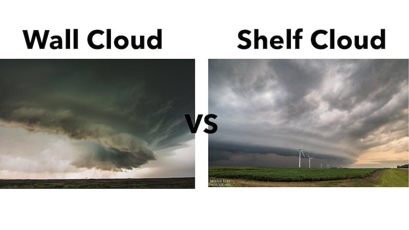
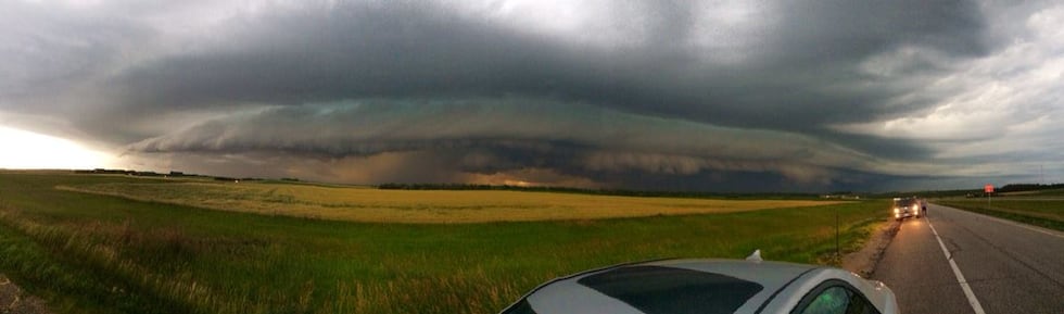
MANKATO, Minn. (KEYC) - A shelf cloud is a long wedge shape cloud that forms on the leading edge of a squall line or multi-cluster storm system. They often stretch for miles across the sky and may have finger (non rotating) like clouds reaching toward the ground. Shelf clouds form as cold air within the storm rushes out lifting warm moist air ahead of the storm. As that warm air lifts it condenses and a shelf cloud forms. What you will experience as a shelf cloud moves towards you is first heavy winds and then rain and hail. The main threat with a shelf cloud is severe damaging winds. Although rare sometimes small tornadoes can occur on the leading edge. Example of shelf clouds can be found below.
Sometimes shelf clouds are not well defined. This is an example of a broken shelf cloud with cloud to ground (CG) lightning. Notice the clouds as they feed up into the front of the shelf giving it a look as if it is rotating horizontally.
Here is another shelf cloud this time at night passing over a lake near Jamestown, ND. Notice the dirt being blown across the lake? Shows the cold air pushing out ahead of the storm lifting the warm moist air to help produce the shelf cloud.
All too often shelf clouds get reported as wall clouds. Wall clouds are isolated lowering clouds attached to the rain free base. Wall clouds most likely have vertical rotation associated with them. They can be found on the backside of a storm system, typically to the south-southwest of precipitation free area. Wall clouds are most often associated with supercell thunderstorms. Wall clouds are precursor to funnel clouds and tornadoes.
In some case when a supercell has heavy precipitation, known as a high precipitation supercell (HP supercell), wall clouds can form on the east-southeast side of a storm. Wall clouds can be as large as 2 miles in diameter and are located near the strongest updraft within the storm.
If you are looking at a wall cloud you may notice vertical rotation and sometimes they have a tail like cloud attached to them known as an inflow tail. Also while looking at a wall cloud you will notice strong winds at your back. If you think you are looking at a wall cloud but the winds are at your face probably not a wall cloud or the storm is dying off/weakening. Examples of wall clouds and developing wall clouds can be found below.
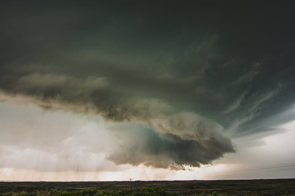
Here is a great example of a developing wall cloud on a storm near Canadian, TX 2015. Watch as the storm spins and the base of the clouds lower.
This is an example of a high precipitation (HP) supercell. As said before HP supercells often have wall clouds that form on the east-southeast side of the precipitation (right side of your screen). Supercells are unique from other storm types in that they have a rotating updraft known as a mesocylone. Sometimes, like in this example, the entire storm can be rotating. Rotation within the storm system can cause striations within the clouds, giving it a space shape like appearance or as if someone stacked pancakes on top of one another. Watch at the end of this video as fingers start to stretch out in the front of the storm. This storm started as a supercell but eventually developed into a line of storms and produced a shelf cloud.
Copyright 2020 KEYC. All rights reserved.


