
Kungsleden:
The King’s Trail
Into the Swedish Lapland
The Kungsleden stretches from Abisko, one of the northern towns of Sweden, to Hemavan. For approximately 467 km (290 mi), it crosses the breathtaking landscapes of Swedish Lapland. Although the terrain and elevation do not represent a real challenge, the weather conditions combined with the mosquitoes (in summer) are not to be taken lightly. But the magnificence of the scenery and the indescribable wilderness feeling are unarguably worth all of it.
This report focuses on the section from Abisko to Kvikkjokk (205 km | 128 mi | 9 days but can be completed in 6), that I hiked in July 2022. Keep in mind that depending on the season extra gear might be necessary against the cold.
9 Days | 205 km (128 mi) | Intermediate - Difficult
Packing List

A detailed and complete list is available below, but here are some general considerations.
Gear
You will be over the Artic Circle, so plan for cold and wet weather (especially at night). A warm base layer, mountain jacket, warm sleeping bag (0°C) are necessary. In summer, the snow has largely melted and as a result the terrain can often be humid if not swamped. You will also have to cross lakes and rivers. Combine waterproof hiking boots and gaiters to keep your feet dry along the whole way. Another regional specificity, in summer the sun almost never sets. Therefore, light sleepers will want to bring a sleeping mask. On the other hand, a head torch isn’t really necessary.Last but most importantly, mosquitoes can represent a real plague. They bite though thin layers so I cannot stress enough the necessity of long sleeves and pants, mosquito face net, and a local mosquito spray (you can resupply in almost every hut but make sure you have enough).
Food
For up to 10 days, and depending on your physical shape, you can try to carry all your food (my personal consumption is around 500g/day including snacks). Alternatively, you will be able to resupply in most huts, but at a noticeably higher price than if you had bought it beforehand. The official pages of the huts mention the presence of a shop when there is one (see Resources section).Total Weight
It really depends on the quality of your gear (the older, the heavier usually) and if you planned on resupplying on the way. Expect more or less 17kg.Explore Hiking Gear:
-
Hiking boots | Gaiters
Long sleeves shirts (x2)
Merino wool leggings
Hiking pants (x2)
Hardshell waterproof jacket
Merino pullover
Underpants | Socks (x3)
Cap | Hat | Gloves
Rain pants | Poncho
-
Water bottle (1L)
Tent (waterproof)
Sleeping bag (0°C)
Sleeping mat
Backpack (80L)
Walking sticks
Cooking pot | Gas
Fork | Spoon | Knife
Sunglasses | Sunscreen
Microfiber towel
Pillow | Eye mask | Earplugs
Toiletries
Pharmacy | Vaseline
Mosquito Spray + Face net
Trash bag
Toilet paper
Candles | Lighters
Blister tape
Tick remover
Wistle
-
Smartphone | Watch
Powerbank | Charging cords
Map | Compass
Explore Food List:
-
Oat: 50g/day
Trail Mix: 20g/day
Instant coffee: 2/day
-
Sandwiches (to be eaten the first days)
Hard cheese
Dried meat
Bread
-
Lyophilised meals (1/ day)
Chocolate tabs (x2)
-
Energy bars (2/day minimum)
Dried fruits
Commuting
From Stockholm, you can take the night train to Abisko (NT94). Mine left at 18h11 and reached Abisko at 11h08 the next day. Although one can purchase a seat (around 100€), if you plan enough in advance you can book a place in bunk beds compartment and enjoy a better quality of sleep (around 130€). From the train station, it is only a few meters to the start of the trail. You will have the opportunity to stop at the STF Hut and supply whatever you still need before starting your journey.
From Kvikkjokk, I first took the bus 94 to Murjek Station (15h35 – 17h30, around 40€) and caught the night train to Stockholm (20h57 – 9h25, day +1).
Report
205.43 km | 3,577 m+ | 45-50h
(moving times do not include breaks)
-
If you haven’t slept at the hut the night before, you will start quite late in the day as the train arrives around 11am. It can be a good idea to start with a short and slow day just to get your body used to the effort and the environment.
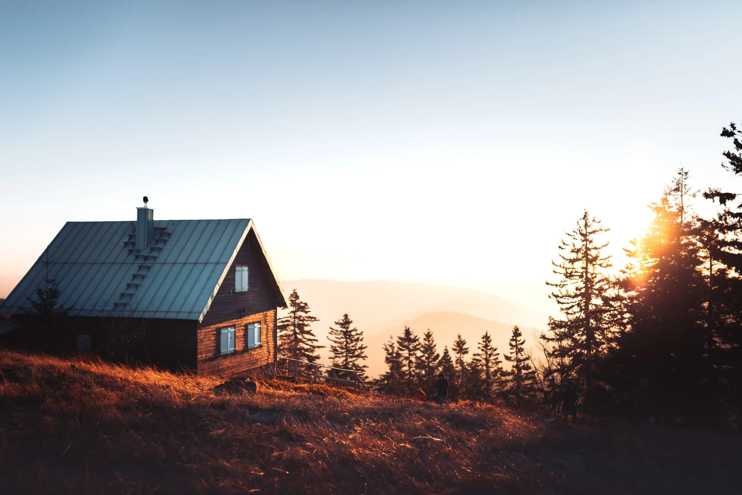
The path starts after a tunnel under the bridge. You will directly encounter the powerful and crystal-clear waters of the North and be reassured you won’t get thirsty. The first day is a comparably flat and easy walk, giving you the opportunity to familiarize with your gear and its weight on your shoulders. It won’t be long until you feel you’re entering the wilderness of the Great North. Pass the Abiskojaure STF Hut, continue 3 km and you will find camp site in between waterfalls. First night out there, take your time to correctly pitch the tent, have a nice dinner and try your setup.
-
The day will start with a steady climb to reach the first high plains. You will also cross more and more marshes while entering wide valleys making you realize how small we are. At that point you won’t have any coverage anymore. Having to meet a friend later on the trail, I left a written message to fellow hikers I met going in the opposite direction – the travelers’ solidarity is not a legend! If you are traveling alone, do not underestimate the effects of solitude on your mind. From experience, the first 36 hours are the hardest and you will then fully enjoy the feeling!
About a third of the way, you will start walking along the shores of grand and magnificent lakes. There is a river crossing before reaching the hut, where my combination boots-n-gaiters showed how waterproof they were. If you don’t have them, you can always remove your boots, socks, and dry your feet on the other side.
The Alesjaure hut has a small shop (selling beers!), toilets, pay phone and a room where you can rest for a time if you need. You can obviously camp on the hut domain, but if you carry on for a kilometer, you will find countless places to pitch the tent on very soft grass. I probably spent the most beautiful evening of the trip there, looking at the mountains in the Northern Sun.
-
See Pictures Part 1 and Part 2
You will now increasingly reach higher grounds, the terrain becomes a bit rockier yet still very walkable, and that is where I encountered the first bit of snow! You will hear a pretty strong waterfall before you see it. Luckily, you’ll only have to cross the stream down from it. The beauty of the landscape makes the climb and challenges absolutely effortless!
Right after the crossing, you will see the Tjäktja STF hut, that I did not visit. While walking the stony way to the Pass, I could see in the distance some elk herds. The path is straight and now requires a bit more attention to your feet but nothing technical at all. After a last climb in a mix of snow and rocks, you eventually reach the Pass where you will find a small cabin and toilets. I did not use any shoes spikes, but I reckon crampons can be necessary in colder seasons. The view from both sides of the Pass reminds you why you decided to take this trip and is really worth sitting and contemplating for some time.
You will keep facing the majestic mountains guarding a long valley on your way down. The opportunity to take amazing pictures! It won’t be too long until you reach a stream cutting the valley in two, that you will follow for some time. It eventually gives to a wide marsh where I strongly recommend having prepared for mosquitoes (face net, long sleeves, repellent). At the hut there will be a stream where you can wash clothes and body. It is pretty cold I admit, but not only does it help with recovery, but it will also reduce your scent and by then mosquitos’ attacks. I arrived comparably early and used the rope available at the hut to let my clothes dry in the wind. A small shop is available and since quite a few people stopped there too, I could enjoy some nice chats with fellow travelers.
About 500 m after the hut, you’ll find perfect pitches for the tent, just by clear running waters. Expect mosquitos if the wind isn’t strong enough though. The scenery is however as always magnificent.
-
See pictures Part 1 and Part 2
For the first 7 km or so, the terrain is not too hilly, and you might still see patches of snow here and there. It looks very much like what you’ve already experienced. The way down to the hut [name] is however of a different kind. You start entering some sort of bush or semi forest. On a hot day mosquitoes will be very active. Take a moment to rest and resupply water at the hut before carrying on through the same type of vegetations before eventually reaching a spongy soil just by a river. Enjoy the flat terrain as it will be the last bit for a while. You will very soon have to face a relatively steep climb taking you all the way to a metallic bridge. In the middle of the bridge the wind blows quite strongly so mosquitoes will leave you alone. I left my backpack on the other side and enjoyed a couple minutes of rest, looking at the impressive waterfalls.
After this, remain about 4 km to the hut where you will find a rather small shop and usual facilites. Ask the hut keepers for directions to the creek. I spent a couple hours there bathing, washing my clothes and enjoying a mosquito-free nap.
You can decide to camp in the forest just by the hut domain, or carry-on another 2 km. After yet another bridge above yet another powerful and loud river, there is some nice flat terrain to pitch the tent.
-
The first part of the trip is flatter than the day before. You will soon have to cross a small valley consisting almost exclusively of very wet land and marshes. The lack of wind makes it a mosquito paradise. But not to worry, you will soon see a small climb to a pass that will unveil over a green and magnificent plateau. The wind steadily blows, only allowing big flies and bees to stand the conditions. It stretches for about 5 km before a steep run downhill to an STF hut by a quiet and scenic lake. It should be almost midday, giving you the perfect opportunity to take a rest and enjoy the view.
Three rowing boats are at your disposal to cross. However, there should always be one available for the person after you. It means that if there is only one on your side of the lake, you have to first cross with it, cross back towing a second one, and cross again. The trick is to wait for someone to cross in the other direction. Don’t be afraid to pair up with other hikers, it is not as easy at it looks.
Hint: resupply at least a liter of water before crossing.
Indeed, right after the lake is a climb in the forest that will get steeper and steeper, and I don’t remember seeing any stream. After the climb, you will lay your eyes on high plains, cut in half by torrents created by the melting snow in summer. Gradually, you will encounter more and more people as you get closer to the road. After a steep climb down, you will eventually reach the STF hut and will easily find a camping spot by the lake. Enjoy the view!
-
From there, a bus will take you to the boat shuttle (check the timetable and costs the day before, you can buy the ticket on the app). You’ll have to pay for boat shuttle to the biggest huts complex you’ve seen so far. I took that day as a zero-mile stage and paid to have access to the facilities (sauna, drying room, kitchen, showers). You will also find a big shop, with all you could possibly need. They even have a restaurant (but you’ll need to book at registration)!
-
After giving your legs a deserved rest, they will surely feel eager to get going again. Fortunately, since you will start with a climb in the forest. As soon as you leave it behind, frequently turn around and admire the view on the lakes and its mountainous warrants. The next 15 km or so will be very flat, following a green canyon. You can end your day either at the hut a few hundred meters down, or push to the boat shuttle (prepare some cash to pay for the cross) to the other side (Svinnje). I camped directly by the shelter on the shores. You will even find toilets.
-
Important hint: if you don’t wanna miss the first boat shuttle, I recommend you get up early.
Indeed, you will face the steepest climb of the trip so far. Once you reach the hut, it take another kilometer or so before you reach the jetty (as always, have some cash in anticipation). I don’t remember if there are rowing boats available, but on my day the wind was blowing too strong and the waters were very rocky.
Alternative: one can decide to climb the Skierfe, best point of view over the regional lakes on a sunny day. The hike isn’t the hardest, but this will most likely add a day to your planning.
On the other side, you will directly enter a forest gradually taking you up in altitude. Again, do not hesitate to frequently stop, turn around and enjoy the scenic view. Once the ground flattens, you will soon walk by a shelter where you will be able to dry and take a nap for a bit. It is important to know that these non-guarded shelters are not for use as overnight stays, except in case of severe weather conditions. Don’t worry though, you will find countless spots to pitch the tent after it. Mine was right after a metallic bridge, by a torrent and with a priceless view over the valley. Know however, that it can be a bit windy and cold, even in summer.
-
The first 3 to 5 kilometers are the last above the tree line. The path will then gradually go down and enter thick forests where you can feel the presence of bigger animals (but are unlikely to see them). You will cross another few wetlands, circle around a large lake and slowly but surely get closer to your destination point. The day is comparably easy, leaving you the opportunity to enjoy the last moments in the wilderness, on the tracks, thinking back to what you are about to achieve. The last section brings you to a parking lot just by the hut complex.
-
I was ahead of schedule and therefore spent a couple days at the hut complex. It features private rooms as well as shared dorms. One can maybe find spots to pitch the tent in the surroundings but not that easily. By paying for a room, you will also have access to the sauna, the drying room, showers, common room etc. They also have a small restaurant with very good quality of food! A small shop is open part of the day for resupplying if you need to.
There is not much to see in the surroundings but for an impressive river, some nature and local buildings including a wooden church. The bus stop is just by this latter.
Good To Know
Coverage disappears already a few kilometers after Abisko, you won’t have any cell coverage anymore. The next time you will potentially get some is around Vakkotavare. Your smartphone will however have normal GPS signal.
Water is never a problem. You will cross rivers and lakes all the time. Some people use filters of purifiers but if you stick to running clear waters, they aren’t necessary (I did not have one). I only carried a 1L bottle and it was definitely enough.
Wildlife is of course present all around! You will see some elks, most probably belonging to Sami people. Although there technically are bears in Sweden, it is very unlikely you’ll come across one (no need for a bear spray). Other larger animals include moose, wolves, and hogs but they are rather shy and will prefer to avoid you. In case of an encounter, make sure they notice you (you don’t want to surprise them) without showing signs of aggressivity, do not try to go to their contact or feed them, and carry on your route while maintaining a reasonable distance to them.
Toilets are available at all huts. You will also find some along the way (marked on offline maps) but remember to bring your own toilet paper. Keep in mind the nature thanks you for not doing bigger business in the wild.
Budget
| Expense Items | Increment | Costs |
|---|---|---|
| Flight To and From Stockholm | 240€ | |
| Train Stockholm - Abisko | 100€ | |
| Train + Bus Kvokkjok - Stockholm | 150€ | |
| Pre-bought Food | 80€ | |
| Resupply | 50€ | |
| Bus and Boat Shuttles | 60€ | |
| Kungsleden Extras (e.g. Sauna) | 50€ | |
| Missing Equipment | 40€ | |
| Total | 770€ |
Year 2022, only indicative and can vary based on price changes, the equipment you need to purchase, the extras you allow yourslef.
Resources
You can purchase a one-year membership giving you access to discounts for huts, transportation and others. They also provide a useful app.
Purchase tickets in advance for a better price and more seat/bed options.
Book in advance, check amenities and presence of shops for resupply.

From and To Kvikkjokk.
A very complete app for offline maps.