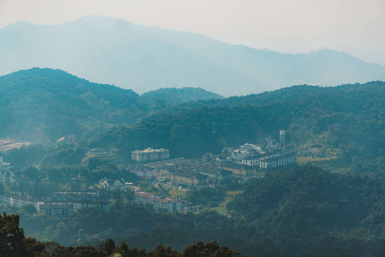
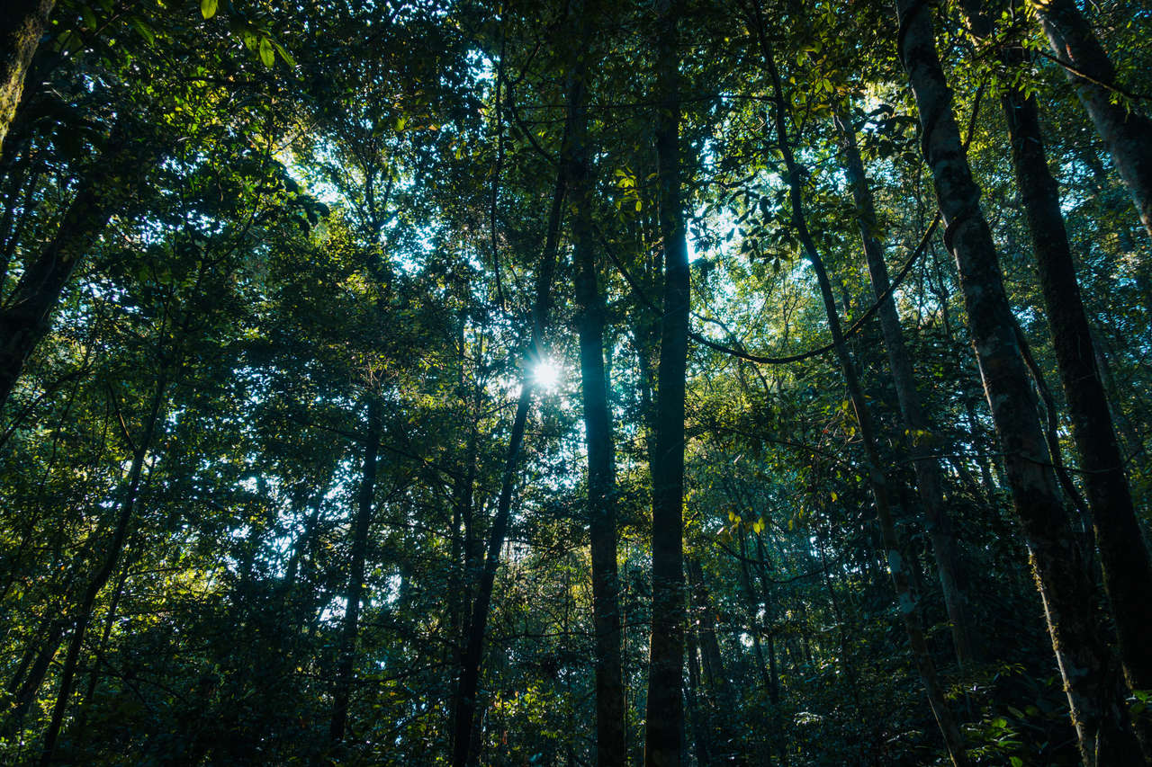
Cameron Highlands is an excellent place to hike in Malaysia. With its comprehensive network of walking trails built during World War II through the jungles and mountains of Cameron Highlands, it can be quite confusing for travelers to wrap their heads around them all and pick the best hiking trails.
Within this guide, you will find complete information about the 14 hiking and jungle walking trails in Cameron Highlands and which one I recommend. Let's begin!
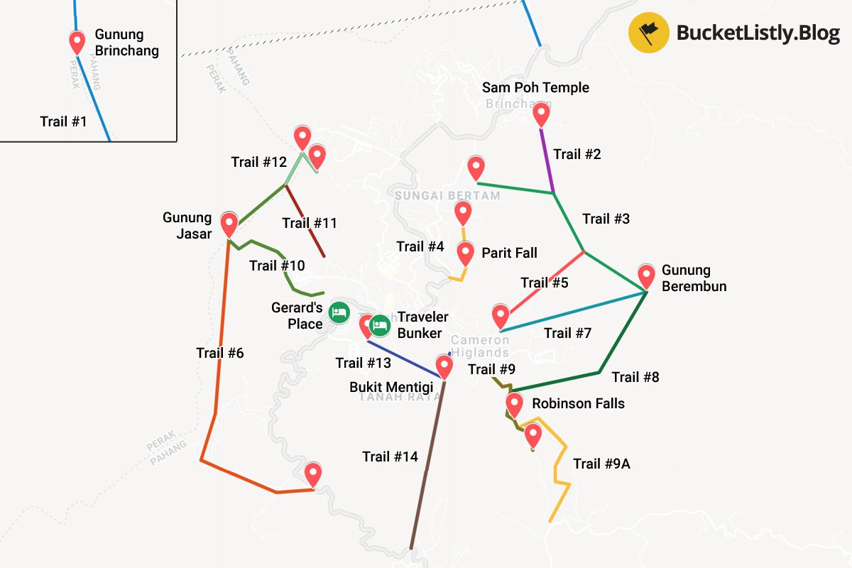
- Cameron Highlands Hiking Map
-
14 Hiking Trails in Cameron Highlands
- Trail #1: Brinchang Town to Gunung Brinchang
- Trail #2: Sam Poh Buddhist Temple to Trail #3
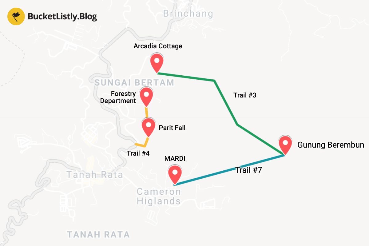
- Trail #3: Arcadia to Gunung Berembun
- Trail #4: Forestry Department to Parit Waterfall
- Trail #5: MARDI to Trail #3
- Trail #6: Cameron Valley to Gunung Jasar
- Trail #7: MARDI to Gunung Beremban
- Trail #8: Robinson Waterfall to Gunung Beremban
- Trail #9: Tanah Rata to Robinson Falls Weather Station through Robinson Waterfall
- Trail #9A: Robinson Falls to Habu Village
- Trail #10: Tanah Rata to Gunung Jasar
- Trail #11: Tanah Rata to Trail #12
- Trail #12: Trail #11 to Tanah Rata Power Station
- Trail #13: Cameronian Holiday Inn to Trail #14
- Trail #14: Trail #13 to Gunung Mentigi to Tanah Rata
- Recommended Trails to Hike in Cameron Highlands
- More Cameron Highlands Activities
- Where to Stay in Cameron Highlands ?
- When to Visit Cameron Highlands?
- How to Get to Cameron Highlands?
- What to Pack and Things to Prepare Before Hiking Cameron Highlands Trails?
- Further Reading for Malaysia
Cameron Highlands Hiking Map
| 🌤️ Best time: | February-April |
| 🚘 Get around: | Hiking |
| 🕓 Time to spend: | 2 days |
| 🚶♂️ Difficulty: | Easy to moderate |
14 Hiking Trails in Cameron Highlands
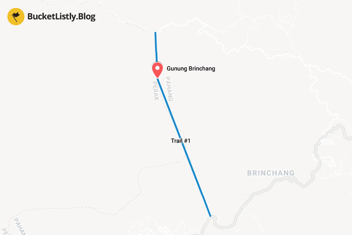
1. Trail #1: Brinchang Town to Gunung Brinchang
Duration: 3-4 hours one-way
Difficulty: Tough
Guide Required: Yes
This trail begins in the Brinchang town, north of Tanah Rata, and it climbs all the way up to Gunung Brinchang (2,032m). It takes around 3-4 hours to hike one way. Most people often take a taxi up to the summit of Brinchang (road access is available) and hike down.
- Traveller Bunker Hostel (Budget)
- Gerards Place (Mid-Range)
- Cameron Highlands Resort (High-End)
- Cameron Highlands Day Tour from Kuala Lumpur with Lunch (SIC - Shared Tours) (12 hours)
- Cameron Highland Best Tour from Ipoh (Private Day Trip) (10 hours)
- Full Day Cameron Highlands Nature Tour (12 hours)
The trail isn't well-marked; however, it is recommended that you do it with a guide.

No time to read?
Don't worry. You can save this page to Pinterest and come back later.
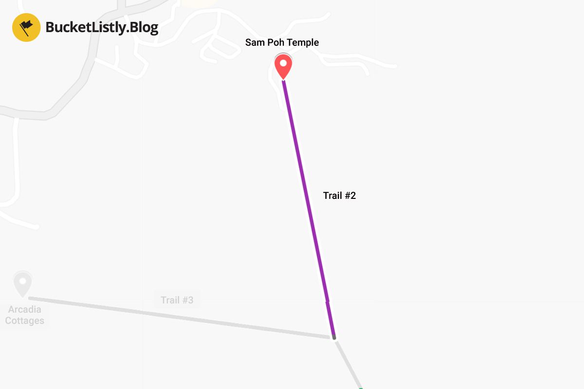
2. Trail #2: Sam Poh Buddhist Temple to Trail #3 (Gunung Berembun)
Duration: 1.5 hours one-way
Difficulty: Tough
Guide Required: No
This trail starts at Sam Poh Buddhist Temple in Brinchang, north of Tanah Rata. It will take you through some really rough and unmarked up-and-down terrain for about 1.5 hours until it merges with Trail #3.
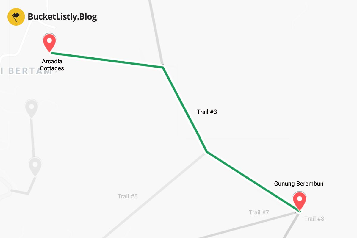
3. Trail #3: Arcadia to Gunung Berembun
Duration: 2.5 hours one-way
Difficulty: Moderate to Tough
Guide Required: No
This trail is a popular choice for a half-day hike, combining Trail #7 or Trail #8 (more below). The trail begins at Arcadia Cottage near the Cameron Highlands Sultan Ahmad Shah Golf Club and goes all the way up to Gunung Berembun (1,841m). It's a steep 2.5-hour climb, so prepare accordingly. Unfortunately, the viewpoint up there is overgrown and may not be as great as it used to be.
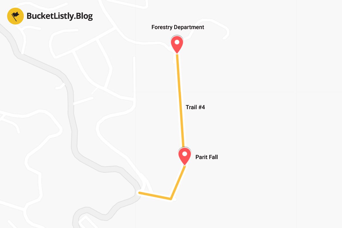
4. Trail #4: Forestry Department to Parit Waterfall
Duration: 30 minutes one-way
Difficulty: Easy
Guide Required: No
This easy 30-minute stroll trail will take you to Parit Waterfall. The trail begins at the Forestry Department and ends in Tanah Rata. This trail is popular among those who are hiking Trail #3 and #7 as it is on the way to/from the beginning/end of Trail #3.
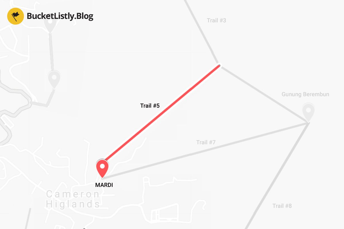
5. Trail #5: MARDI to Trail #3 (Gunung Berembun)
Duration: 1 hour one-way
Difficulty: Easy
Guide Required: No
This is an easy 1-hour walking trail that starts at MARDI and merges with Trail #3, with an option to either go to Arcadia Cottage or up the Gunung Brinchang summit. On your way to Arcadia Cottage, you will also have the option to hike Trail #2 to Sam Poh Buddhist Temple instead.
6. Trail #6: Cameron Valley to Gunung Jasar
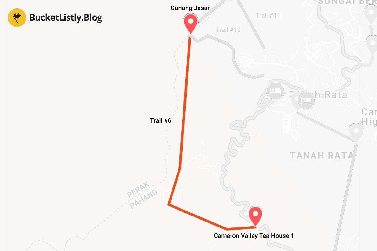
Duration: 2.5 hours one-way
Difficulty: Moderate to tough
Guide Required: No
This trail begins at the Cameron Valley Tea House 1 and goes all the way up to Gunung Jasar (1,670m), where the trail merges with Trail #10. The trail is unmarked and especially hard to navigate once you go up Gunung Jasar. I would recommend doing this from the other side instead (Start from Trail #10 and then take Trail #6 to go down, more below).
7. Trail #7: MARDI to Gunung Beremban
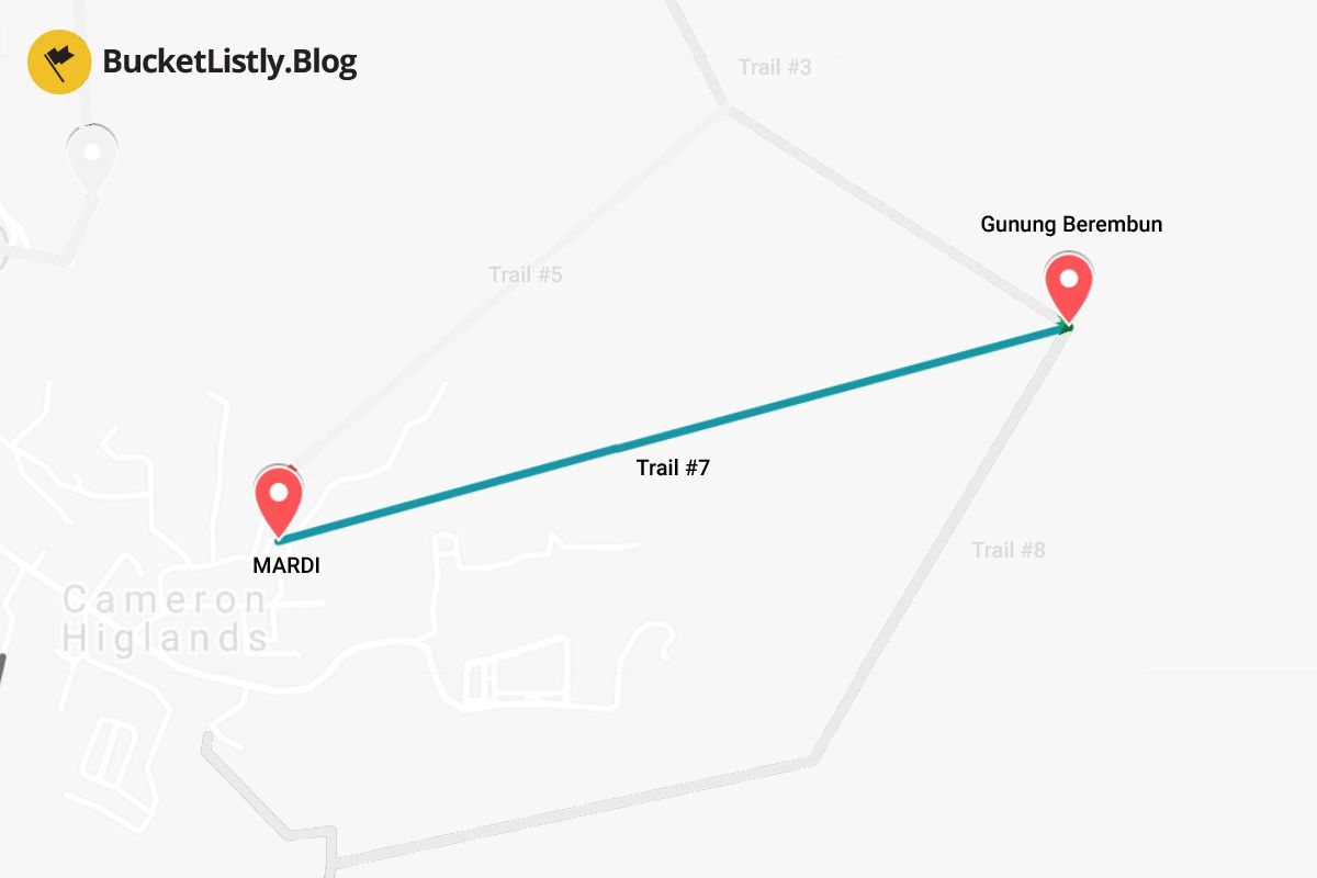
Duration: 2 hours one-way
Difficulty: Very tough
Guide Required: No
This is another popular trail if you want to go up Gunung Beremban. The trail begins at MARDI, and it's a straight path to the summit for 2 hours one-way. The trail merges with Trail #3 and Trail #8. Most people recommend taking Trail #3 down as it is more scenic and easier to navigate.
8. Trail #8: Robinson Waterfall to Gunung Beremban
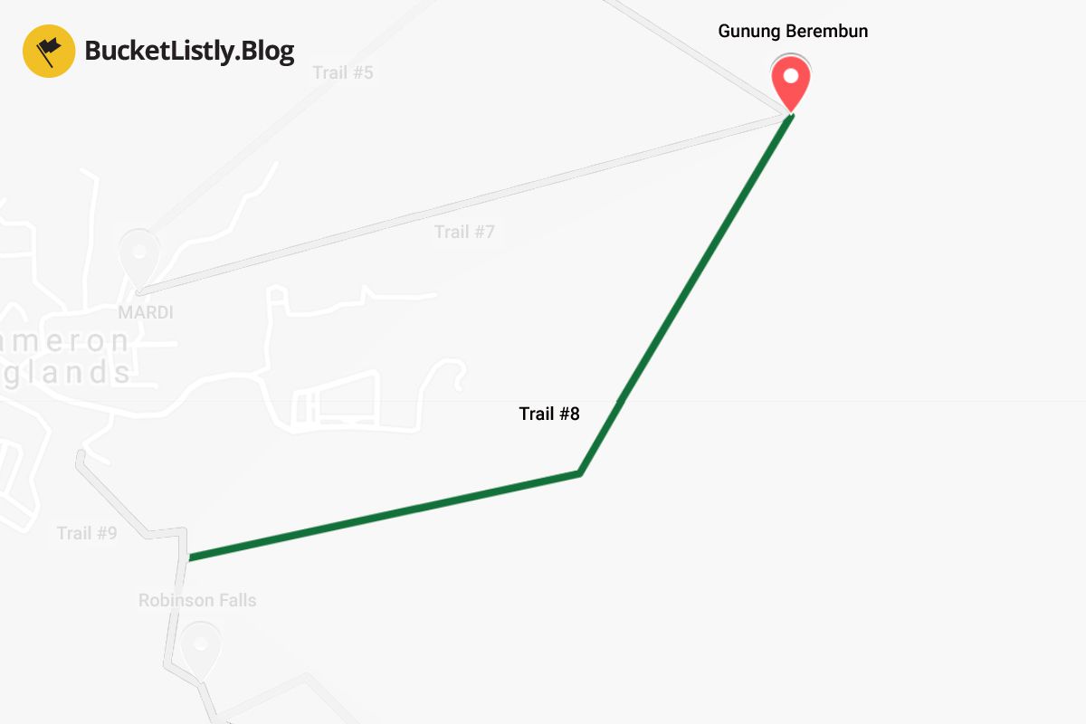
Duration: 3 hours one-way
Difficulty: Very tough
Guide Required: No
A difficult 3-hour climb from Robinson Waterfall leads all the way up to Gunung Beremban. The trail merges with Trail #3 and Trail #7 at the end.
9. Trail #9: Tanah Rata to Robinson Falls Weather Station through Robinson Waterfall
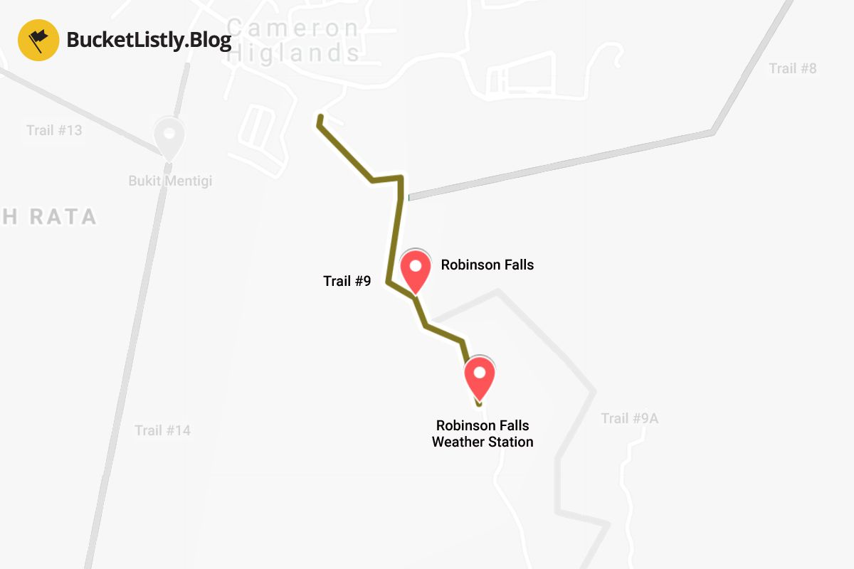
Duration: 1 hour one-way
Difficulty: Moderate
Guide Required: No
This trail begins in Tanah Rata, goes down to Robinson Falls, and then descends steeply with some difficult scrambling towards the Robinson Falls Weather Station where you can take a local bus back to Tanah Rata.
10. Trail #9A: Robinson Falls to Habu Village
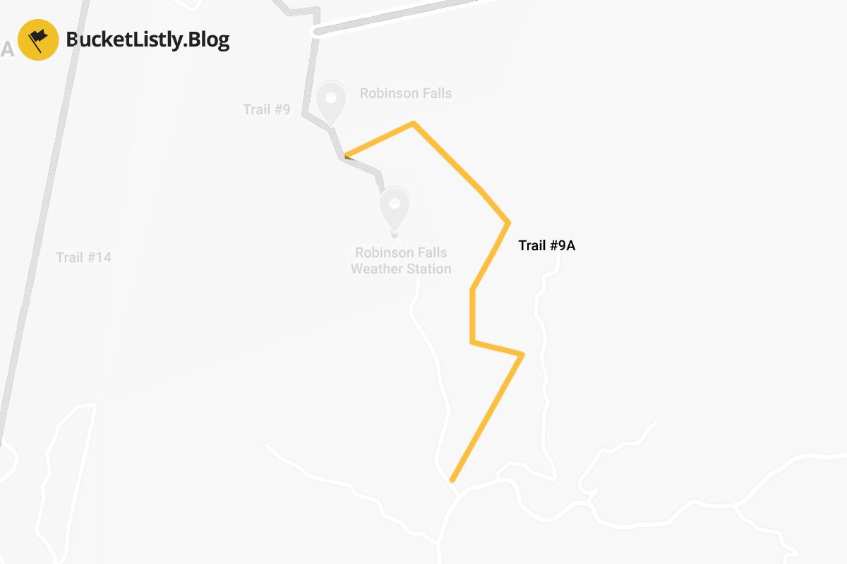
Duration: 2 hours one-way
Difficulty: Moderate
Guide Required: No
This is an alternative trail to Trail #9 that you can take from Robinson Falls. It is less steep than Trail #9, and it should take around 2 hours to get to the end at the BOH Tea Plantation Road near Habu Village.
11. Trail #10: Tanah Rata to Gunung Jasar
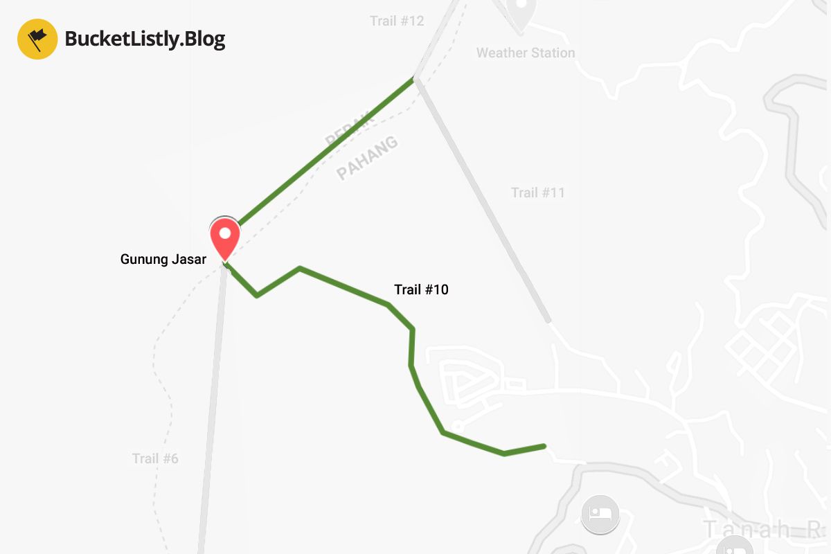
Duration: 1 hour one-way
Difficulty: Moderate to Tough
Guide Required: No
This is a great trail in conjunction with Trail #6 to create an epic half-day hike. The trail begins in Tanah Rata near H2O Apartment and goes up for one hour to the top of Gunung Jasar. You will be rewarded with an unobstructed view of Tanah Rata and Cameron Highlands.
The trail eventually merges with Trail #6 first, where you can continue down to Cameron Valley. Alternatively, if you continue north from the summit towards Gunung Perdah (1,551m), the trail will merge with Trail #11 and Trail #12.
12. Trail #11: Tanah Rata to Trail #12
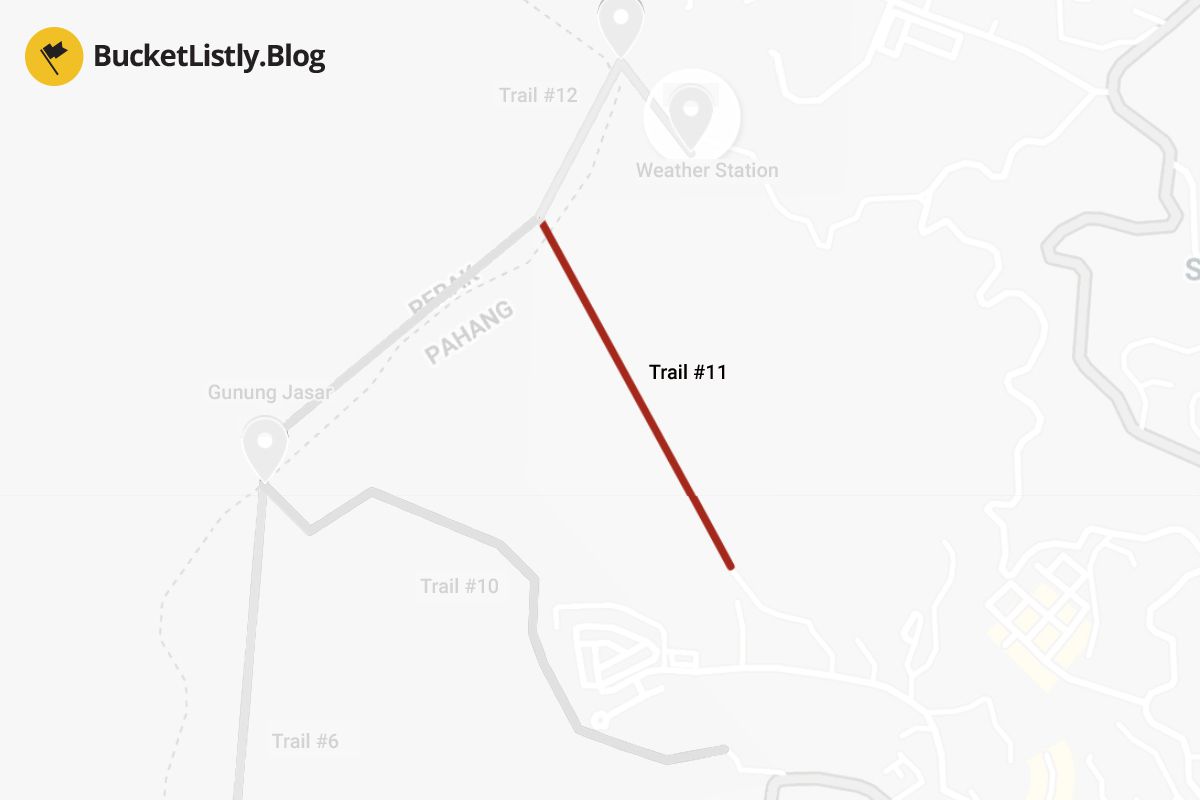
Duration: Unknown
Difficulty: Unknown
Guide Required: Yes
This is an alternative trail to Trail #10 if you want to avoid climbing up Gunung Jasar. The trail goes directly parallel with a path up Gunung Perdah and merges with Trail #12, and ends at the Power Station.
13. Trail #12: Trail #11 to Tanah Rata Power Station (Closed)
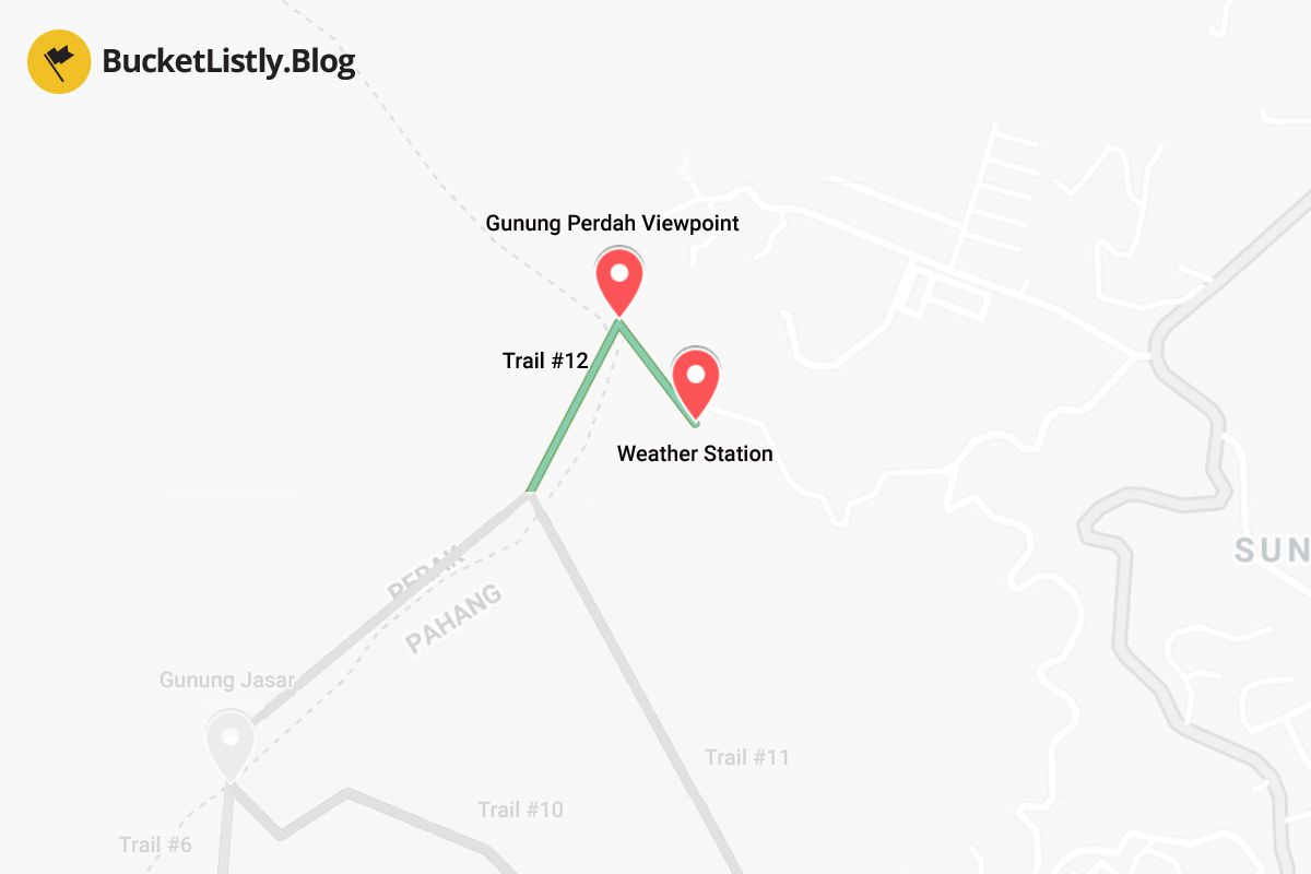
This trail connects Trail #11 to an exit via the Orang Asli village. This trail is permanently closed as the area has been used for construction for a real estate project.
14. Trail #13: Cameronian Holiday Inn to Trail #14
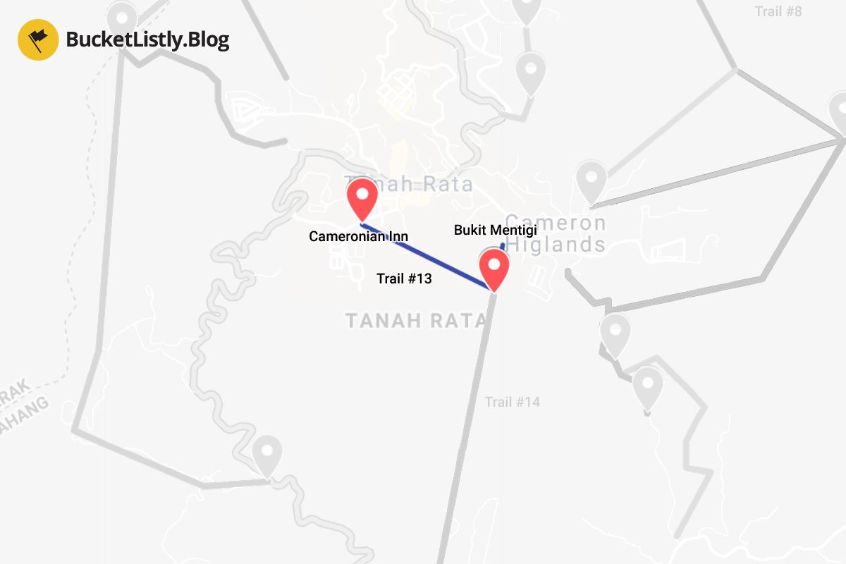
Duration: 1.5 hours one-way
Difficulty: Moderate
Guide Required: Yes
This trail begins at Cameronian Holiday Inn and connects you to Trail #14. Not much information is known about this trail; however, I wouldn't recommend doing it alone unless you plan to do Trail #14 with a guide.
15. Trail #14: Trail #13 to Gunung Mentigi to Tanah Rata
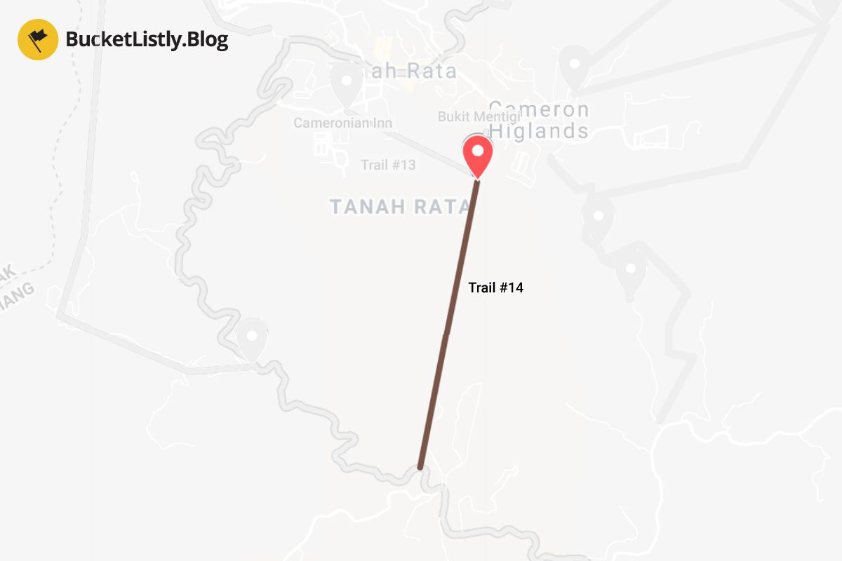
Duration: 4 hours one-way
Difficulty: Moderate
Guide Required: Yes
Another elusive trail that begins from Trail #13, where it continues up Gunung Mentigi (1,535m) through the mossy forest to the end of the trail at the Tanah Rata Road, way south of Tanah Rata. From there, you must hitchhike or take a local bus back to Tanah Rata. The hike supposedly takes around 4 hours, and I recommend taking a guide with you on this one.
Recommended Trails to Hike in Cameron Highlands
1. Climb up to Gunung Jasar and down to Cameron Valley (Trail #10 + Trail #6) (Half-Day)
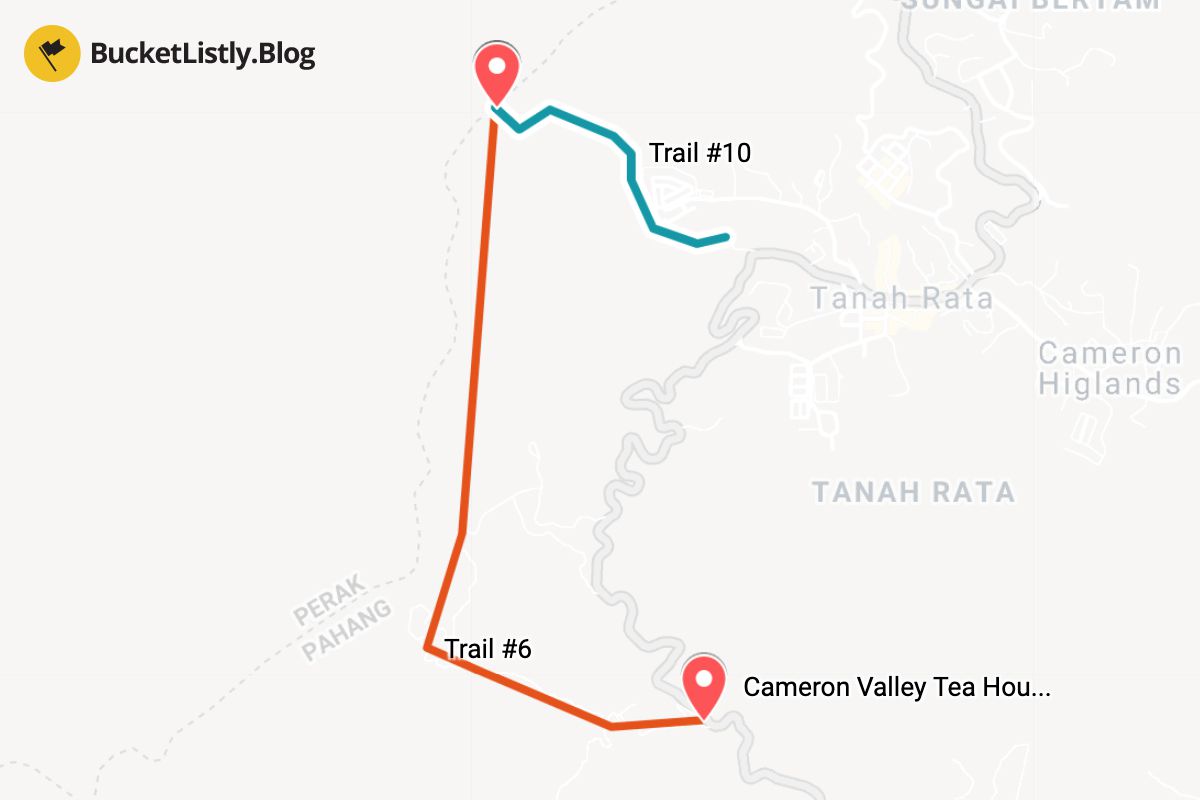
Duration: 4 hours
Difficulty: Moderate
Guide Required: No
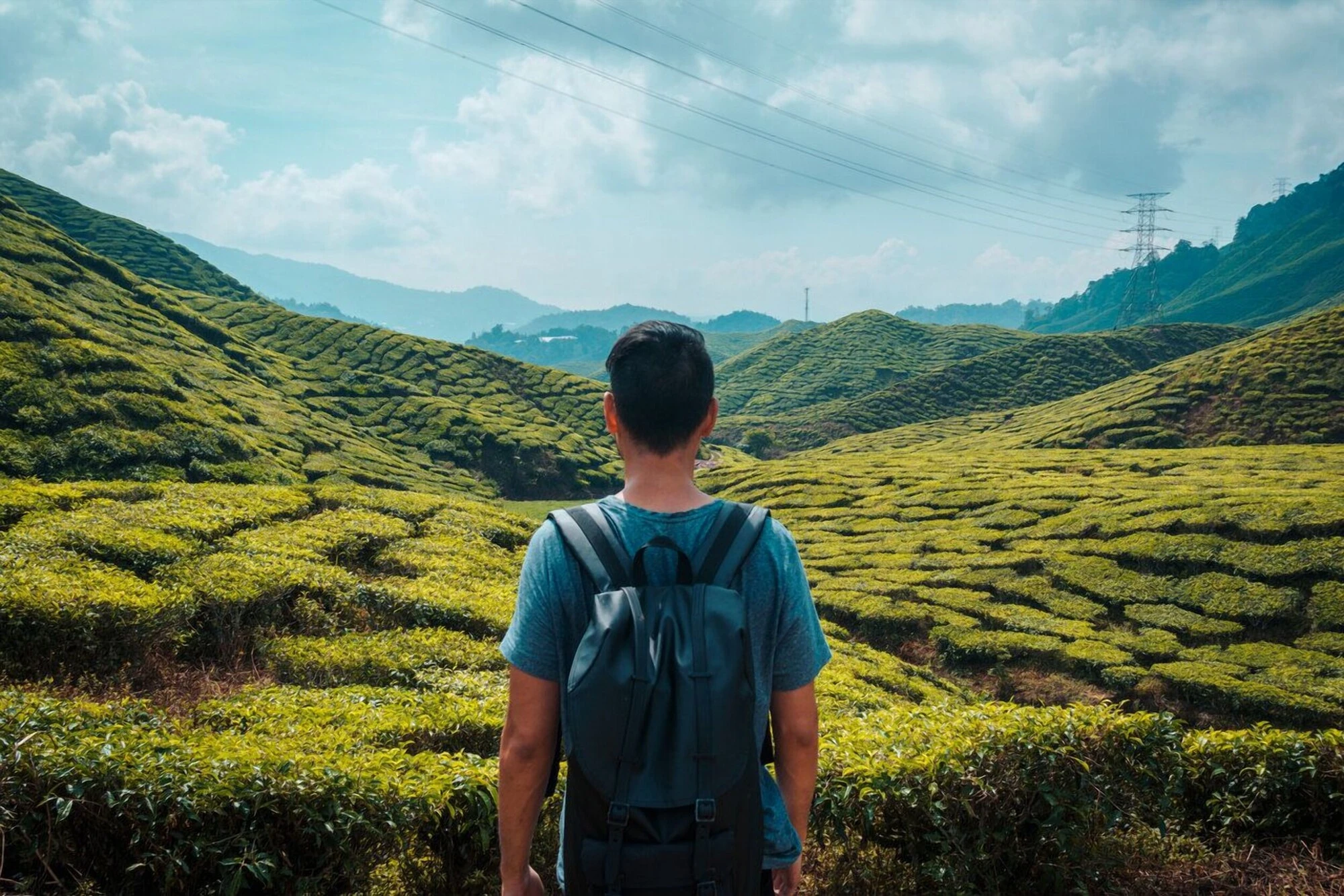
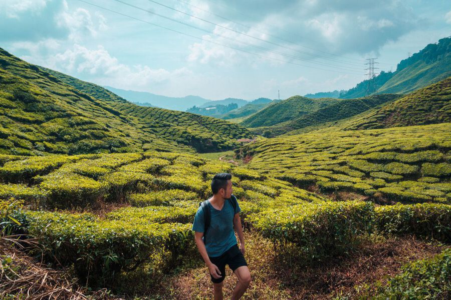
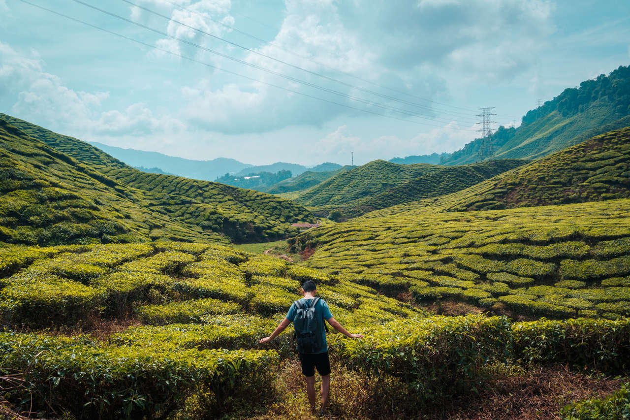
This trail, which most people recommended to me and the one I chose to do, combines Trail #10 and Trail #6. It starts from Tanah Rata near H2O Apartment, an easy walk from your accommodation.
Make sure you have Maps.me installed on your phone so you can follow the correct trail. The trailhead begins just off the corner of H2O Apartment, where you turn right towards Tan's Camellia Garden.
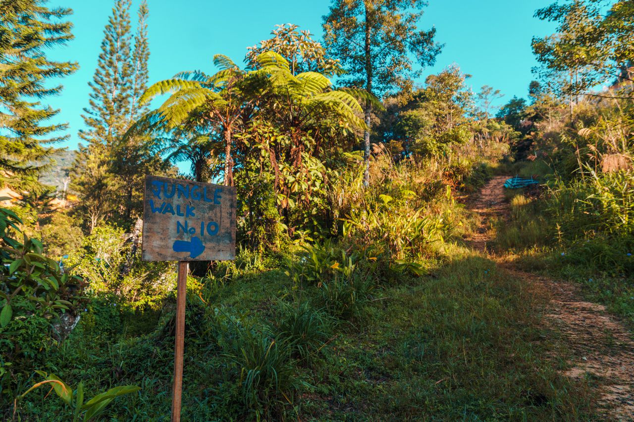
You should see a sign with an arrow and blue text saying "Jungle Walk No. 10" as shown above. Follow this sign.
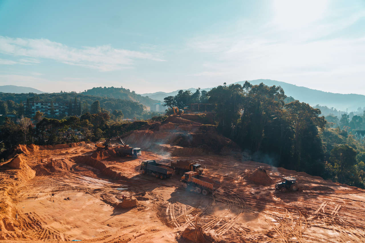
When I was there (early 2019), a construction site cut off the trail. You will have to walk through it until you find a path that leads you out of the construction site and up a hill into the forest. If you are not sure where, ask a construction worker there, and they will point it out for you.
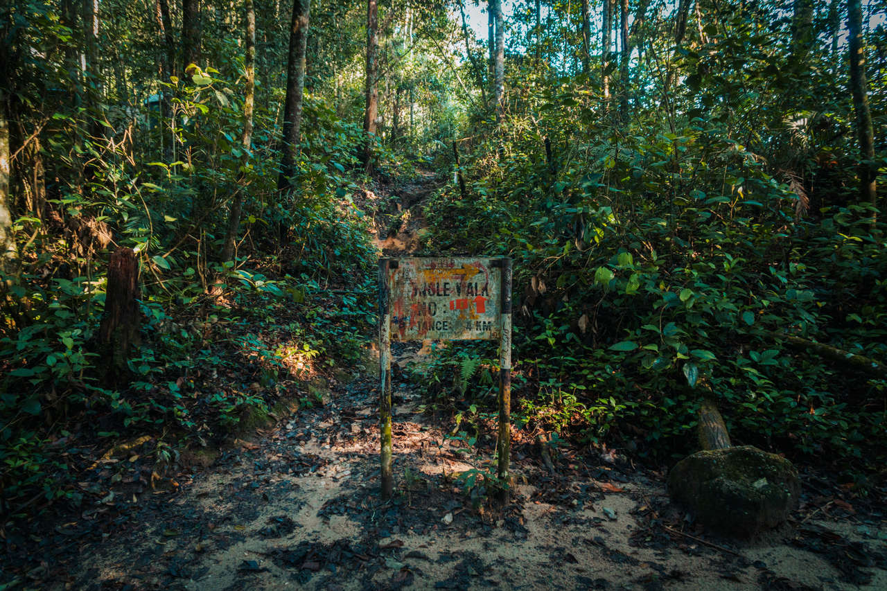
The trail begins zig-zagging through a thick forest without much up or down for about 15-30 minutes, and then you will stumble upon an intersection with a very confusing sign, as seen above. This is where the trail merges with Trail #11, but that's not what you are doing now, so simply go straight when you see this sign.
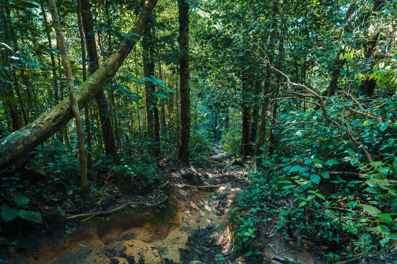
From that point, it's all straight up to Gunung Jasar for 30 minutes. You will arrive at an opening and an intersection going left and straight up. This is where Trail #10 merges with Trail #6, where we will be hiking down to the exit, but not just yet. We have to summit to see first. Continue straight to the summit.
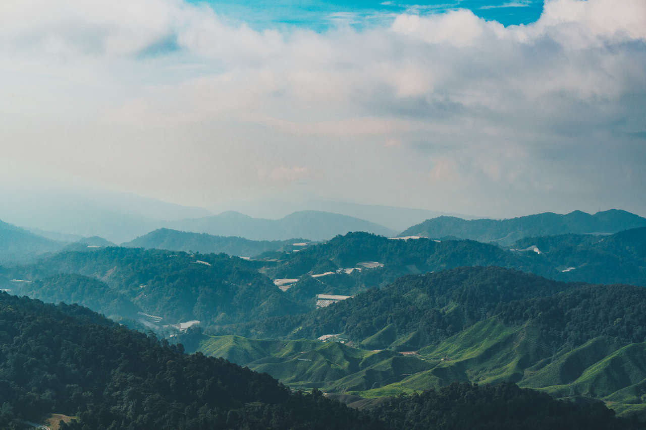
Once at the top, you will be rewarded with an unobstructed view of Tanah Rata and the stunning surrounding landscape. This is one of the best views you can get in Cameron Highlands, so I recommend you do this trail instead of all the others.
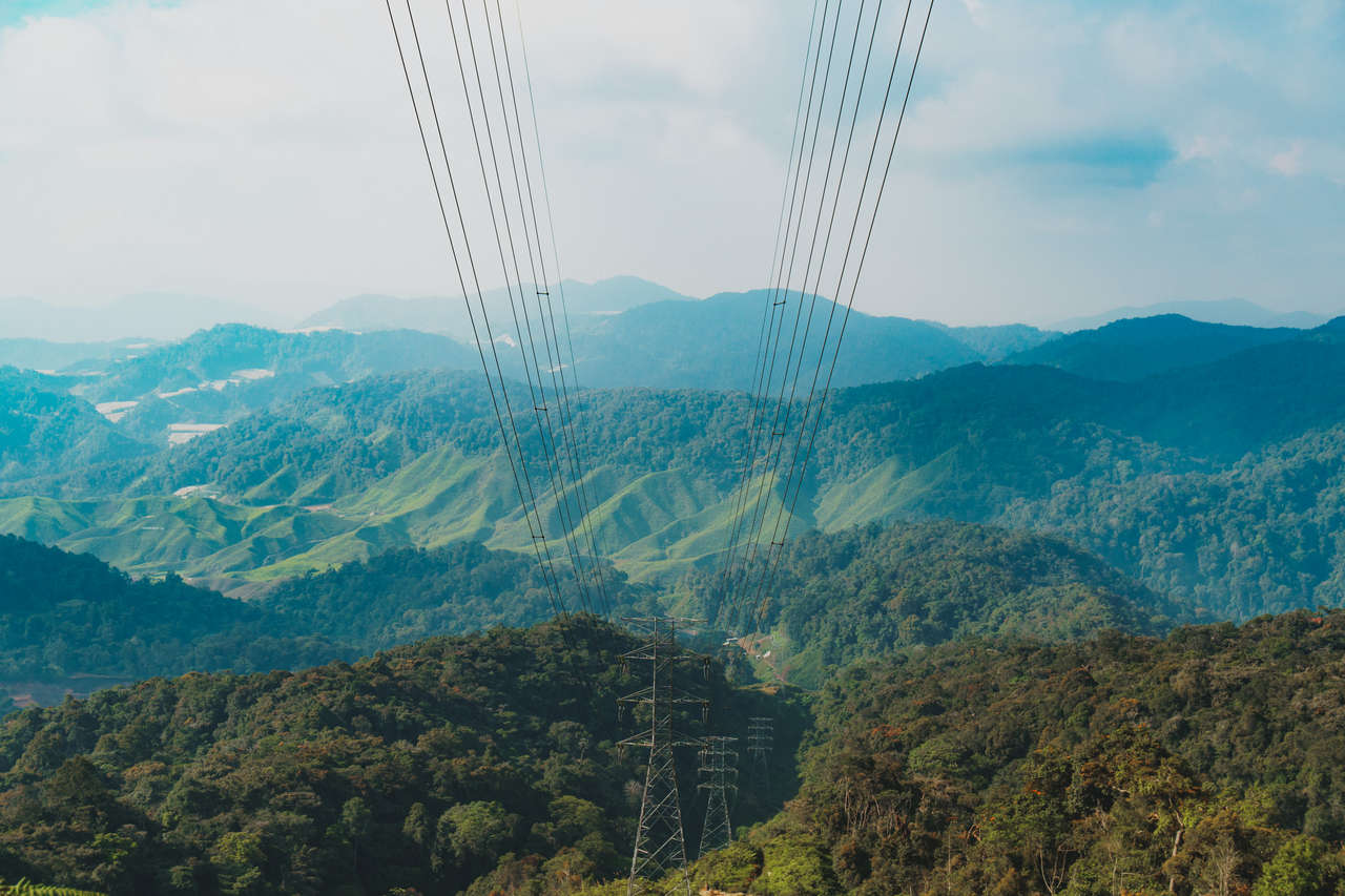
Once you are done absorbing the epic view, continue down the same way to that intersection again. Instead of returning the same way, turn right and descend along trail #6, which follows the power line.
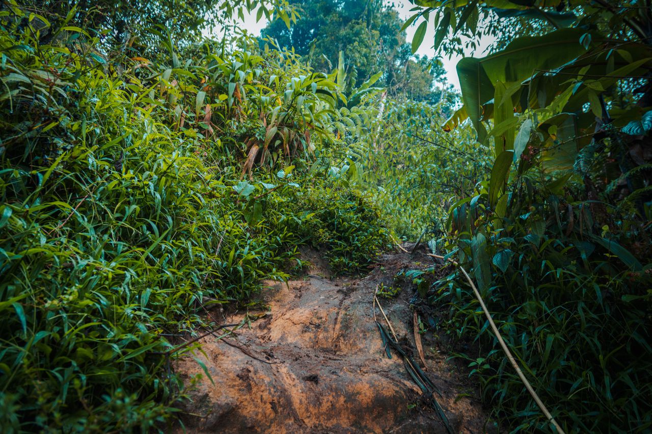
This trail is overgrown, and the path is so narrow that you might think you are on the wrong trail. When you are unsure, check Maps.me as often as possible to ensure you are heading in the right direction. Be careful, as this trail can get quite slippery, especially when going down.
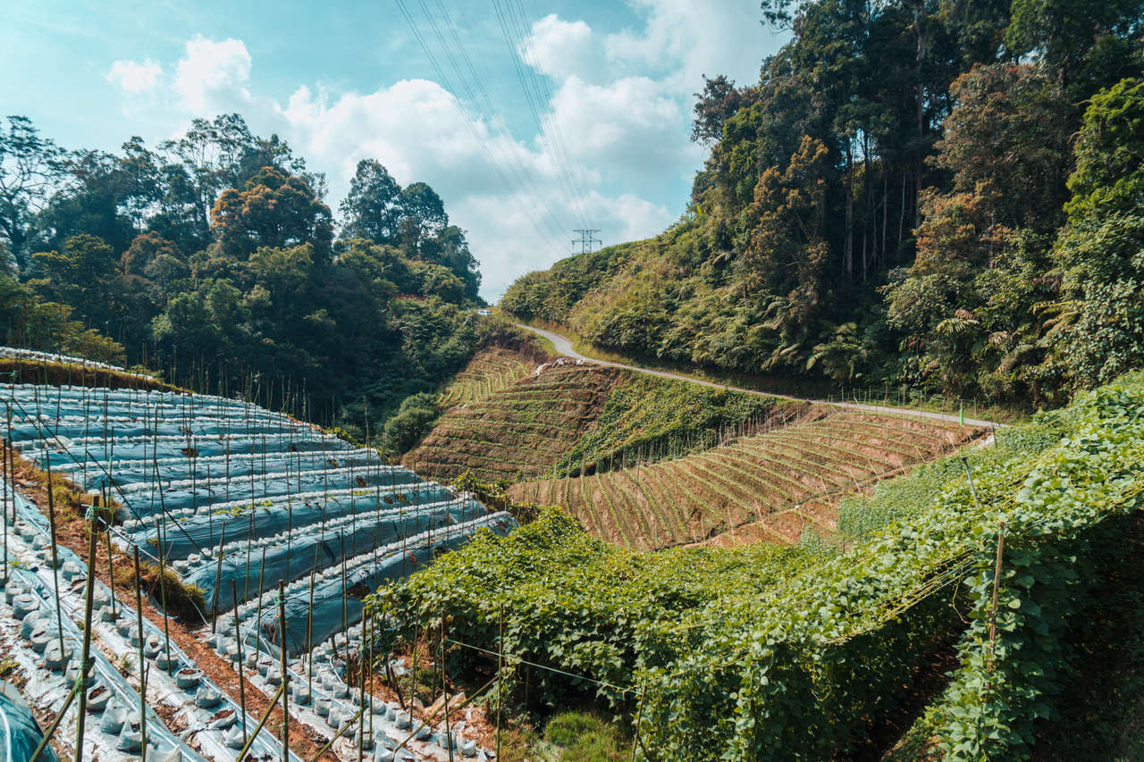
It will take you around 1-2 hours to walk through bushes and people's chayote farm before you arrive at a paved road and an intersection. Stick to your right and continue along the road until you start seeing tea plantations. Yes, you will get to walk through them!
Once the road starts turning sharply to the right, instead of following the road, go left and follow the trail through the tea plantation. This is by far my favorite part of hiking this trail. You will get to experience the tea plantation up close without the crowds.
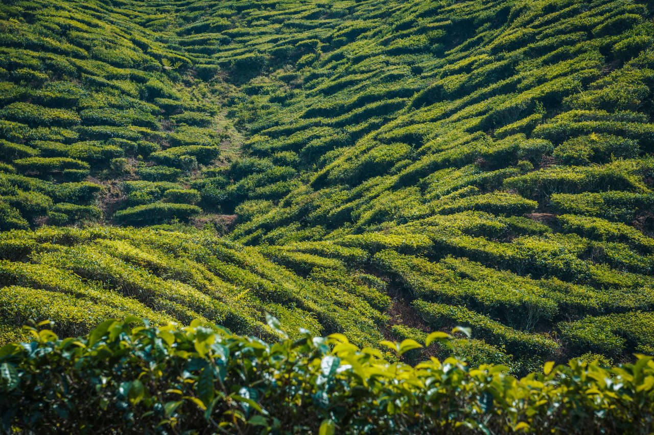
It should take 30-40 minutes to walk through the plantation, more so if you are like me and can't seem to control yourself and always stop for photos. 😅
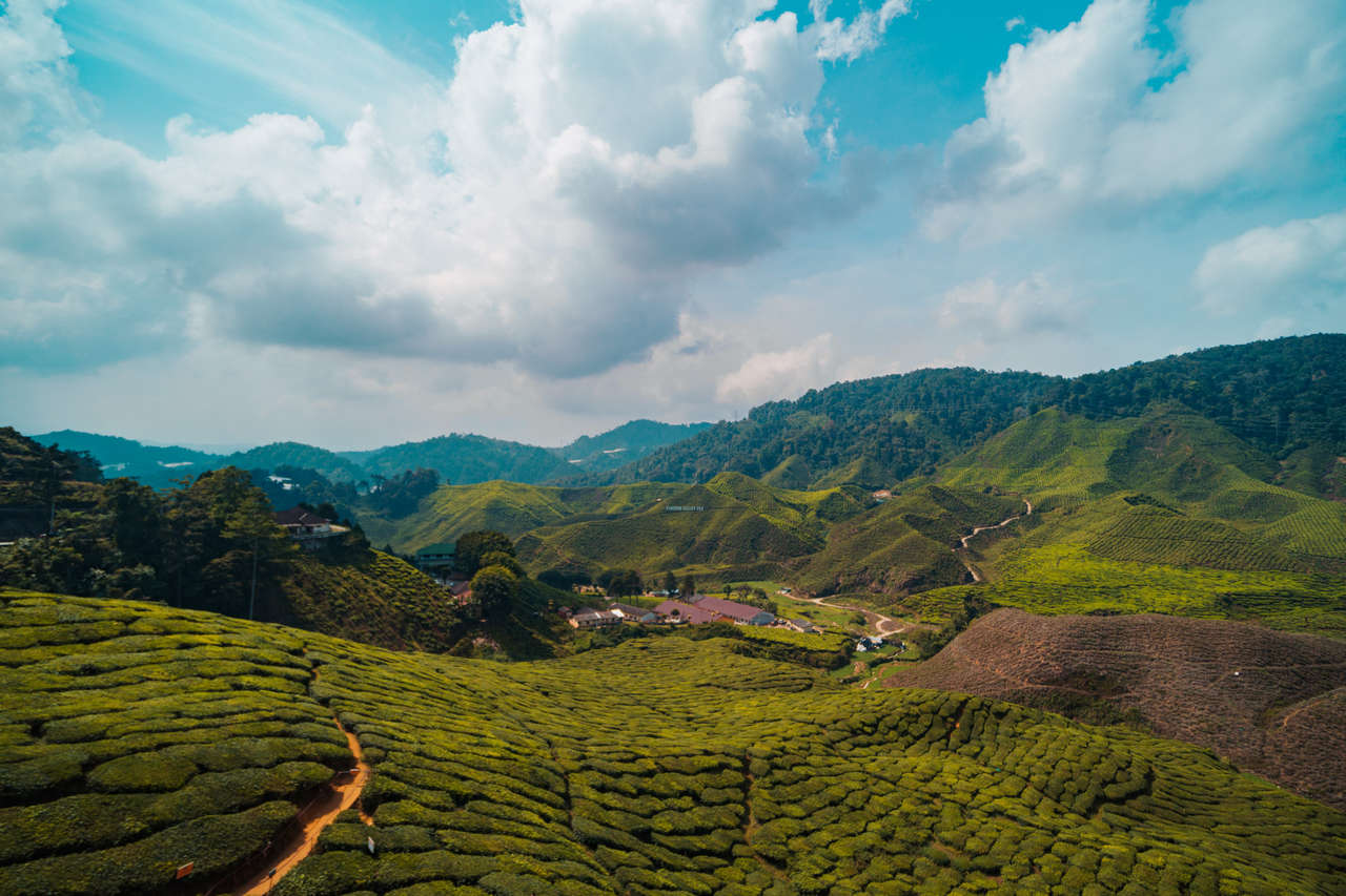
At the end of the trail, you will be at the Cameron Valley Tea House, where you can rest, have a nice cup of tea, and enjoy the tea plantation from the platform above. Alternatively, you can hitchhike back to Tanah Rata.
2. To Gunung Berembun and Down to Acadia and Back to Tanah Rata through Parit Falls (Trail #7 + Trail #3 + Trail #4) (Half-Day)
Duration: 5 hours
Difficulty: Moderate
Guide Required: No
Another trail that people recommend, but I didn't have time to do, is a combination of Trail #7, Trail #3, and Trail #4. You begin hiking from Tanah Rata, all the way up to Gunung Berembun (2 hours) via Trail #7, and then you take Trail #3 down to Arcadia Cottage (2.5 hours) before finishing your journey with a visit to Pirit Falls (30 mins) via Trail #4.
I did the Trail #10, Trail #6 combination instead of this one because I heard that the view from Gunung Berembun is overgrown, and it is no match for the view you get from Gunung Jasar. Also, I was more interested in hiking around a tea plantation rather than a forest, and Trail #6 is the best for that.
That being said, if you have the time, Trail #7, Trail #3, and Trail #4 will keep you occupied for another day in Cameron Highlands.
More Cameron Highlands Activities
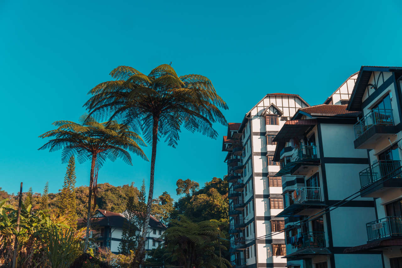
Where to Stay in Cameron Highlands (Tanah Rata)?


When to Visit Cameron Highlands?
It rains a lot throughout the year in Cameron Highlands, so there is no escaping it. However, one thing you can avoid is the crowds. The best time to hike in Cameron Highlands is from February to April on weekdays. The temperature is perfect for hiking, ranging from 21 to 24°C. Since it's not during the school holidays, Cameron Highlands is unlikely to be as crowded as the peak season (May - September).
How to Get to Cameron Highlands?
First and foremost, you will have to get yourself to Kuala Lumpur, Malaysia, and to do that, I would recommend you browse through Skyscanner or Expedia for a cheap flight from your home country.
Getting from Kuala Lumpur to Cameron Highlands
From Kuala Lumpur, you can get a direct bus from Terminal Bersepadu Selatan to Cameron Highlands (Tanah Rata) for 35 MYR, and it will take around 4 hours each way. You can easily book your bus ticket online at 12Go Asia.
Book A Bus from Kuala Lumpur to Cameron Highlands
Getting to the Hiking Trailheads
Most of the trails either start from or end in Tanah Rata, where you will be based, so walking is possible to get to the trailheads.
Most of the hiking trails ended somewhere else. You can either walk back along the road or simply hitchhike your way back to Tanah Rata (which is very easy as a lot of traffic is passing through this area). Personally, I don't enjoy walking back on the road, so I ended up hitchhiking instead.
Some trails are recommended to be done with a guide, and they often provide transportation, so you don't need to worry about this part.
What to Pack and Things to Prepare Before Hiking Cameron Highlands Trails?
- Water Bottles: Even though the weather in Cameron Highlands is nice and cool, you will often find yourself in an impenetrable thick forest where the wind can't get through, causing you to sweat a lot. Stay hydrated and bring enough water for the trail. I always carry my 2-liter hydration pack, which I recommend so you don't have to stop to stay hydrated.
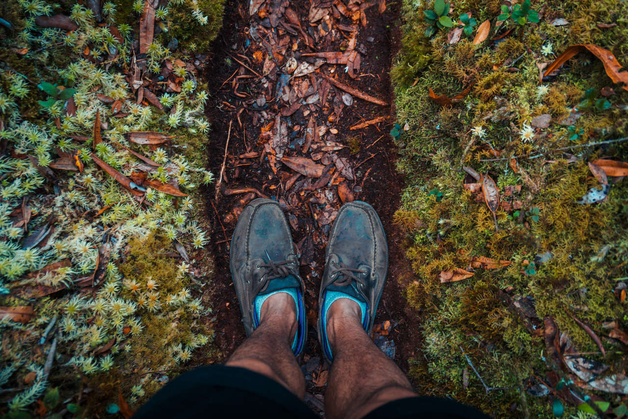
- Sturdy Shoes that can withstand muddy trails: It rains a lot in Cameron Highlands, and the forests are extremely thick, barely getting any sunlight. Therefore, the trails can get quite muddy and slippery. Make sure you have shoes you don't mind walking on muddy trails. These Timberland Shoes are my go-to hiking boots in most situations.
- Rain Jacket: As mentioned earlier, it rains a lot in Cameron Highlands, and you might accidentally get caught in light rain. Having a rain jacket with you on the trail is recommended. Here is a jacket I recommend you get for the trip: the beautiful orange Columbia outer-shell jacket.
- Snacks: Some trails take up to 4 hours, so it is best to have snacks with you just in case you get hungry along the trail.
- A Daypack: You will need a daypack to carry all your gear when you are out and about. During this trip, I use the classic Herschel Supply's Little America Backpack to carry everything with me. It is lightweight, has good capacity, and is stylish as hell.
- Maps.me: Not all hiking trails are available on Maps.me, but they have all the major ones in Cameron Highlands. Fortunately, the trails I recommended here are available on Maps.me. The app is available on both Android and iOS. Make sure you download the offline maps before you hit the trail.
Check Out My Hiking Packing List
That is it for A Complete Hiking Guide to Cameron Highlands, Malaysia. Have we missed anything? Have you found the guide useful? Let us know in the comments below!
Now that we have all the information we need, it's time to plan your trip to Cameron Highlands, Malaysia! Here are some resources to help you get your trip going:
Are you planning to travel to Cameron Highlands, Malaysia independently? Be sure to check out my guide on How To Plan A Backpacking Trip here.
Further Reading for Malaysia
Malaysia may often be overlooked by travelers, but the country has so much to offer that you can't get anywhere else in Southeast Asia.
Here is a selection of articles you might want to read about Malaysia:
- Looking for a complete itinerary and travel guide for Malaysia? 10-Day Itinerary for Malaysia.
- Planning a trip to Malaysia and not sure where to begin? Check out: 10 Best Places to Visit in Malaysia.
- Are you planning to travel to Malaysia as part of a big Southeast Asia trip? Check out our 3-month backpacking itinerary for Southeast Asia.
- Kuala Lumpur is where you will likely land when you are traveling in Southeast Asia, and from the outside, it may look like your typical Asian city. However, KL is so much more, and at a cheaper price too. Here’s a complete guide on things to do in Kuala Lumpur.
- Not your first time in Kuala Lumpur? How about we go explore the café and the unique Kopitiam culture of Kuala Lumpur with the 8 Best Cafés and Restaurants to try in Kuala Lumpur guide?
- If you are looking for a day trip from Kuala Lumpur or somewhere to stop on your way to/from Singapore, Melaka is a great place to stop and learn a little bit about this ancient port city. Check out my 8 Incredible things to do in Melaka travel guide here.
- Cameron Highlands is a break from the hot, humid weather and the bustling city of KL that you need. Surrounded by mountains and tea plantations, here is a complete travel guide on things to do in Cameron Highlands.
- Penang is the food heaven of Malaysia, and it is a must-stop on your way to/from Thailand. Here are 10 Best Things to Do in Penang.
- Want to go off the beaten path in Malaysia? Let’s head over to Borneo with a complete travel guide and a 2-week itinerary for Borneo and Brunei.
- Want to know where to go after Malaysia? How about spending 3 days in Singapore or going snorkeling on Koh Lipe, Thailand?
- Looking for more travel guides for Southeast Asia? You can find more on my Southeast Asia Travel Guide page.
- I have also compiled all of my favorite photos I took in Southeast Asia into one post. Check out 64 photos of Southeast Asia that will inspire you to travel.
- For more of my travel guides, visit the All Destination Travel Guide page.
13 Comments
Thank you so much for a great article!
We took our kids (7 and 9) to trail 10 and 6. Left our car at TeaShop 1, took taxi to H2O apartments where the trail 10 starts. Up the hill, enjoyed the views from Ganung Jasar and down via trail 6 back to the tea plantations and our car. Everything as described in the article. The descent from Ganung Jasar is challenging but we helped kids and made it safely down to road. The rest was very easy and relaxing.
Very nice loop. I would not recommend going after rain and definitely would not go other way around.
Hey MJ,
I'm glad to hear about your successful trip through the tea plantation! The view is pretty stunning isn't it? Also, thank you for the report back on your experience and that it is kid-friendly! I do agree that if it is raining or it rained the day before, it can be quite dangerous coming down from Gunung Jasar.
Thanks again for the comments!
Hi! Planning to visit Cameron Highlands. Your article is very great. I just want to ask if Trail #10, #6 is beginner-friendly? I really want to hike but it is my first time. Is it going to be fine?
Thank you!
Hey NA,
It can be quite steep and slippery after a rainy day, so be sure to avoid doing the hike during that time. If it has been sunny, the trail shouldn't be too difficult for you. Take it slow and you should be able to complete it in a few hours. :)
Hi! How n where can I get a guide for some of the trails you recommended? Thank you :)
I would like to hike this coming saturday. Can I get anyone number who can guide me and my family there.....please
I'm afraid I don't know any but you can look up organized tours to help you with the guided part. Here are some of the tours available at the moment: Get Your Guide
Be sure to check them out :)
I do not know any guide personally but they do have many organized tours running you can choose from here: Get Your Guide
I hope this helps!
Trail 6 is Closed (17-03-2024)
Oh no! That's a shame! it was one of my favorite trails! :( Do you happen to know why it is close?