Nyhavn
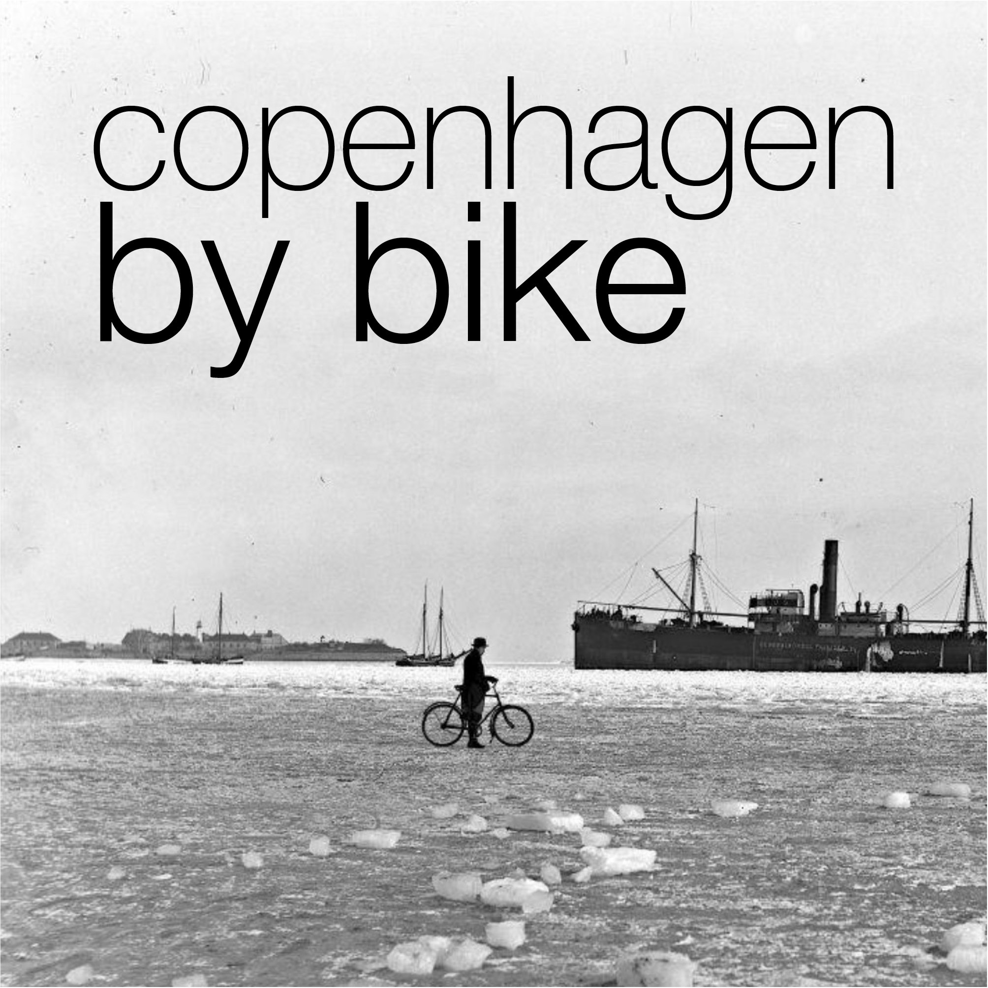
/above - east end of Nyhavn where ships from the sound come into the New Harbour
the photograph was taken around 1900
right - detail of a map drawn in the middle of the 18th century that shows the large irregular public space of Kongens Nytorv with the palace of Charlottenborg - the large building around an enclosed courtyard on the east side of the square - and the harbour and quays of Nyhavn running from the square eastwards to the main harbour
the octagonal public space and the palaces of Amalienborg with the streets of Frederiksstaden to the north of Nyhavn and the large courtyard palace of Christiansborg to the south are obvious and the main difference between the mid 18th century and now is in the area south of the gardens of Charlottenborg that was then the site of naval dockyards … the very long and narrow range running down diagonally from Kongens Nytorv to the harbour was the rope walk.
history:
Nyhavn was constructed between 1670 and 1675 by, it is said, Swedish prisoners from the war between Denmark and Sweden.
This new harbour, with long wharves on both sides, replaced the old city wharf at Gammel Strand that was constricted by the expansion of the castle of Christiansborg although Gammel Strand appears to have continued in popular use as the fish market. The wharf at Børsen - The Exchange - immediately east of the royal castle was built in the 1620s but must still have been important and there were also wharves on the canals of Christianshavn but the new wharves at Nyhavn had the advantage of connecting directly with a large new market place - Kongens Nytorv - laid out at when the harbour was constructed.
The medieval defences around the east side of the old city had started at the harbour close to Holmens Kirke and the east gate was close to where the east end of the Walking Street now enters Kongens Nytorv …. the foundations of the gate were uncovered by archaeologists in 2010.
There must always have been some trade outside the east gate but when the line of the wall that continued from the east gate along what is now Gothersgade was removed and the area protected within the defences extended northwards to Kastellet - a new citadel - and the east gate moved to a point in the defences close to what is now Østerport Station, the area of Kongens Nytorv - The Kings New Square - was enlarged. Grand new houses were built around the edge of the new square so both Nyhavn and Kongens Nytorv were part of this major expansion of the city northwards in the 17th century.
The first bridge over Nyhavn was a timber foot bridge constructed in 1874 and the present stone bridge was built in 1912 to replace that foot bridge.
Nyhavn now
Nyhavn is now one of the most visited tourist attractions in the city but again this illustrates a complicated sequence of significant planning decisions and shows how a series of changes over years and sometimes over decades can alter the character of an area of a city in dramatic ways.
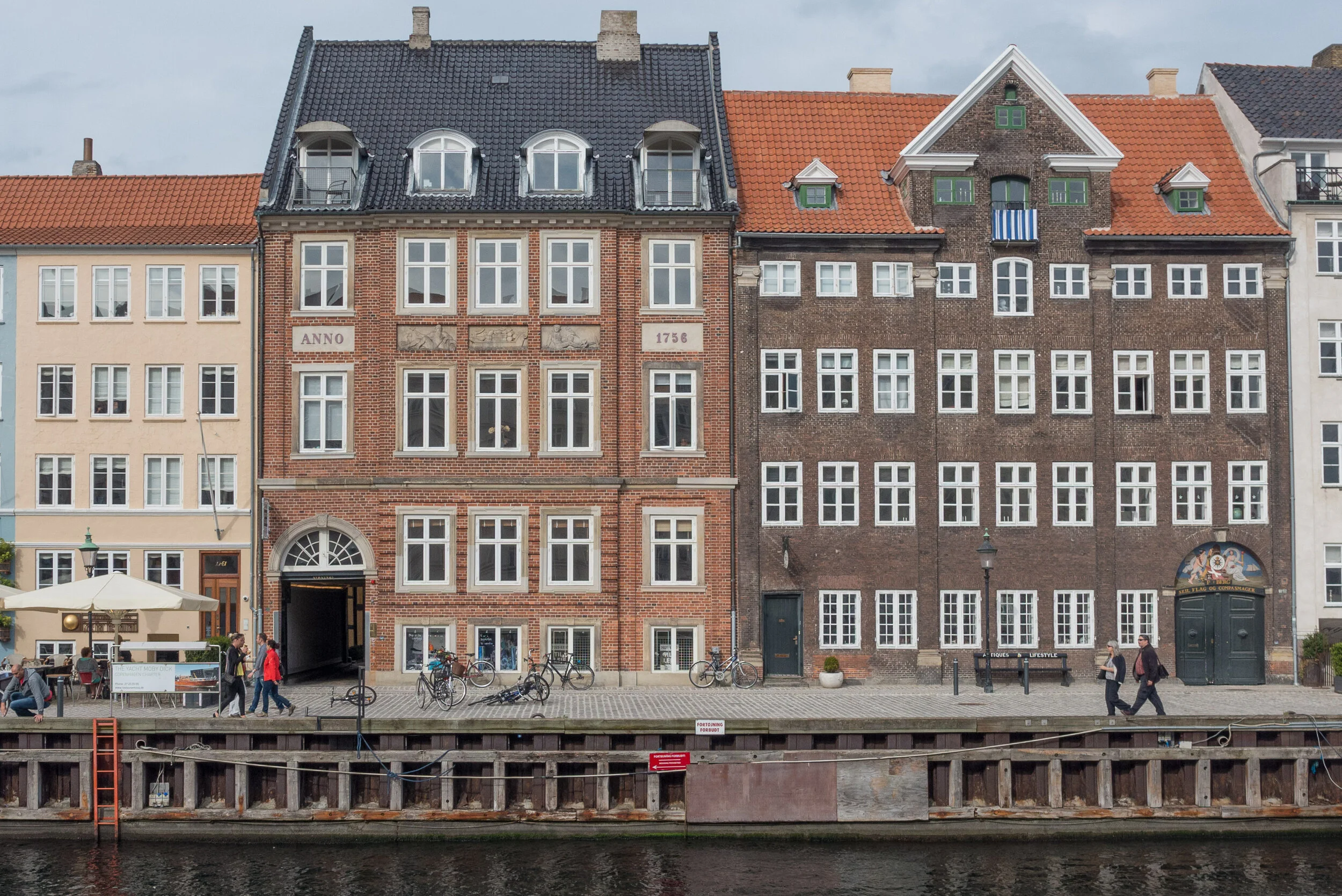
Presumably, few tourists appreciate that in the 1950s this area was still very much part of the working docks with hostels for sailors; a large number of tattoo parlours and what sounds like a thriving sex trade. When I tell people that I live on Nyhavn, younger Danes ask if I live on the Sun Side - it faces south and I do - but older Danes who remember the tattoo parlours and the sex workers will ask if I live on the Sin Side. The Royal Academy of Art, in Charlottenborg, I hasten to add, is not on the Sin Side but in the shade - if you want to read anything into that.
In the 1960s there were proposals to demolish everything with one scheme to fill in the harbour for a wide roadway down from Kongens Nytorv to a new road bridge over to Amager. Was this the same group of developers and ‘forward looking’ planners who at about the same period saw the lakes on the west side of the city as the ideal route for a new six-lane inner ring road?
detail of map from 1658
the blue line marks the site of Nyhavn constructed in the 1670s
A - the site of the east gate
B - Kongens Nytorv
C - Charlottenborg
D - Kastellet
E - Rosenborg
F - Nørreport / North Gate
G - Vesterport / West Gate
H - Gammel Strand
I - Christiansborg
J - Christianshavn
cars parked along the quay in 1963
cars and delivery lorries on Nyhavn in 1976
Nyhavn survived but by the 1970s it was little more than a long thin car park and more than a little run down.
But then there came a decision to ban vehicles from the street on the side of the harbour facing south and that certainly changed the way the area was used. The last stage was to resurface the section of quay from the bridge to the theatre in 2015 and now high-quality stone setts extend the full length of the harbour and mark out well-defined bands of the quay with an inner pathway immediately in front of the buildings; an area for umbrellas and outside seating - the umbrellas are square and a standard design but each restaurant has its own chairs and tables - and then there is a broad strip defined as the promenade and an outer strip against the water where there are the waste bins and where there are bollards and iron rings for ships to tie up.
Many of the ships moored on the north or sun side of the harbour and most of the ships on the inner quay between the bridge and the square are historic masted sailing ships and Nyhavn has been designated as a veteran ship harbour or museum harbour since 1977.
This was all part of a planning policy, to bring Nyhavn and the open harbour beyond into the polite life of the city when, presumably, many in the city saw the harbour as not so much as a recreational amenity but simply as commercial and naval docks with all that meant in terms of dirt, noise and pollution.
My only quibble now is that the conversion of the quayside into one long outdoor restaurant has probably gone too far. Millions of visitors walk along here and it is crowded year round. Most certainly seem to appreciate their visit - even if they see it mostly through staring at their cameras as they take selfies - but with many of the buildings dating from the 1680s, this is an important groups of historic mercantile houses.
Copenhagen is here and Copenhagen has prospered because of trade and there are topographic paintings and historic photographs that show Nyhavn crowded with sailing ships loading or unloading.
There was no heavy industry in Copenhagen - at least not on any large scale apart from ship building - so there was none of the rapid and extensive growth in the late 19th century that was seen in many other European capitals - and no destructive re-development on any large scale in the post-war period so in the historic centre, merchants houses along Gammel Strand; buildings around Højbro Plads and Ved Stranden - opposite Christiansborg - and the houses and warehouse of Strandgade on Christianshavn, along with these mercantile properties of Nyhavn have all survived.
I'm not saying that the restaurants should go - in order to survive historic buildings have to have a financially viable use - but the buildings and the interiors and the back buildings that survive are a crucial part of why Copenhagen is here and many of the houses are exceptionally good architecture and most have a fascinating back story. They not only have to be kept but they do deserve some respect and some recognition otherwise it really will become more and more like a run of fake fronts from a Disney-World back lot.


